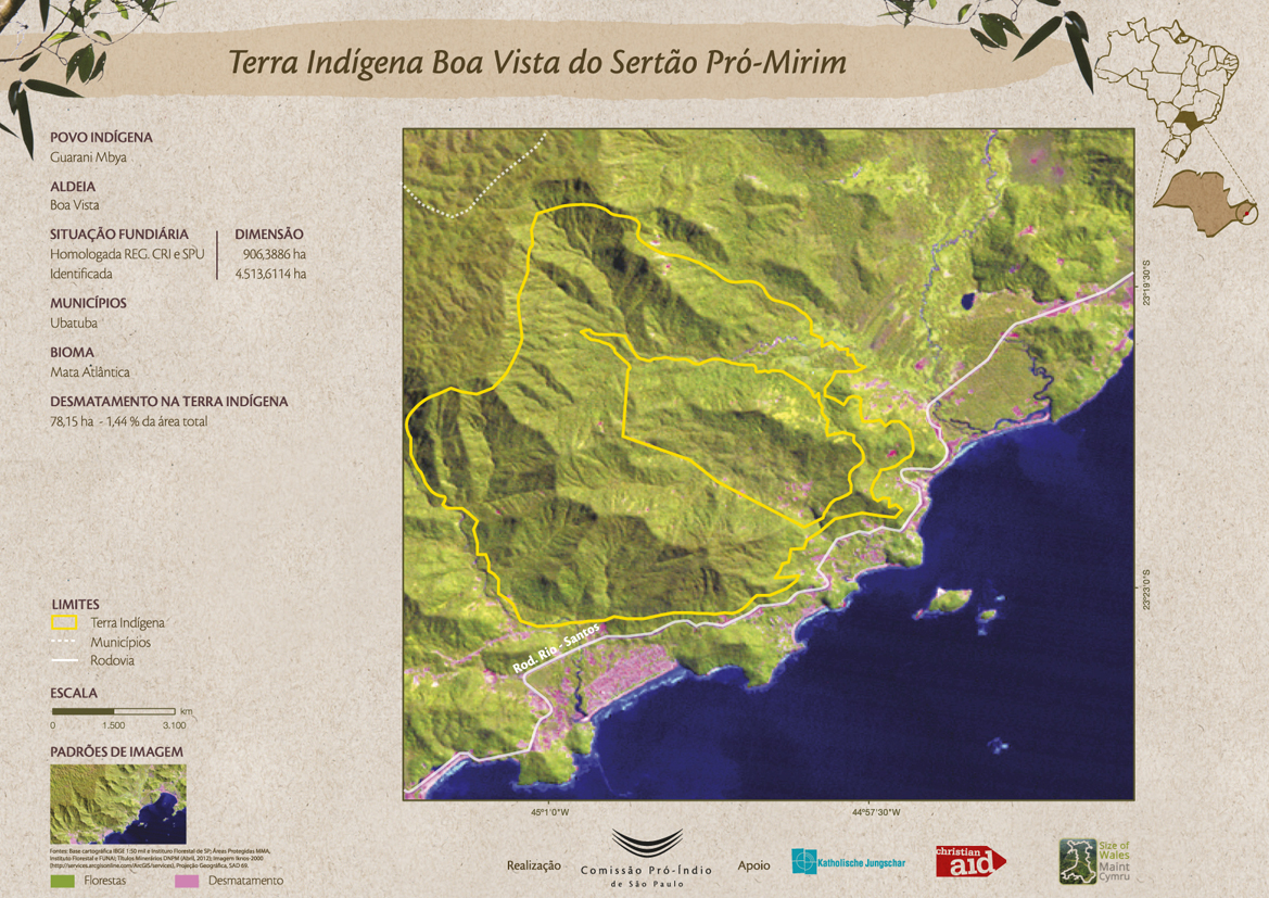
Pueblos
- GUARANI MBYA
Cita
Comissão Pró-Índio de São Paulo. "Terra Indígena Boa Vista do Sertão Pró-Mirim." Map. Comissão Pró-Índio de São Paulo. September 2016. Accessed July 3, 2023. https://cpisp.org.br/wp-content/uploads/2016/09/TI_BoaVista.jpg.
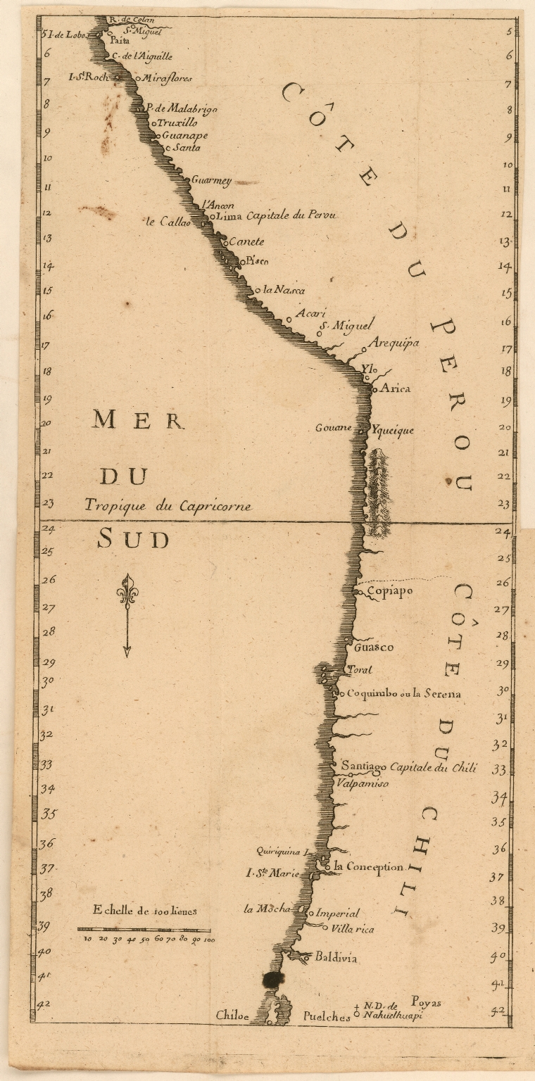
Côte du Perou
Mapa 1707
CARTA GEOGRÁFICA DEL ECUADOR POR DR. TEODORO WOLF;PUBLICADA POR ORDEN DEL SUPREMO GOBIERNO DE LA REPÚBLICA Y TRABAJADA BAJO LAS PRESIDENCIAS DE LOS EE. SEÑORES DR. D.J.M. PLÁCIDO CAAMAÑO Y DR. D. ANTONIO FLORES. 1892 ... INSTITUTO GEOGRAFICO DE H. WAGNER & E. DEBES EN LEIPZIG. (WITH) LA REGION ORIENTAL DEL ECUADOR. (WITH) ARCHIPIÉLAGO DE GALÁPAGOS.
Mapa 1892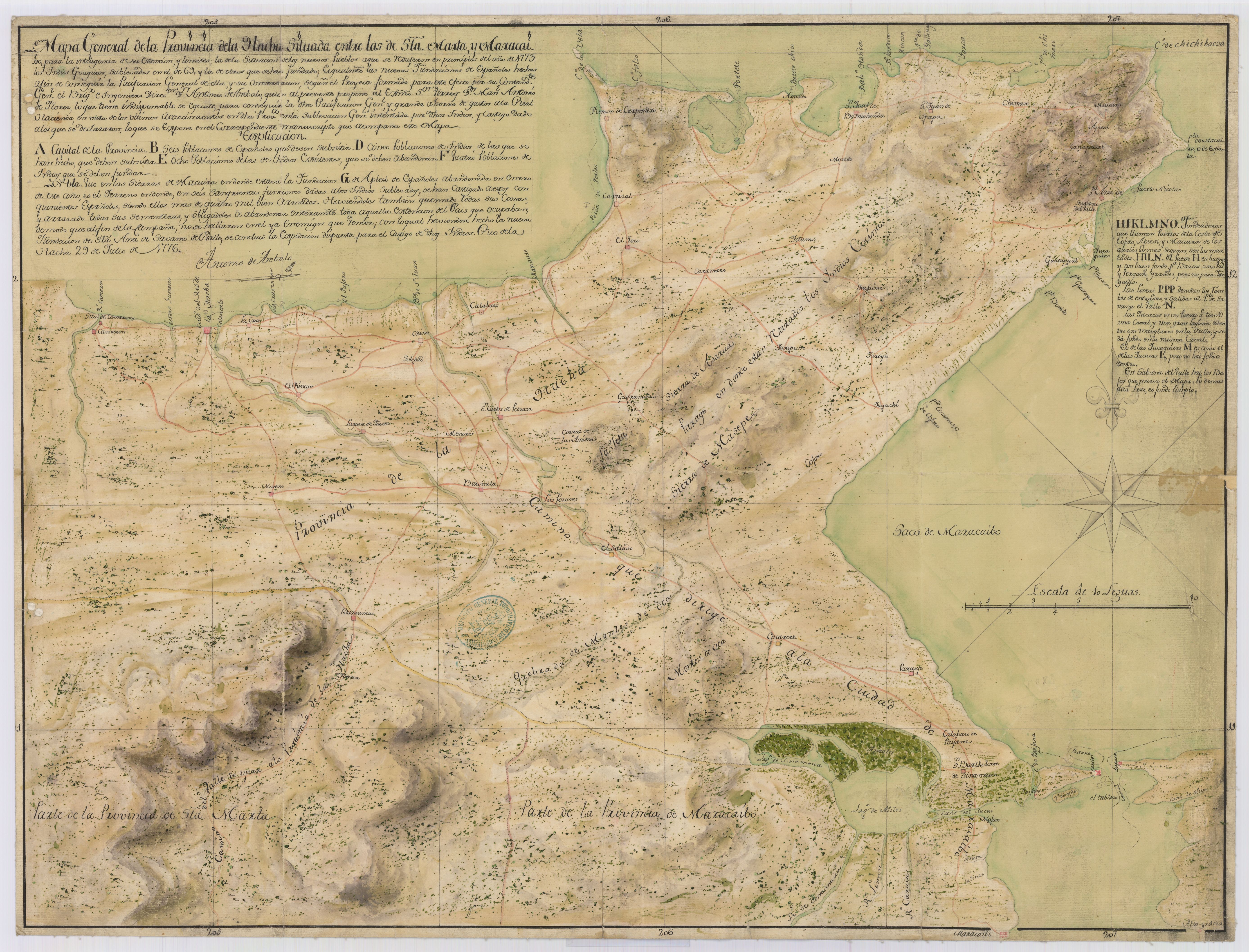
Mapa general de la Provincia de la Hacha : Situada entre las de Sta. Marta, y Maracaibo para inteligencia de su Estencion y limites de la situación de los nuevos pueblos a los que se redujeron en principios del año 1773 los indios goagiros, sublevados en el de 69 y la de otros que se han fundado, e igualmente las nuevas fundaciones de españoles hechas a fin de conseguir la pacificacion general de ella, y su conservacion, segun el proyecto formado para este efecto por su Comandte. Genl. el Briga. de ingenieros director Dn. Antonio de Arebalo, quien al presente propone al Exmo. Sor. Virrey Dn. Manl. Antonio de Florez lo que tiene indispensable se ejecute para conseguir la otra pacificacion Gnl., y grande ahorro de gastos a la Real Hacienda
Mapa 1776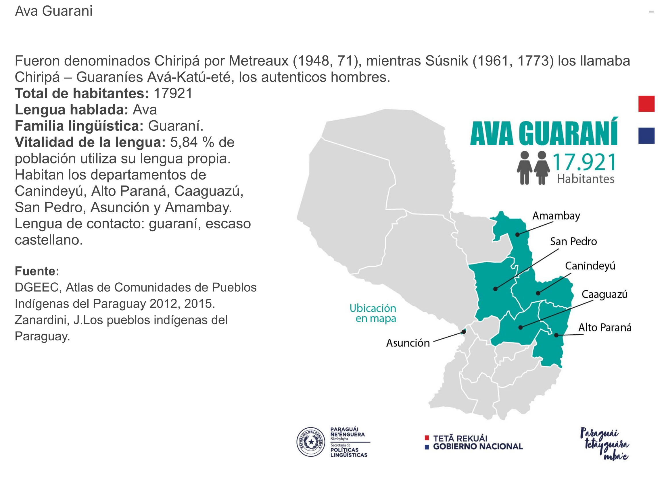
AVA GUARANÍ
Mapa 2015
Mobilizações étnicas e transformações sociais no Rio Negro
Mapa 2007 - 2012
PROVINCIE DEL PARA E DEL MARAGNONE
Mapa 1600 - 1699
TOBA
Mapa 2015
MAPA DE LOCALIZACIÓN DE NACIONALIDADES Y PUEBLOS INDÍGENAS DEL ECUADOR
Mapa 2010