
Pueblos
- CARANGAS
Cita
Cottyn, H. (2021) Carangas en movimiento: estado liberal, elites provinciales y movilidad trans-fronteriza andina entre el Altiplano boliviano y el Pacífico (1860-1930). Diálogo Andino, 66, pp. 261-272.
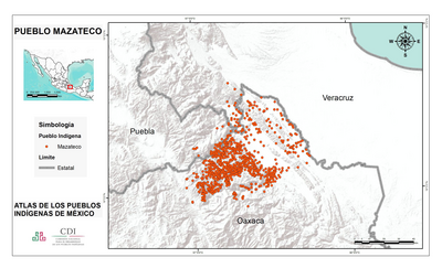
PUEBLO MAZATECO
Mapa 2020![[Côtes de la Guyane].](https://dnet8ble6lm7w.cloudfront.net/maps/CNT/CNT0171.jpeg)
[Côtes de la Guyane].
Mapa 1700 - 1799
Subdelegaciones de la Nueva España en 1800
Mapa 1800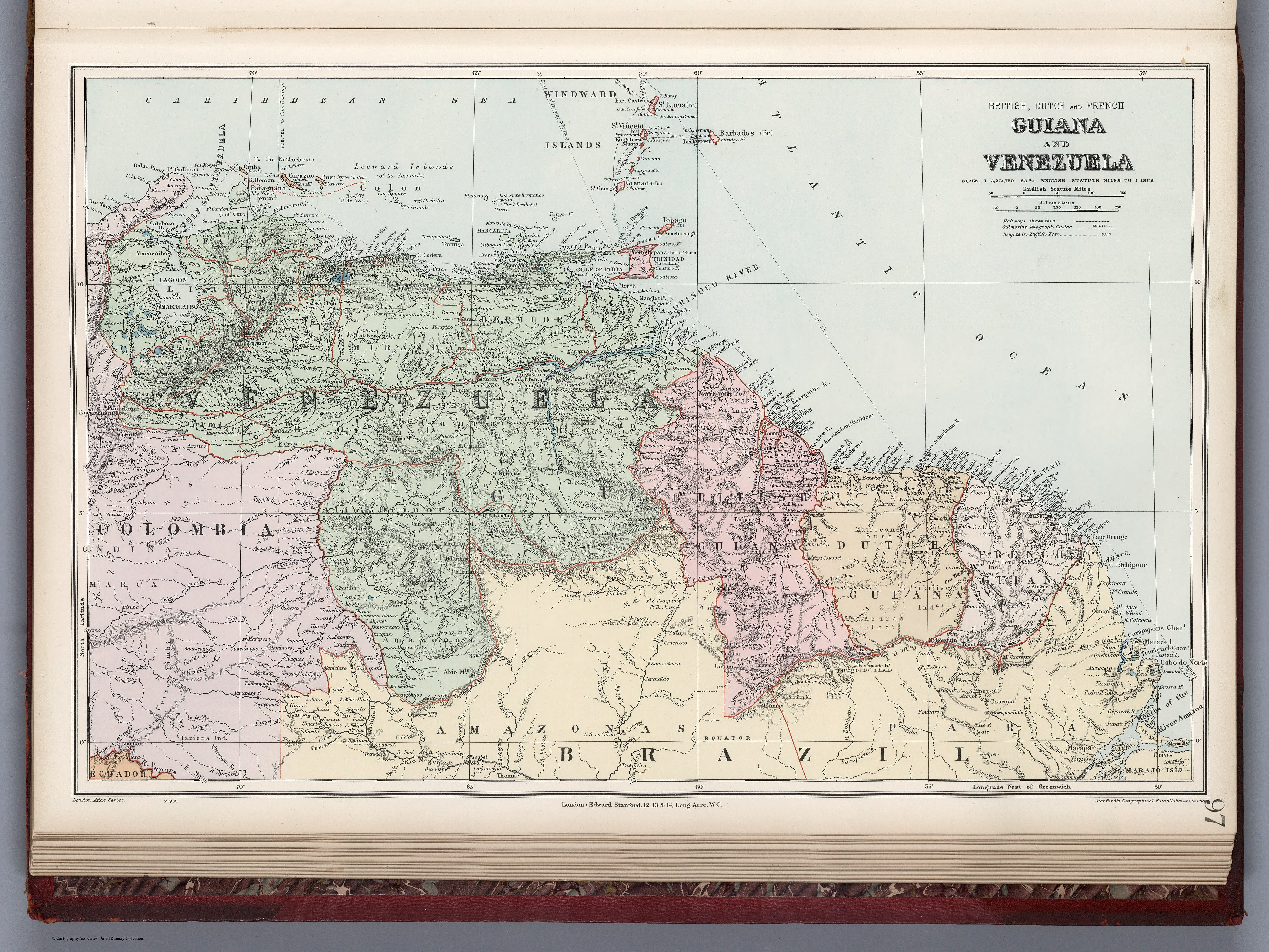
GUIANA AND VENEZUELA
Mapa 1900 - 1999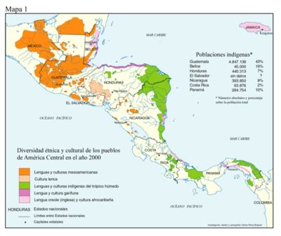
Diversidad étnica y cultural de los pueblos de América Central en el año 2000
Mapa 2000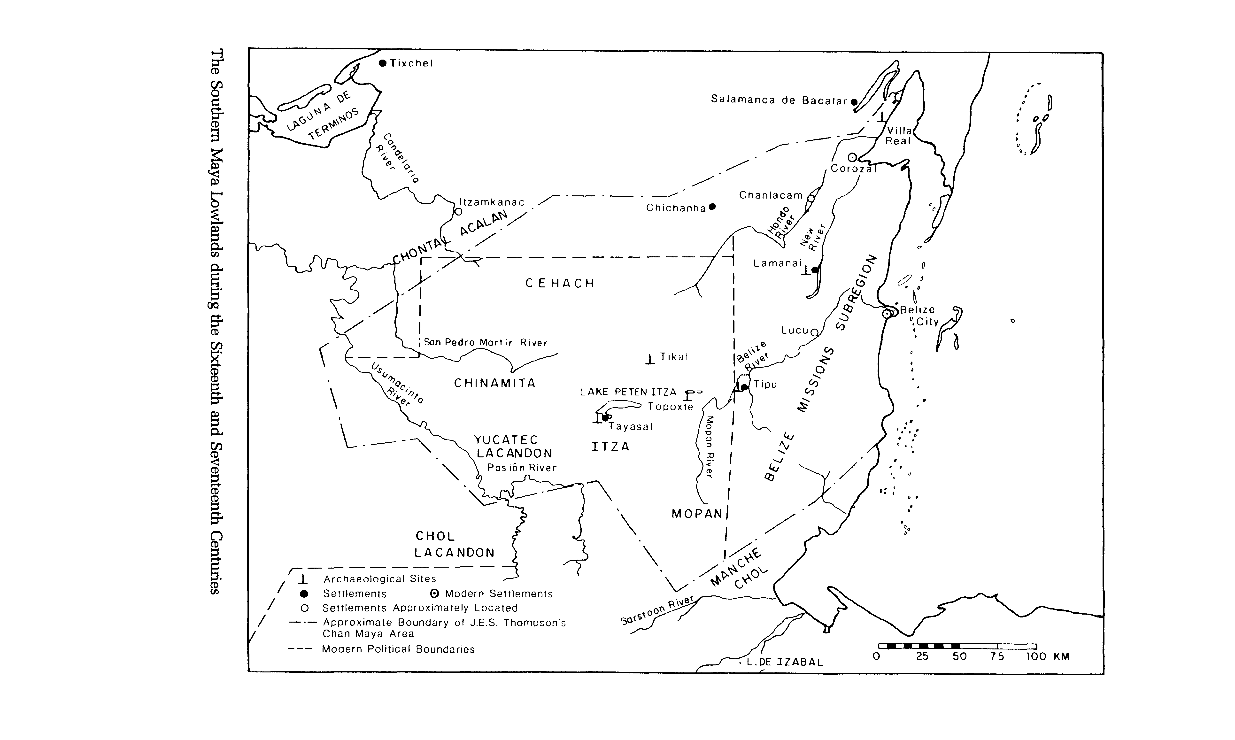
The Southern Maya Lowlands during the Sixteenth and Seventeenth Centuries
Mapa 1500 - 1700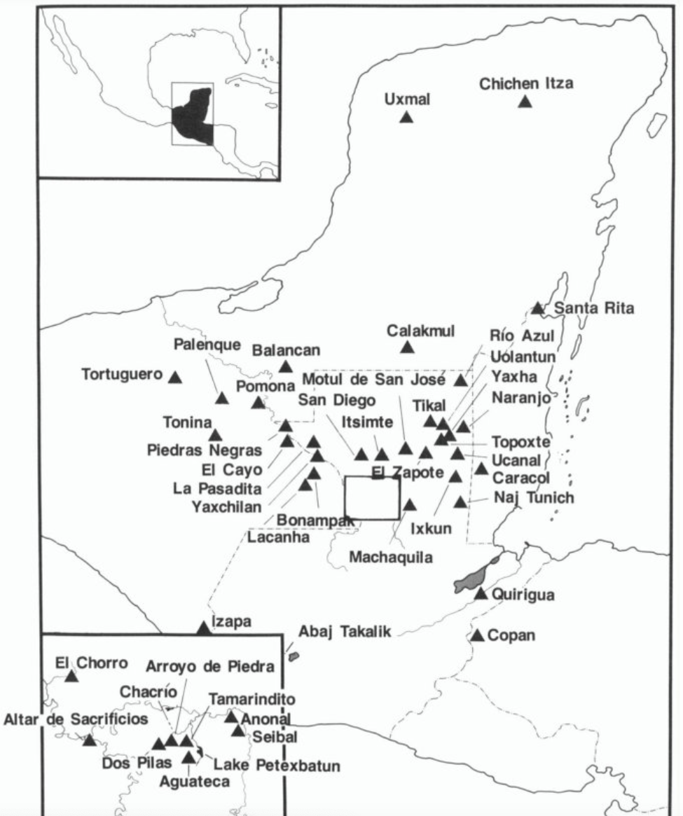
Map showing Sites Mentioned In Text
Mapa 200 - 900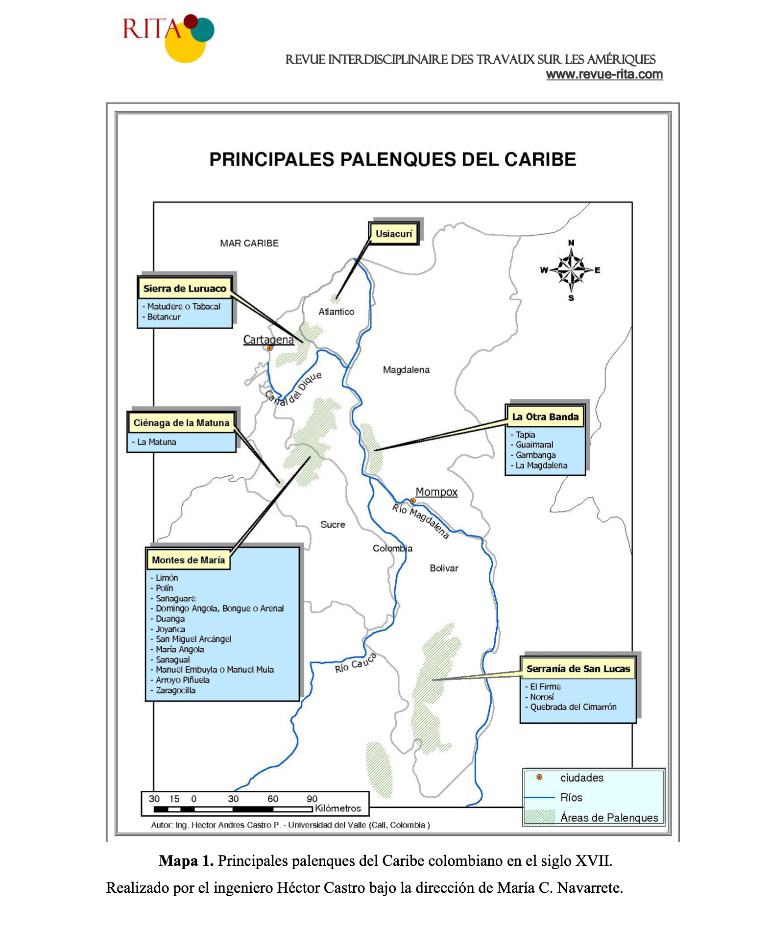
PRINCIPALES PALENQUES DEL CARIBE
Mapa 1600 - 1699