
Pueblos
- CARANGAS
Cita
Cottyn, H. (2021) Carangas en movimiento: estado liberal, elites provinciales y movilidad trans-fronteriza andina entre el Altiplano boliviano y el Pacífico (1860-1930). Diálogo Andino, 66, pp. 261-272.
Protected Natural Areas in the Maya Region
Mapa 2000 - 2100
PUEBLO ASHANINKA
Mapa 2021
H. KIEPERT'S KARTE DES NORDLICHEN TROPISCHEN AMERICA
Mapa 1858
FIGURAS DE ORDENAMIENTO TERRITORIAL EN LA SNSM
Mapa 2009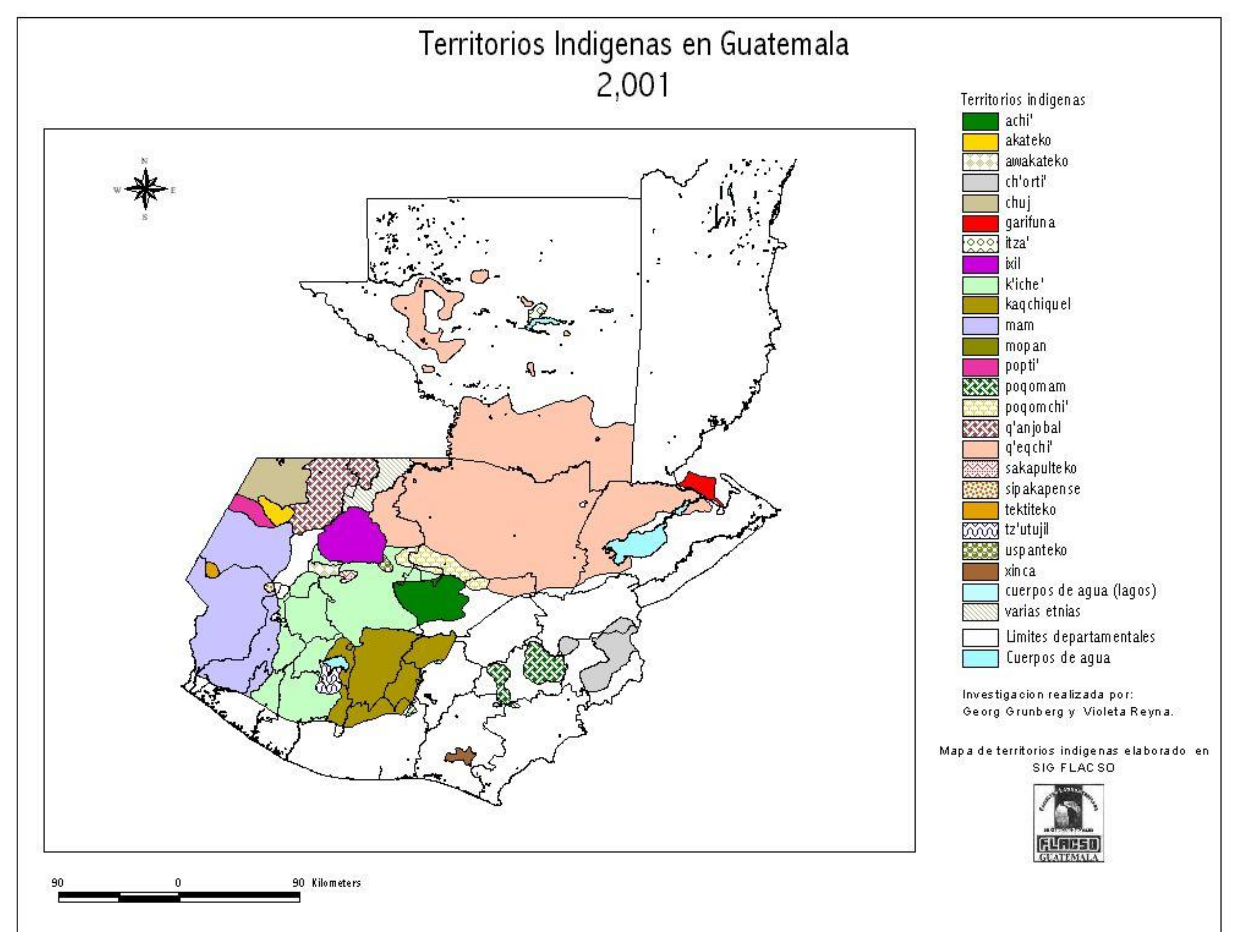
Territorios Indigenas en Guatemala 2,001
Mapa 2001
Cartes de la Guyane. Carte de la Guyane Drançaise. Dressée sur l'ordre de M.e M. E. Picanon Gouverneur.
Mapa 1907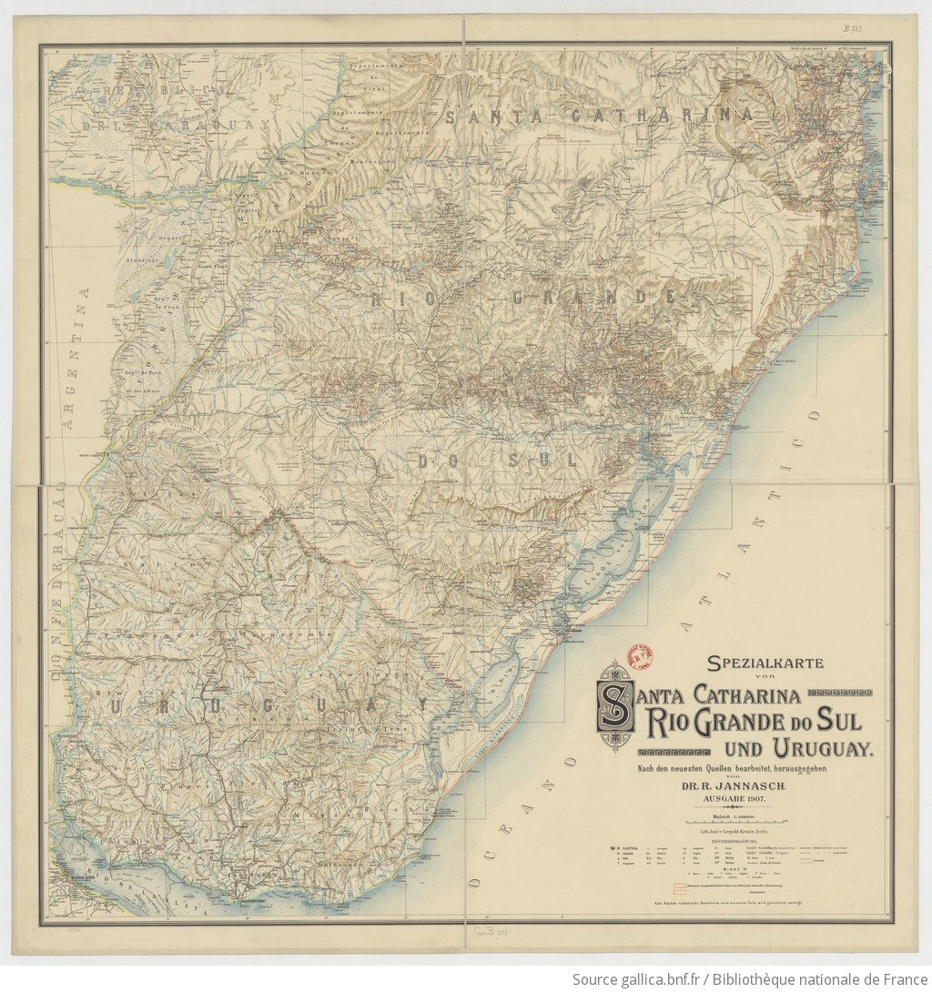
SPEZIALKARTE von SANTA CATHARINA, RIO GRANDE DO SUL UND URUGUAY
Mapa 1907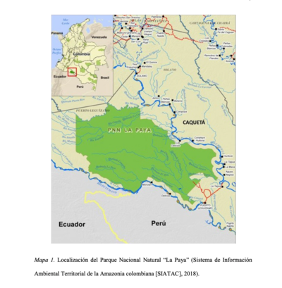
LOCALIZACION DEL PARQUE NACIONAL NATURAL "LA PAYA"
Mapa 2018