Pueblos
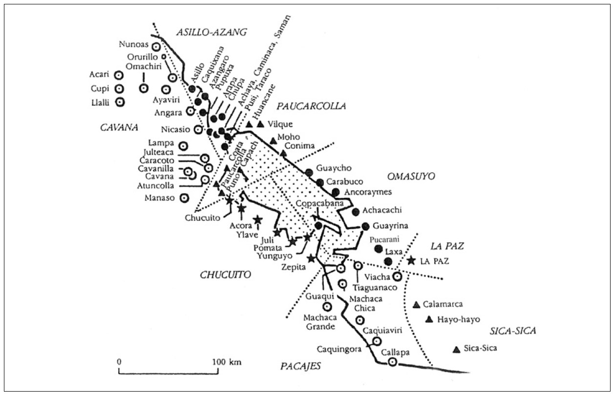
- PACAJES
- OMASUYOS
Cita
Morrone, A. (2017). El lago de los curas: Mediación sociopólitica y cultural en los corregimientos del lago Titicaca (1570 - 1650). Estudios Atacameños de Arqueología y Antropología Surandinas, (55), 183-202.
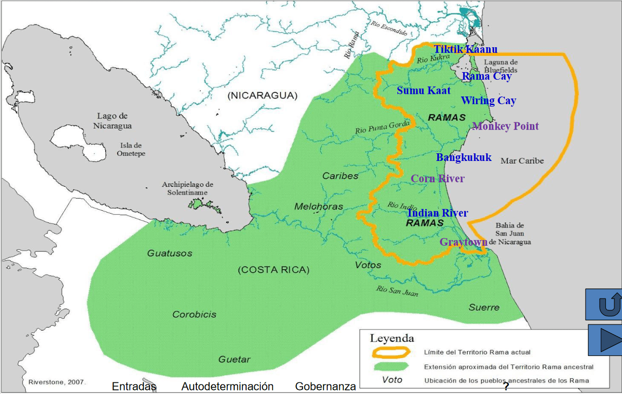
Pueblos Originarios y Afrodescendientes de Nicaragua, Etnografía, ecosistemas naturales y áreas protegidas
Mapa 1400 2022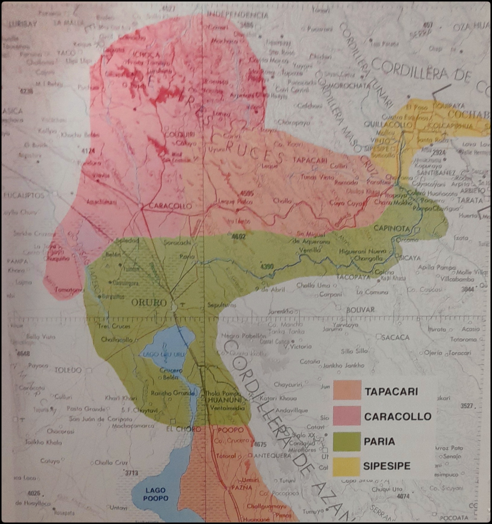
EL SEÑORÍO AYMARA DE LOS SURAS EN EL SIGLO XVI
Mapa 1500 - 1699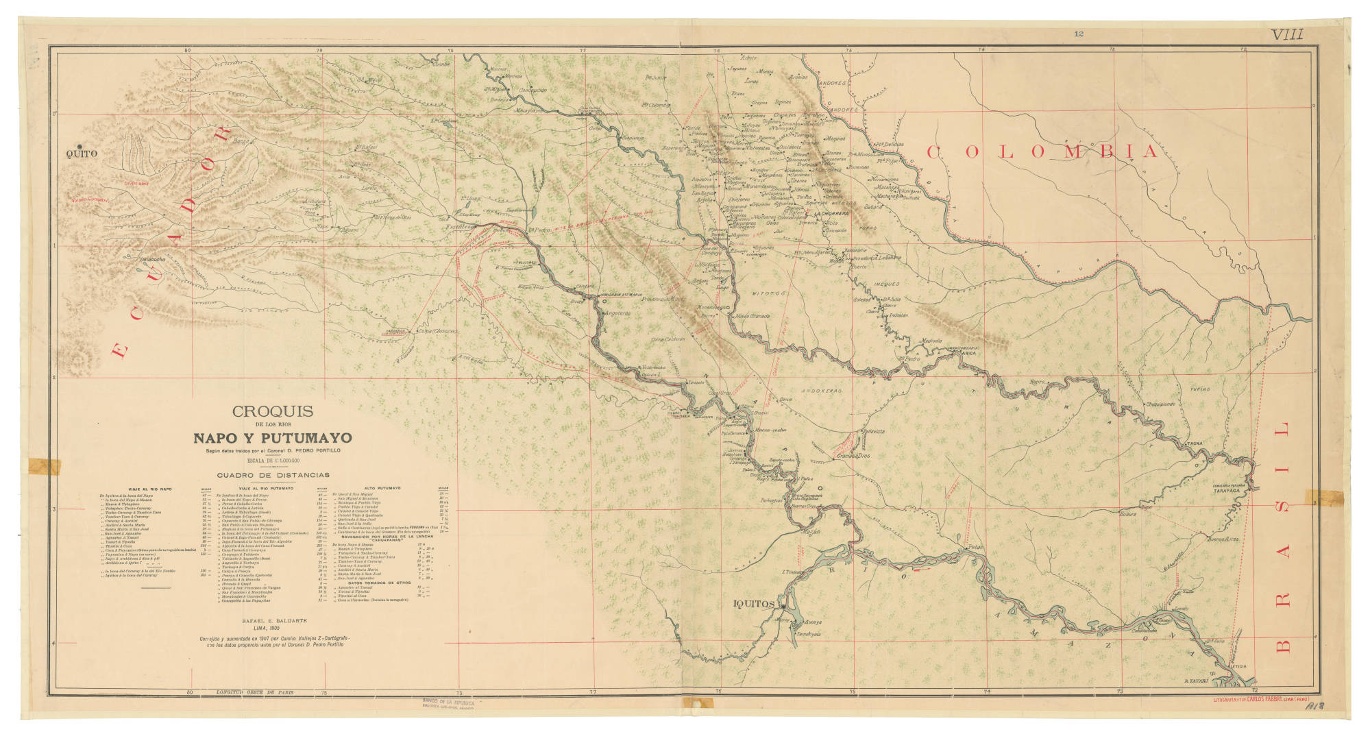
CROQUIS DE LOS RÍOS NAPO Y PUTUMAYO Según datos traídos por el Coronel D. PEDRO PORTILLO
Mapa 1905
4. Ubicación de las comunidades indígenas y composición étnica de la región del Vaupés.
Mapa 2013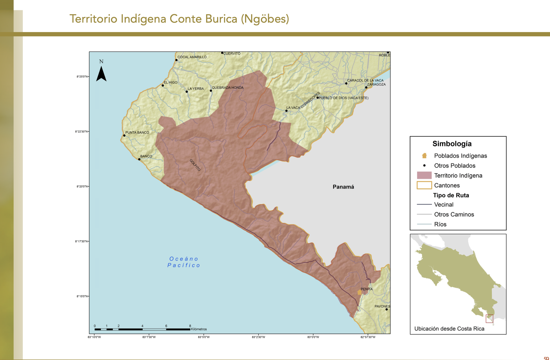
"Territorio Indígena Conte Burica (Ngöbes)
Mapa 2010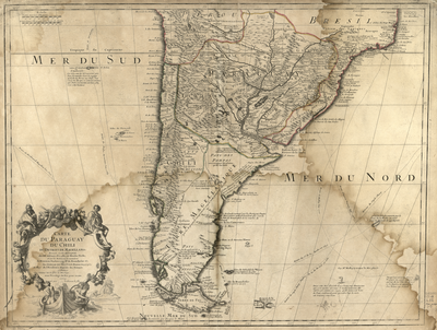
Carte du Paraguay;du Chili;du Detroit de Magellan &c. Dressée sur les descriptions des PP. Alfonse d'Ovalle;et Nicolas Techo;et sur les relations et memoires de Brouwer;Narbouroug;Mr. de Beauchesne &c.
Mapa 1703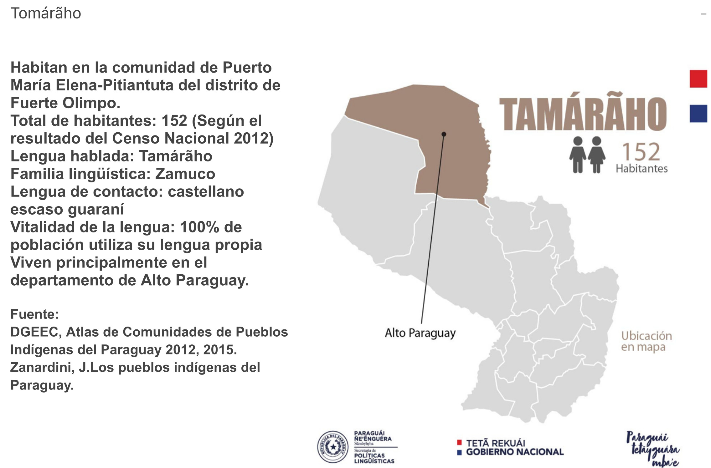
TAMÁRÃHO
Mapa 2015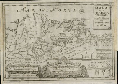
Mapa de la Provincia y Missiones de la CompañÍa de IHS del Nuevo Reyno de Granada
Mapa 1741