Pueblos
- COLLAS
- LUPACAS
- PACAJES
Cita
Domínguez, N. (2014). The "puquina" language in the early colonial southern Andes (1548-1610): A geographical analysis. Journal of Latin American Geography, 13(2), 181-206.
Location of Nahuat Area on Gulf Coast Plain
Mapa 1969
CARTE DU THÉÂTRE DE LA GUERRE ENTRE LE BRÉSIL, LA CONFÉDÉRATION ARGENTINE, LA RÉPUBLIQUE DE L'URUGUAY & LE PARAGUAY
Mapa 1864 - 1865
Detail from the 1770 copy of Francisco Álvarez Barreiro’s 1728 map of northern New Spain illustrating Spanish mapping of Indian domains in southern Texas and along the Gulf Coast, especially through the repetition of labels: “tierra de los Pampopas,” “tierra de los Carrizos,” “tierra de los Cujanes,” etc.
Mapa 1728
PUEBLO AYAPANECO
Mapa 2020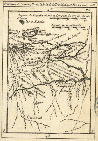
Provincias de Cumana;Paria;la Isla de la Trinidad;y el Rio Orinoco. 1758.
Mapa 1758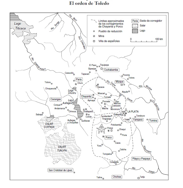
ORDENAMIENTO POLÍTICO DEL ESPACIO BAJO EL DOMINIO COLONIAL A FINALES DEL SIGLO XVI
Mapa 1580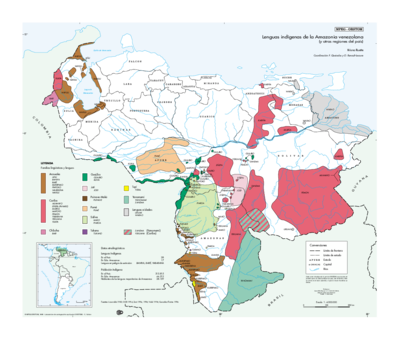
Lenguas indígenas de la Amazonia venezolana (y otras regiones del país)
Mapa 1998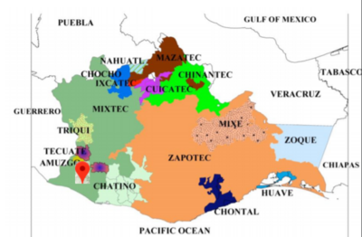
No Title
Mapa 2008