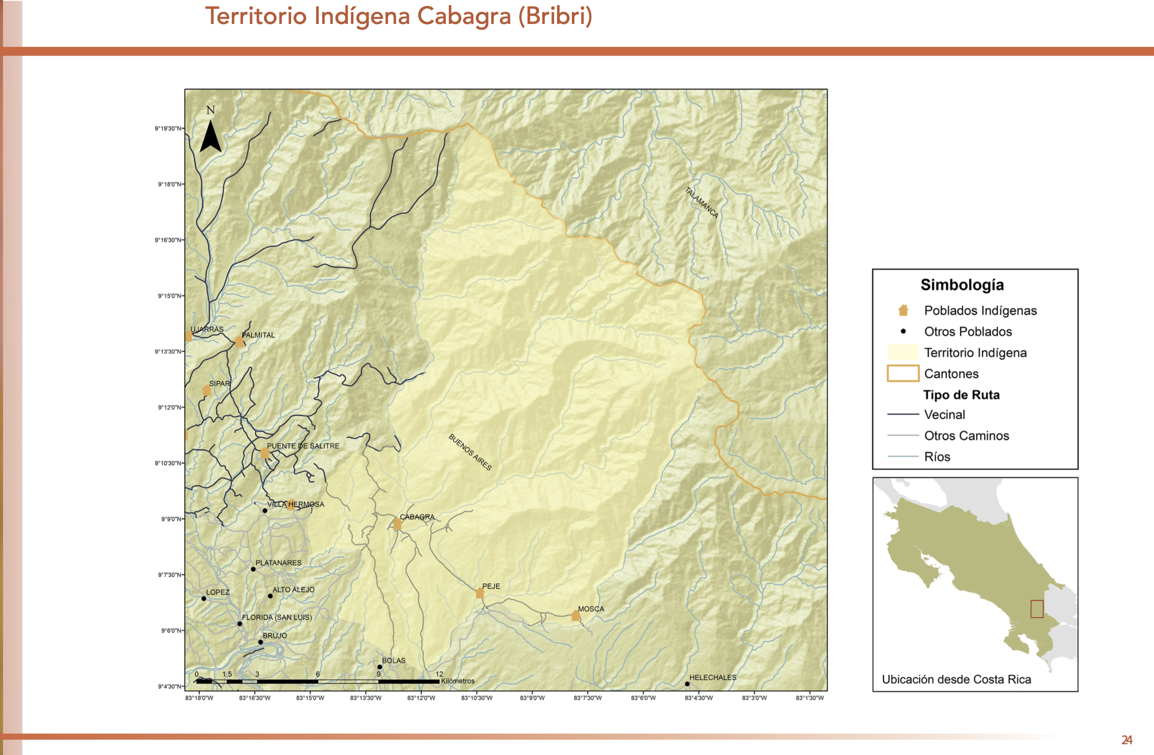
Pueblos
- INDIAN
Cita
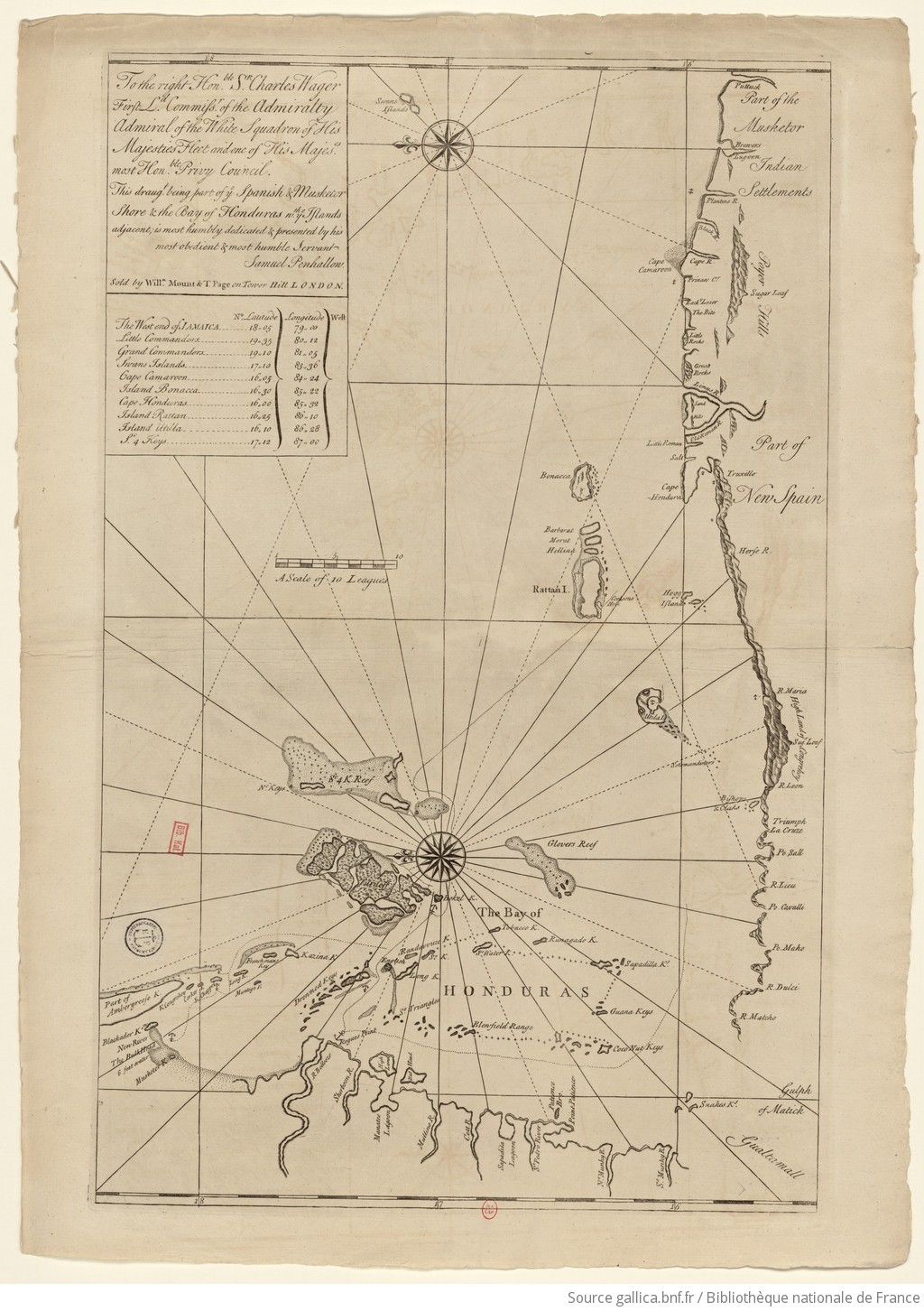
Samuel Penhallon. 1735. "The Spanish and Musketor shore and the bay of Honduras and the islands adjacent." Bibliothèque nationale de France, département Cartes et plans, GE SH 18 PF 143 DIV 2 P 1. Accessed April 26, 2024. https://gallica.bnf.fr/ark:/12148/btv1b5970790d/f1.item.zoom.
![[Ecuador & Peru Coastlines] Carta particolare del'Peru che comincia con il capo di Guanapo e finisce con il C. S:](https://dnet8ble6lm7w.cloudfront.net/maps/PER/PER0087.jpg)