Pueblos
- MAYA
Cita
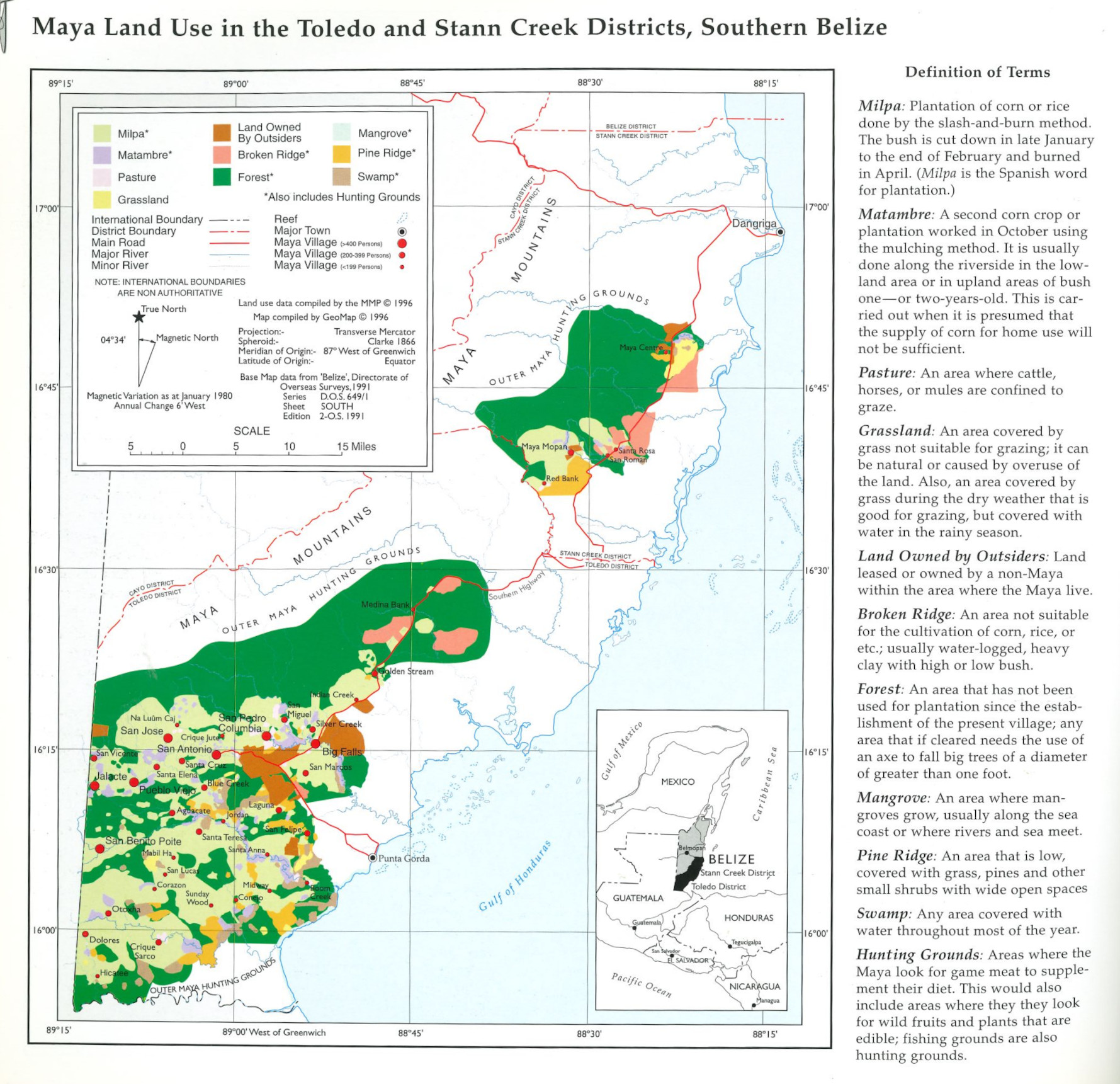
Indian Law Resource Center GeoMap Group. 1997. “Maya Land Use in the Toledo and Stann Creek Districts, Southern Belize.” In Maya Atlas: The Struggle to Preserve Maya Land in Southern Belize, 18. Berkeley, CA: North Atlantic Books. book
![[Panama]](https://dnet8ble6lm7w.cloudfront.net/maps/PAN/PAN0004.jpeg)