
Cita
United States Department of Commerce, Transportation Department. 1920. "Railroad Map of British Honduras." https://hdl.loc.gov/loc.wdl/wdl.11329
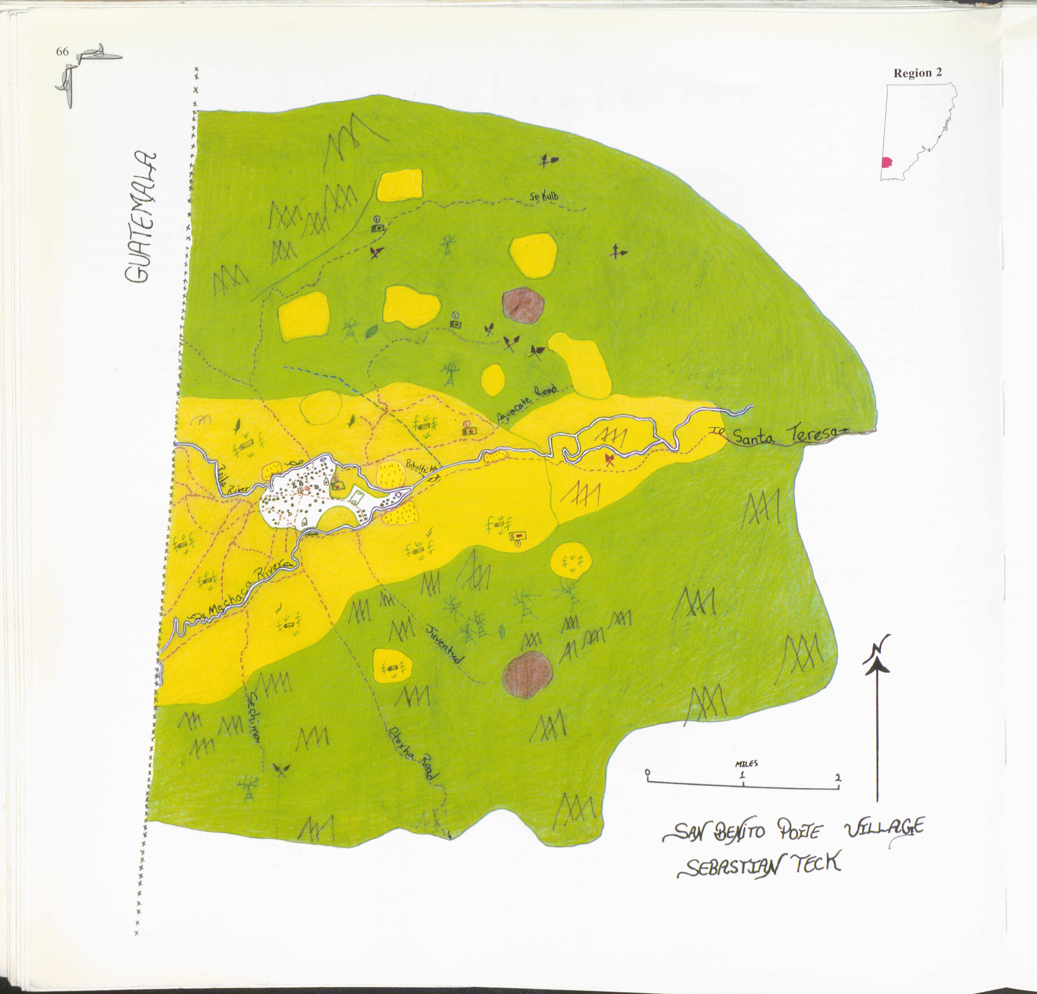
San Benito Poite
Mapa 1997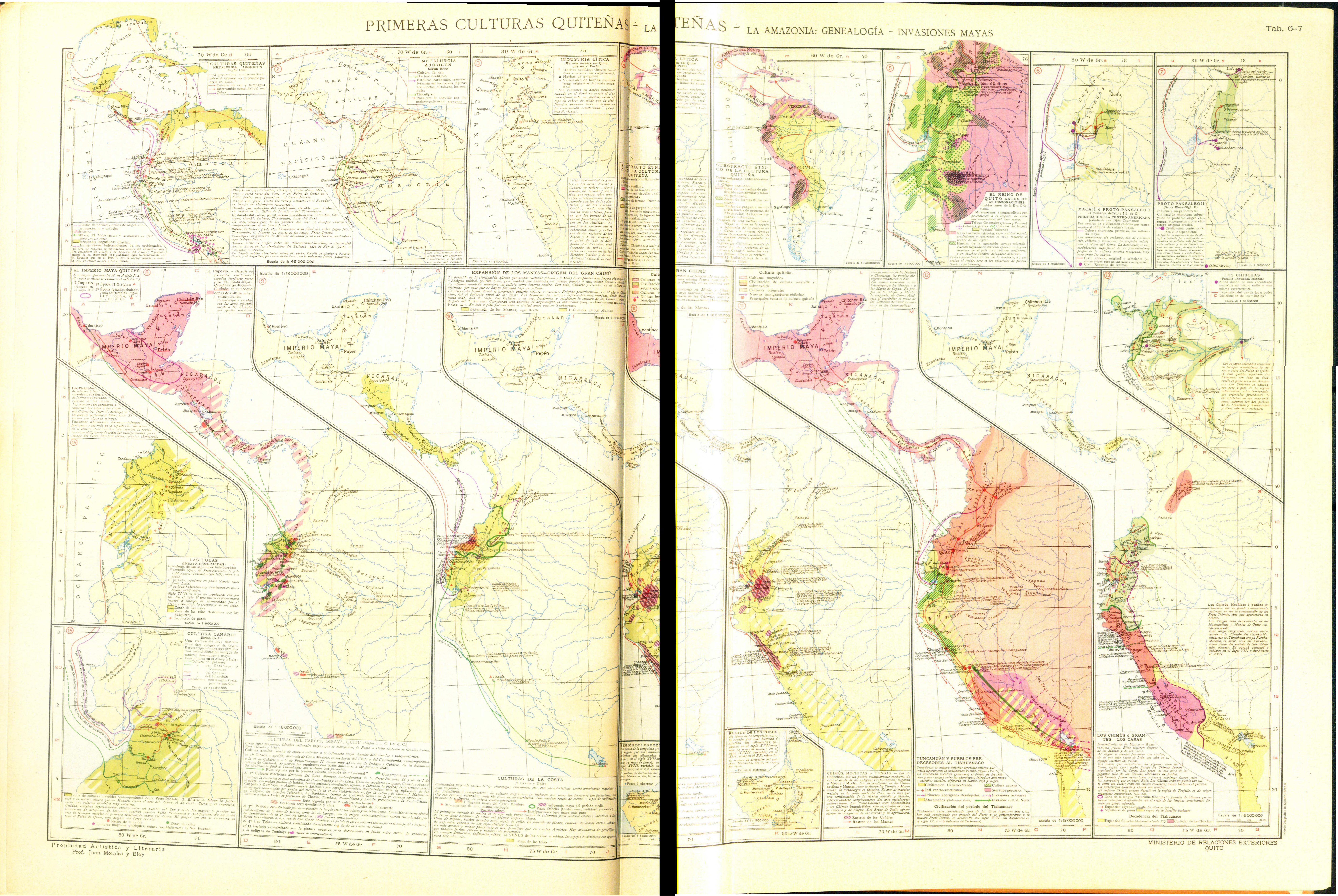
PRIMERAS CULTURAS QUITENAS - LA AMAZONIA - GENEALOGÍA - INVASIONES MAYAS
Mapa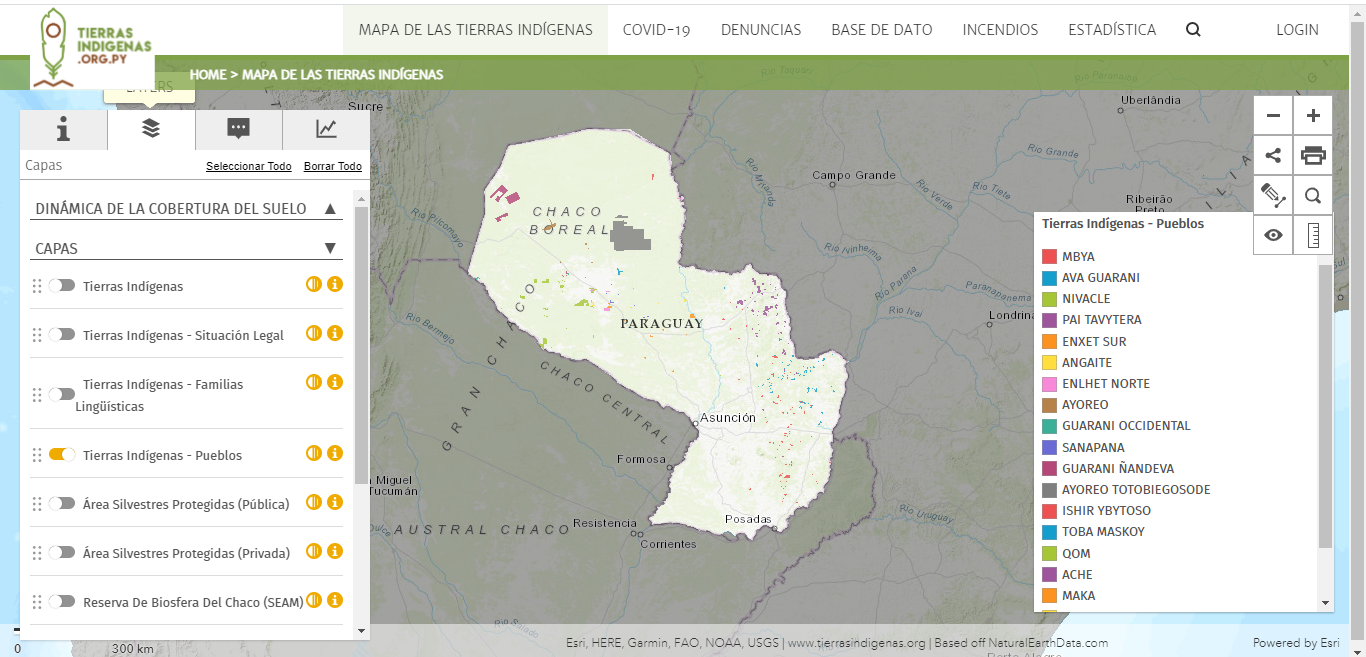
Mapa de las tierras indígenas - Pueblos
Mapa 2017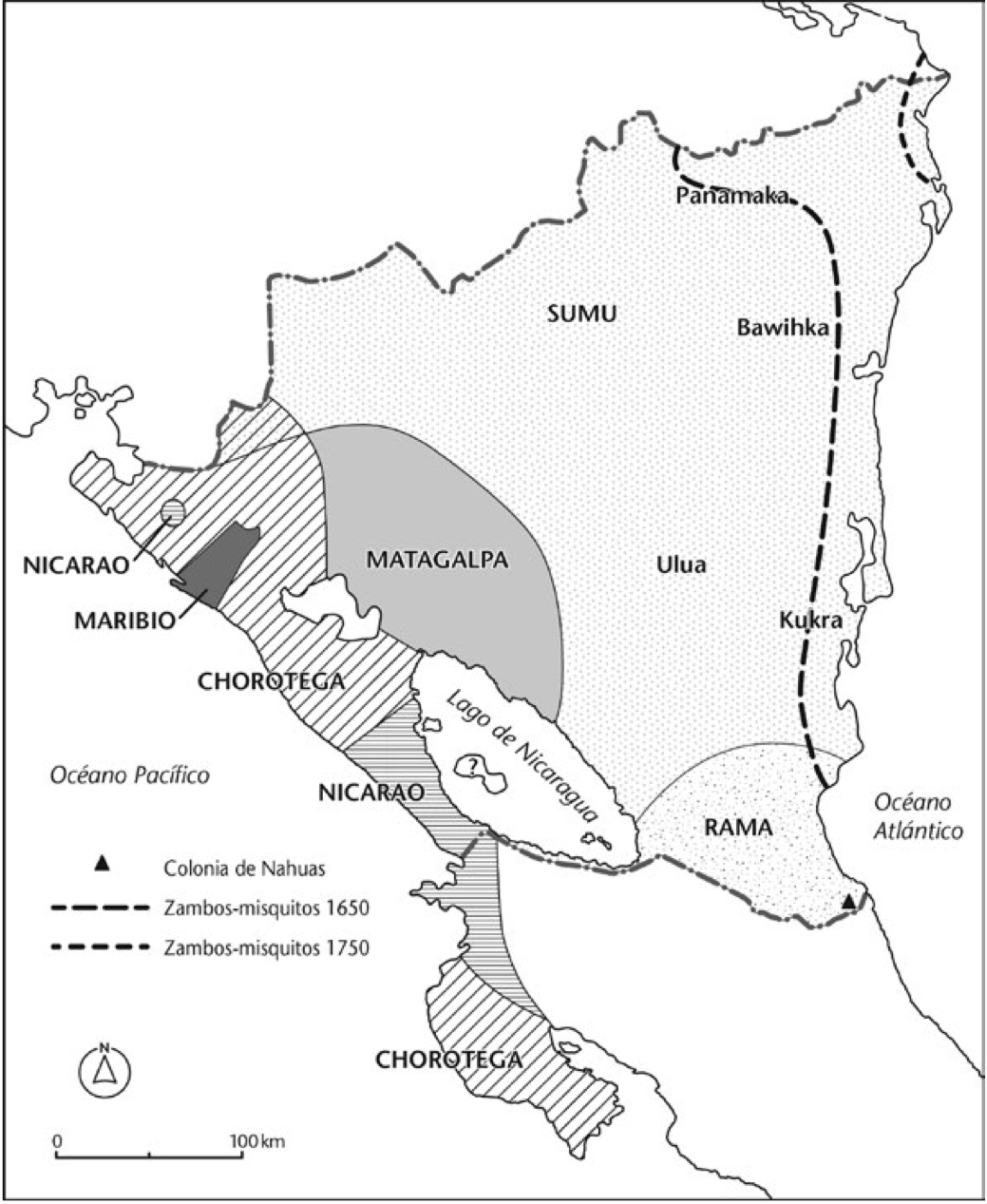
Mapa de las culturas indígenas en vísperas de la conquista española.
Mapa 1650 - 1750
Sin título
Obra de Arte
NOVA ET EXACTA DELINEATIO AMERICA
Mapa 1534
Demonstración Geográfica de las Provincias que abraza cada Yntendencia de las establecidas en la parte del Perú desde Salta, pertenecientes a el Virreynato del Río de la Plata
Mapa 1783
Etnias Norte Grande
Mapa 2015