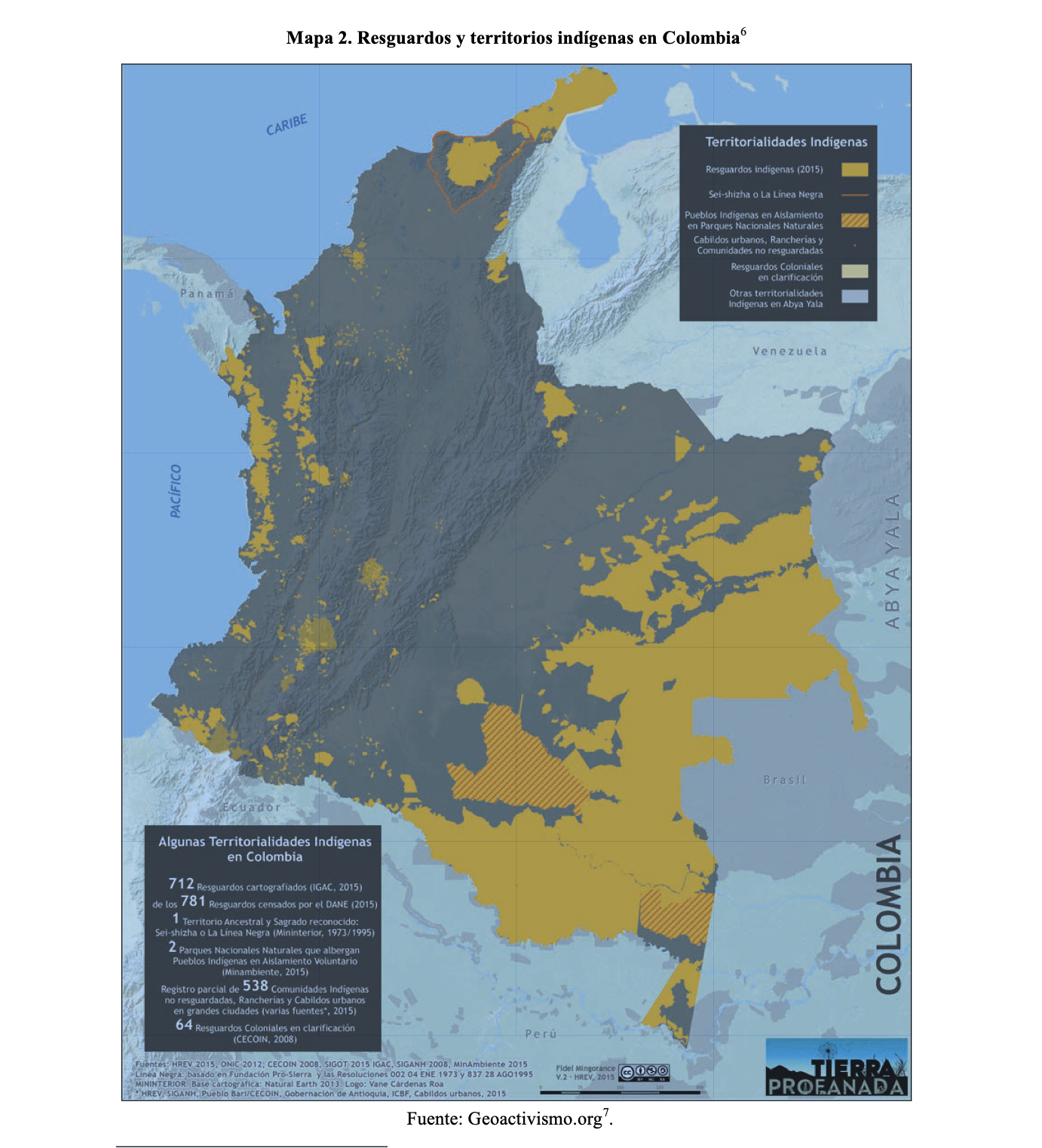
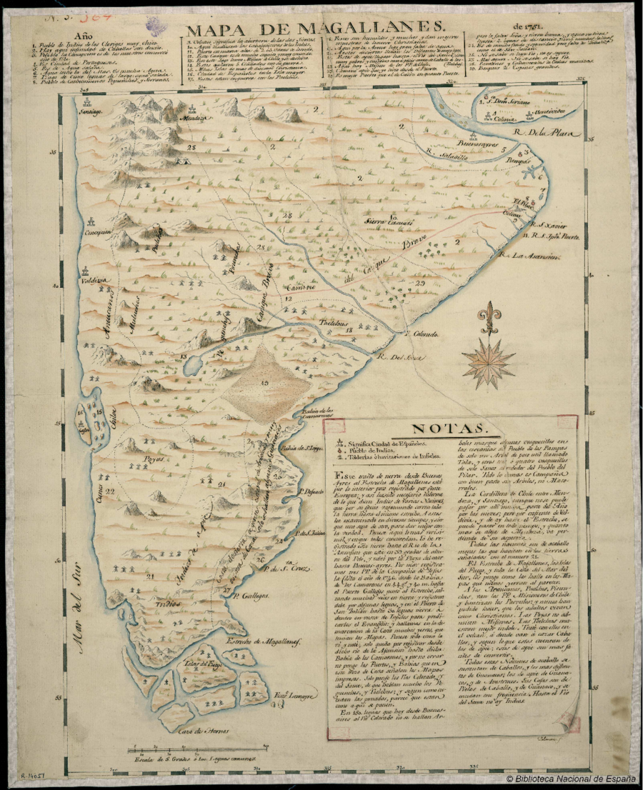
Dispossesions in the Americas

Dispossesions in the Americas

  • Inicio
  • Explorar
  • Autores
  • Sobre
  • Arte
  • Cuerpos
  • Planes de Estudio
  • Herencia Cultural
  • Mapas
  • Territorios
Volver a Explorar

Leyendo en Inglés

Mapa 1746

Mapa de Magallanes

  • Francisco Javier Santiago Palomares

Publicado: 1751

  • Descargar Imágen
  • Descargar Imágen
Mapa 1746

Mapa de Magallanes

  • Francisco Javier Santiago Palomares

Publicado: 1751

  • Descargar Imágen

Pueblos

  • CUNCOS
  • POYAS
  • ARAUCANOS
  • MULUCHES
  • PUELCHES
  • PEGUNCHES
  • PICUNCHES
  • TOELCHES
  • INDIOS DE A PIE

Cita

Biblioteca Nacional de España, Sala Goya - Cartografía, Call number: MR/42/403, Código de barras: 1002003390. http://bdh.bne.es/bnesearch/CompleteSearch.do?showYearItems=&field=todos&advanced=false&exact=on&textH=&completeText=&text=mapa+de+magallanes&pageSize=1&pageSizeAbrv=30&pageNumber=7

  • Descargar Imágen

Leyendo en Portugués

Mapa 1746

Mapa de Magallanes

  • Francisco Javier Santiago Palomares

Publicado: 1751

  • Descargar Imágen

Pueblos

  • CUNCOS
  • POYAS
  • ARAUCANOS
  • MULUCHES
  • PUELCHES
  • PEGUNCHES
  • PICUNCHES
  • TOELCHES
  • INDIOS DE A PIE

Cita

Biblioteca Nacional de España, Sala Goya - Cartografía, Call number: MR/42/403, Código de barras: 1002003390. http://bdh.bne.es/bnesearch/CompleteSearch.do?showYearItems=&field=todos&advanced=false&exact=on&textH=&completeText=&text=mapa+de+magallanes&pageSize=1&pageSizeAbrv=30&pageNumber=7

  • Descargar Imágen

Artículos Relacionados

RESGUARDOS Y TERRITORIOS INDIGENAS EN COLOMBIA

RESGUARDOS Y TERRITORIOS INDIGENAS EN COLOMBIA

Mapa 2015
Áreas culturales de Venezuela prehispánica

Áreas culturales de Venezuela prehispánica

Mapa 1490
INTENDENCIA DE YUCATÁN

INTENDENCIA DE YUCATÁN

Mapa 1800
The coexistence of indigenous peoples and the natural environment in Central America

The coexistence of indigenous peoples and the natural environment in Central America

Mapa 1900 - 1999
Lacandon Settlements in Eastern Chiapas

Lacandon Settlements in Eastern Chiapas

Mapa 1969
The Pech: Most important municipios, 2001

The Pech: Most important municipios, 2001

Mapa 2001
Departamentos y municipios de mayor concentración del pueblo Awá

Departamentos y municipios de mayor concentración del pueblo Awá

Mapa 2005
Fig. 1. Map of French Guiana with locations of the various Amerindian groups

Fig. 1. Map of French Guiana with locations of the various Amerindian groups

Mapa 1999

Despojos en las Américas

Un Proyecto de

University of Pennsylvania

Copyright 2024

Con el apoyo de

Mellon Foundation

Diseño y Desarrollo del Sitio

Element 84

Créditos Artísticos

Biblioteca Nacional de España, Sala Goya - Cartografía, Call number: MR/42/403, Código de barras: 1002003390. http://bdh.bne.es/bnesearch/CompleteSearch.do?showYearItems=&field=todos&advanced=false&exact=on&textH=&completeText=&text=mapa+de+magallanes&pageSize=1&pageSizeAbrv=30&pageNumber=7

Páginas del Sitio

  • Inicio
  • Explorar
  • Autores
  • Sobre
  • Arte
  • Cuerpos
  • Planes de Estudio
  • Herencia Cultural
  • Mapas
  • Territorios