Pueblos
- PATAGONES
- PUELCHES
- PAMPAS
- PEHUENCHES
- TEHUELCHES
- AUCAS
- CHARRUAS
Cita
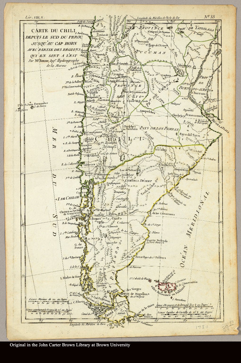
Bonne, Rigobert. "Carte du Chili depuis le sud du Perou jusqu'au Cap Horn ... par Mr. Bonne, Ingr. Hydrographe de la Marine." Map. 1780. Accessed April 3, 2022. https://jcb.lunaimaging.com/luna/servlet/detail/JCBMAPS~1~1~3469~101683:Carte-du-Chili-depuis-le-sud-du-Per?sort=normalized_date%2Cfile_name%2Csource_author%2Csource_title#
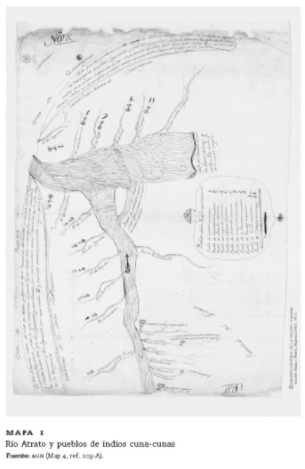
![Plano que conti[en]e las Provincias de Sonora, Pimerías, Papaguería, Apachería, Rios Gila y Colorado y tierras descubiert[a]s hasta el Puerto de S[a]n Fran[cis]co en la California Septentrional y jasta el Pueblo de Oraybe en la Provincia de el Moqui, con arreglo á los diarios de el Coronel D[o]n Ant[oni]o Crespo y de los P.P. Misioneros Fr[ray] Pedro Font y Fr[ay] Francisco Garcés de q[uie]n, los viajes desde la nación Jabajaba en el Río Colorado hasta la misión de S[a]n Gabriel, a las Naciones que están al Norte de esta Misión, su regreso á los Jamajabas y camino que hizo al Moqui, están señalados con lineas de puntos: con cuia señal se manifiesta también la línea de Presidios de esta frontera](https://dnet8ble6lm7w.cloudfront.net/maps_sm/MEX/MEX0188.png)