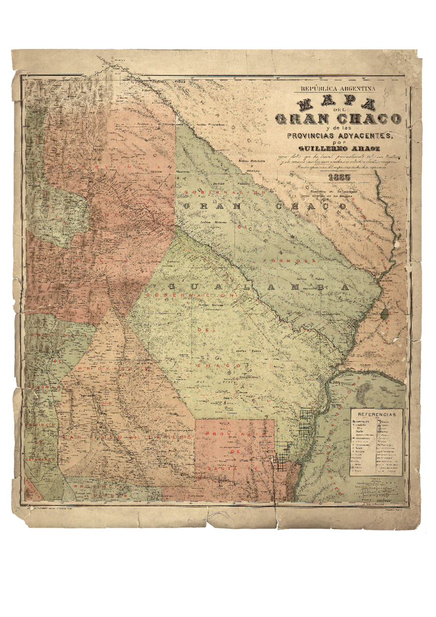
Pueblos
- MATACOS
- TOBAS
- GUAYCURUES
- MOCOVIES
- CHIRIGUANOS
- GUANAS
- GUISNAIS
- TIRUMBAES
Cita
Araoz, Guillermo. "Mapa del Gran Chaco y Provincias Adyacentes." Map. 1885 https://www.argentina.gob.ar/sites/default/files/5._el_gran_chaco_0.pdf
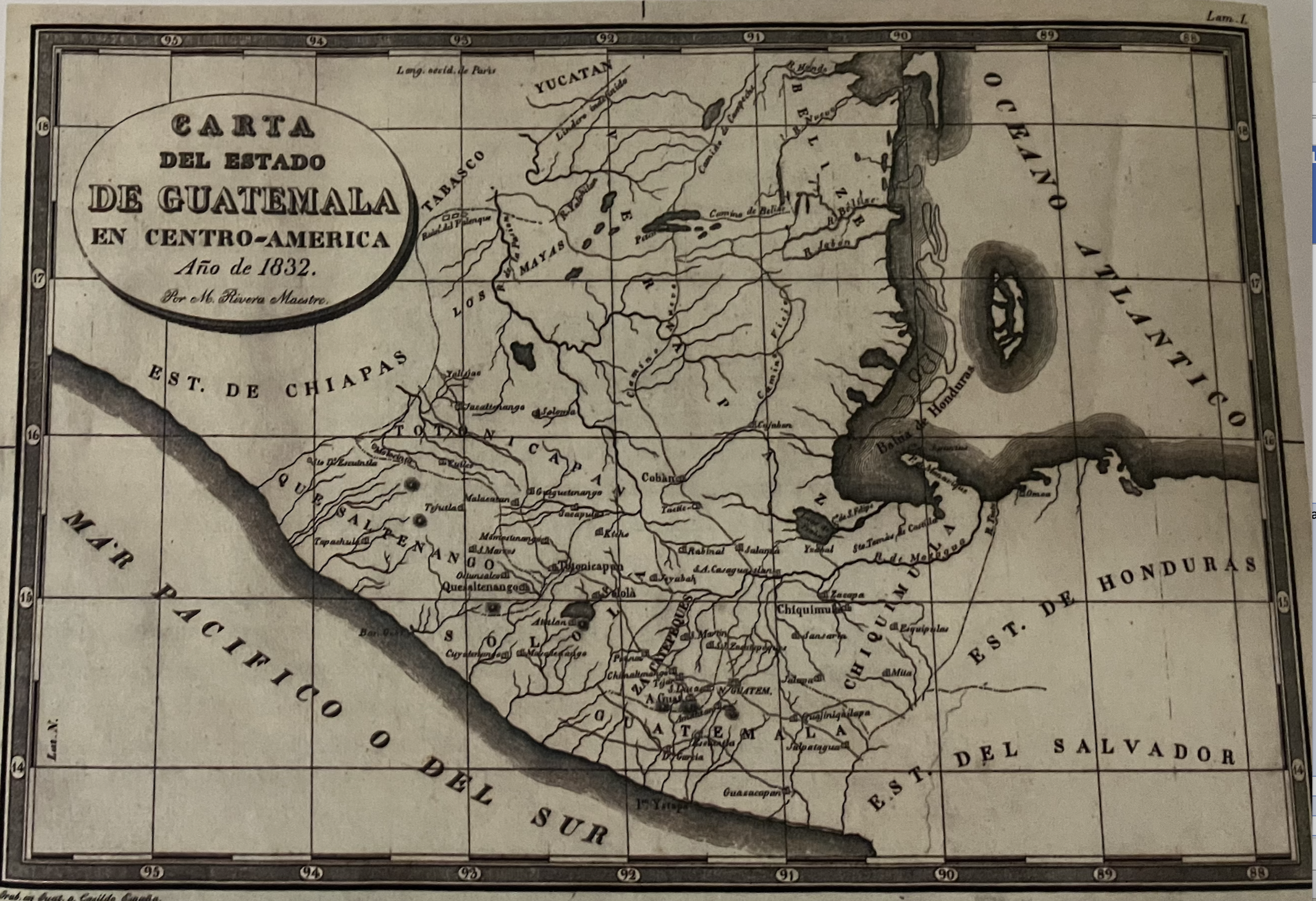
Carta/del/Estado/de Guatemala/en Centro-Americ
Mapa 1832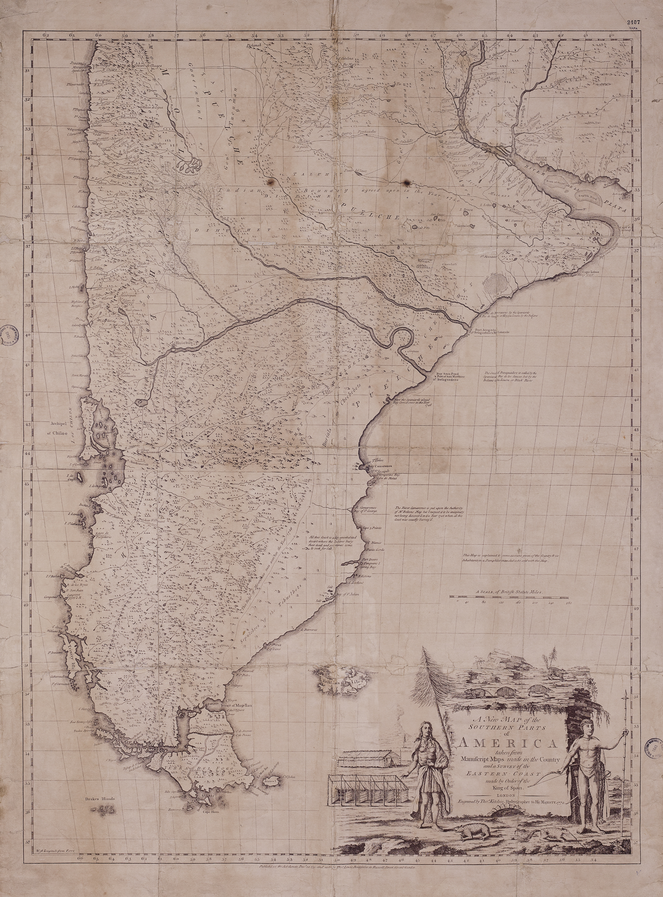
A New Map of the Southern Parts of America
Mapa 1772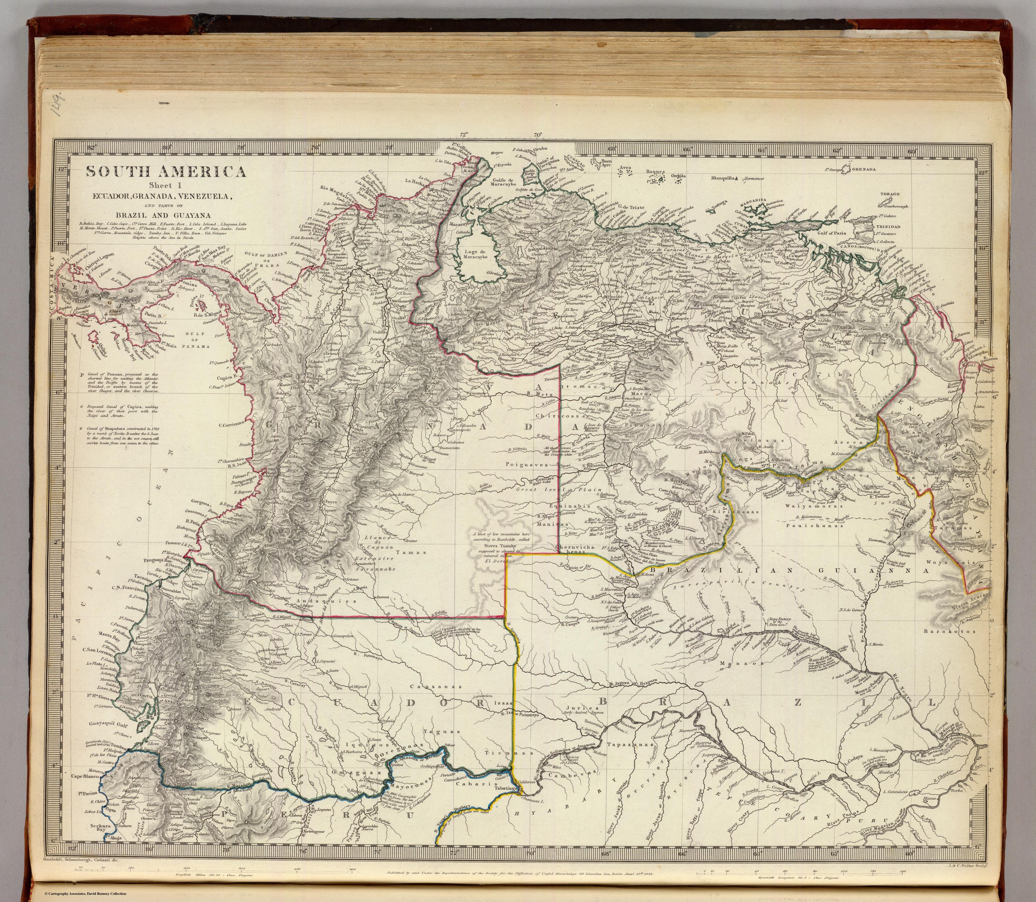
SOUTH AMERICA SHEET I. ECUADOR;GRANADA;VENEZUELA;AND PARTS OF BRAZIL AND GUAYANA
Mapa 1842
"Transversalidad Histórica entre las Tierras Indidas de 1940 y los Pueblos Indígenas de Costa Rica en la actualidad"
Mapa 1940 - 2014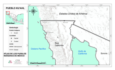
PUEBLO KU'AHL
Mapa 2020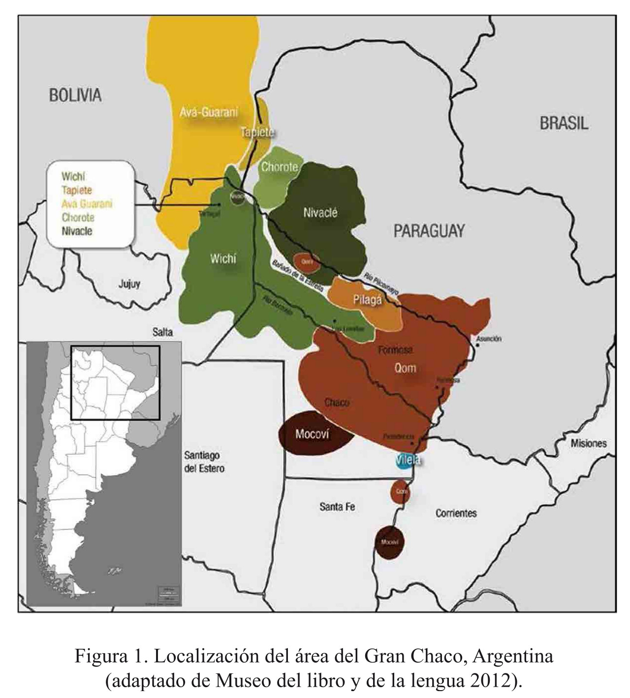
Localización del área del Gran Chaco, Argentina
Mapa 2016
Detail from the 1770 copy of Francisco Álvarez Barreiro’s 1728 map of northern New Spain illustrating Spanish mapping of Indian domains in southern Texas and along the Gulf Coast, especially through the repetition of labels: “tierra de los Pampopas,” “tierra de los Carrizos,” “tierra de los Cujanes,” etc.
Mapa 1728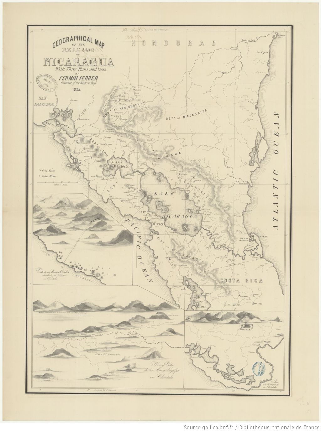
Geographic Map of the Nicaragua with three plans and views.
Mapa 1855