
Pueblos
- PAI-GUARANI
- MBYA-GUARANI
- ACHE-GUARANI
- AVA-GUARANI
Cita
Endepa. "Mapa Guaraní en Argentina." Accessed September 2021. https://www.endepa.org.ar/mapa-guarani-en-argentina/
KART VON OST-BRASILIEN. CARTE GÉOGRAPHIQUE DE LA PARTIE ORIENTALE DE L'EMPIRE DU BRÉSIL
Mapa 1831
Guatemala Maya Ethnicity Year 2018
Mapa 2000
Muchitlán, Tlaxcala, Mexico
Mapa 1582
Los Chorti: Most important minicipios, 2001
Mapa 2001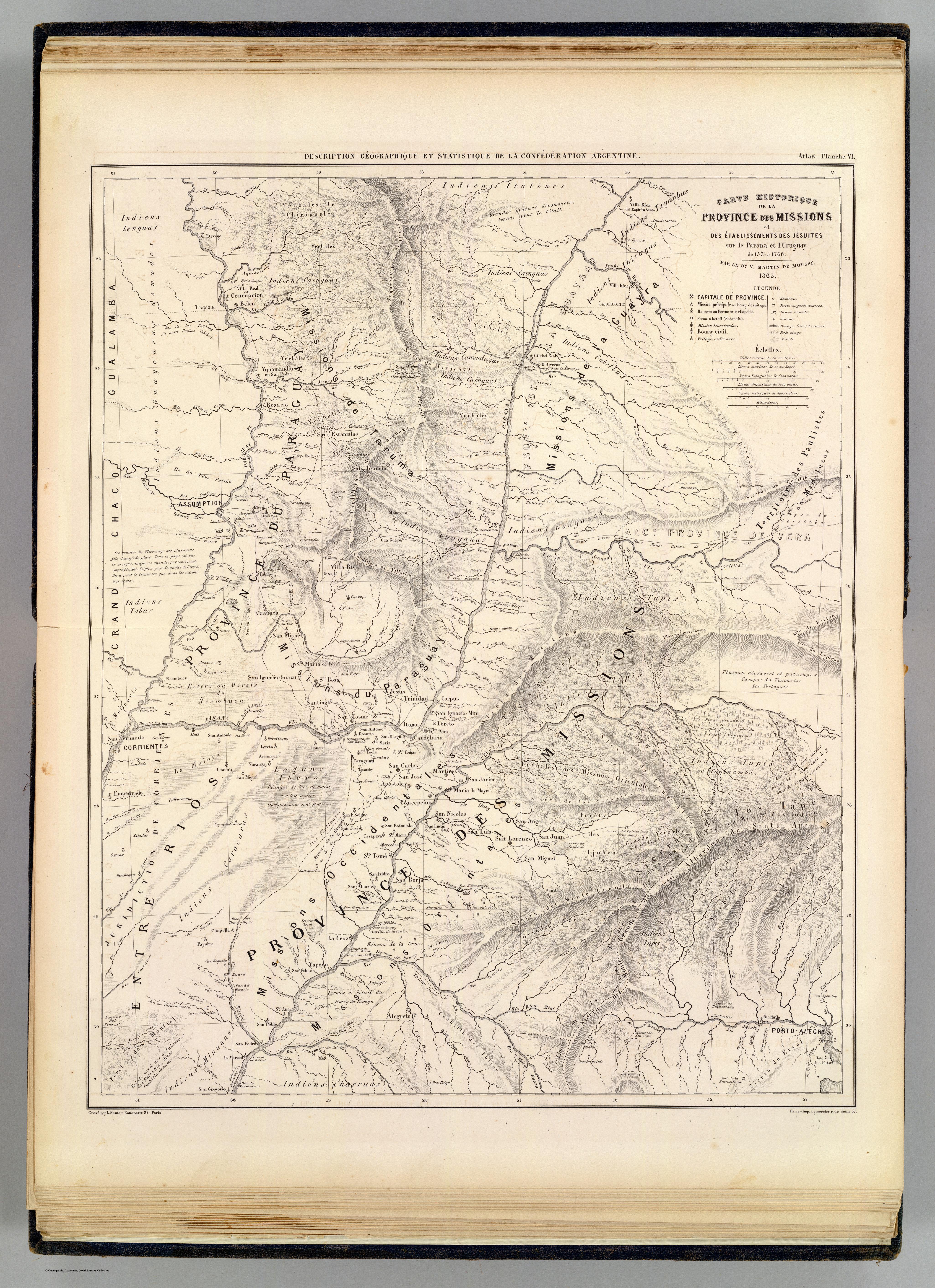
Carte hist.;Prov. des Missions;etabl. Jesuites;Parana et l'Uruguay;1575- 1768
Mapa 1575 - 1768
Sketch of the country from reduction to Buenos Ayres, shewing the movements of B. Genl. Beresford, when he captured that place June 1806. Drawn from memorandums furnished by Capt: Donnelly
Mapa 1806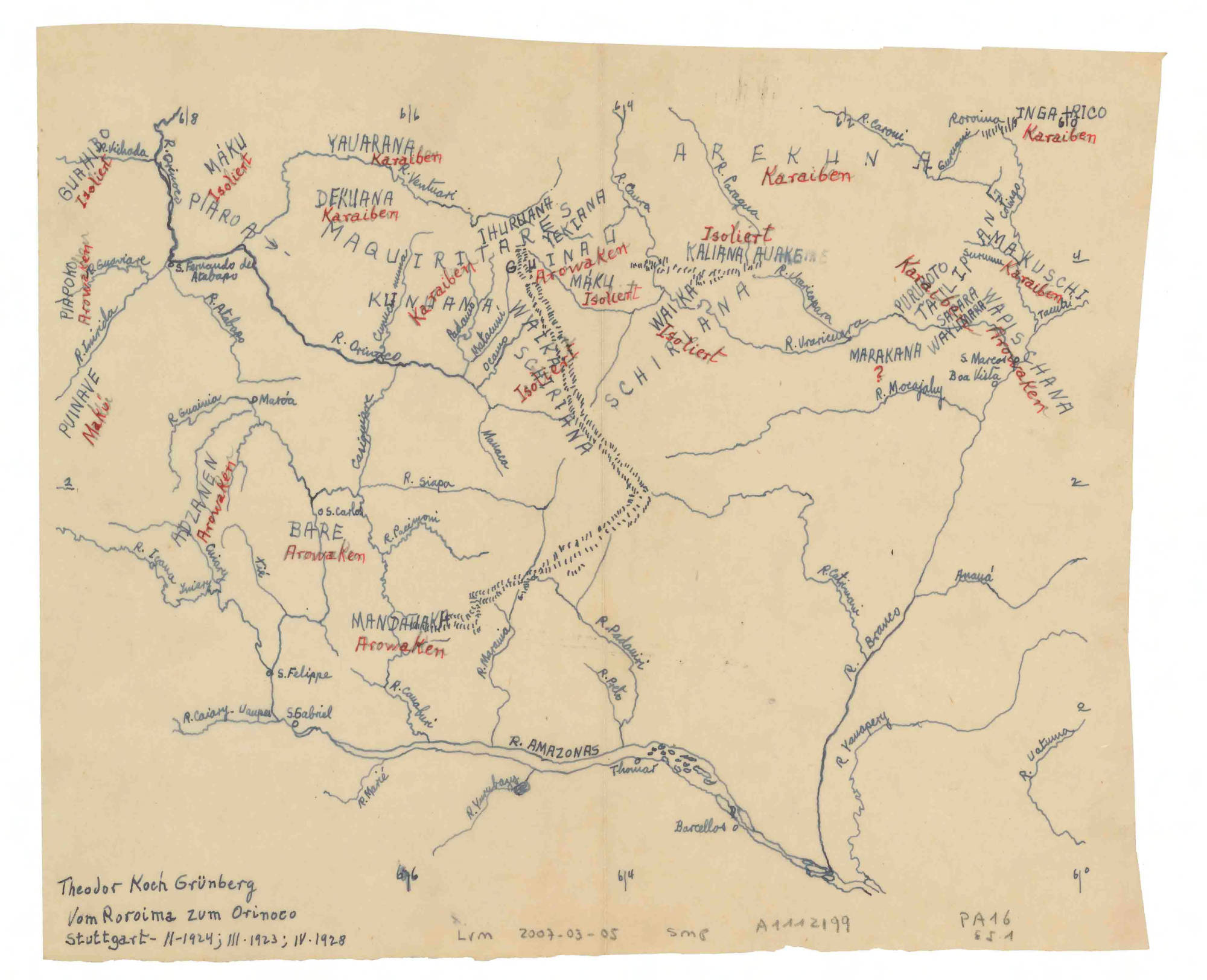
Vom Roroima zum Orinoco
Mapa 1923 - 1928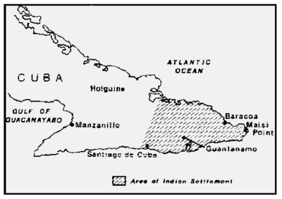
Indians in Cuba
Mapa 1989