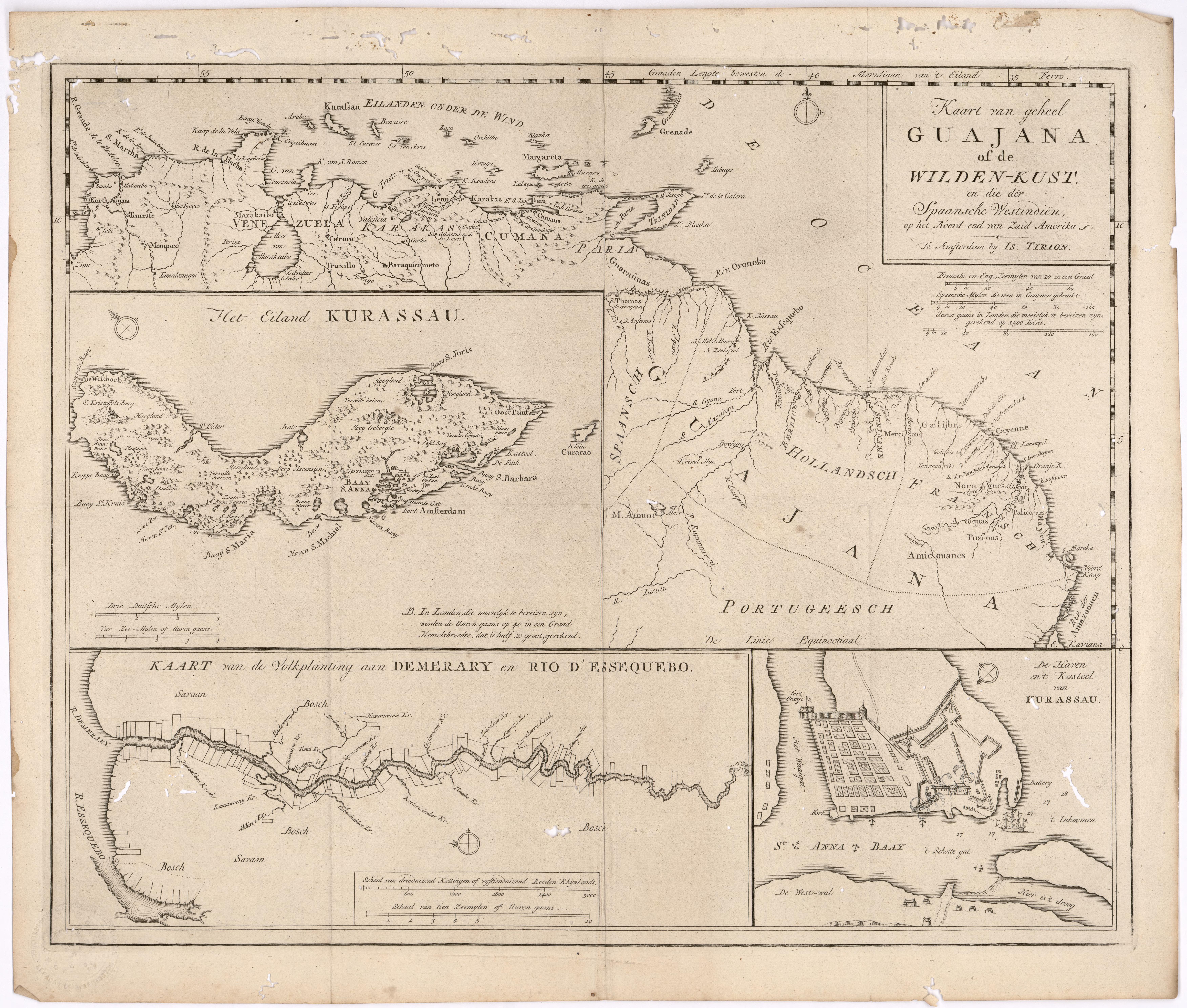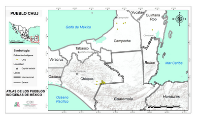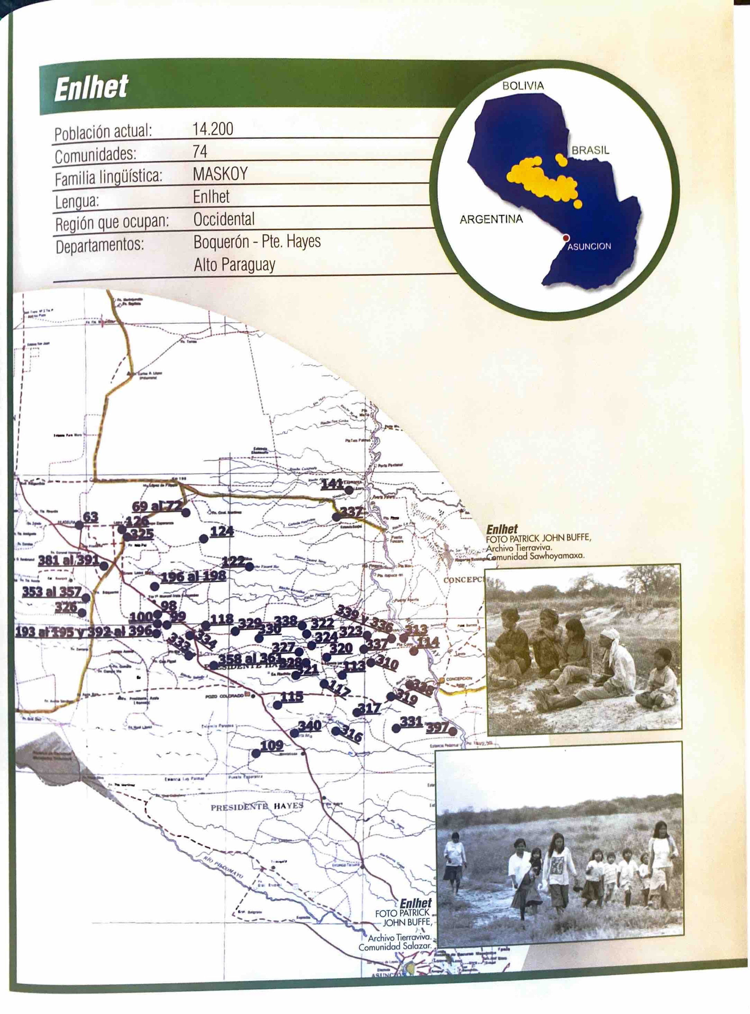
Peoples
- INDIOS
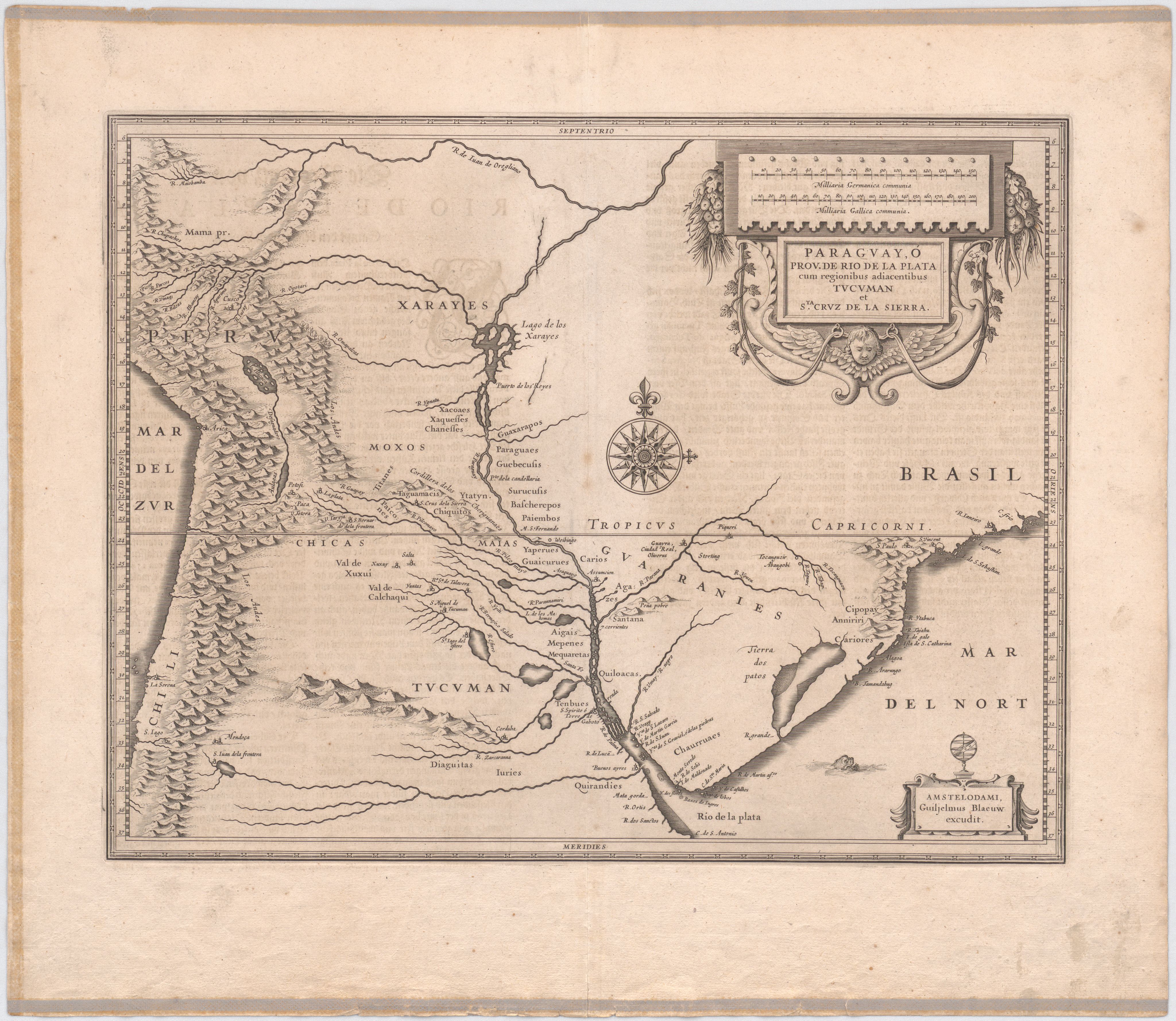
Citation
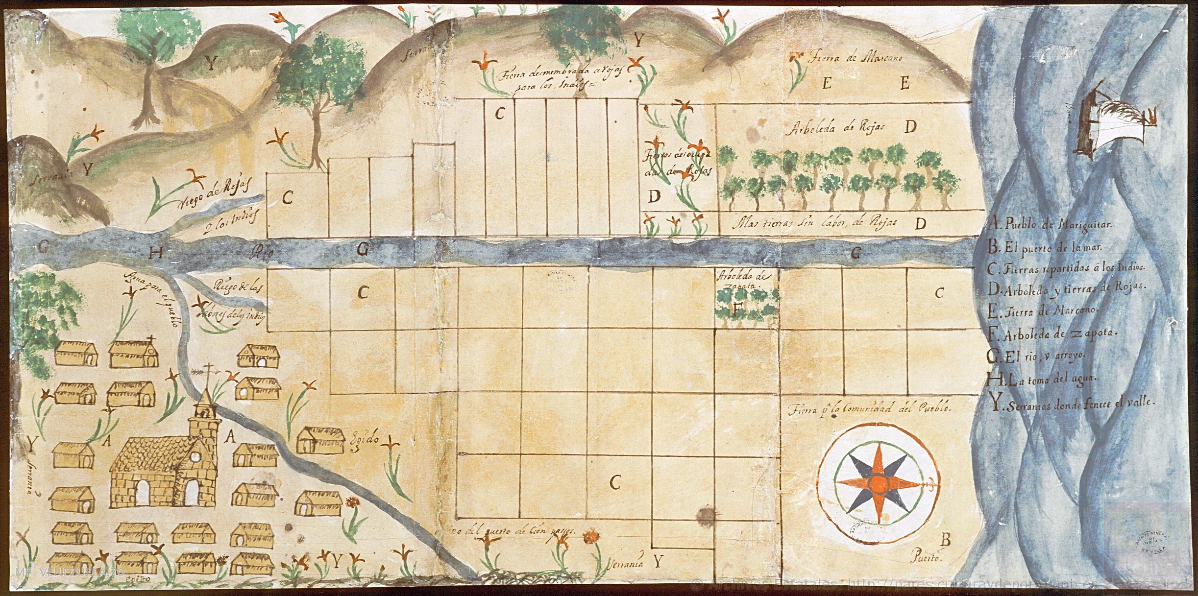
Plano del pueblo de Mariquitar y de las tierras repartidas a los indios. ES.41091.AGI//MP-VENEZUELA,70. Portal de Archivos Españoles - PARES. Accessed, October 27, 2023. https://pares.mcu.es/ParesBusquedas20/catalogo/show/25985