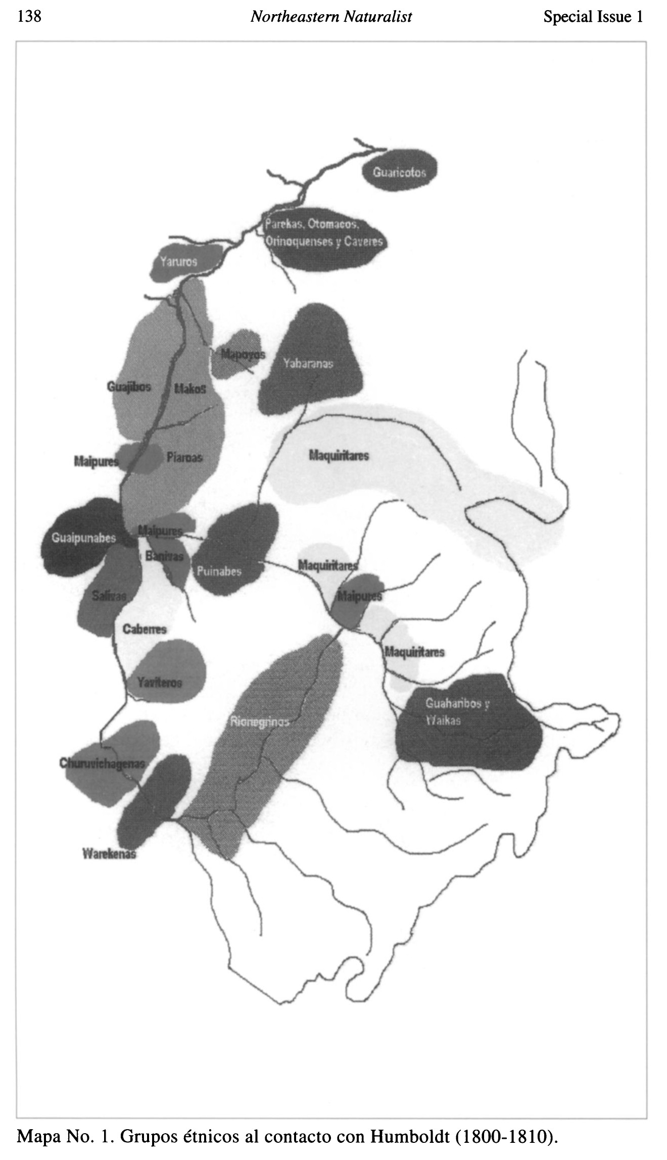
Peoples
- CARIBE
- GUAICAS
Citation
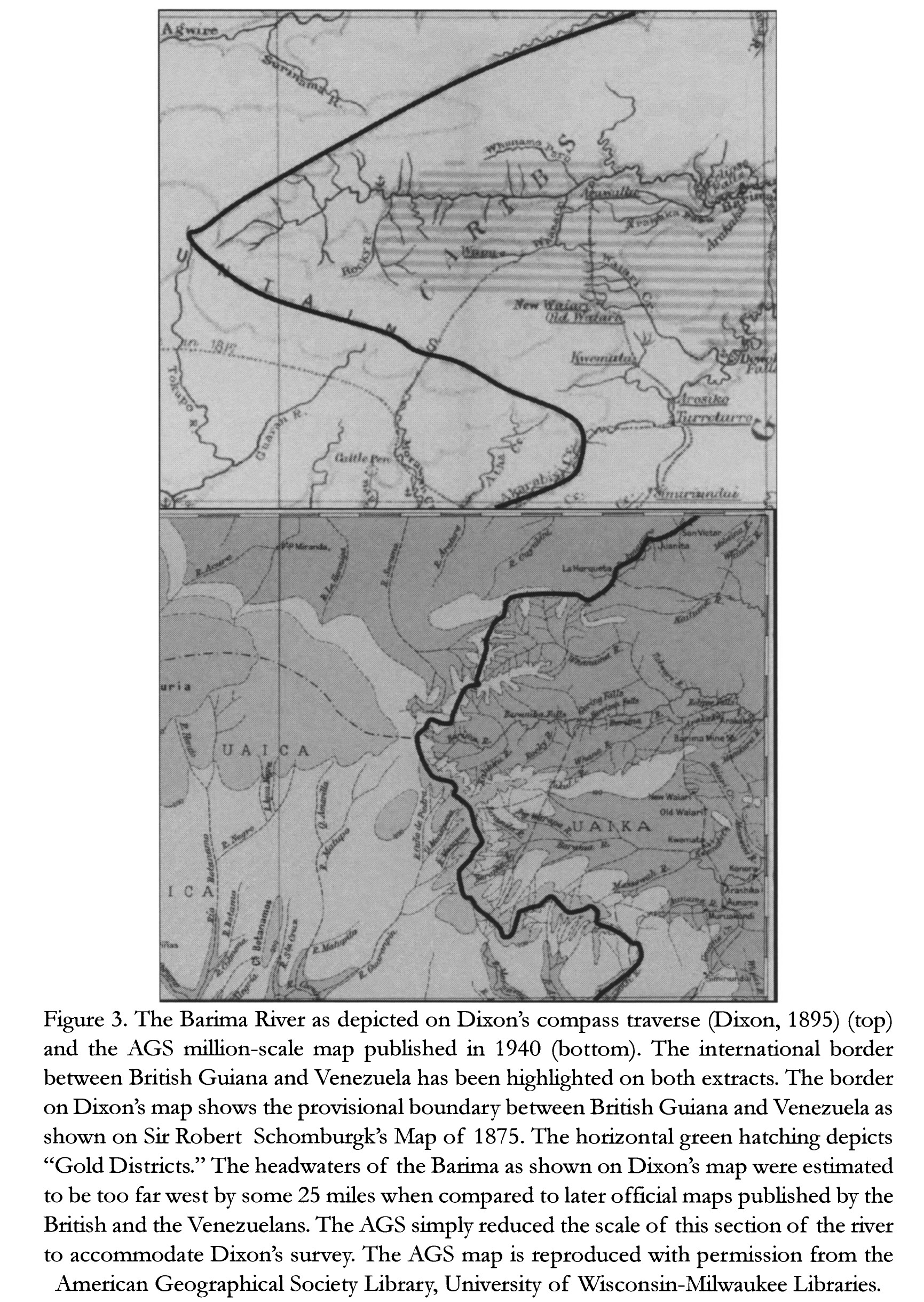
Dixon;George. "The Barima River as depicted on Dixon's compass traverse and the AGS million-scale map published in 1940 (bottom)." Map. In Revealing the 'Lost World': The American Geographical Society and the Mapping of Roraima during the 1930s;by Alastair Pearson and Michael Heffernan;186. Vol. 14. Journal of Latin American Geography;2015. Accessed March 4;2023. https://www.jstor.org/stable/43964634?seq=19.