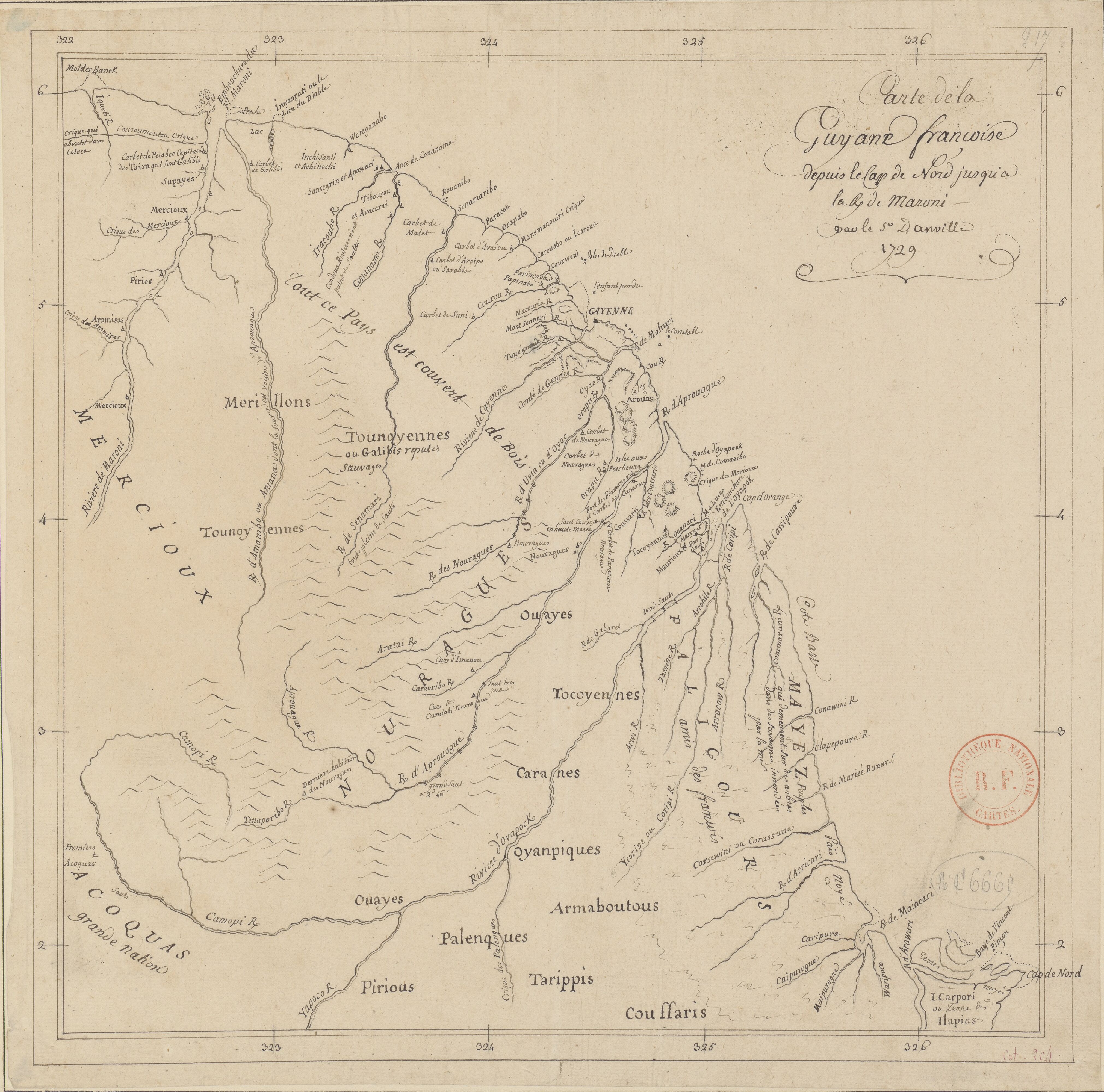
Peoples
- YARURO
- OTOMACO
- MACOS
- JIVI
- PUINAVE
- EQUINABIS
- MANIVAS
- CHURUVICHAGENA
- PIAROA
- CURACHICANAS
- YAVARANA
- CARIBE
- YEKUANA
- GUAINARES
- ABERIANA
- GUAICAS
- GUAHARIBOS
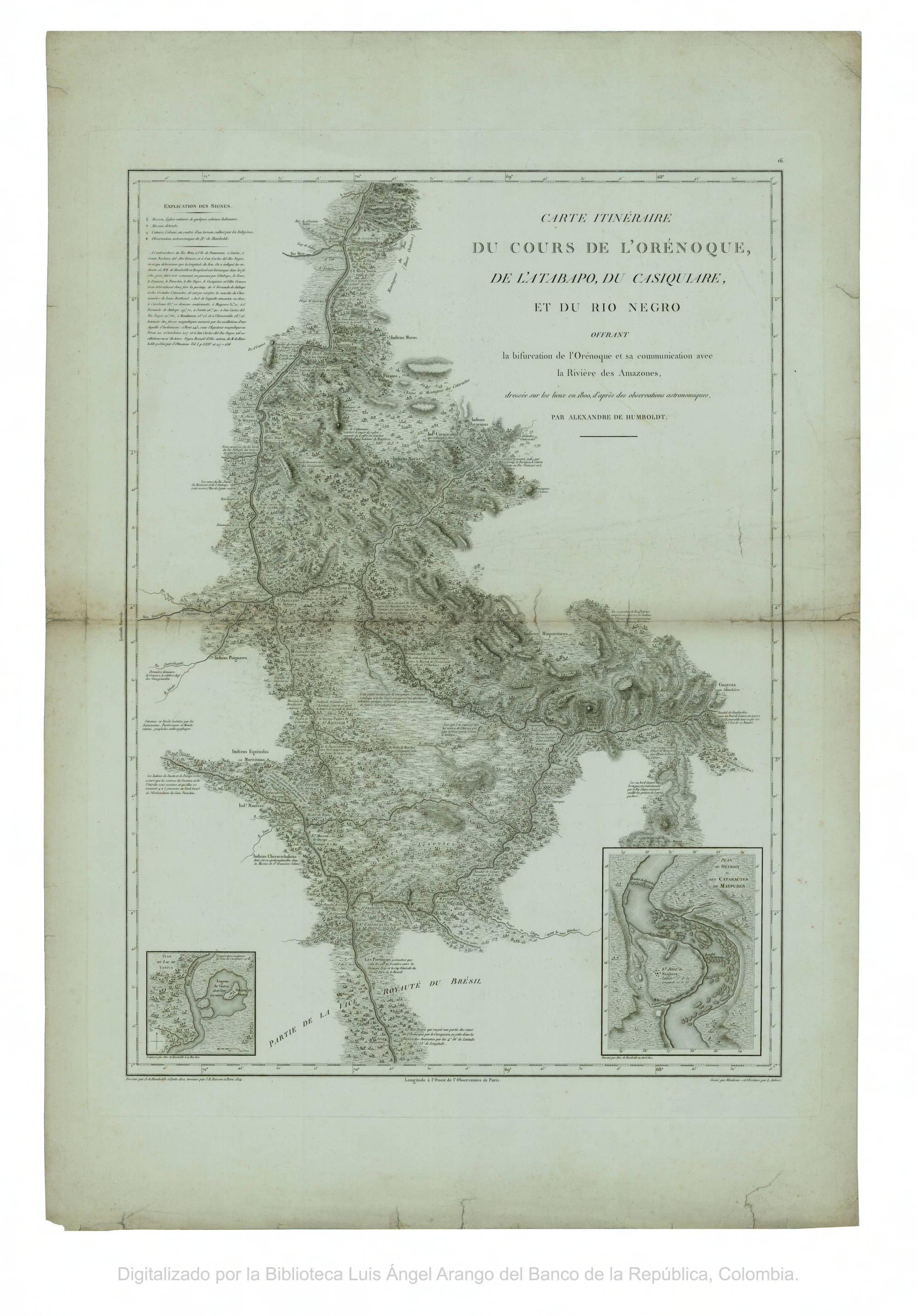
Citation
Humboldt;Alexander von;and Aimé Jacques Alexandre Bonpland. Carte itineraire du cours de l'Orenoque;de l'Atabapo;de Casiquiare et du Rio Negro;offrant la bifurcation de l'Orenoque et sa communication avec la rivière de l'Amazone. Map. Paris: J.B. Porison;1814. Accessed February 2;2023. https://babel.banrepcultural.org/digital/collection/p17054coll13/id/653/rec/75.
![Serie Esclavas de la fiebre de oro [Series Slaves of the Golden Fever]](https://dnet8ble6lm7w.cloudfront.net/art_sm/APER063-0.png)
![Chic Material [Material Chic]](https://dnet8ble6lm7w.cloudfront.net/art_sm/AARG020.png)