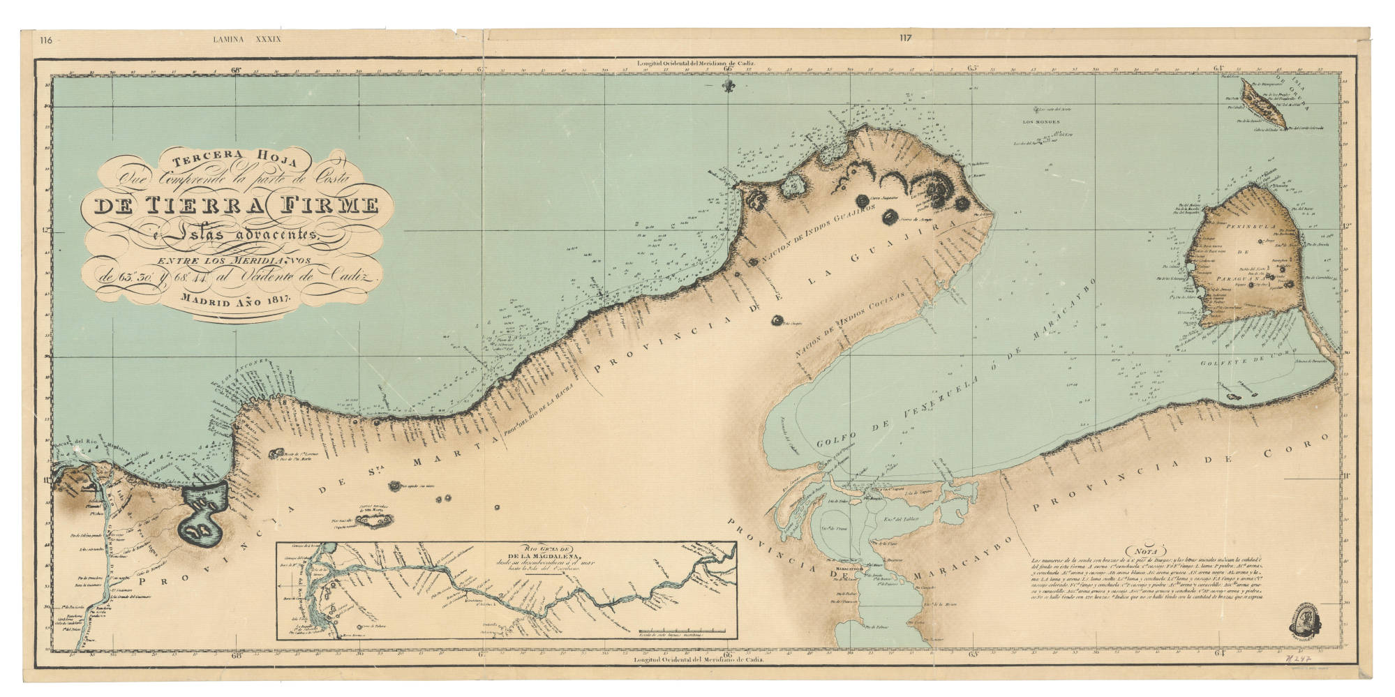
Peoples
- WAYUU
- COSINAS
Citation
Fidalgo;Joaquín Francisco. Tierra Firme e islas adyacentes. Map. Madrid;1817. Accessed January 22;2023. https://babel.banrepcultural.org/digital/collection/p17054coll13/id/545/rec/30.
PLANTA DA MARCHA DO 2º CORPO DO EXERCITO BRAZILEIRO DO RIO URUGUAY AO PARANÀ em 1866
Map 1866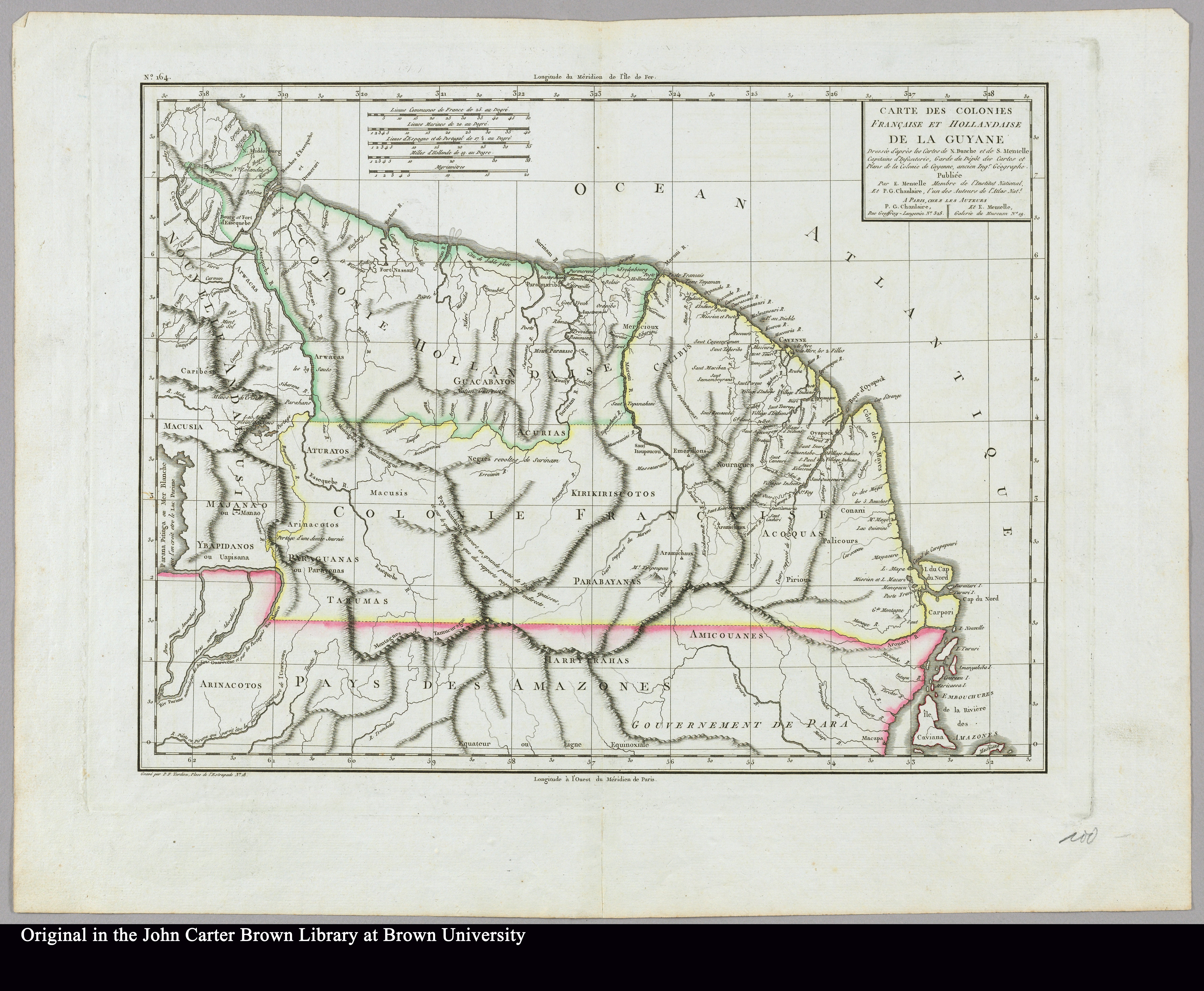
Carte des colonies Française et Hollandaise de la Guyane Dressée d'après les cartes de N. Buache et de S. Mentelle Capitaine d'Infanterie
Map 1800 - 1899
Outlines of the physical and political division of South America: Delineated by A. Arrowsmith partly from scarce and original documents, published before the year 1806 but principally from manuscript maps & surveys made between the years 1771 and 1806, corrected from accurate astronomical observations to 1810.
Map 1800 - 1899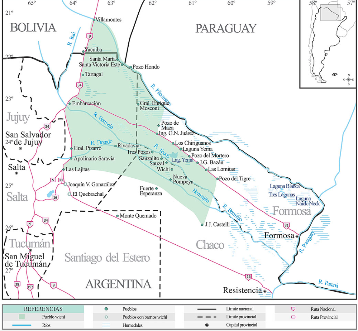
Lengua wichí. Dónde se habla
Map 2009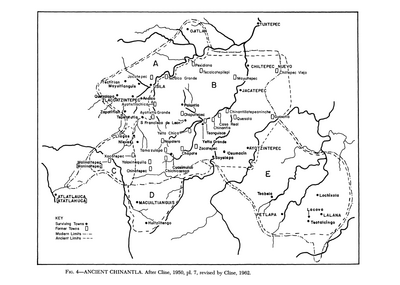
Ancient Chinantla
Map 1962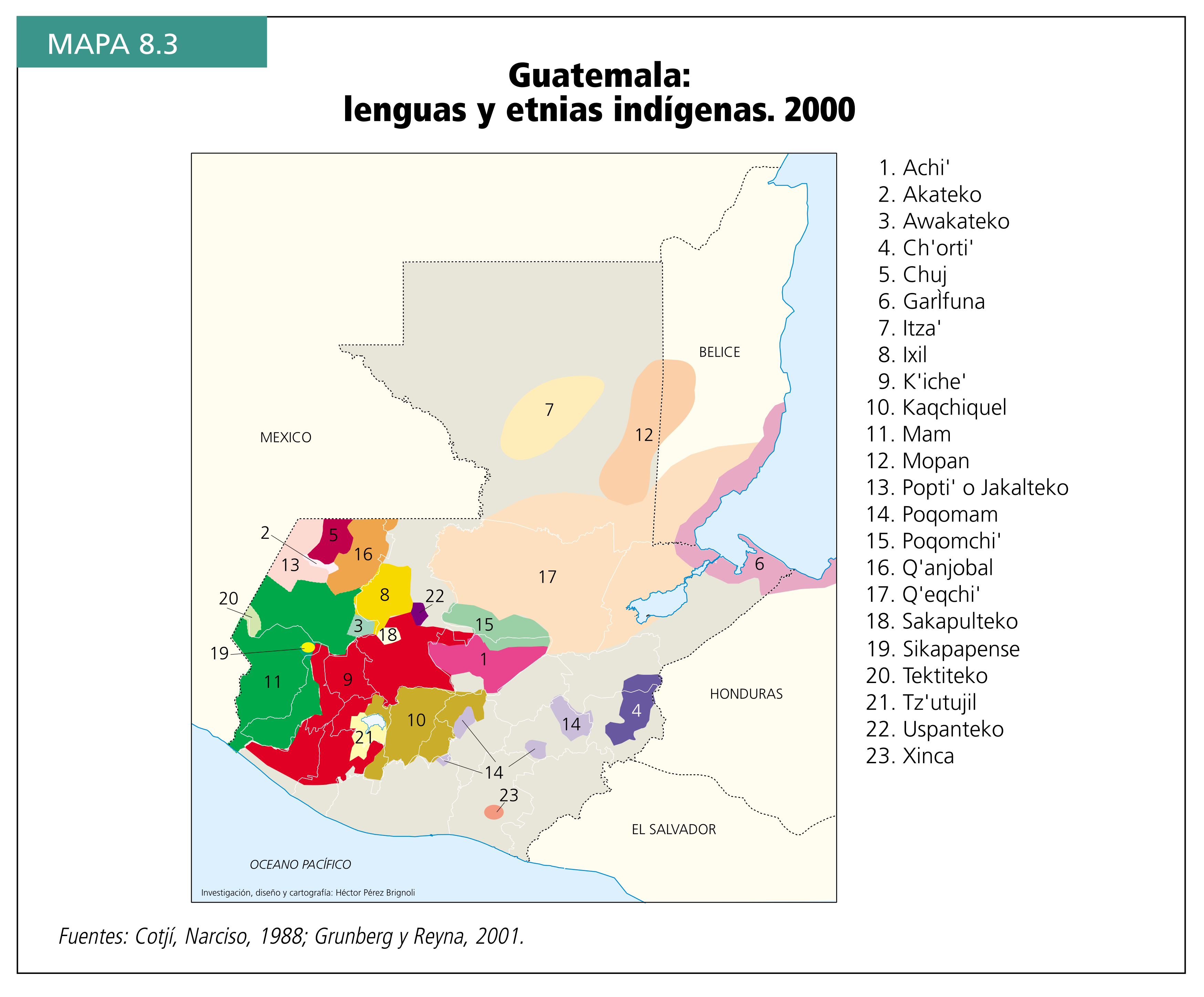
Guatemala: lenguas y etnias indígenas. 2000
Map 2000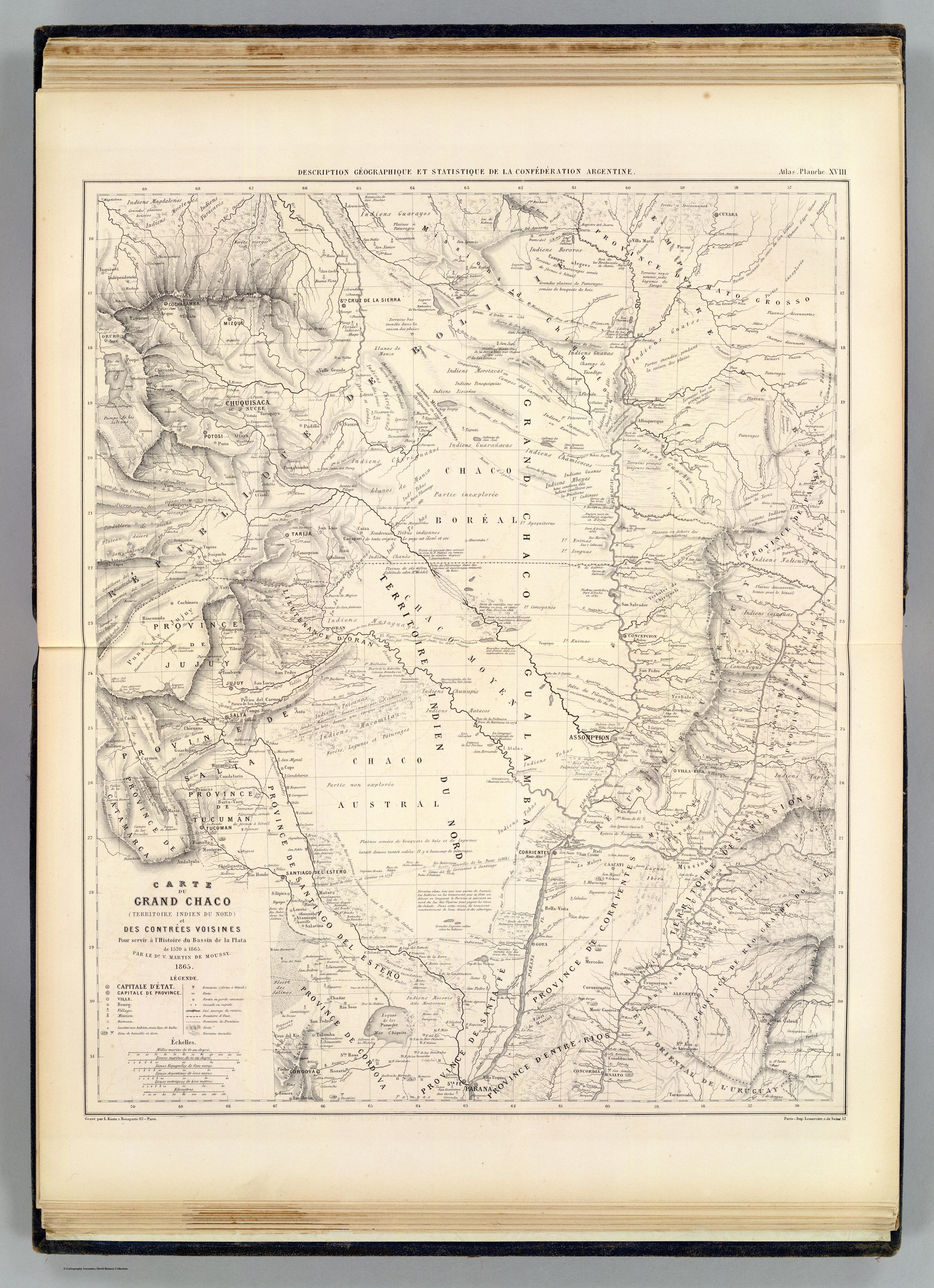
CARTE DU GRAND CHACO (TERRITOIRE INDIEN DU NORD) et DES CONTRÉES VOISINES
Map 1520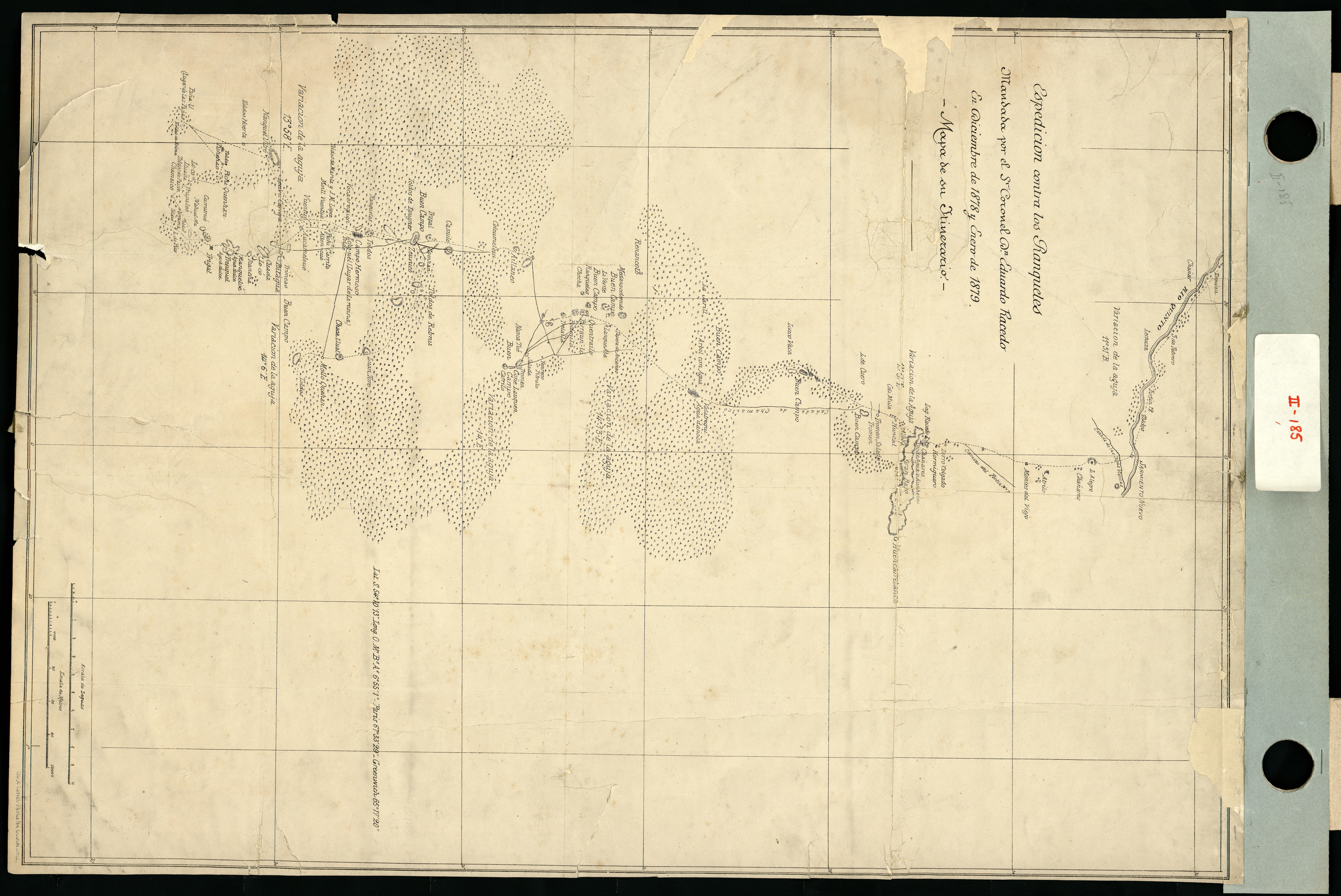
Espedicion contra los ranqueles
Map 1878 - 1879