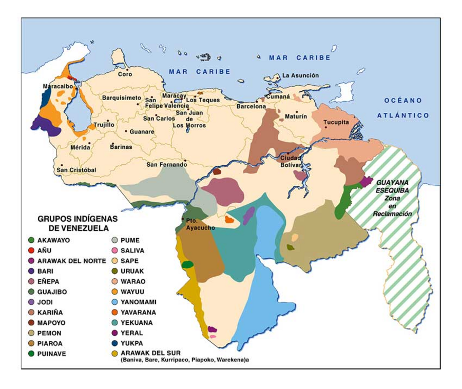
Dispossesions in the Americas

Dispossesions in the Americas

  • Home
  • Explore
  • About
  • Authors
  • Art
  • Bodies
  • Curricula
  • Cultural Heritage
  • Maps
  • Territories
Back to Explore
Map 2000 - 2010

GRUPOS INDÍGENAS DE VENEZUELA

    Published: 2009

    • Download Image

    Peoples

    • AKAWAYO
    • ANU
    • ARAWAK DEL NORTE
    • BARI
    • ENEPA
    • GUAJIBO
    • JODI
    • KARINA
    • MAPOYO
    • PEMON
    • PIAROA
    • PUINAVE
    • PUME
    • SALIVA
    • SAPE
    • URUAK
    • WARAO
    • WAYUU
    • YANOMAMI
    • YAVARANA
    • YEKUANA
    • YERAL
    • YUKPA
    • ARAWAK DEL SUR
    • BANIVA
    • BARE
    • KURRIPACO
    • PIAPOKO
    • WAREKENA

    Citation

    "Grupos Indígenas de Venezuela." Map. La Guayana Esequiba. October 28;2009. Accessed September 10;2021. http://laguayanaesequiba.blogspot.com/2009/10/indigenas-venezolanas-una-historia.html.

    • Download Image

    Reading in Spanish

    Map 2000 - 2010

    GRUPOS INDÍGENAS DE VENEZUELA

      Published: 2009

      • Download Image
      • Download Image

      Related Content

      Ubicación Corregimiento de la Pedrera

      Ubicación Corregimiento de la Pedrera

      Map 2019
      CARTE DU BRÉSIL

      CARTE DU BRÉSIL

      Map 1851
      Ilustración 1. Territorios de Pueblos y Nacionalidades en la Amazon Ecuador;2006

      Ilustración 1. Territorios de Pueblos y Nacionalidades en la Amazon Ecuador;2006

      Map 2006
      No Title

      No Title

      Map 1660
      DIVISION DE CORREGIMIENTOS EN LA PROVINCIA DE SANTA FE

      DIVISION DE CORREGIMIENTOS EN LA PROVINCIA DE SANTA FE

      Map 1575
      Corazon

      Corazon

      Map 1997
      Carte de la Neustrie dressée, ainsi que la carte générale, d'après les cartes de Jn. Purdy, celles de Th. Jefferys, corrigées, etc., etc. / par Desmadryl jeune

      Carte de la Neustrie dressée, ainsi que la carte générale, d'après les cartes de Jn. Purdy, celles de Th. Jefferys, corrigées, etc., etc. / par Desmadryl jeune

      Map 1830
      LOCALIZACION GEOGRAFICA DE LAS COMUNIDADES CIMARRONAS EN COLOMBIA DURANTE LOS SIGLOS XVI Y XVII

      LOCALIZACION GEOGRAFICA DE LAS COMUNIDADES CIMARRONAS EN COLOMBIA DURANTE LOS SIGLOS XVI Y XVII

      Map 1500 - 1699

      Dispossessions in the Americas

      A project by

      University of Pennsylvania

      Copyright 2024

      With support from

      Mellon Foundation

      Site design & development

      Element 84

      Art Credits

      “Grupos Indígenas de Venezuela.” Map. La Guayana Esequiba. October 28;2009. Accessed September 10;2021. http://laguayanaesequiba.blogspot.com/2009/10/indigenas-venezolanas-una-historia.html.

      Site Pages

      • Home
      • Explore
      • About
      • Authors
      • Art
      • Bodies
      • Curricula
      • Cultural Heritage
      • Maps
      • Territories