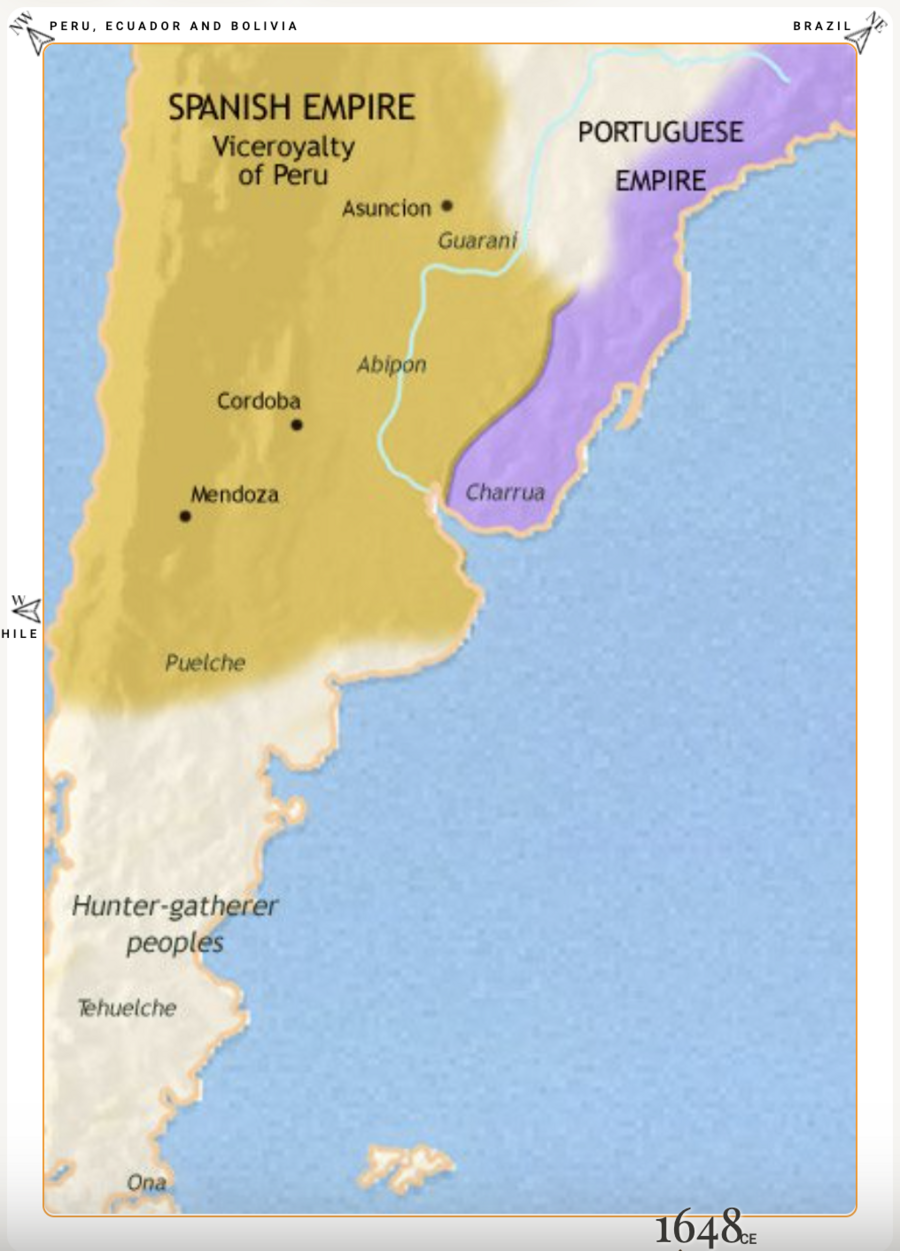
Peoples
- CHARRUA
- GUARANI
- PUELCHE
- TEHUELCHE
- ONA
- ABIPON
Citation
"Argentina, Paraguay and Uruguay 1648 CE." Map. Time Maps. Accessed January 23, 2022. https://www.timemaps.com/history/argentina-1648ad/.
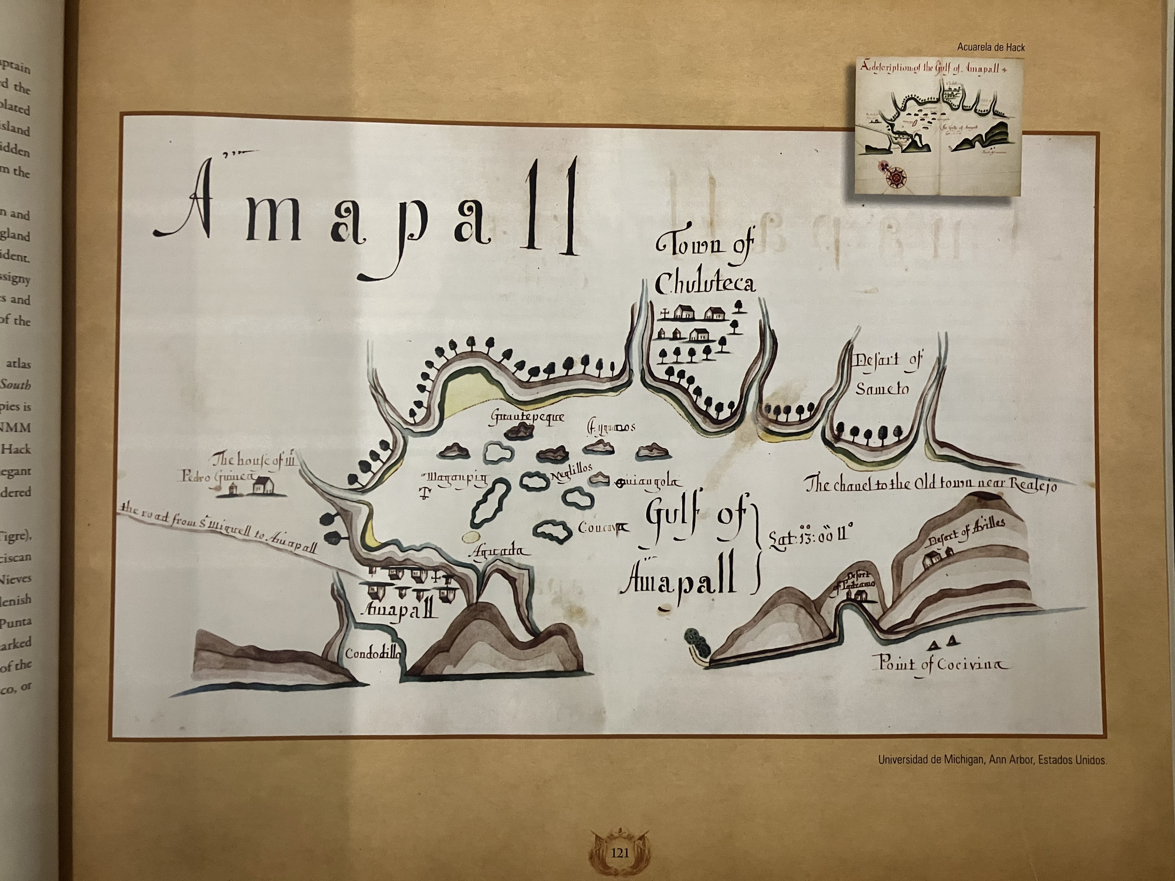
Gulf of Amapall
Map 1683 - 1685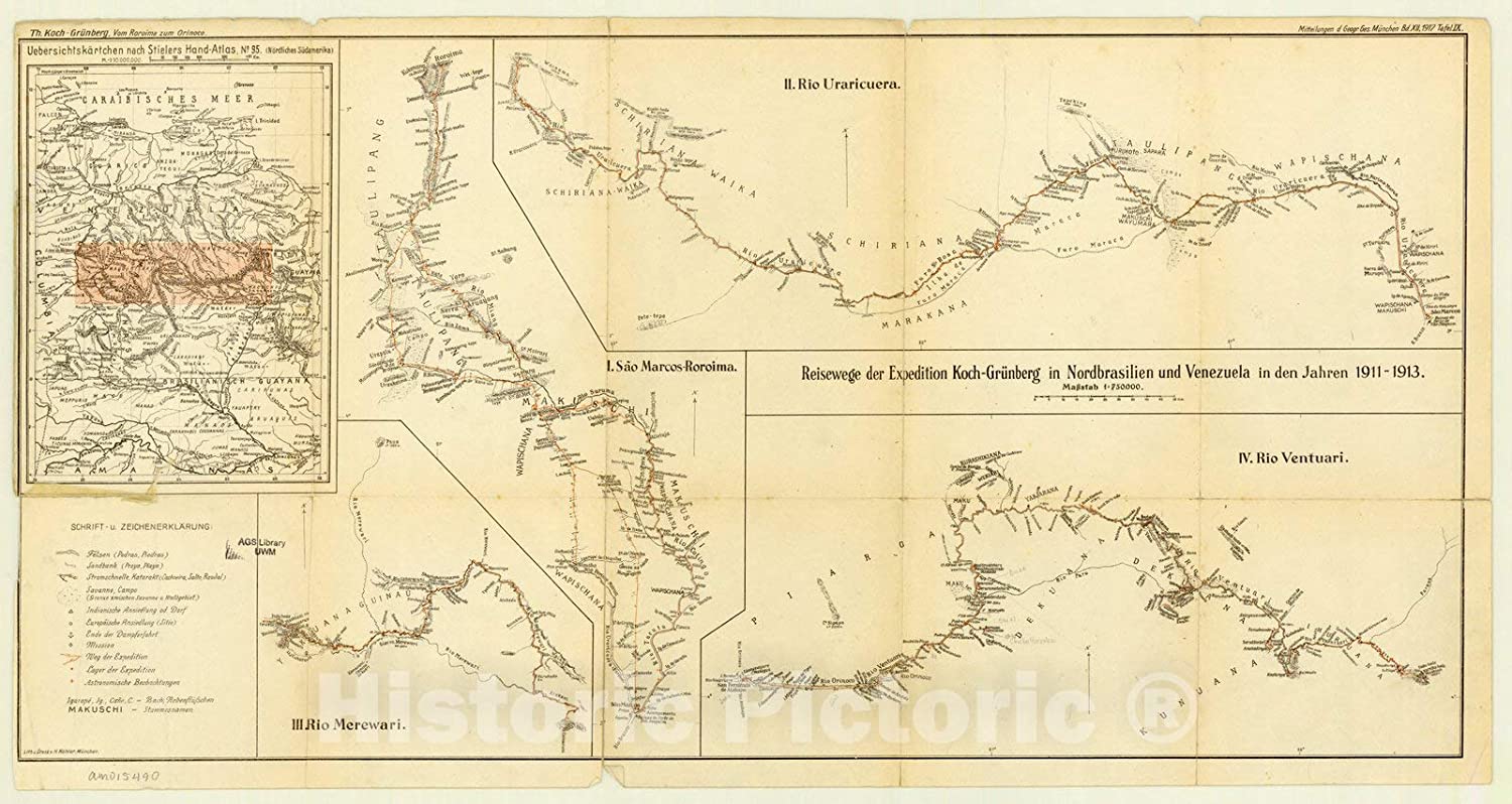
Expedition Koch-Grunberg in Nordbrasilien und Venezuela in den Jahren 1911-1913
Map 1911 - 1913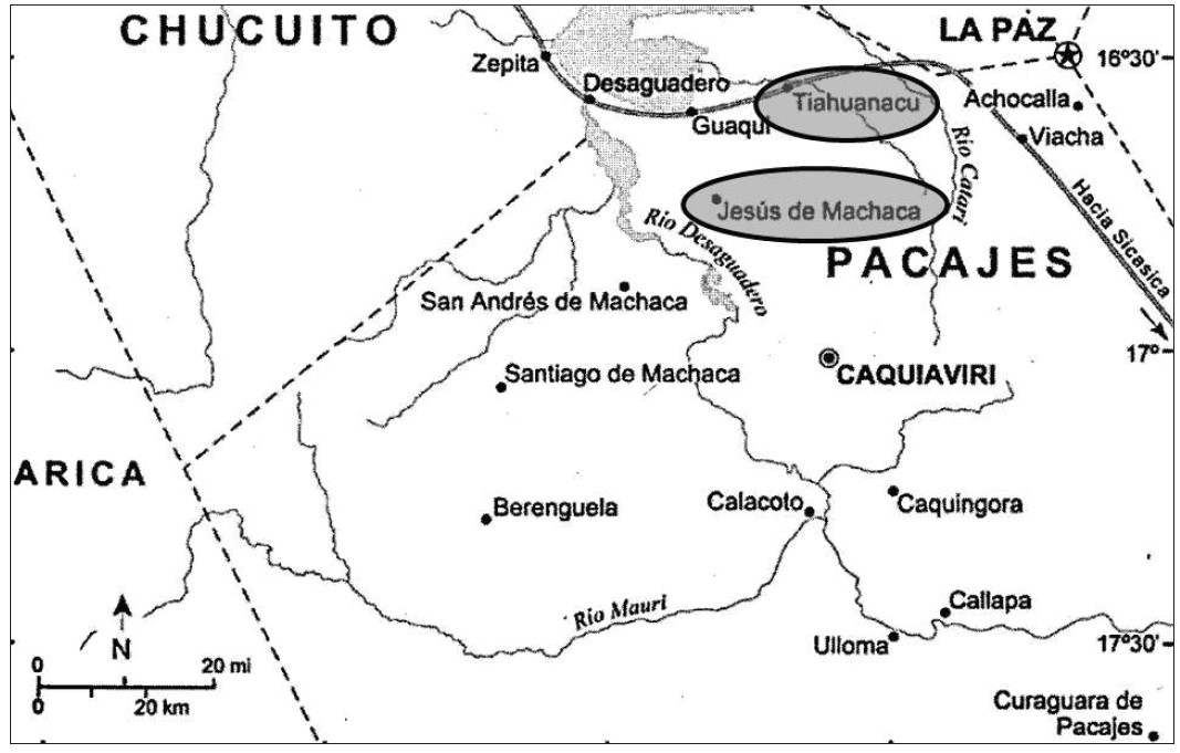
‘INDIAN ROYAL TOWNS’ (REDUCCIONES) IN THE PACAJES PROVINCE (CORREGIMIENTO) UNDER SPANISH COLONIAL RULE IN THE LATE 16TH CENTURY
Map 1570 - 1630![No nos culpes por lo que pasó [Do not blame us fow what happened]](https://dnet8ble6lm7w.cloudfront.net/art_sm/AECU010.png)
No nos culpes por lo que pasó [Do not blame us fow what happened]
Artwork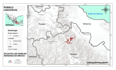
PUEBLO CUICATECO
Map 2020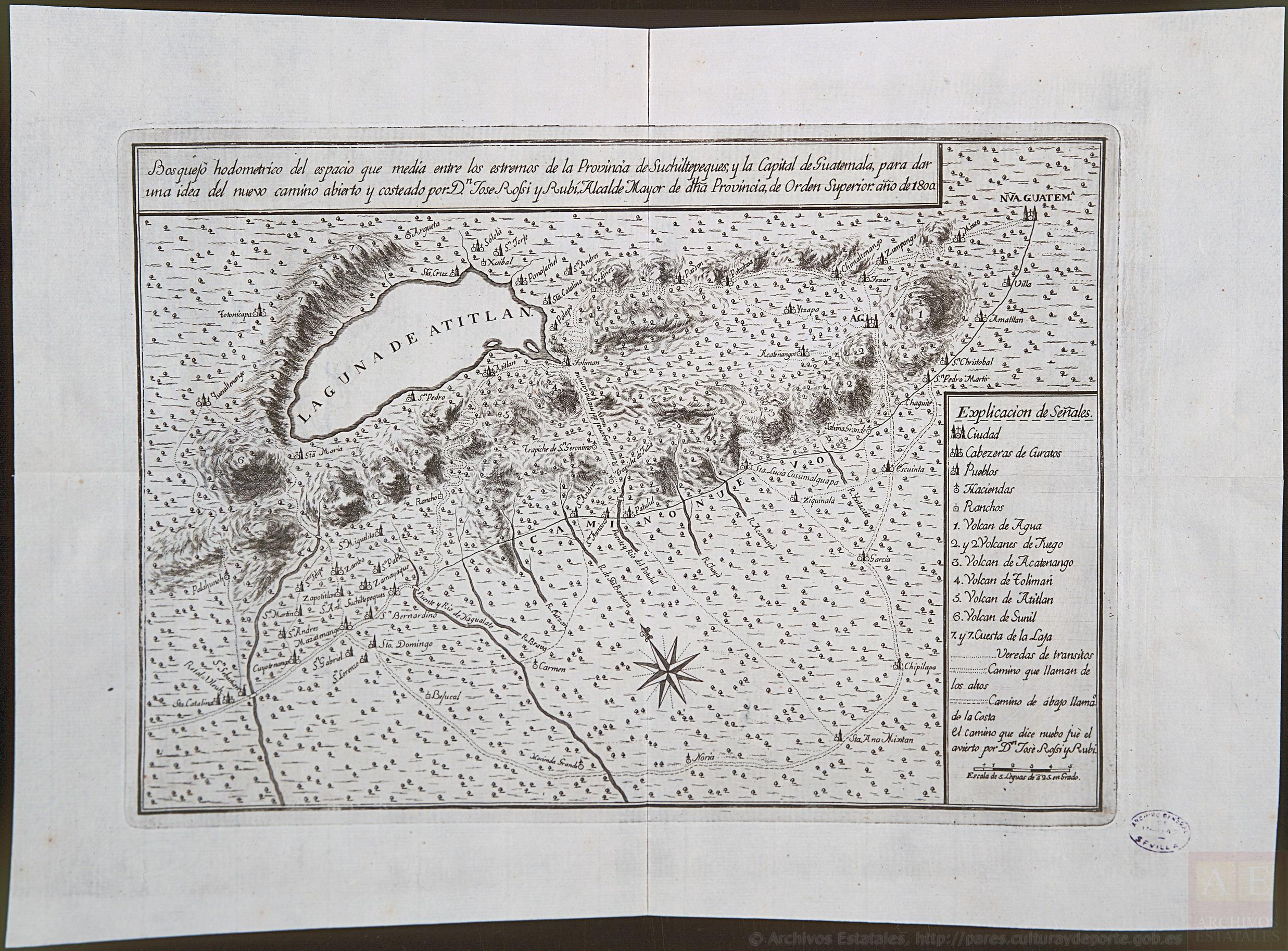
Bosquejo hodométrico del expacio que media entre los extremos de la Provincia de Suchiltepeques y la Capital de Guatemala, para dar una idea del nuevo camino abierto y costeado por D. José Rossi y Rubí, Alcalde mayor de dicha Provincia, de orden superior, año de 1800.
Map 1800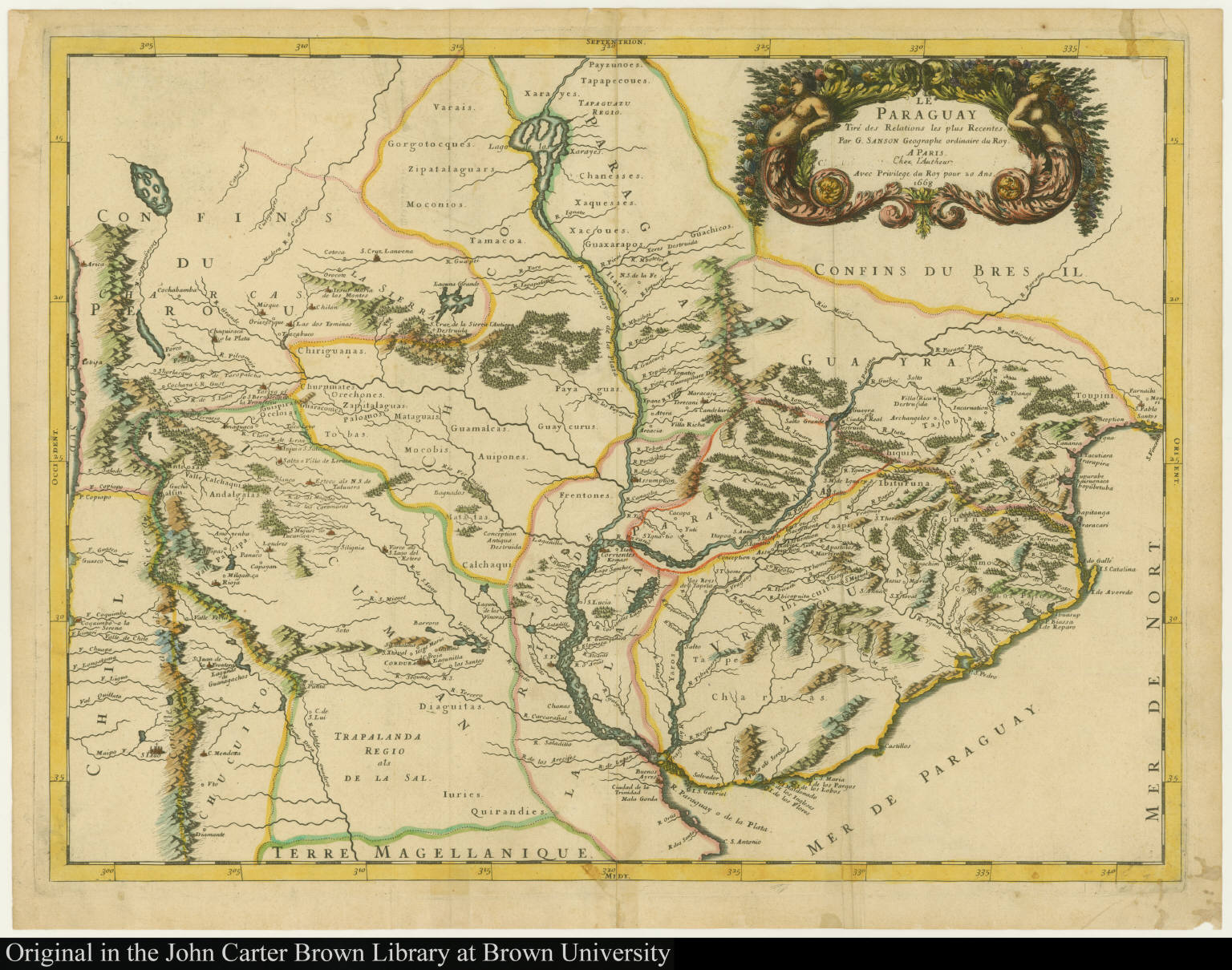
Le Paraguay Tiré des Relations les plus Recentes
Map 1668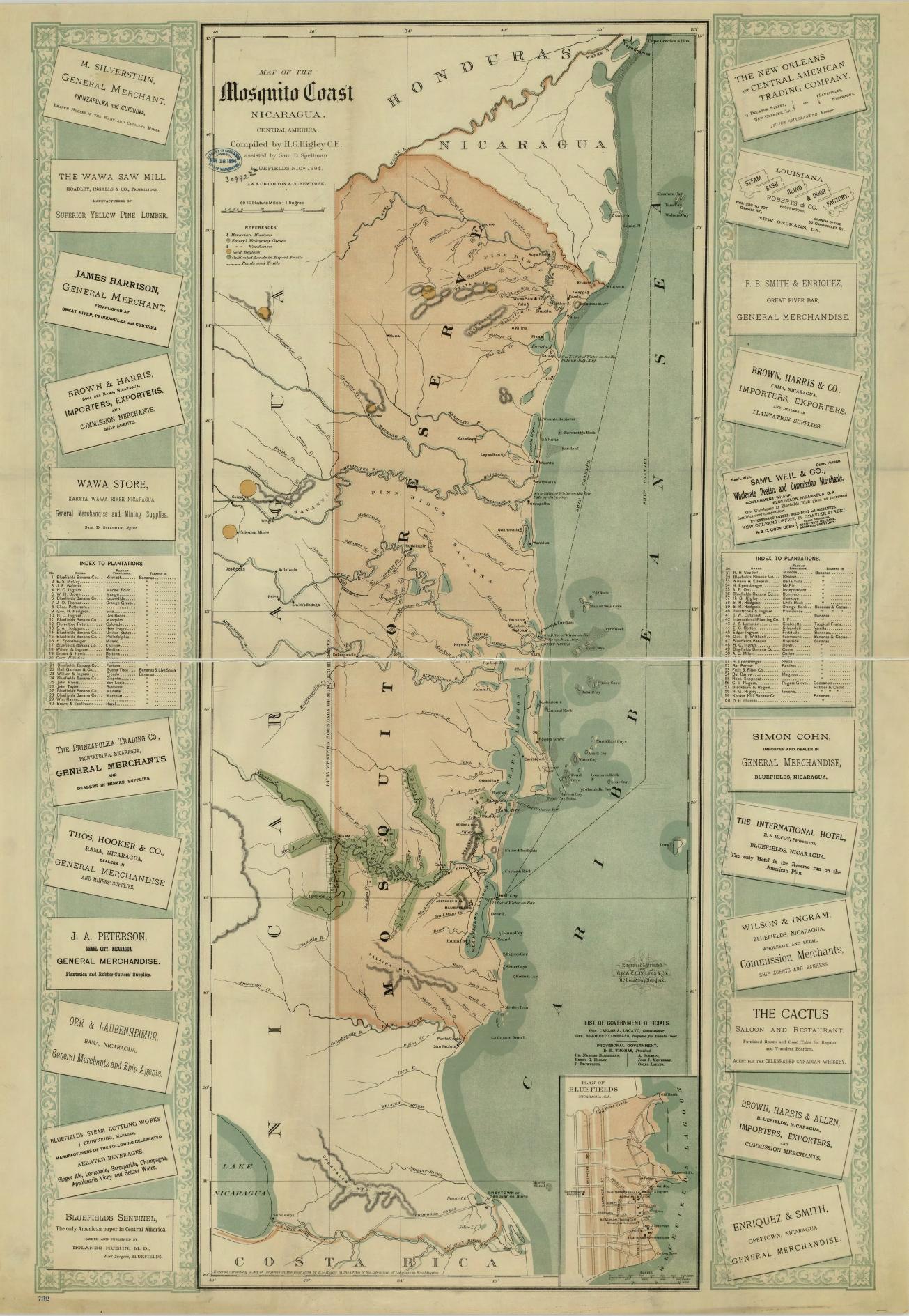
Map of the Mosquito Coast;Nicaragua
Map 1894