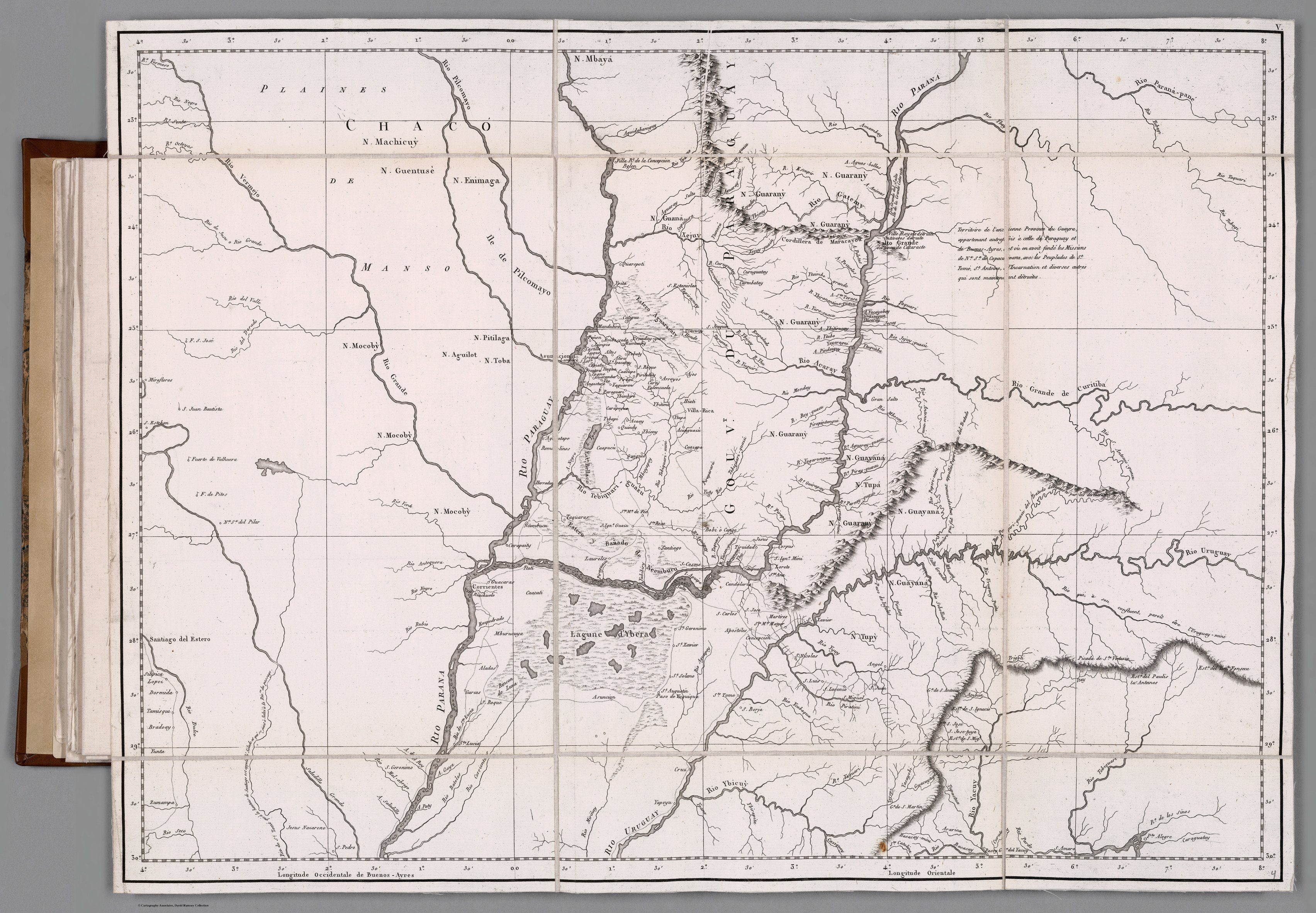
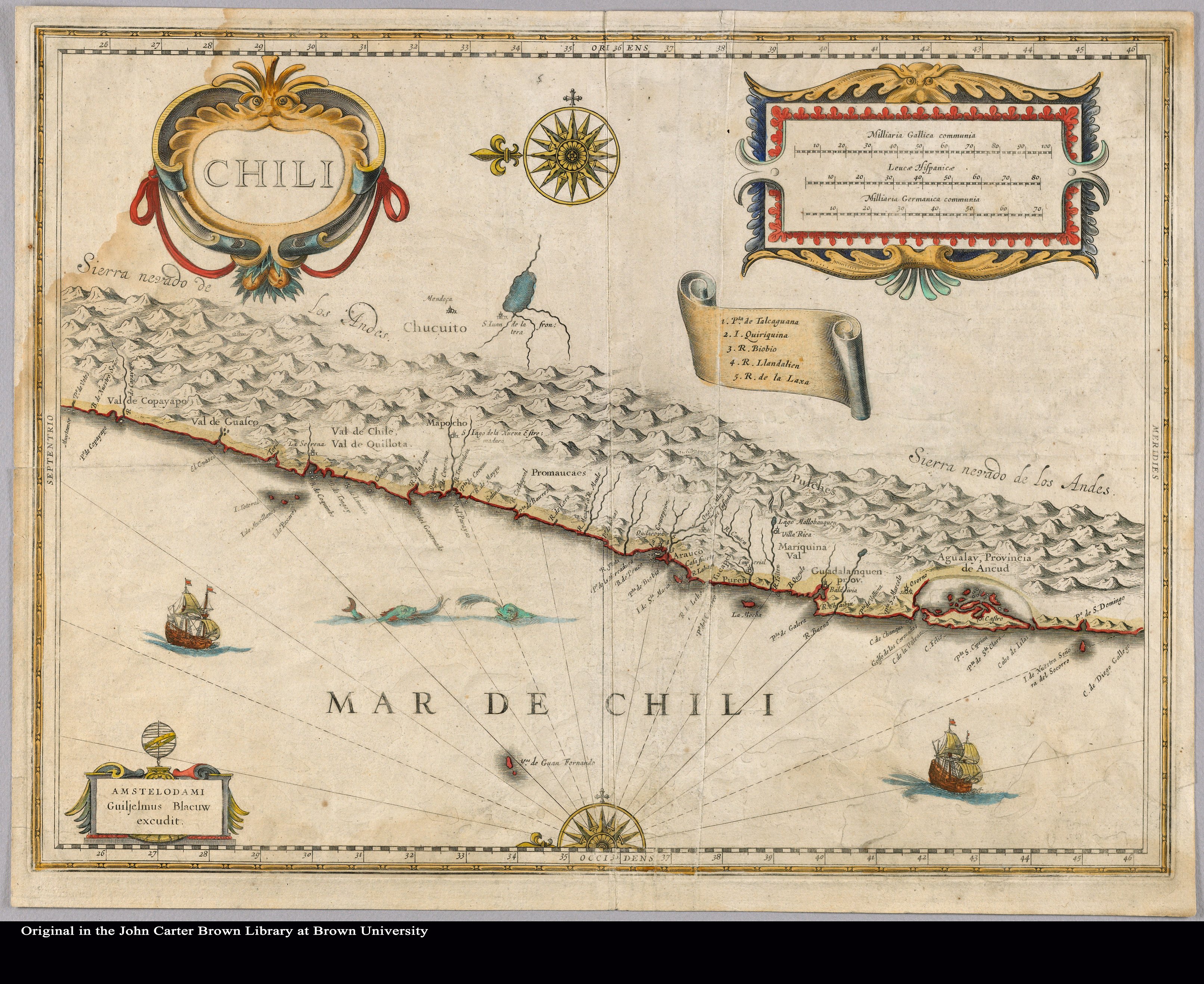
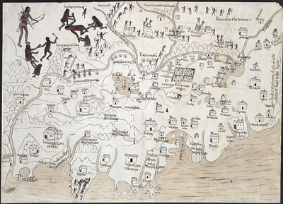
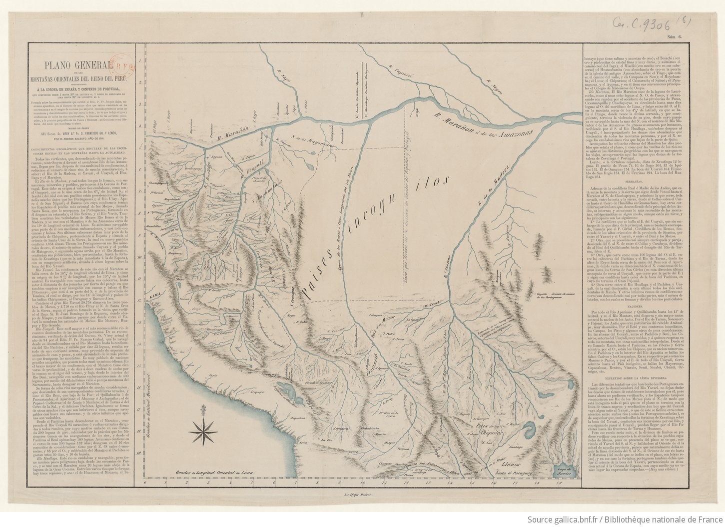
Dispossesions in the Americas

Dispossesions in the Americas

  • Home
  • Explore
  • About
  • Authors
  • Art
  • Bodies
  • Curricula
  • Cultural Heritage
  • Maps
  • Territories
Back to Explore
Map 1795

Plano general de las montañas orientales del Reino del Peru

  • Baleato, D.Andres

Published: 1872

  • Download Image

Peoples

  • ANTIS
  • CAPANAHUAS
  • CARAPACHOS
  • CASIVOS
  • CHIPEOS
  • CHIRIHUANOS
  • CHIQUITOS
  • CHUNTIS
  • CONIVOS
  • MANOAS
  • MAYORUNAS
  • MOXOS
  • ORMIGAS
  • PANOS
  • PIROS
  • REMUS
  • RENTUS
  • SENTI
  • SINABU
  • VINAVIS

Citation

Atlas de cartas geograficas de los païses de la America Meridional. Gallica. Last modified: June 22, 2015. Accessed, August 18, 2024. https://gallica.bnf.fr/ark:/12148/btv1b53098629w/f6.item.zoom

  • Download Image

Reading in Spanish

Map 1795

Plano general de las montañas orientales del Reino del Peru

  • Baleato, D.Andres

Published: 1872

  • Download Image
  • Download Image

Reading in Portuguese

Map 1795

Plano general de las montañas orientales del Reino del Peru

  • Baleato, D.Andres

Published: 1872

  • Download Image

Peoples

  • ANTIS
  • CAPANAHUAS
  • CARAPACHOS
  • CASIVOS
  • CHIPEOS
  • CHIRIHUANOS
  • CHIQUITOS
  • CHUNTIS
  • CONIVOS
  • MANOAS
  • MAYORUNAS
  • MOXOS
  • ORMIGAS
  • PANOS
  • PIROS
  • REMUS
  • RENTUS
  • SENTI
  • SINABU
  • VINAVIS

Citation

Atlas de cartas geograficas de los païses de la America Meridional. Gallica. Last modified: June 22, 2015. Accessed, August 18, 2024. https://gallica.bnf.fr/ark:/12148/btv1b53098629w/f6.item.zoom

  • Download Image

Related Content

A Description of the Plantations in the Valley of Paneca

A Description of the Plantations in the Valley of Paneca

Map
Caminho do Kechuita, Aguapé, RS/Brasil

Caminho do Kechuita, Aguapé, RS/Brasil

Map 1999
GOUVERNEMENT DU PARAGUAY ET PARTIE DU CHACO

GOUVERNEMENT DU PARAGUAY ET PARTIE DU CHACO

Map 1781
PUEBLO MAYO

PUEBLO MAYO

Map 2020
ZACATECAS

ZACATECAS

Map 2015
GUARANÍ OCCIDENTAL

GUARANÍ OCCIDENTAL

Map 2015
Chili

Chili

Map 1663
MAPA DE LA NUEVA GALICIA

MAPA DE LA NUEVA GALICIA

Map 1550

Dispossessions in the Americas

A project by

University of Pennsylvania

Copyright 2024

With support from

Mellon Foundation

Site design & development

Element 84

Art Credits

Atlas de cartas geograficas de los païses de la America Meridional. Gallica. Last modified: June 22, 2015. Accessed, August 18, 2024. https://gallica.bnf.fr/ark:/12148/btv1b53098629w/f6.item.zoom

Site Pages

  • Home
  • Explore
  • About
  • Authors
  • Art
  • Bodies
  • Curricula
  • Cultural Heritage
  • Maps
  • Territories