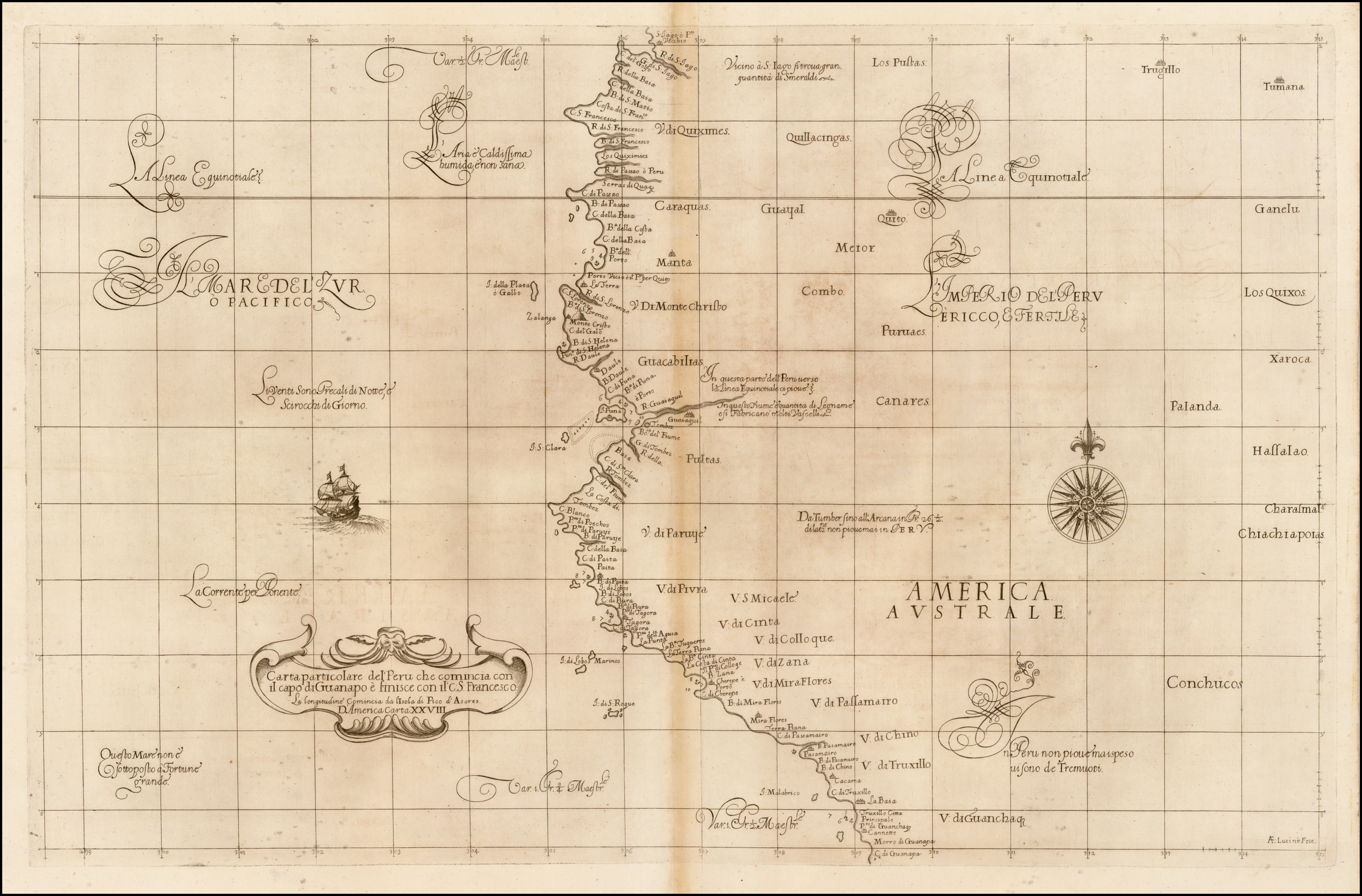
Dispossesions in the Americas

Dispossesions in the Americas

  • Home
  • Explore
  • About
  • Authors
  • Art
  • Bodies
  • Curricula
  • Cultural Heritage
  • Maps
  • Territories
Back to Explore
Map 1646

[Ecuador & Peru Coastlines] Carta particolare del'Peru che comincia con il capo di Guanapo e finisce con il C. S:

  • Robert Dudley

Published: 1646

  • Download Image

Peoples

  • CONCHUCOS
  • CANARES

Citation

Dudley, R. (Cartographer). (1646). Carta particolare del'Peru che comincia con il capo di Guanapo e finisce con il C. S [Map]. Barry Lawrence Ruderman. https://www.raremaps.com/gallery/detail/40798/ecuador-peru-coastlines-carta-particolare-delperu-che-dudley

  • Download Image

Reading in Spanish

Map 1646

[Ecuador & Peru Coastlines] Carta particolare del'Peru che comincia con il capo di Guanapo e finisce con il C. S:

  • Robert Dudley

Published: 1646

  • Download Image
  • Download Image

Reading in Portuguese

Map 1646

[Ecuador & Peru Coastlines] Carta particolare del'Peru che comincia con il capo di Guanapo e finisce con il C. S:

  • Robert Dudley

Published: 1646

  • Download Image

Peoples

  • CONCHUCOS
  • CANARES

Citation

Dudley, R. (Cartographer). (1646). Carta particolare del'Peru che comincia con il capo di Guanapo e finisce con il C. S [Map]. Barry Lawrence Ruderman. https://www.raremaps.com/gallery/detail/40798/ecuador-peru-coastlines-carta-particolare-delperu-che-dudley

  • Download Image

Related Content

THE CARIBBEE ISLANDS AND GUAYANA DRAWN BY L. DELAROCHETTE

THE CARIBBEE ISLANDS AND GUAYANA DRAWN BY L. DELAROCHETTE

Map 1776
PUEBLO NAHUA DE TLAXCALA

PUEBLO NAHUA DE TLAXCALA

Map 2020
FAMILIAS LINGUÍSTICAS Y LENGUAS INDÍGENAS EN OASISAMÉRICA

FAMILIAS LINGUÍSTICAS Y LENGUAS INDÍGENAS EN OASISAMÉRICA

Map 2009
TERRARUM S: MICHAELIS oppidi Americae meridionalis in provincia olim Tape dicta, trans Flumen Vruguai siti, cum adjacentibus simul aliorum oppidorum terris & vicinia Lusitanorum, accurata descriptio.

TERRARUM S: MICHAELIS oppidi Americae meridionalis in provincia olim Tape dicta, trans Flumen Vruguai siti, cum adjacentibus simul aliorum oppidorum terris & vicinia Lusitanorum, accurata descriptio.

Map 1750 - 1760
COLUMBIA;ECUADOR;VENEZUELA;BRITISH DUTCH AND FRENCH GUIANA

COLUMBIA;ECUADOR;VENEZUELA;BRITISH DUTCH AND FRENCH GUIANA

Map 1900 - 1999
Carte Croquis DU COURS DE L'ORÉNOQUE de Bolivar àu Rio Meta

Carte Croquis DU COURS DE L'ORÉNOQUE de Bolivar àu Rio Meta

Map 1884
MAPA DE LA REPÚBLICA DEL PARAGUAY

MAPA DE LA REPÚBLICA DEL PARAGUAY

Map 1908
Terra Indígena Rio Branco (do Itanhaém)

Terra Indígena Rio Branco (do Itanhaém)

Map 2011

Dispossessions in the Americas

A project by

University of Pennsylvania

Copyright 2024

With support from

Mellon Foundation

Site design & development

Element 84

Art Credits

Dudley, R. (Cartographer). (1646). Carta particolare del’Peru che comincia con il capo di Guanapo e finisce con il C. S [Map]. Barry Lawrence Ruderman. https://www.raremaps.com/gallery/detail/40798/ecuador-peru-coastlines-carta-particolare-delperu-che-dudley

Site Pages

  • Home
  • Explore
  • About
  • Authors
  • Art
  • Bodies
  • Curricula
  • Cultural Heritage
  • Maps
  • Territories