Peoples
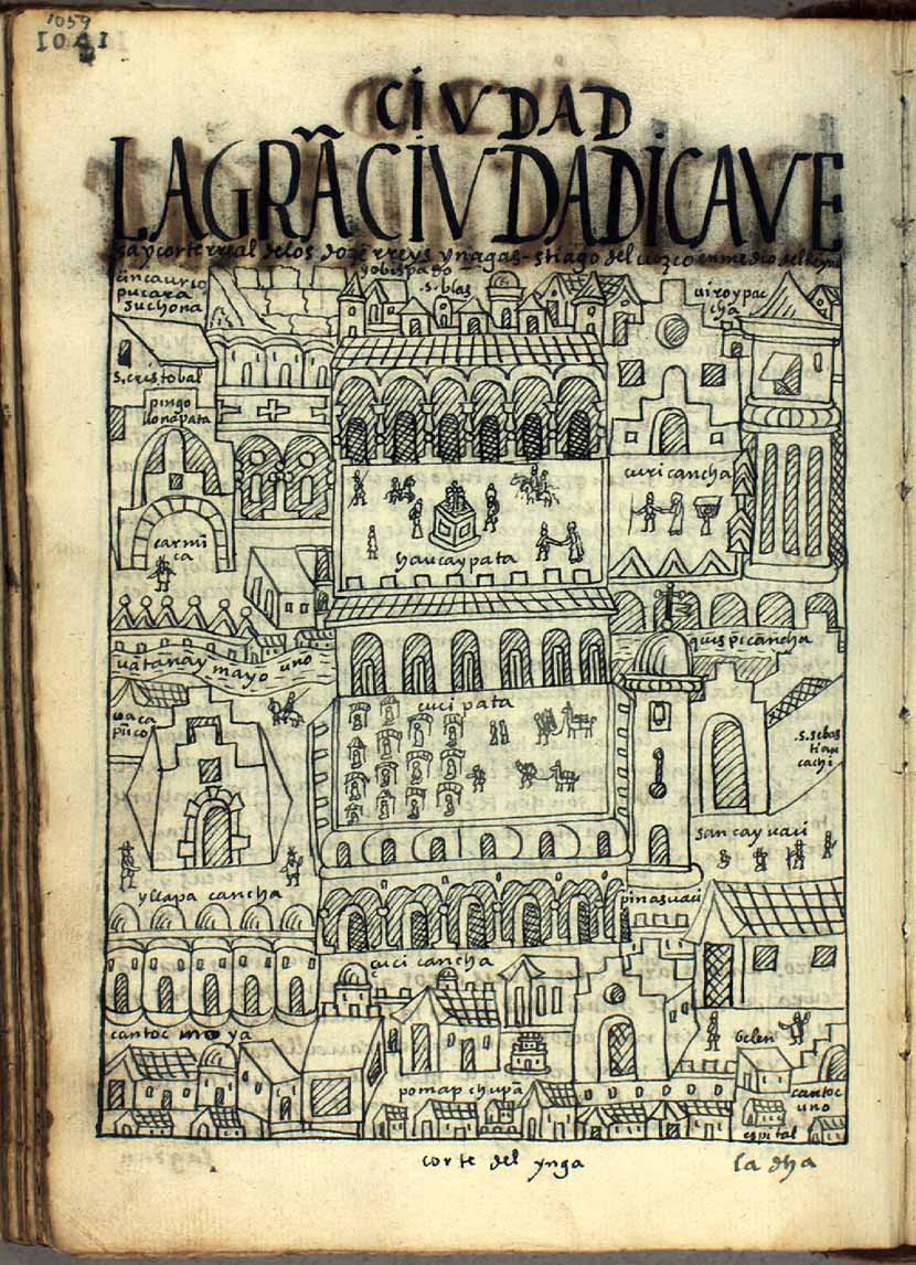
- CORTE DEL YNGA
Citation
Poma de Ayala, F. G. (Cartographer). (1615). LA GRAN CIVDAD [Map]. Det Kgl. Bibliotek. https://poma.kb.dk/permalink/2006/poma/1059/en/text/?open=idm656&imagesize=XL
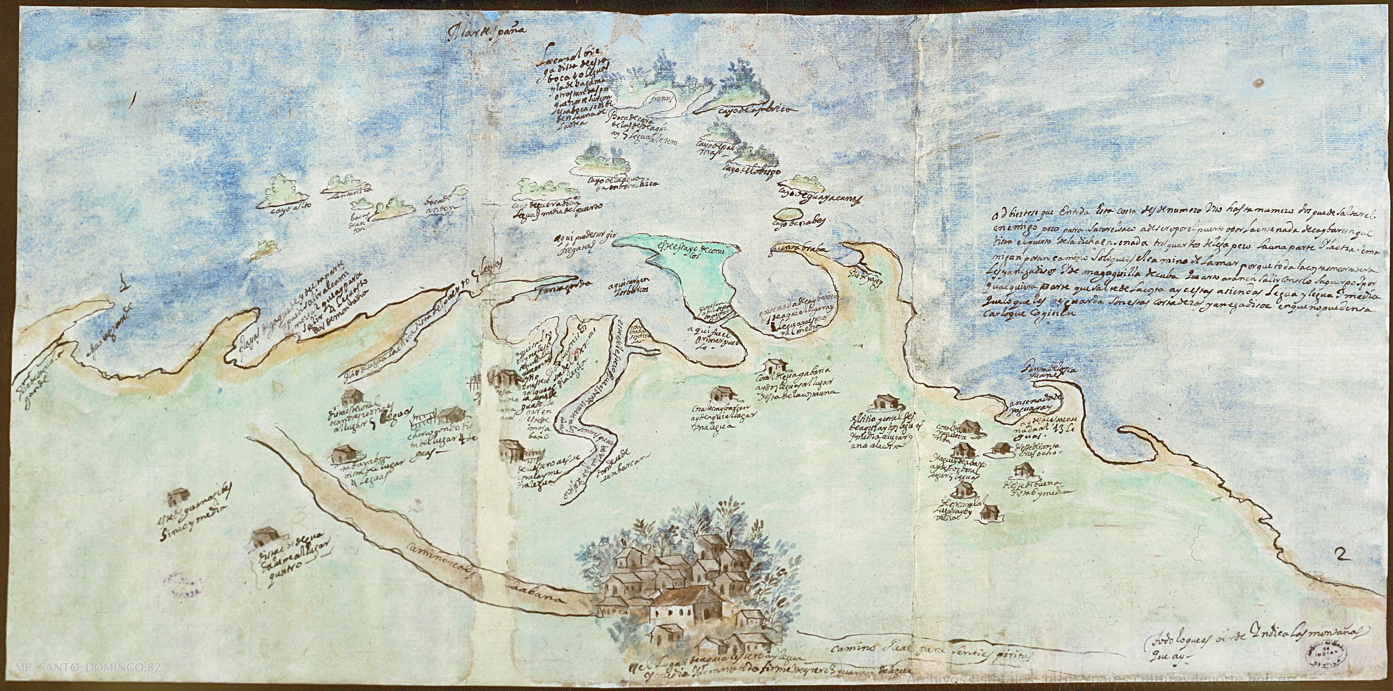
Mapa de la villa de San Juan de los Remedios de el Cayo y sus contornos
Map 1600 - 1699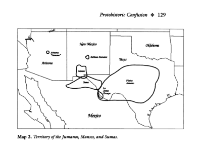
Territory of the Jumanos, Mansos, and Sumas
Map 1997![Sin título [Untitled]](https://dnet8ble6lm7w.cloudfront.net/art_sm/ACOL005.png)
Sin título [Untitled]
Artwork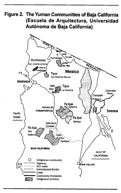
The Yuman Communities of Baja California
Map 2016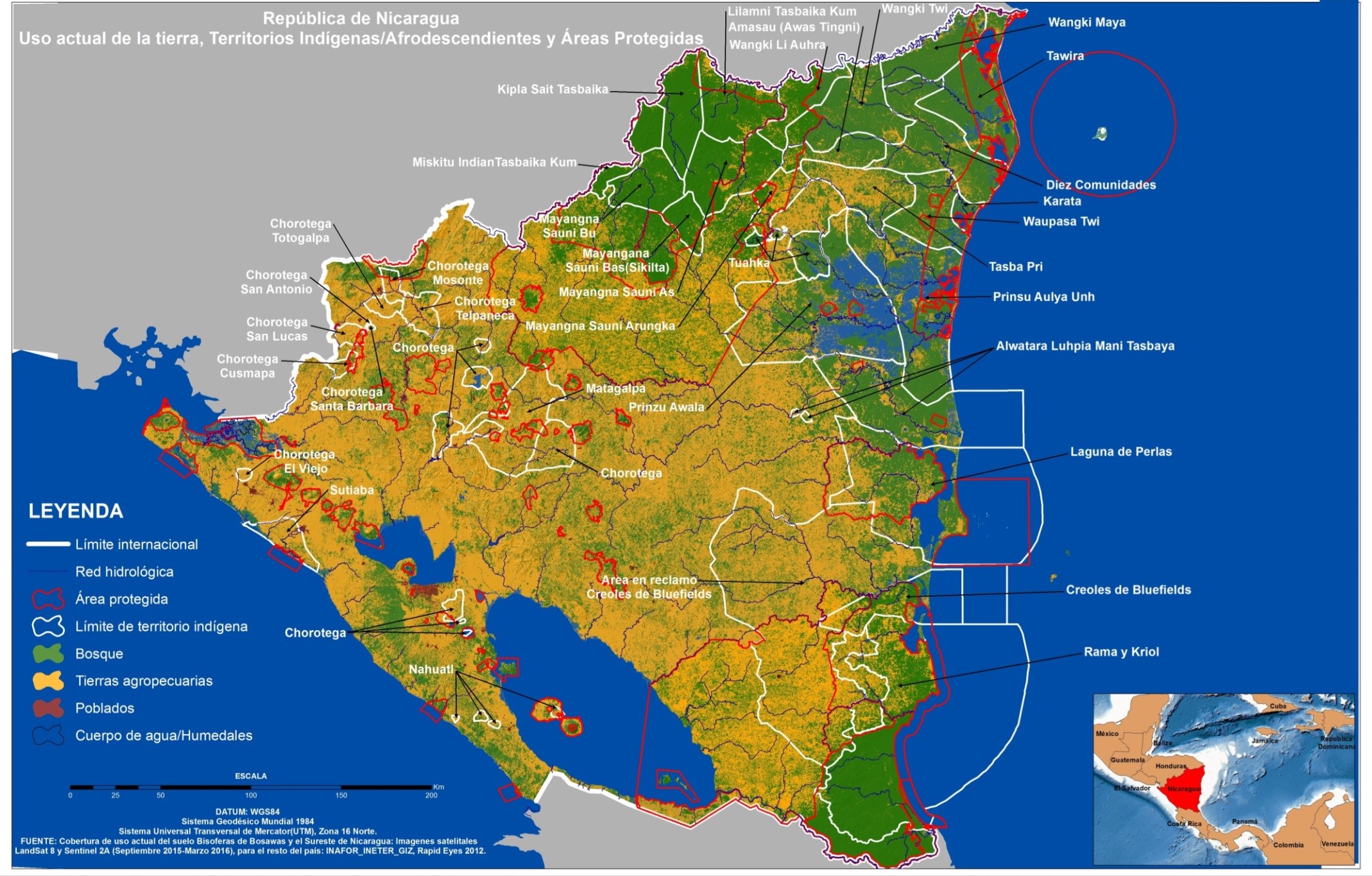
República de Nicaragua: uso actual de la tierra;Territorios Indígenas/Afrodescendientes y Areas Protegidas
Map 2012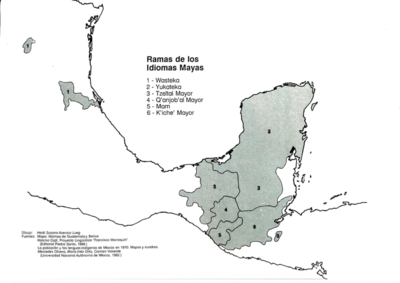
Ramas de los Idiomas Mayas
Map 1970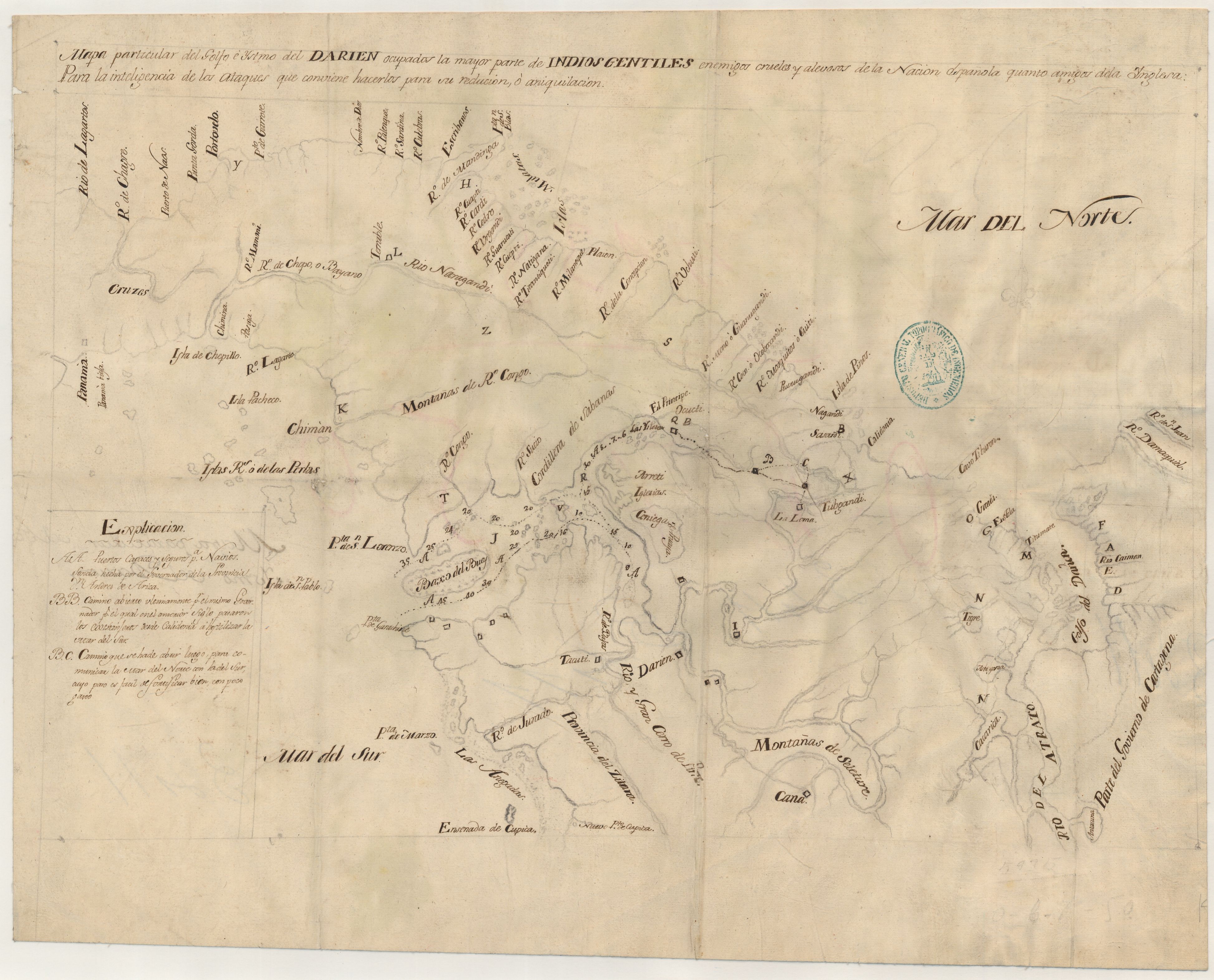
Mapa particular del Golfo e Ystmo del Darien ocupados por la mayor parte de los indios gentiles enemigos crueles y alevosos de la Nacion española quanto amigos dela inglesa : para la inteligencia de los ataques que conviene hacerlos para su reducion o aniquilacion
Map 1700 - 1799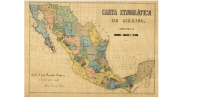
CARTA ETNOGRÁFICA DE MEXICO
Map 1864