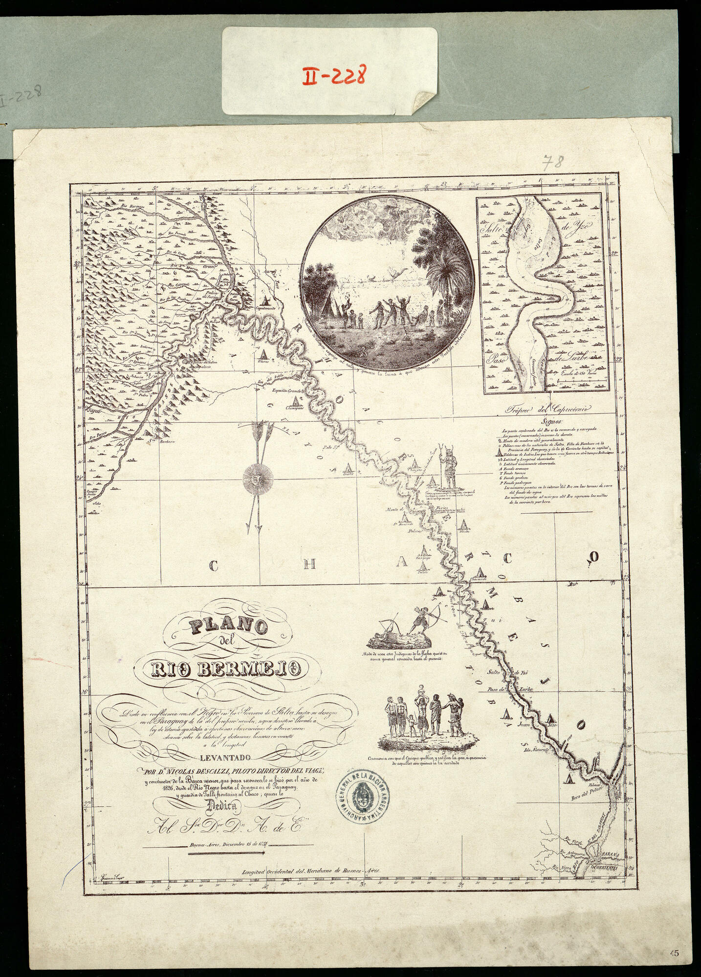
Plano del Río Bermejo desde su confluencia con el Negro en la Provincia de Salta hasta su desagüe en el Paraguay de la del propio nombre según derrotero llevado a ley de estima ajustada a oportunas observaciones de altura meridiana sobre la latitud y distancias lunares en cuanto a la longitud. Levantado por Don Nicolás Descalzi piloto director del viaje y constructor de la barca menor que para reconocerlo se hizo por el año de 1826 desde el Río Negro hasta el desagüe en el Paraguay y guardia de talla fronteriza al Chaco quien lo dedica al Señor Doctor Don A. de E. Impreso.
Map
1826

![La casa de fierro [The Iron House]](https://dnet8ble6lm7w.cloudfront.net/art_sm/APER085.png)