Peoples
- QUECHUA
- AYMARA
Citation
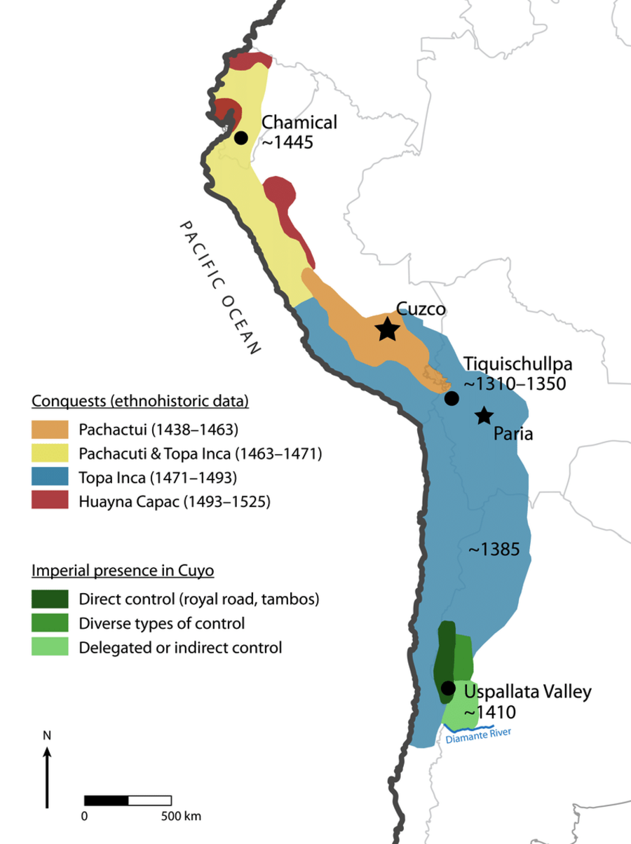
Article Marsh, E., Kidd, R., Ogburn, D., & Durán, V. (2017). Dating the Expansion of the Inca Empire: Bayesian Models from Ecuador and Argentina. Radiocarbon, 59(1), 1-24. https://doi.org/10.1017/RDC.2016.118
![La viruela del mono [Monkeypox]](https://dnet8ble6lm7w.cloudfront.net/art/APER056.jpg)
La viruela del mono [Monkeypox]
Artwork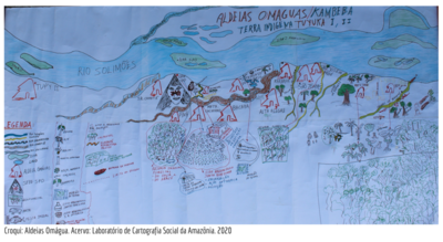
ALDEIAS OMAGUAS/KAMBEBA
Map 2020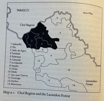
CHOL REGION AND THE LACANDON FOREST
Map 1998
Carte 23: Guyane
Map 1900 - 1999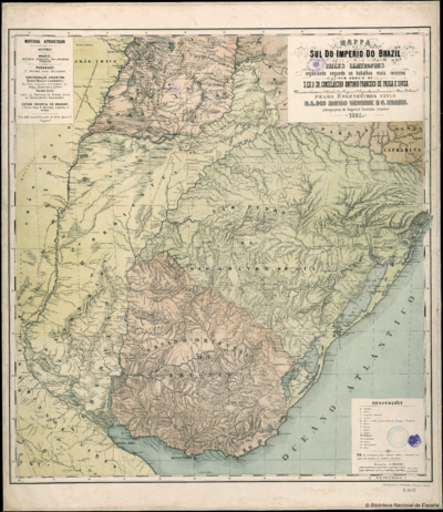
Mappa do Sul do Imperio do Brazil e Paizes Limitrophes
Map 1865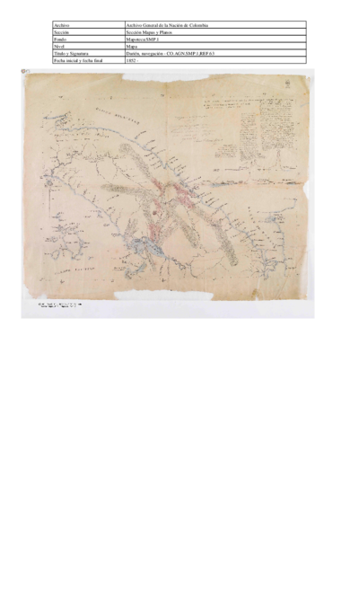
Navegacion de Buques para el Darien. Mapa topográfico de una porción del Itsmo del Darién mostrando el sitio de la Navegación Pase Oceanico que se propone
Map 1852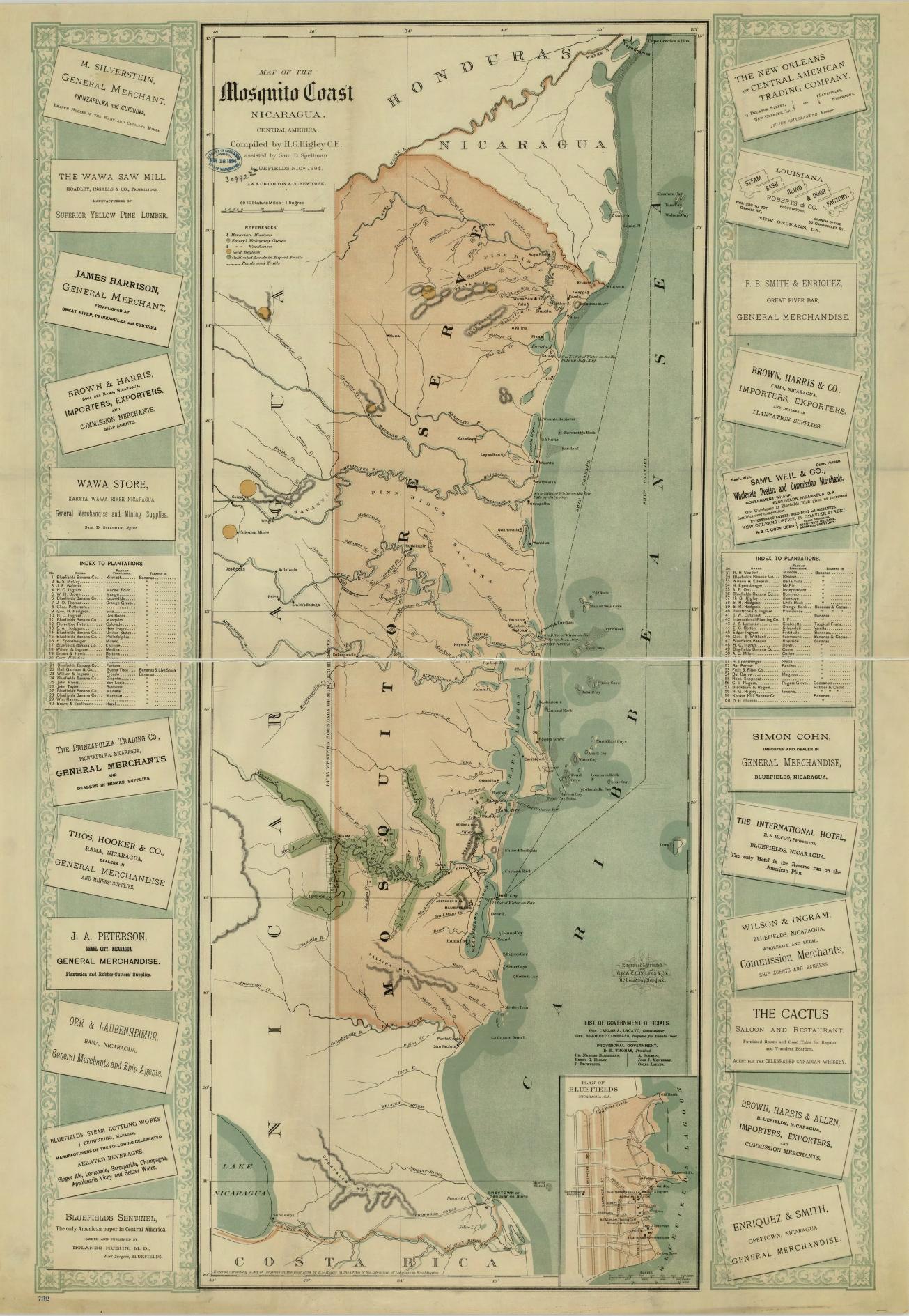
Map of the Mosquito Coast;Nicaragua
Map 1894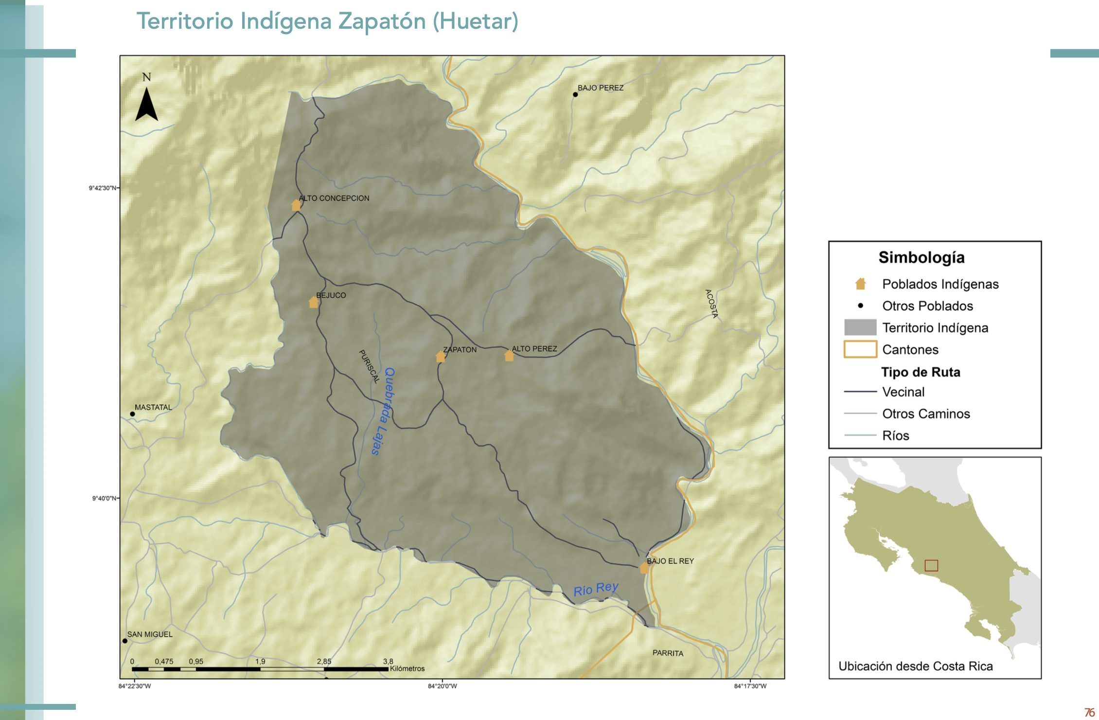
"Territorio Indígena Zapatón (Huetar)"
Map 2010