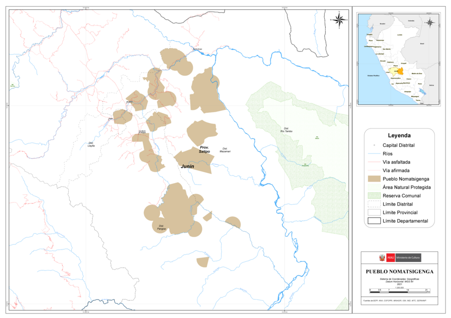
Peoples
- NOMATSIGENGA
Citation
Ministerio de Cultura Perú. (2020). Lista de pueblos indígenas u originarios. BDPI: Base de Datos de Pueblos Indígenas u Originarios. https://bdpi.cultura.gob.pe/pueblos-indigenas
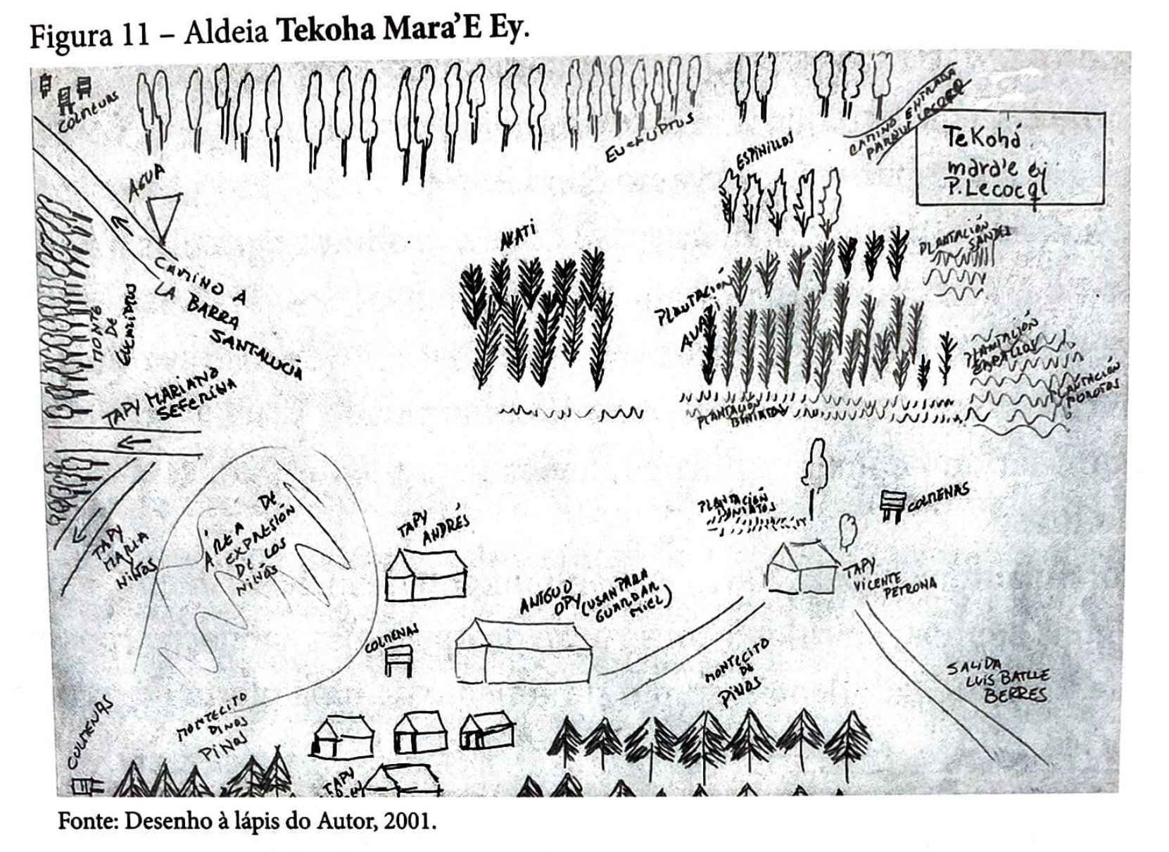
Aldeia Tekoha Mara’E Ey
Map 1989 - 2001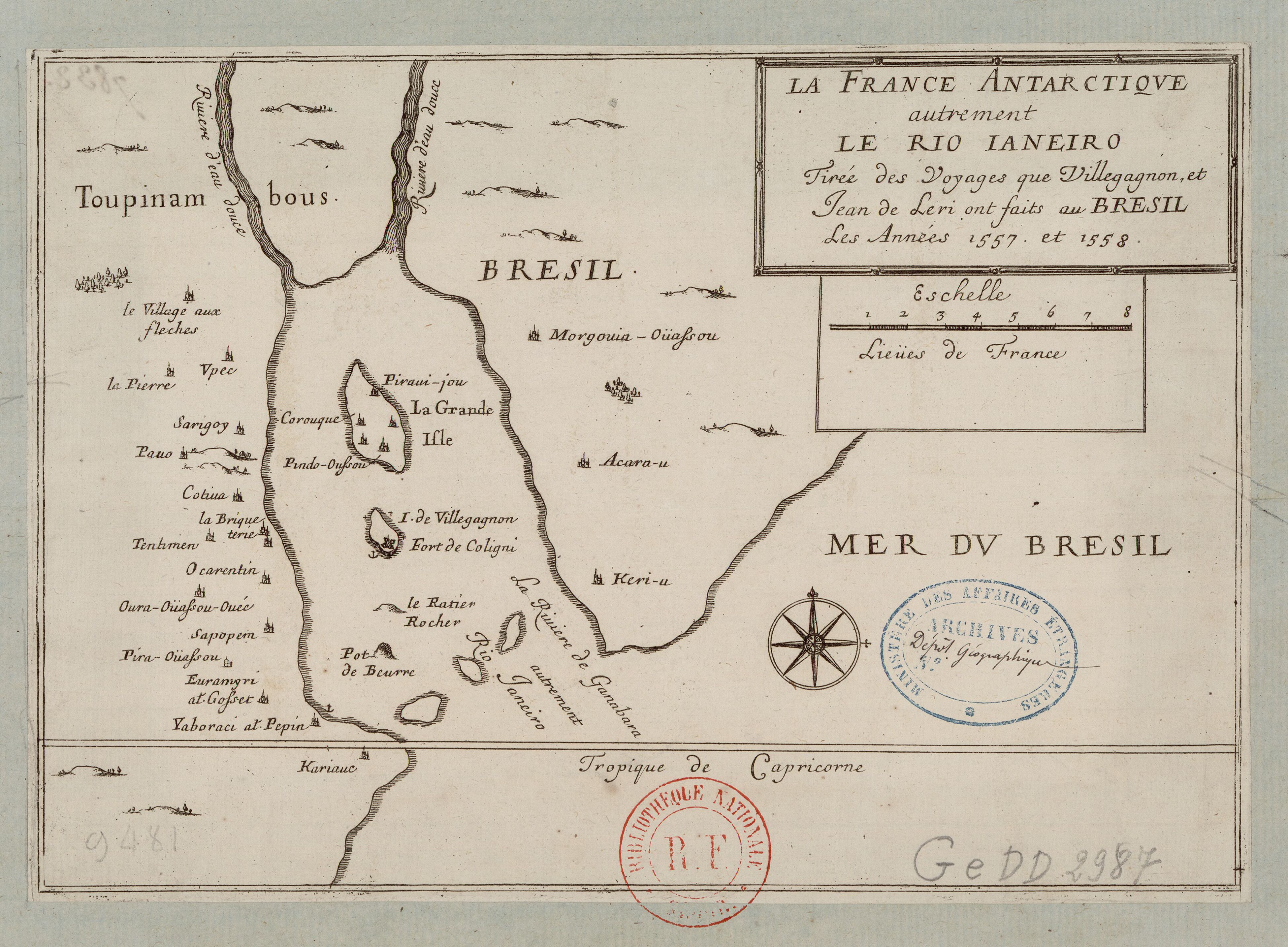
La France Antarctique autrement le Rio de Janeiro
Map 1557 - 1558![Carta Particular de la Costa de Mosquitos;con sus Baxos;Escollos;Canales;Sonadas & c.a.[Material cartogáfico]:Para el Uso Delos Navios de Guerra Yngleses;y de la que sirve el Almirantasgo para su govierno.](https://dnet8ble6lm7w.cloudfront.net/maps_sm/NIC/NIC0039.png)
Carta Particular de la Costa de Mosquitos;con sus Baxos;Escollos;Canales;Sonadas & c.a.[Material cartogáfico]:Para el Uso Delos Navios de Guerra Yngleses;y de la que sirve el Almirantasgo para su govierno.
Map 1764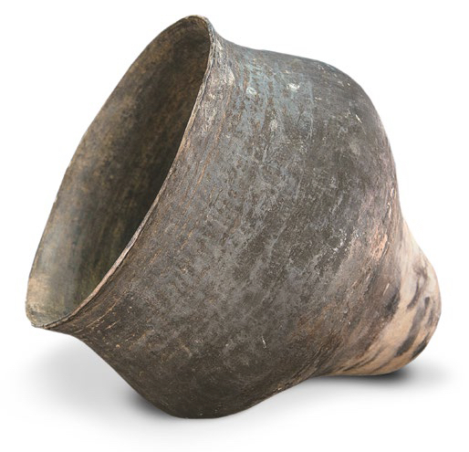
AM, Brazil - Pot
Artwork
Tabula geographica regni Guiane Navigationes Gualteri Ralegh.
Map 1600 - 1699
A New Chart of the Coast of Brazil from the Banks of St. Roque, to the Island of St. Sebastian;with the Islands and Soundings in the Offing
Map 1794
Carte de la Guyane Française.
Map 1951
TITLED INDIGENOUS TERRITORIES (TIOCs) IN THE BOLIVIAN INTER-ANDEAN VALLEYS BY 2011
Map 2011