
Peoples
- MURUI-MUINANI
Citation
Ministerio de Cultura Perú. (2020). Lista de pueblos indígenas u originarios. BDPI: Base de Datos de Pueblos Indígenas u Originarios. https://bdpi.cultura.gob.pe/pueblos-indigenas
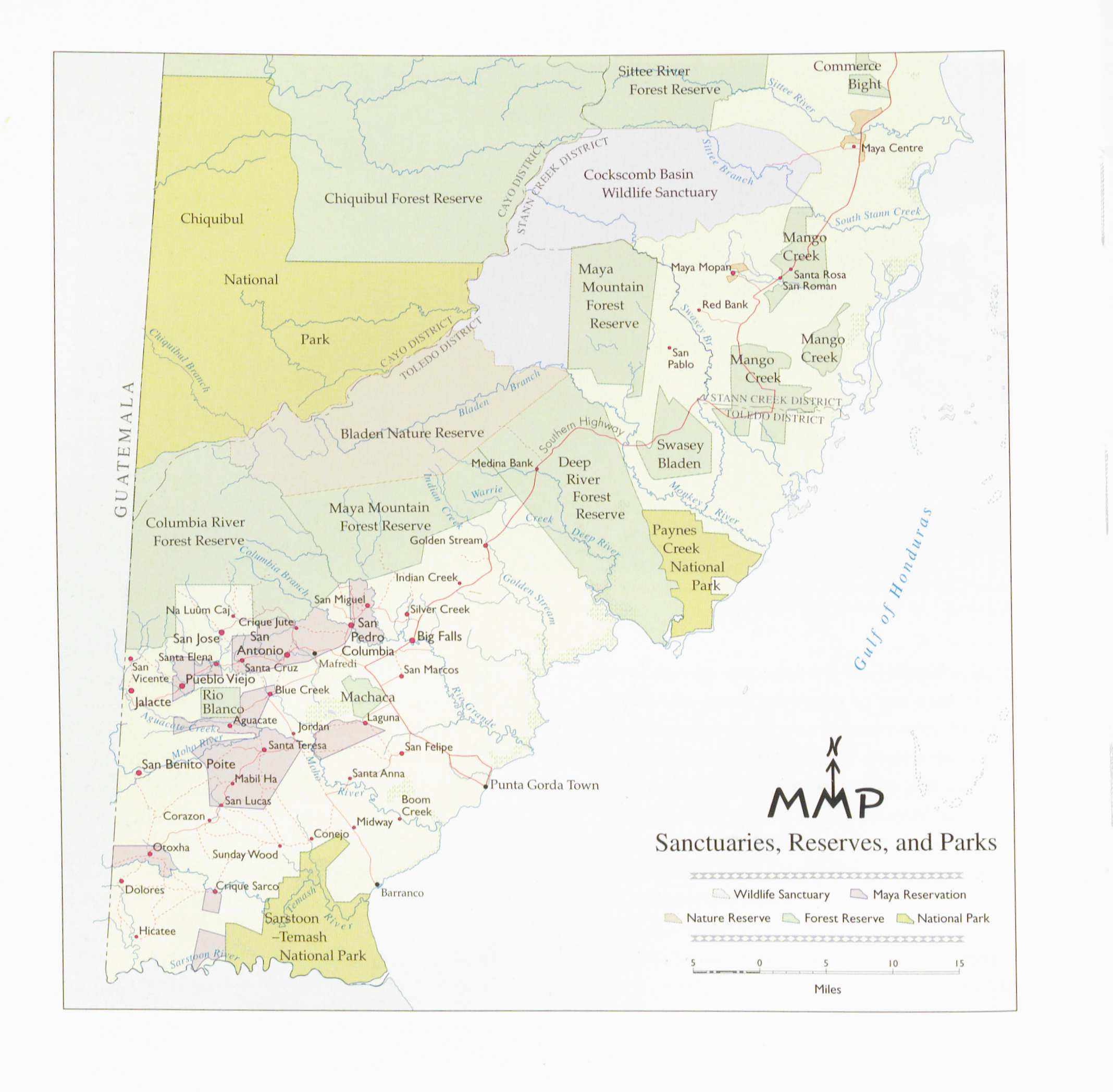
Sanctuaries Reserves and Parks
Map 1997
LOS GRUPOS LOCALES AYOREO DENTRO DE SU TERRITORIO
Map 1490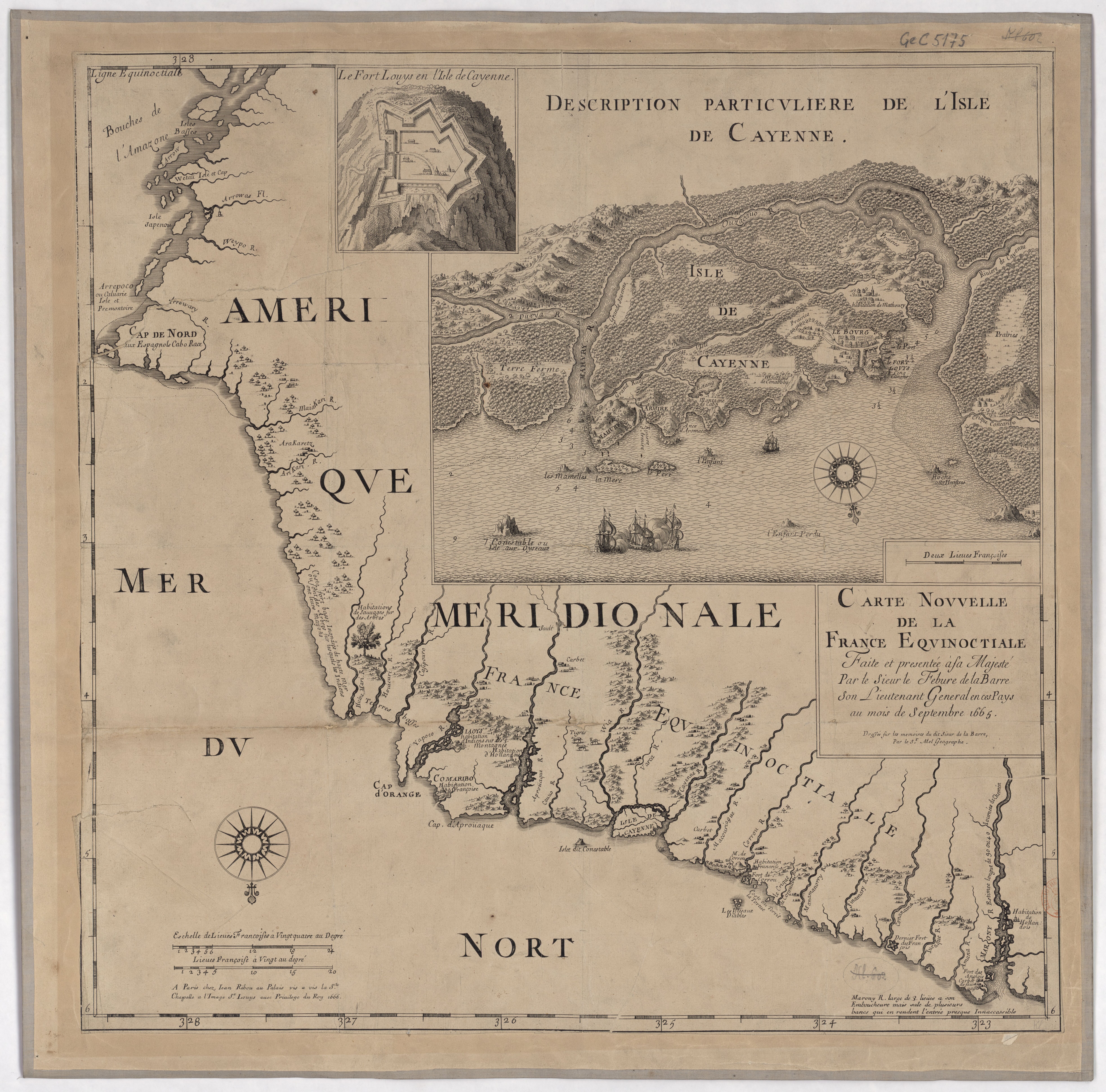
Carte nouvelle de la France Equinoctiale
Map 1665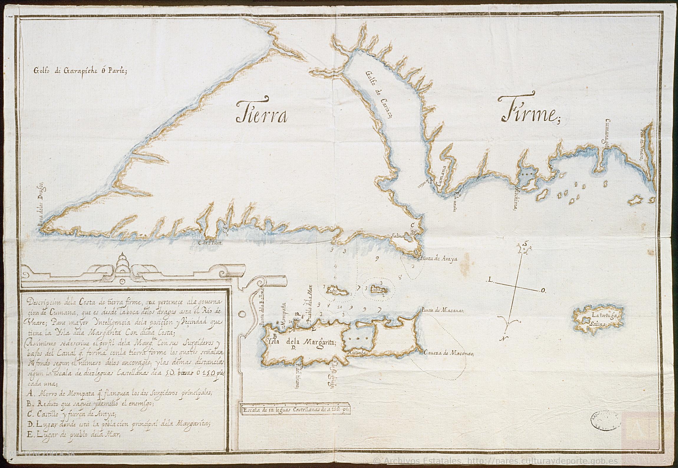
Descripción de la costa de tierra firme que perteneçe a la gouernaçión de Cumaná;que es desde la boca de los Dragos asta el río de Unare para mayor inteligencia de la posición y vecindad que tiene la ysla de la Margarita con dicha costa
Map 1661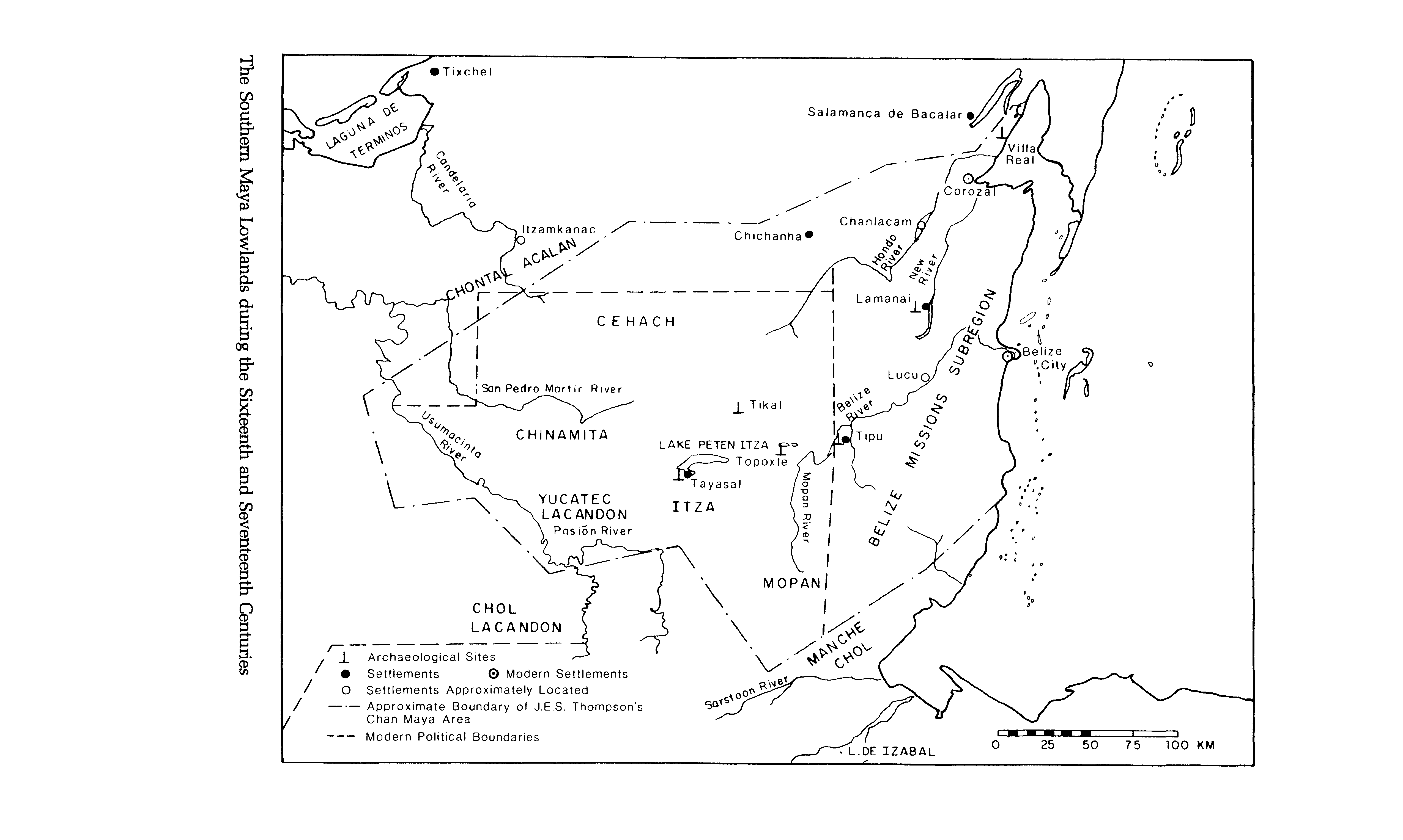
The Southern Maya Lowlands during the Sixteenth and Seventeenth Centuries
Map 1500 - 1700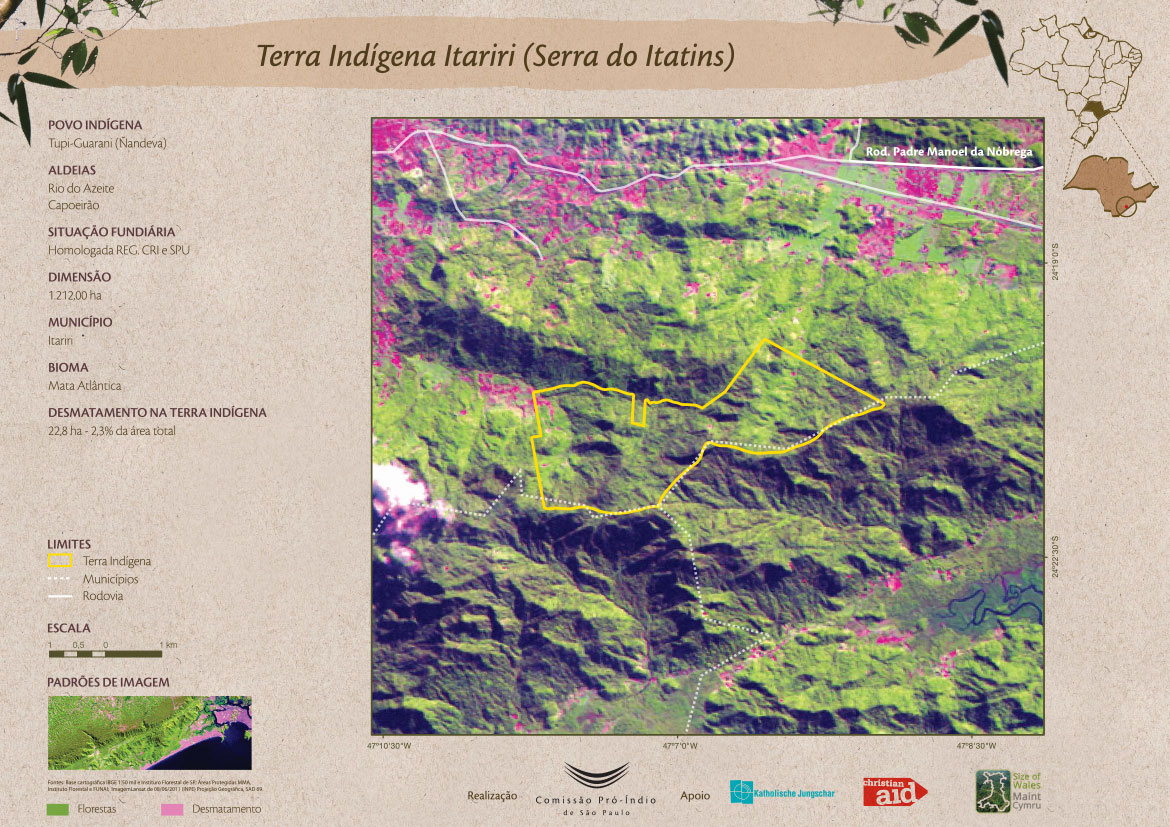
Terra Indígena Itariri (Serra do Itatins)
Map 2011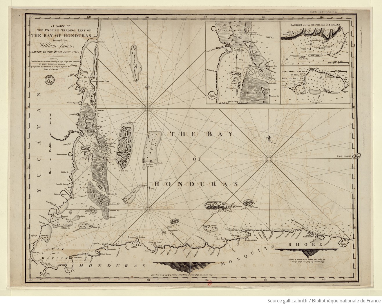
A chart of the English trading part of the bay of Honduras
Map 1791
VISTA DE LA NUEVA POBLACION DE SAN FERNANDO DE GUADALUPE EN EL SALTO DE AGUA DEL RIO TULIJA, QUE LLEVA SU CORRIENTE A LAS LAGUNAS DE CHICHICASTE Y DE TÉRMINOS
Map 1795