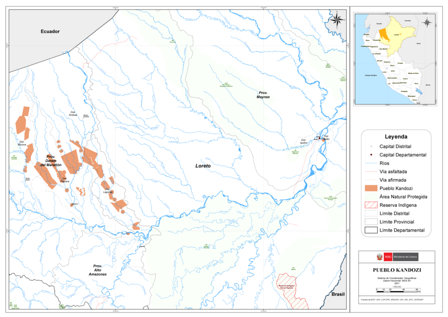
Peoples
- KANDOZI
Citation
Ministerio de Cultura Perú. (2020). Lista de pueblos indígenas u originarios. BDPI: Base de Datos de Pueblos Indígenas u Originarios. https://bdpi.cultura.gob.pe/pueblos-indigenas
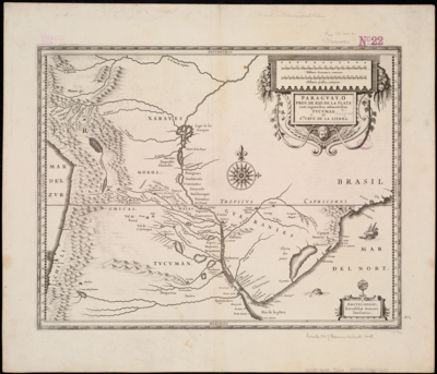
Paraguay;ó prov. de Rio de la Plata cum regionibus adiacentibus Tucuman et Sta. Cruz de la Sierra
Map 1600 - 1699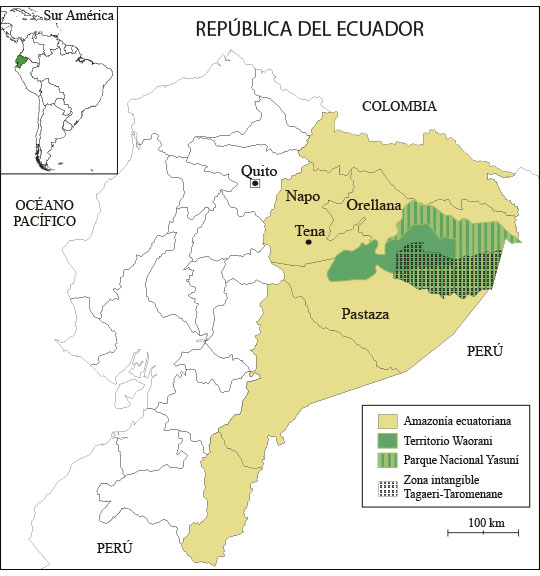
Mapa 1. Ubicación geográfica del territorio Waorani
Map 2018
Cours du Sinnamary
Map 1777
"Transversalidad Histórica entre las Tierras Indidas de 1940 y los Pueblos Indígenas de Costa Rica en la actualidad"
Map 1940 - 2014
Plano del pueblo de Mariguitar y de las tierras repartidas a los indios
Map 1703
The Tarahumar Country
Map 1600 - 1699
PUEBLOS DE INDIOS DE LAS INTENDENCIAS Y GOBIERNOS MILITARES DE LA NUEVA ESPAÑA EN 1800 (4,468 PUEBLOS DE INDIOS)
Map 1800
AMERIQUE MERIDIONALE: BRESIL AUX PORTUGAIS: CAPITAINERIE DE RIO-IANEIRO
Map 1757