Peoples
- GUARANI
Citation
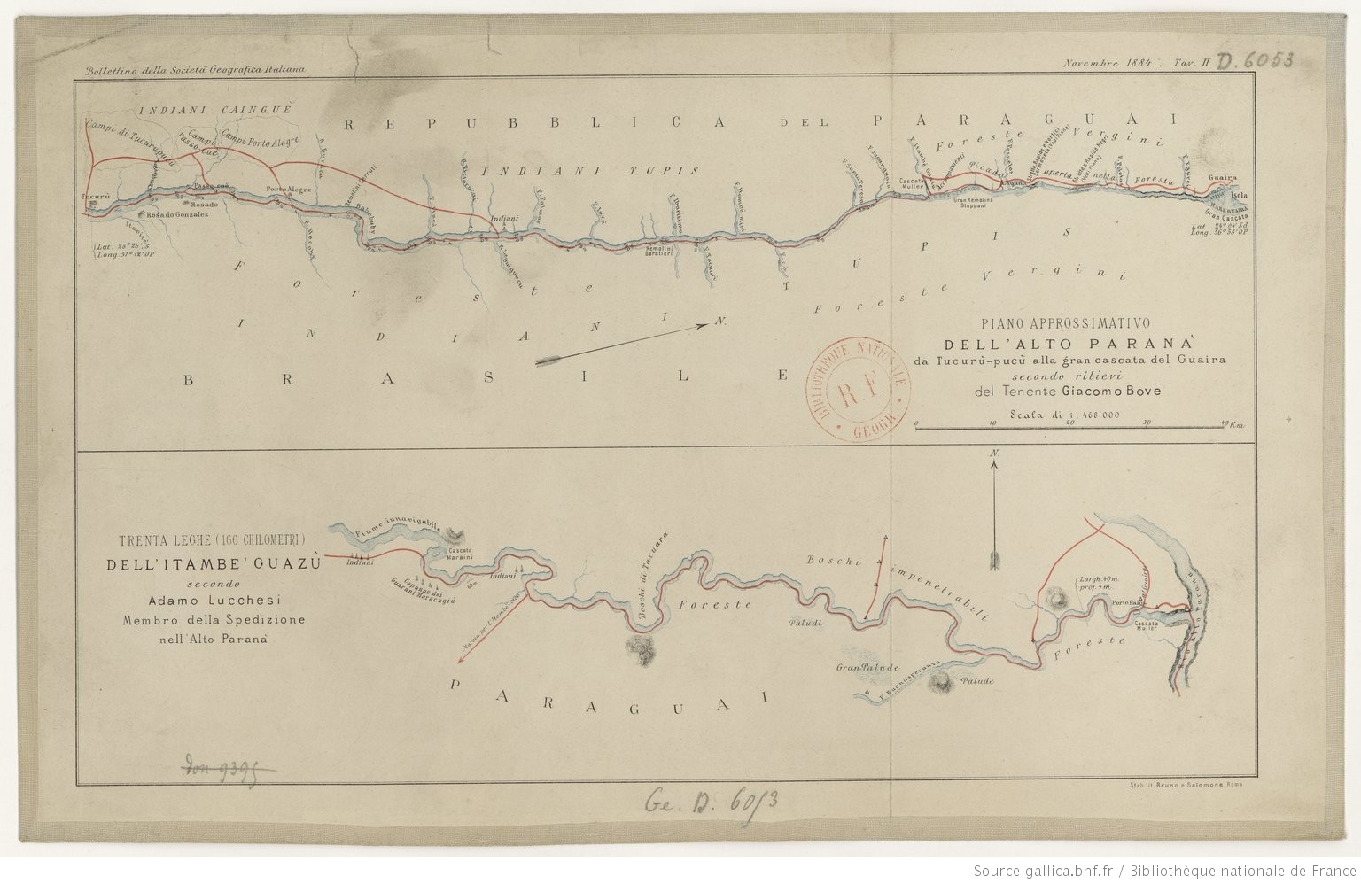
Lucchesi, Adamo. Trenta Leghe (166 chilometri) Dell' Itambe' Guazù. Map (Bottom). Rome: Bruno e Salomone, 1884. Accessed May 7, 2023. https://gallica.bnf.fr/ark:/12148/btv1b84449935#.
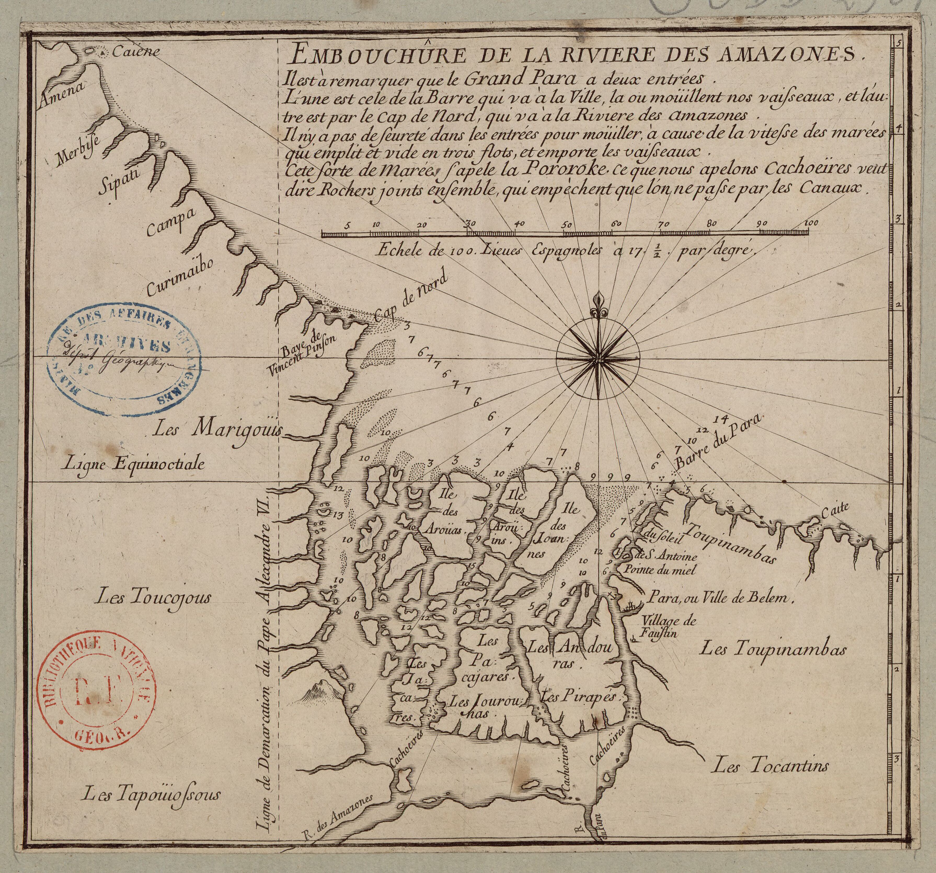
EMBOUCHÛRE DE LA RIVIERE DES AMAZONES
Map 1700 - 1799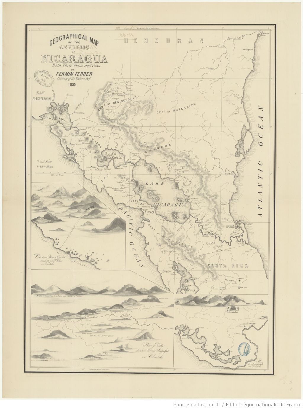
Geographic Map of the Nicaragua with three plans and views.
Map 1855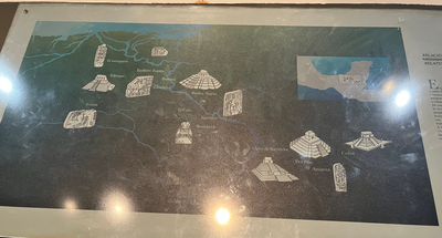
MAYAN SPIRITUAL SITES
Map -2500 - 1520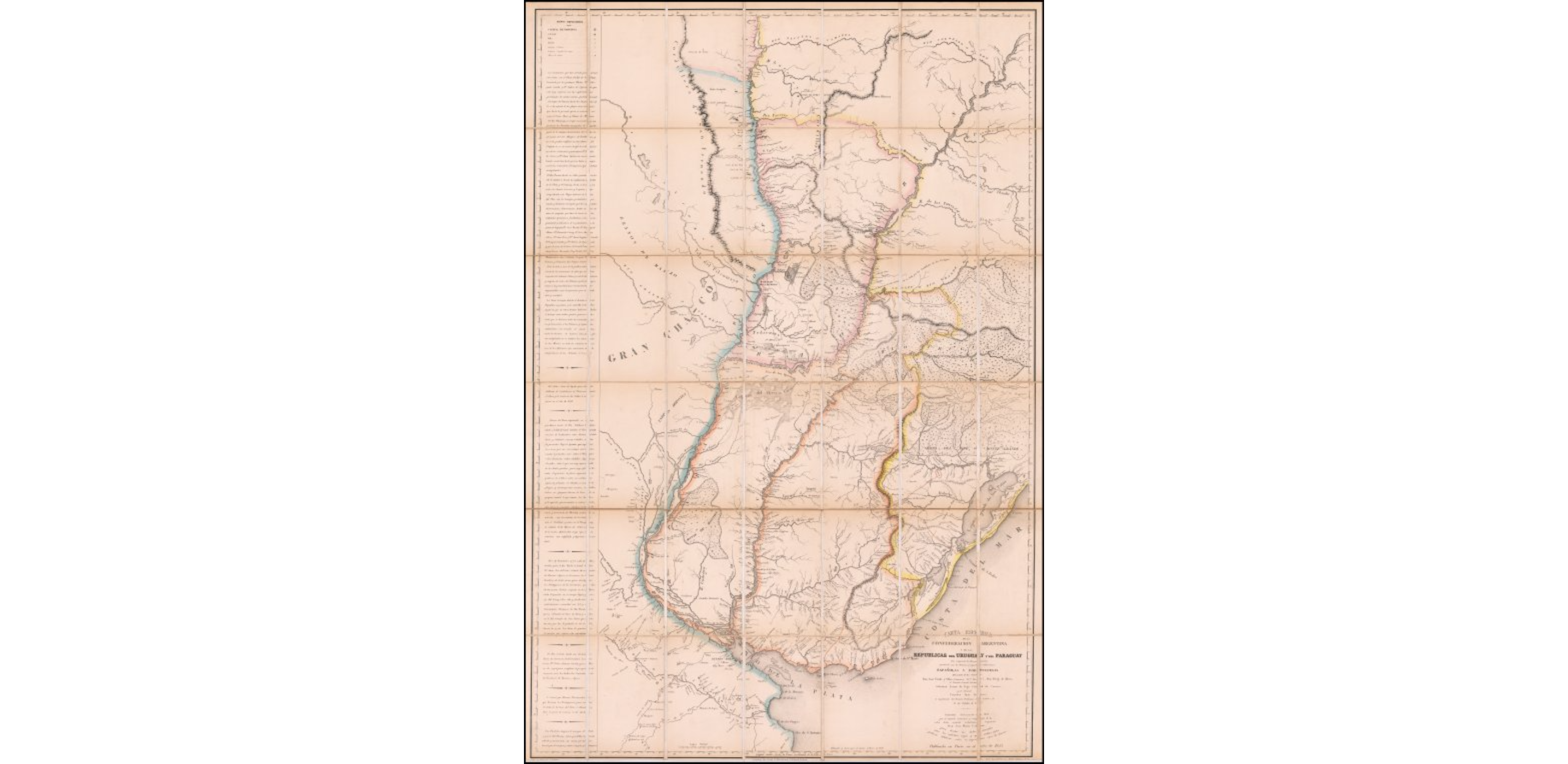
Carta Esférica de la Confederacion Argentina y de las Republicas del Uruguay y del Paraguay que comprende los Reconocimientos practicados por las Primeros y Segundas Subdivisions Españolas y Portuguesas del mando de los Señores Don Jose Varlea y Ulloa (Comisario Pral. Diror.) Don Diego de Albear;el Teniente General Lucitano Sebastian Xavier da Vega Cabrad da Camara;y el Coronel Francisco Juan Roscio;en Cumplimento del Tratado Preliminar de Limites de 11 de Ocubre de 1777
Map 1802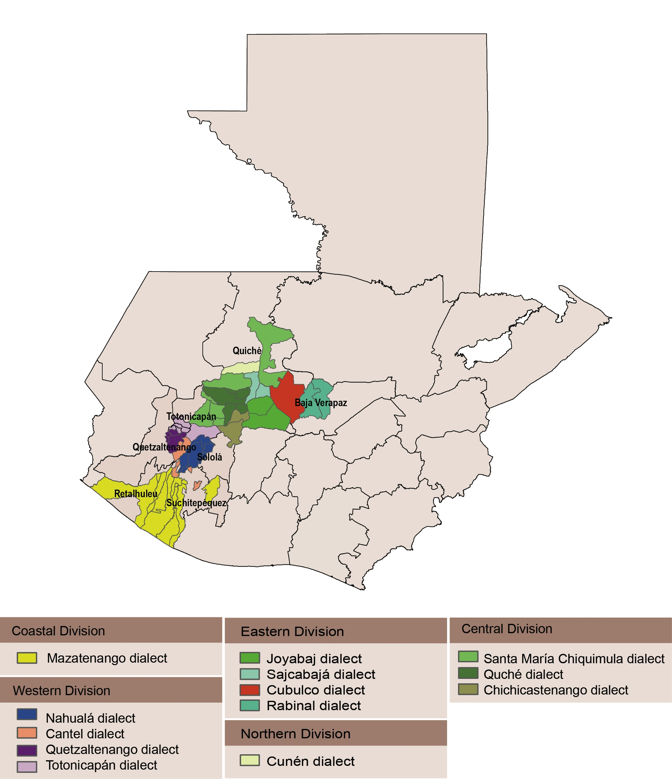
Dialect geography of K'ichee'
Map
San Juan Baptista, San Luys Tezontla y Santa María Nochtongo. Oaxaca, 1579
Map 1579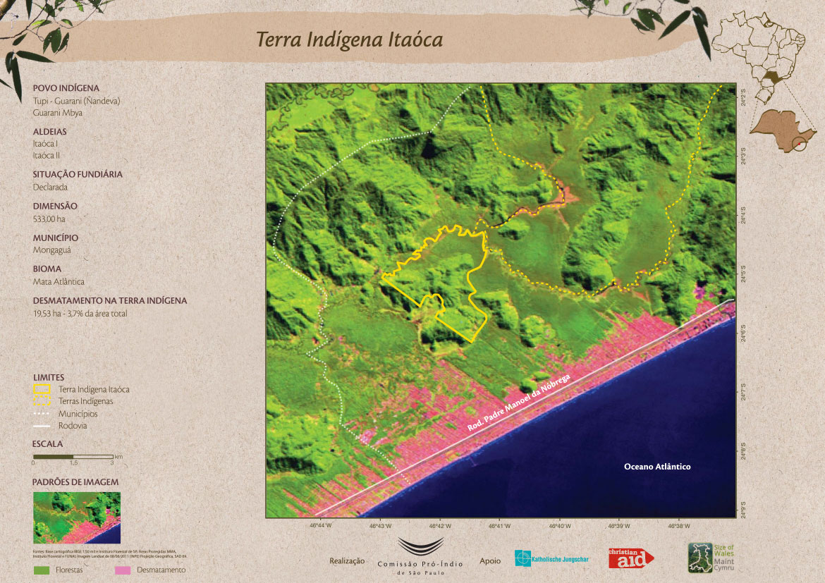
Terra Indígena Itaóca
Map 2011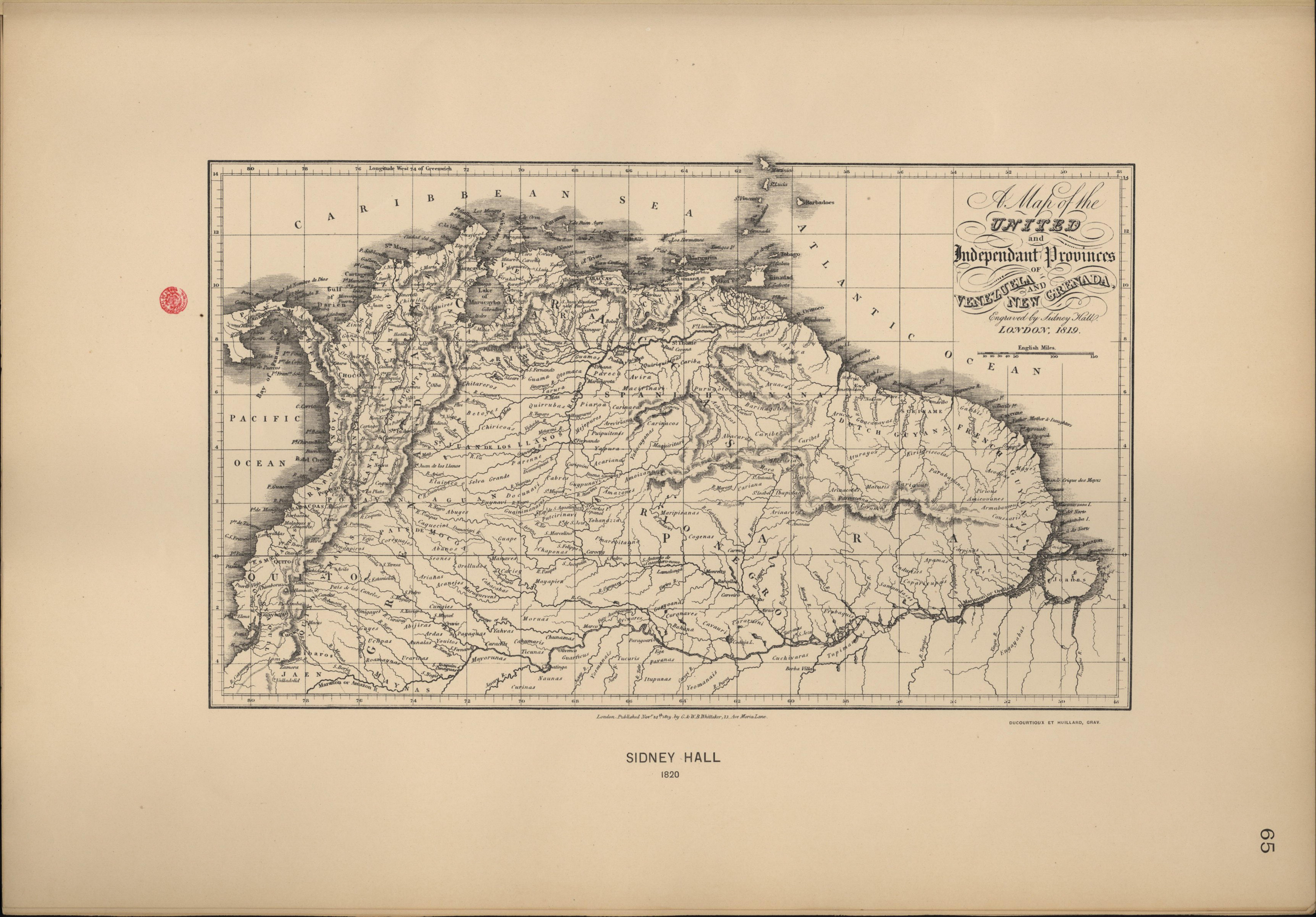
A Map of the United and Independant Provinces of Venezuela and New Grenada.
Map 1800 - 1899