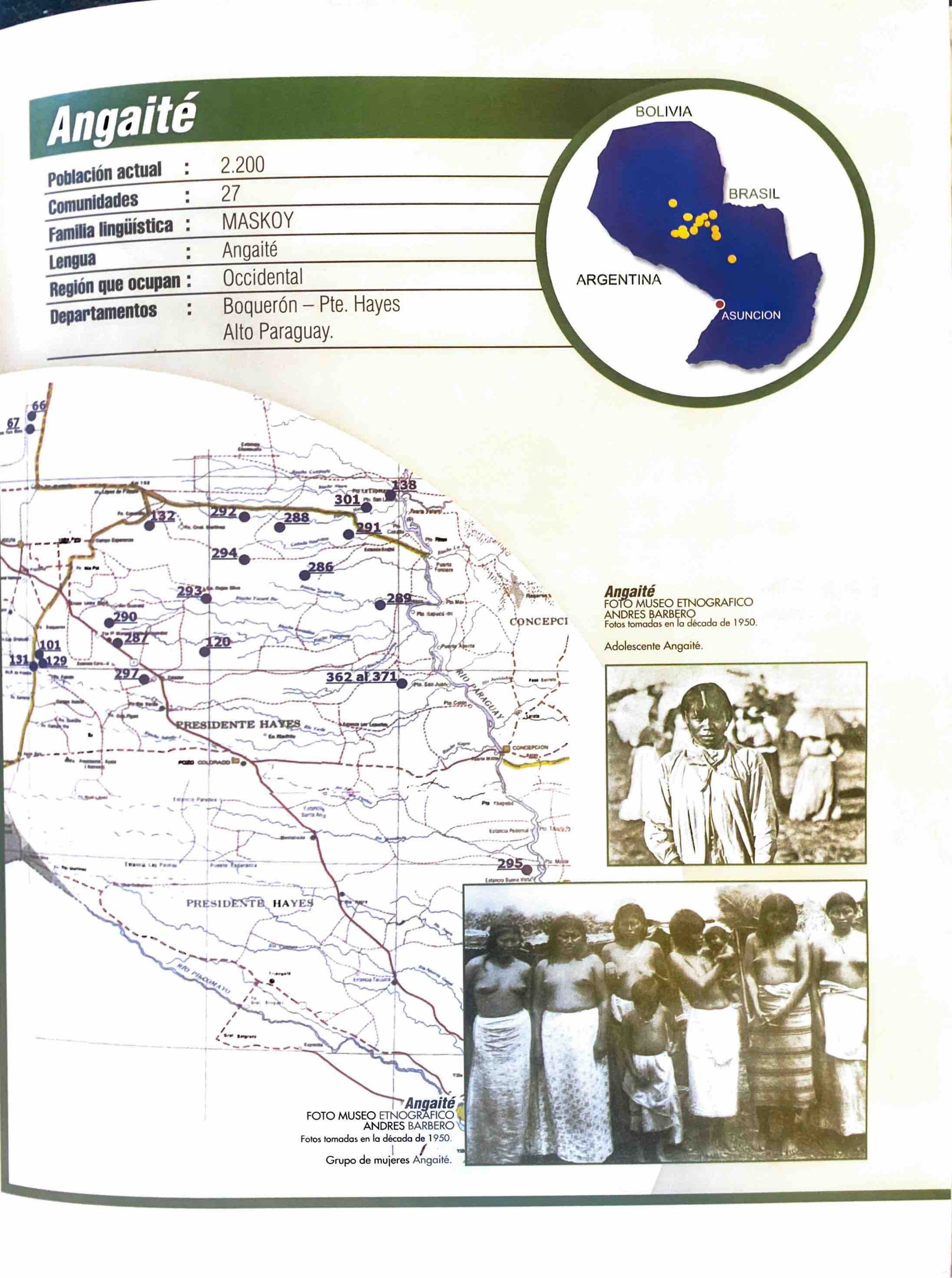
Peoples
- ANGAITE
Citation
Zanardini, José, and Walter Biedermann. Los Indígenas Del Paraguay. 2nd ed. Asunción: ITAIPU Binacional, 2006.
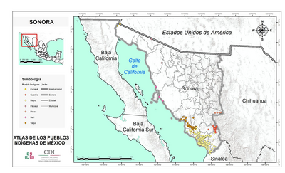
SONORA
Map 2015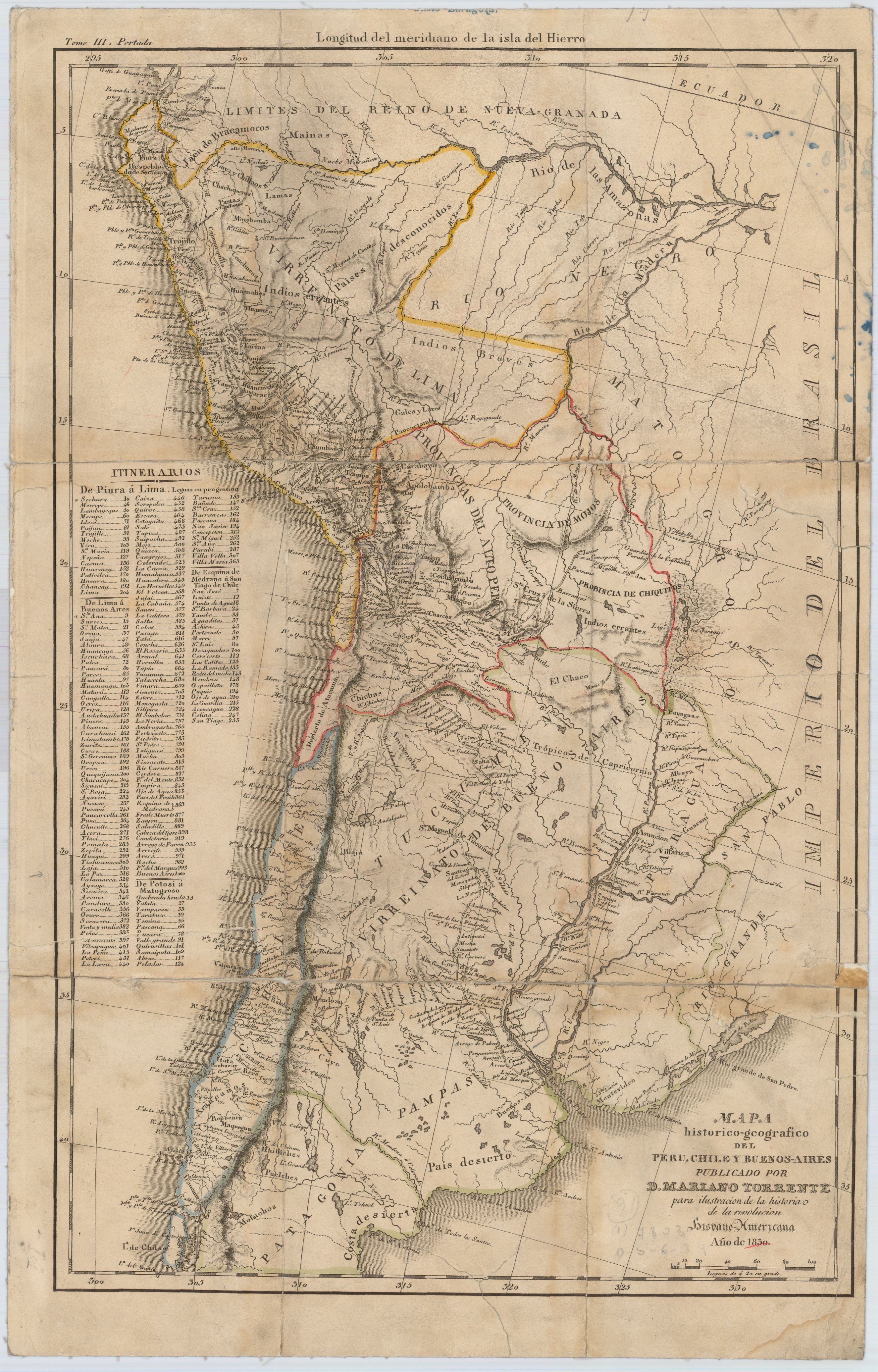
Mapa histórico-geográfico de Perú, Chile y Buenos Aires
Map 1830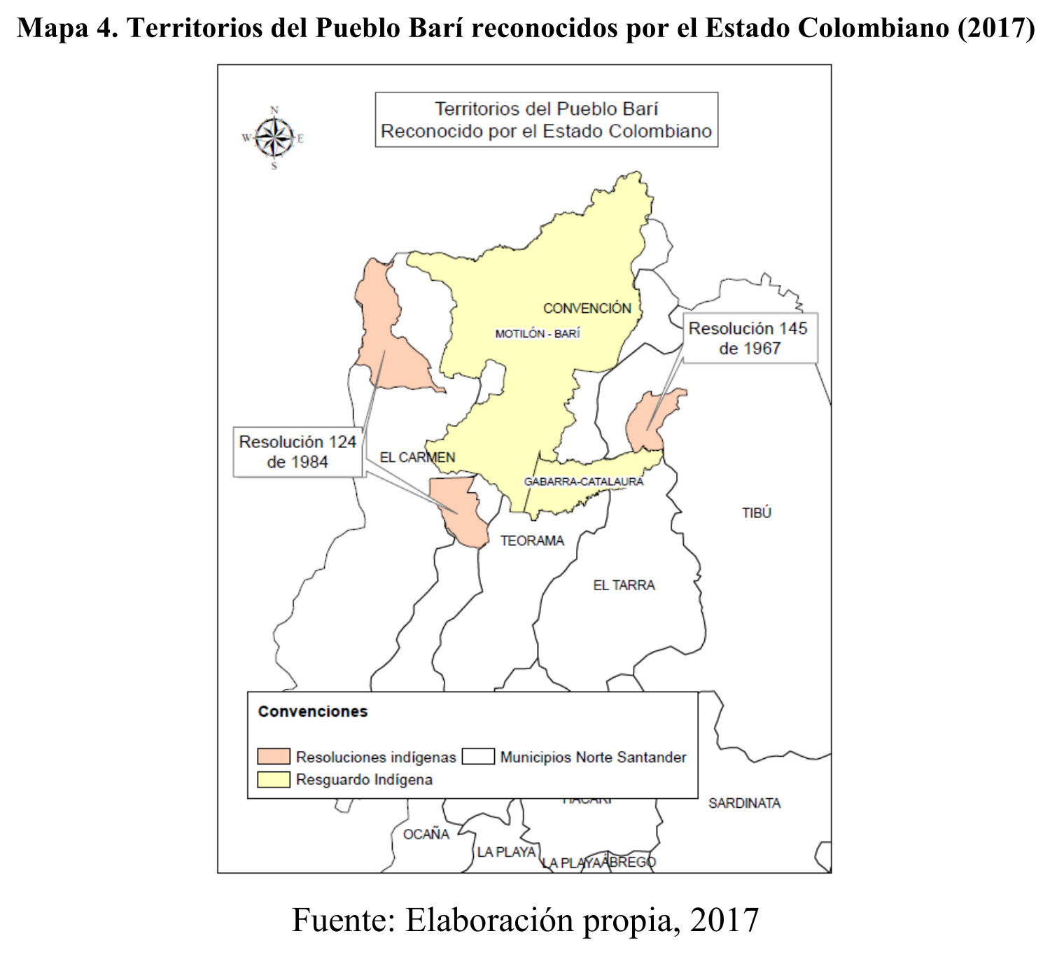
Territorios del Pueblo Barí reconocidos por el Estado Colombiano (2017)
Map 2017![La casa de fierro [The Iron House]](https://dnet8ble6lm7w.cloudfront.net/art_sm/APER085.png)
La casa de fierro [The Iron House]
Artwork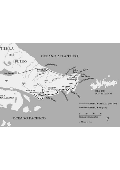
Haush
Map 1800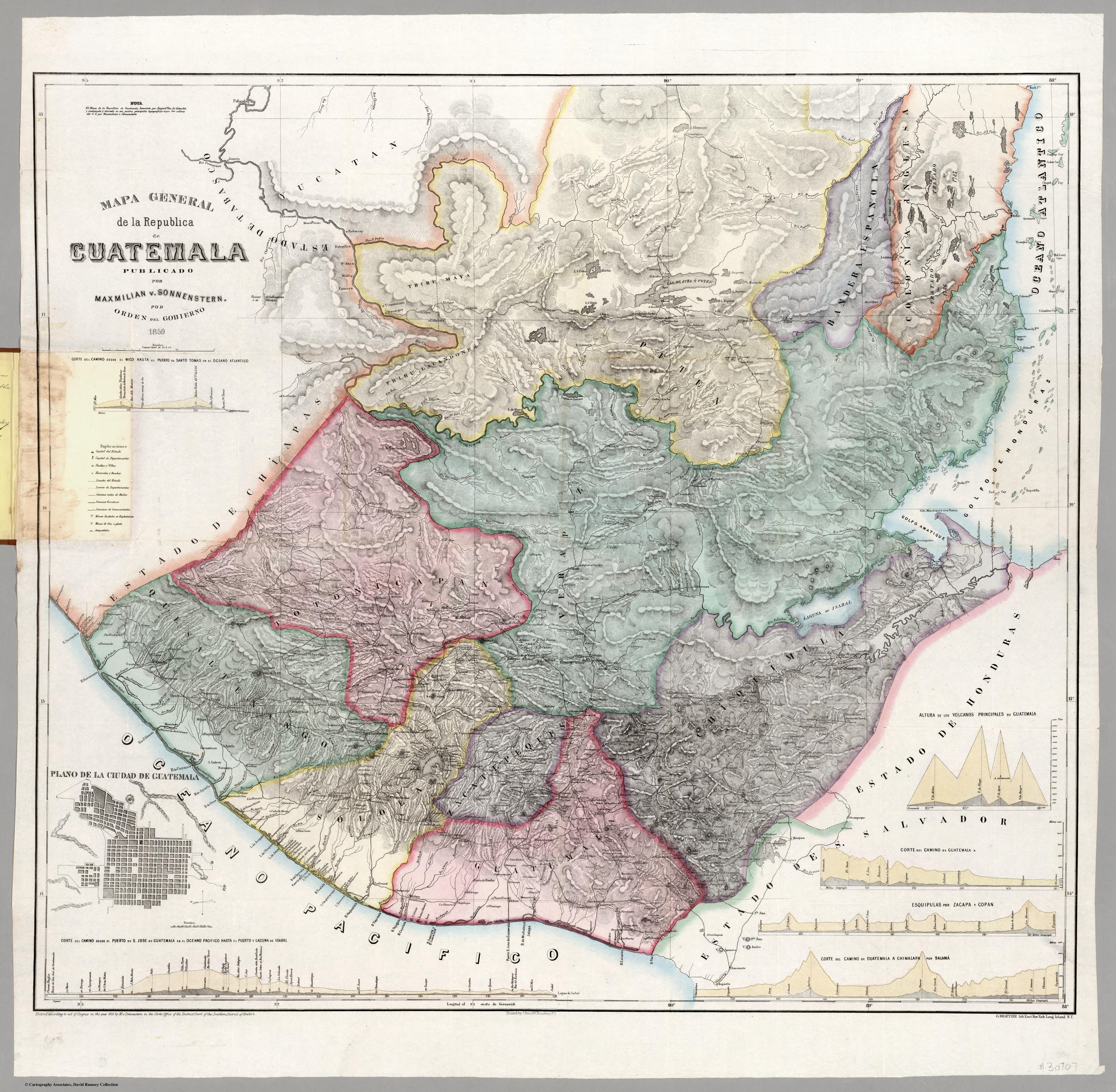
Mapa general de la Republica de Guatemala. Publicado por Maximilian v. Sonnenstern por orden del gobierno, 1859. Printed by J. Rau, 33 Broadway, NY. G Kraetzer lith, East New York Long Island, N.Y. "Entered according to act of Congress in the year 1859 by M.v Sonnenster...New York. (insets) Plando de la Ciudad de Guatemala;and 6 releif profiles.
Map 1800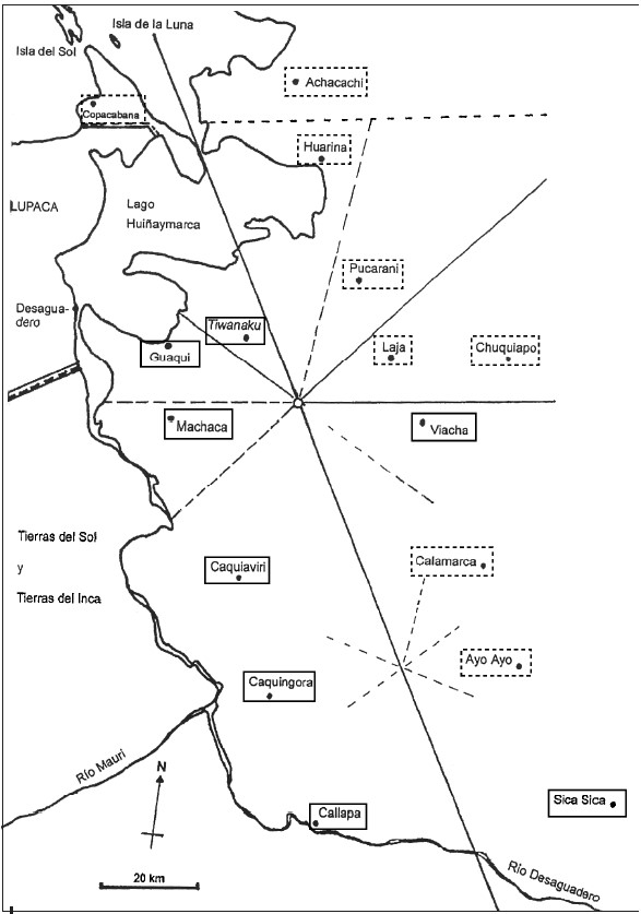
INDIGENOUS DRAFT LABOR (MITA) FOR MINES OF POTOSI UNDER SPANISH COLONIAL RULE – THE CASE OF THE PAKAXA AYMARA POLITY IN THE LATE 16TH CENTURY
Map 1570 - 1650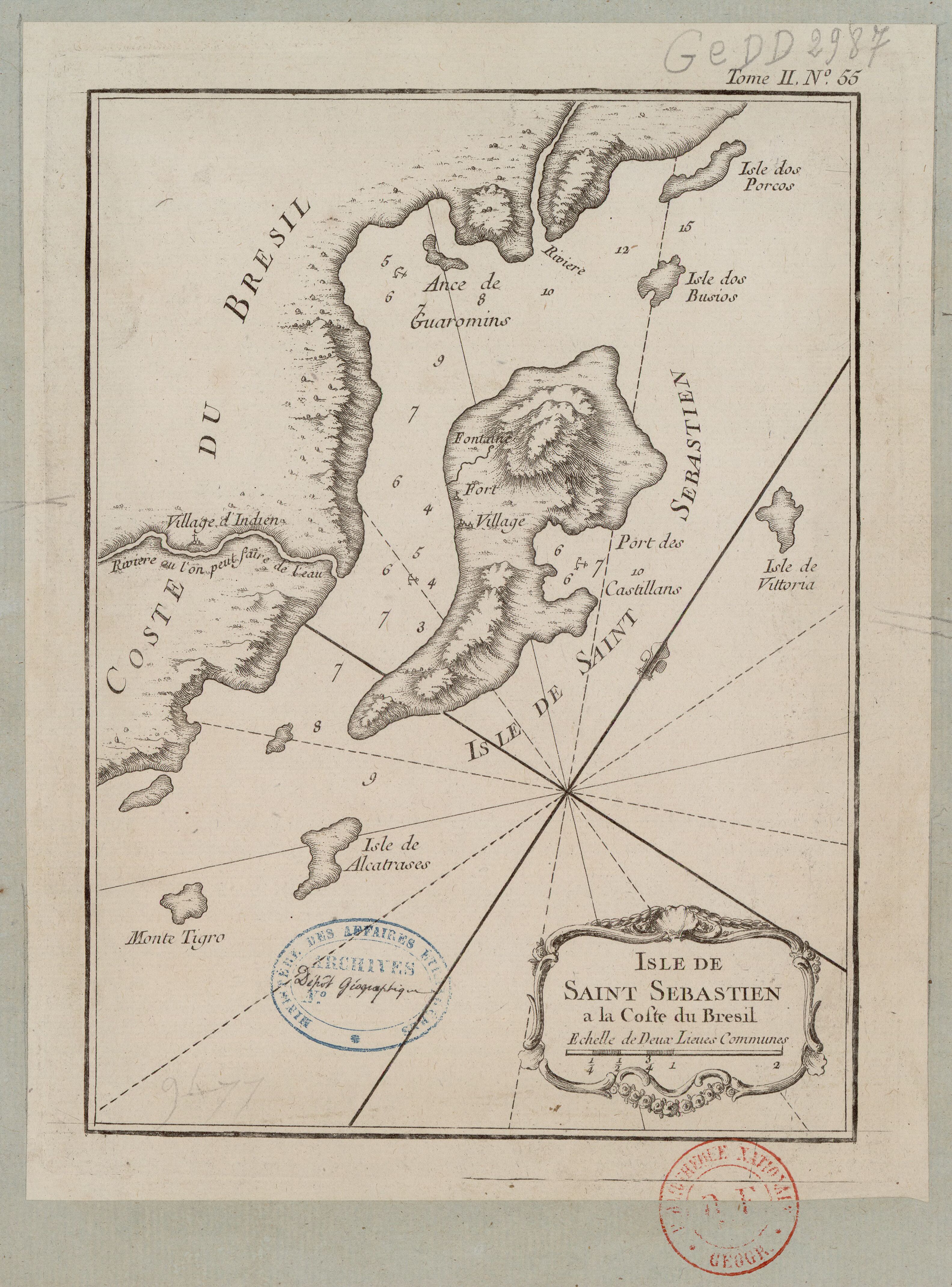
ISLE DE SAINT SÉBASTIEN a la Coste du Brésil
Map 1764