Citation
Federación por la Autodeterminación de los Pueblos Indígenas. "Mapa de las Tierras Indígenas." Map. Tierras Indígenas. 2017. Accessed April 8, 2023. https://www.tierrasindigenas.org/Mapa.

Detail from the 1770 copy of Francisco Álvarez Barreiro’s 1728 map of northern New Spain illustrating Spanish mapping of Indian domains in southern Texas and along the Gulf Coast, especially through the repetition of labels: “tierra de los Pampopas,” “tierra de los Carrizos,” “tierra de los Cujanes,” etc.
Map 1728
SOUTH AMERICAN STATES. NEW GRANADA & VENEZUELA.
Map 1872
Carte de la Guyane Française et l'Isle de Cayenne
Map 1798
Area of Tarascan Speech about 1850
Map 1850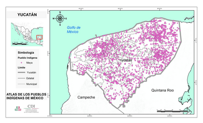
YUCATÁN
Map 2015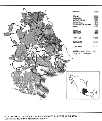
Distribution of Indian Languages in Central Mexico
Map 1969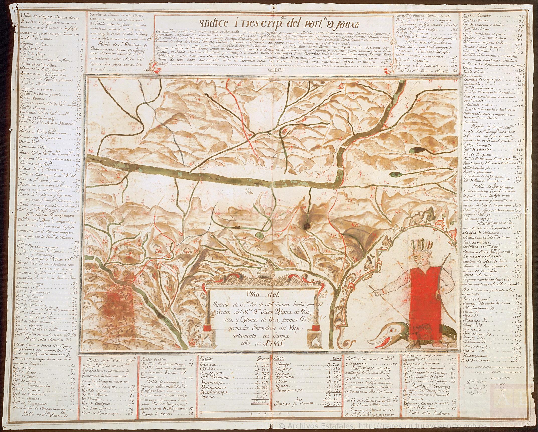
Plan del Partido de Santa Fé de Atun Jauxa, hecho por orden del Sr. D. Juan María de Gálvez y Montes de Oca, primer Gobernador Intendente del Departamento de Tarma. Año de 1785.
Map 1785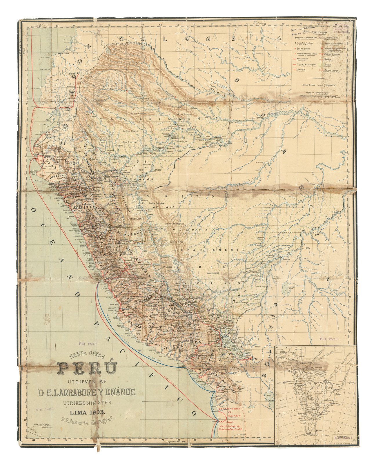
Karte Ofver Peru Utgifven D.E. Larrabure y Unnanue Utrikesminister
Map 1903