
Peoples
- POSESIONES DE LOS INDIOS
Citation
"Darien, navegación" (1852). Archivo General de la Nacion de Colombia, Sección Mapas y Planos, Mapoteca 1, Mapa 63. http://consulta.archivogeneral.gov.co/ConsultaWeb/index.jsp
Carte nouvelle de la France Equinoctiale faite et présentée à sa Majesté par le SieurLe Febure de la Barre son Lieutenant Généralen ces pays au mois de septembre 1665
Map 1665
PLANO QUE SE ADJUNTA AL PROCESO QUE SIGUEN LOS INDÍGENAS DE LA COMUNIDAD DE COLAMBO;LOJA CONTRA DIEGO BRICINO A QUIEN ACUSAN DE HABERSE APROPIADO DE LAS TIERRAS DE ESTA COMUNIDAD
Map 1697
Theories of Migration (Charrúas).
Map 1680 - 1805
South America from the latest discoveries, shewing the Spanish & Portuguese settlements according to Mr. D'Anville
Map 1771
A NEW MAP OF BRAZIL, COMPILED FROM THE LATEST Government & other Authentic Surveys.
Map 1866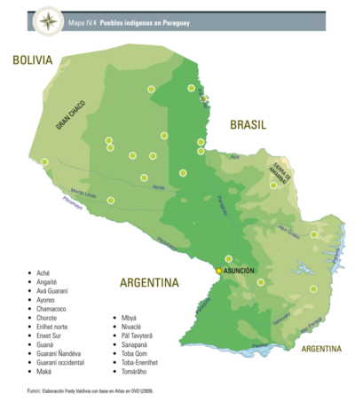
Pueblos Indígenas en Paraguay
Map 2009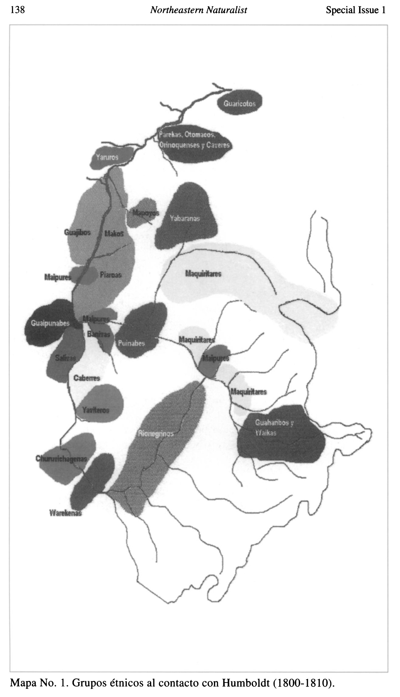
Grupos étnicos al contacto con Humboldt (1800-1810)
Map 1800 - 1810
No Title
Map 2008