Peoples
- INDIAN EMPIRE OF DARIEN
Citation
Hacke, W. (1688). This is a description of the Isle of Pines and Golden Island / William Hacke [Map]. Gallica. https://gallica.bnf.fr/ark:/12148/btv1b5905636w/f1.item.r=Panama.zoom
Mapa general del Perú
Map 1865
COAHUILA
Map 2015
SOUTH AMERICA FROM THE BEST AUTHORITIES
Map 1802
Terra Indígena Tenondé Porã
Map 2012
Carte des colonies Française et Hollandaise de la Guyane Dressée d'après les cartes de N. Buache et de S. Mentelle Capitaine d'Infanterie
Map 1800 - 1899
Pueblos del Chanar y el Algarrobo. Los Atacamas del Siglo XVII.
Map 1600
KART VON OST-BRASILIEN. CARTE GÉOGRAPHIQUE DE LA PARTIE ORIENTALE DE L'EMPIRE DU BRÉSIL
Map 1831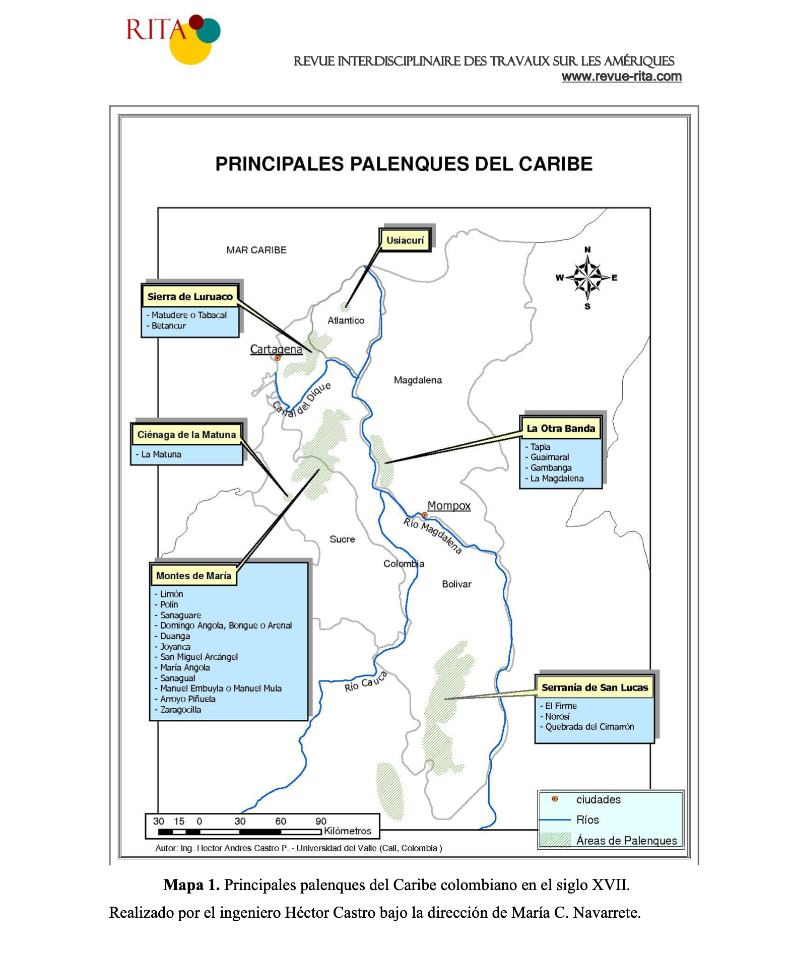
PRINCIPALES PALENQUES DEL CARIBE
Map 1600 - 1699