Peoples
- INDIANS
Citation
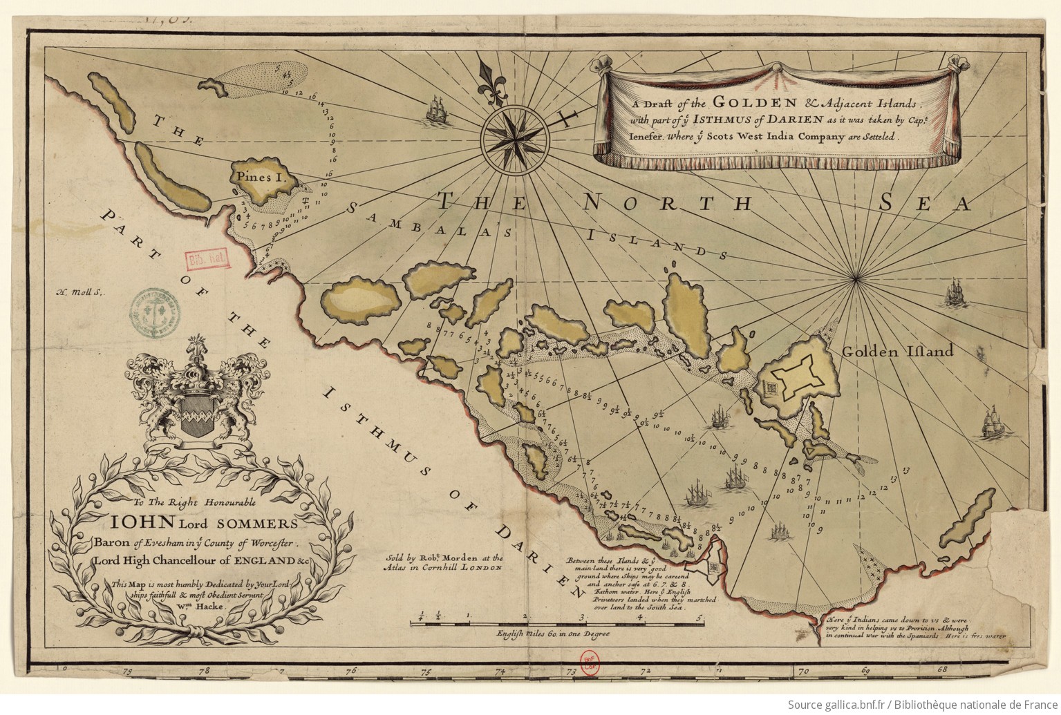
Hacke, W., & Morden, R. (Cartographers). (1688). A draft of the Golden and adjacent islands [Map]. Gallica. https://gallica.bnf.fr/ark:/12148/btv1b5970838s/f1.item.r=Panama.zoom
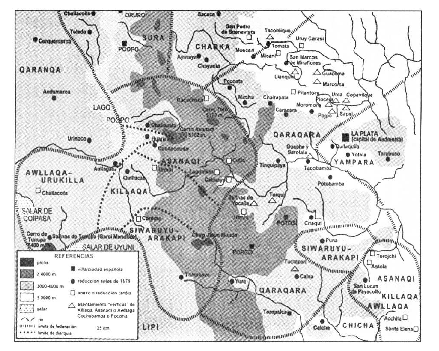
TERRITORIO DEL SEÑORÍO AYMARA DE LOS KILLAKAS A PRINCIPIOS DEL SIGLO XVI
Map 1500 - 1530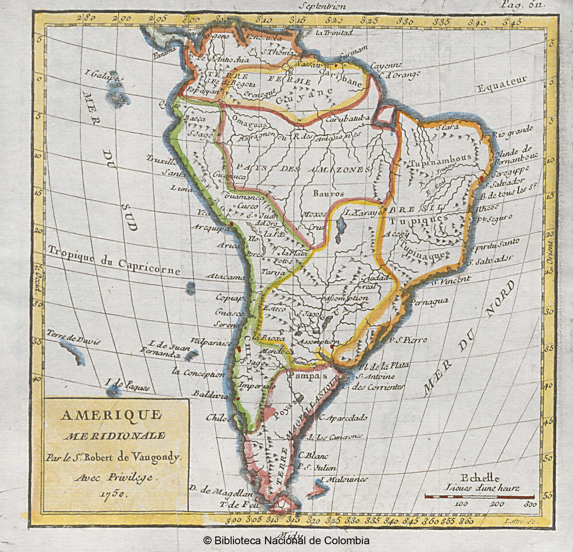
AMERIQUE MERIDIONALE
Map 1750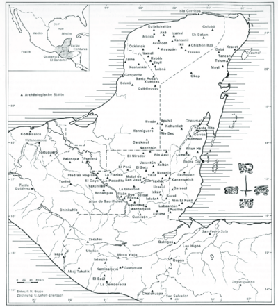
MAP OF THE YUCATAN PENINSULA WITH MAJOR ARCHEOLOGICAL SITES
Map 2019
A MAZO
Artwork
Guiana verdeelt in Guiana en Caribana. door N. Sanson d.'Abbeville, Geogr ordre. du Roÿ
Map 1600 - 1699
La France équinoctiale remise soubs l'Obeissance du Roy en l'année 1664.
Map 1664
Ilustración 2. Territorios de Pueblos y Nacionalidades en la Sierra Ecuador;2006
Map 2006
Tohono O’odham Nation Map
Map