Peoples
- INDIANS
Citation
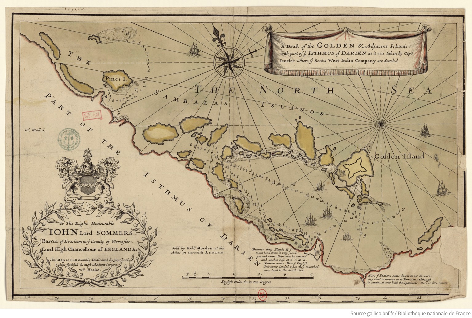
Hacke, W., & Morden, R. (Cartographers). (1688). A draft of the Golden and adjacent islands [Map]. Gallica. https://gallica.bnf.fr/ark:/12148/btv1b5970838s/f1.item.r=Panama.zoom
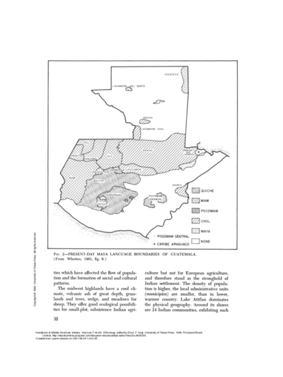
PRESENT-DAY MAYA LANGUAGE BOUNDARIES OF GUATEMALA
Map 1961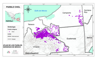
PUEBLO CHOL
Map 2020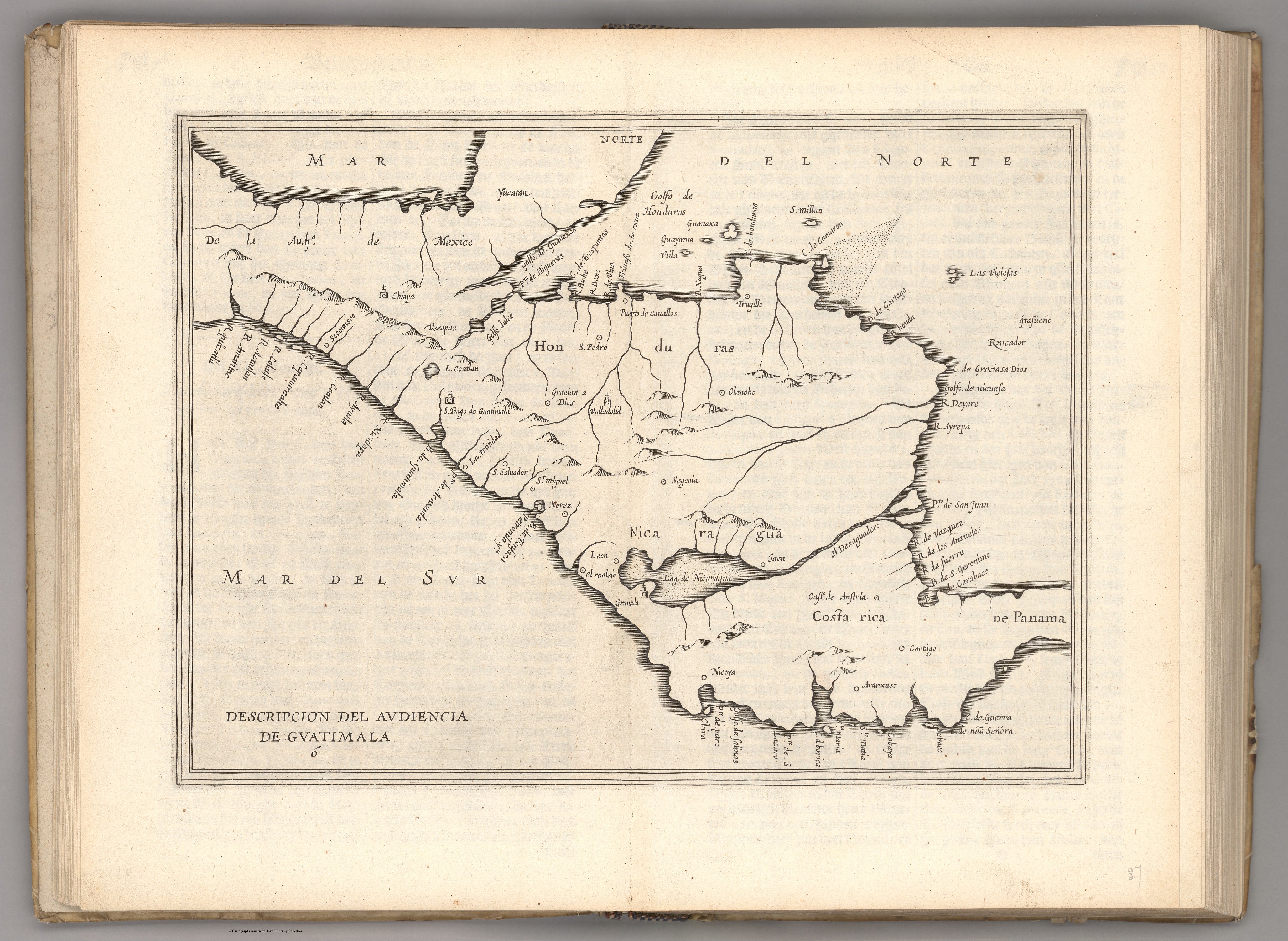
Descripcion del audiencia de Guatimala. 1622
Map 1600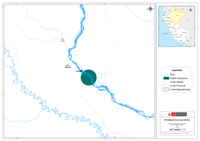
PUEBLO VACACOCHA
Map 2021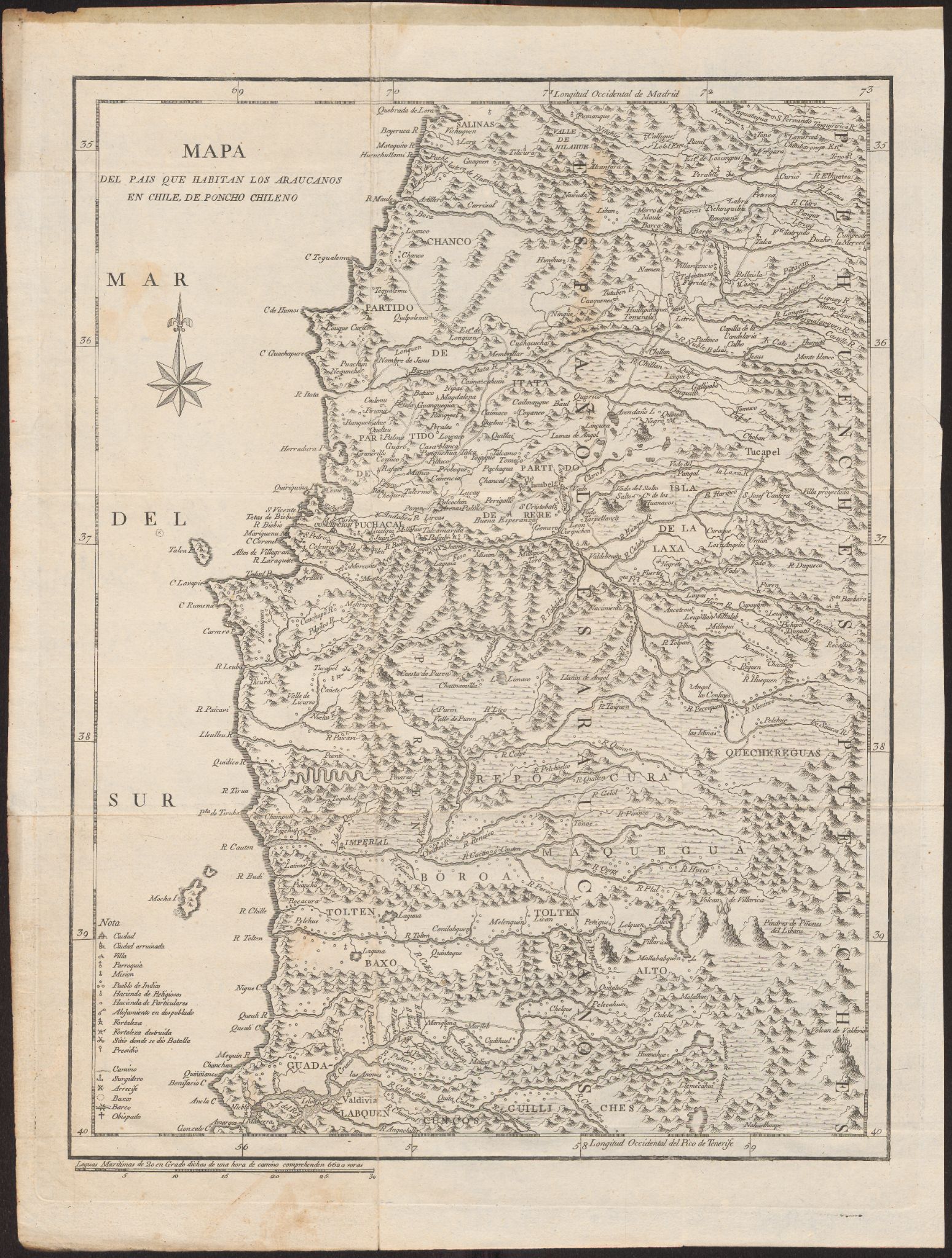
Mapa Del Pais Que Habitan Los Araucanos En Chile, De Poncho Chileno
Map 1700 - 1800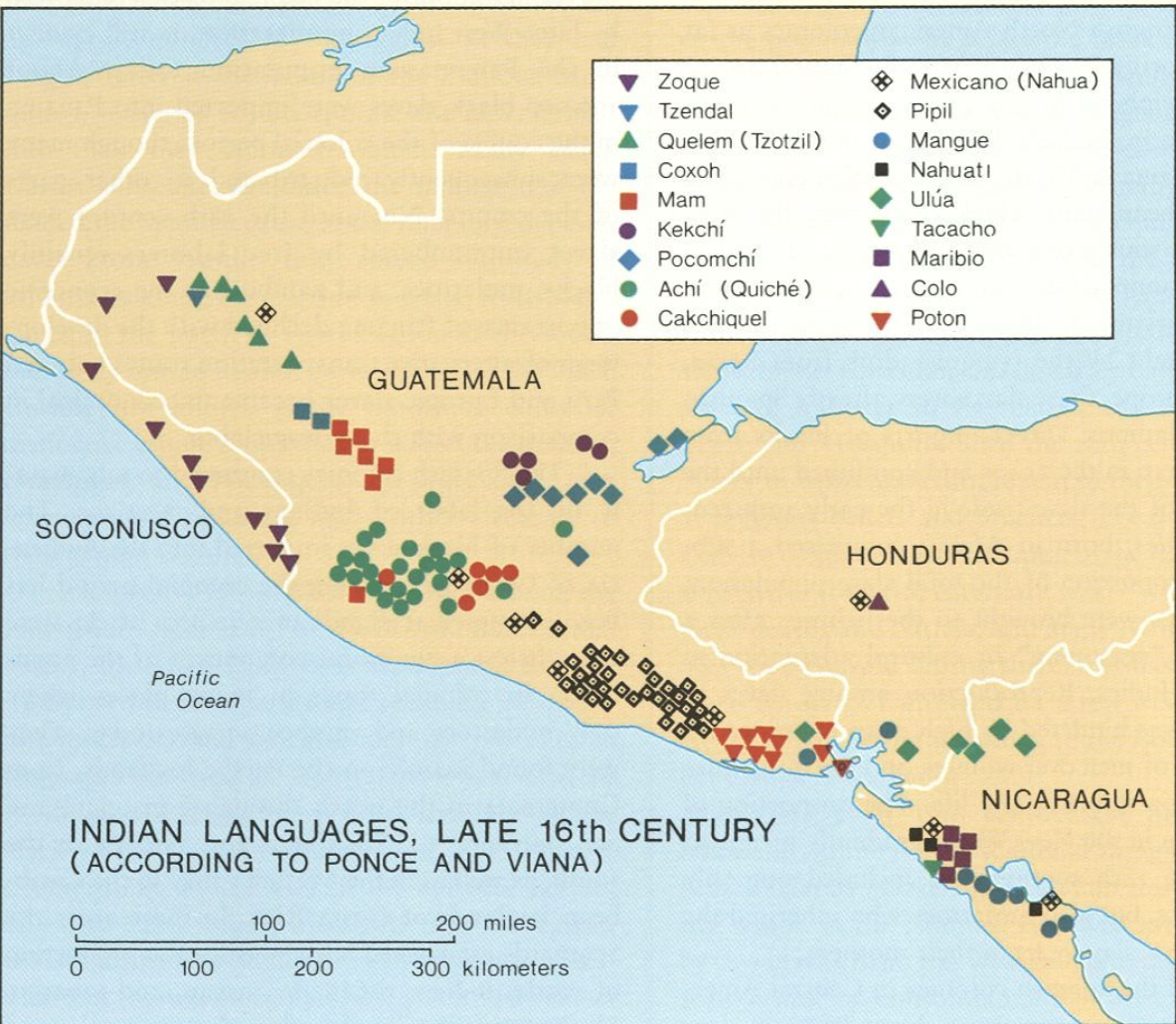
Indian Languages, Late 16th Century, (According to Ponce and Viana).
Map 1500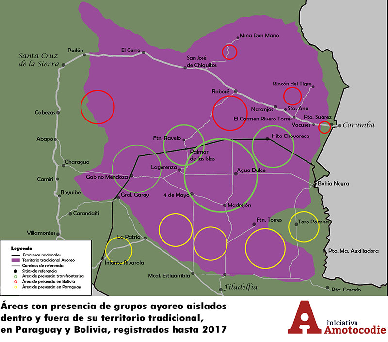
Áreas con presencia de grupos ayoreo aislados dentro y fuera de su territorio traditional, en Paraguay y Bolivia, registrados hasta 2017
Map 2017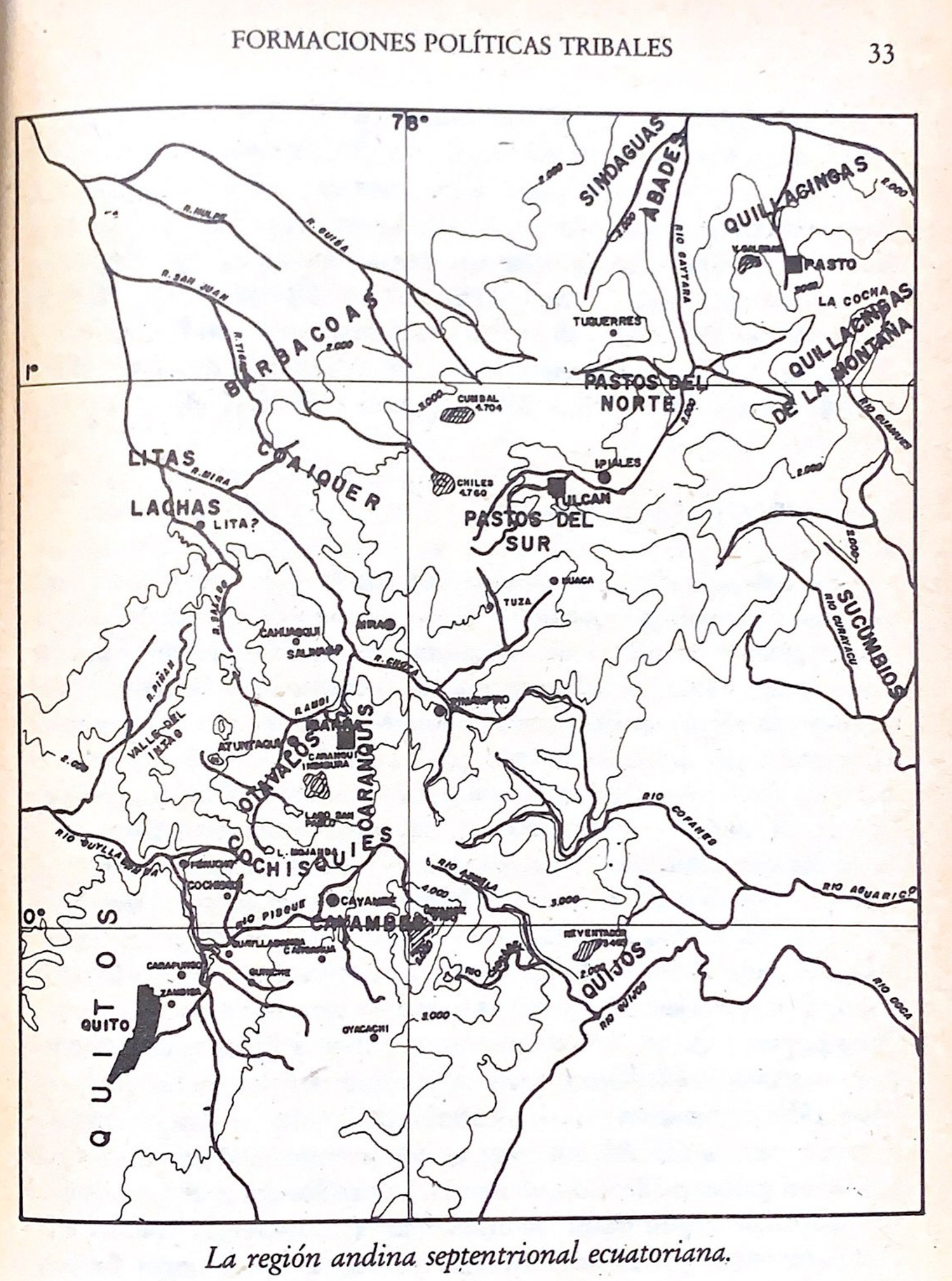
La región andina septentrional ecuatoriana
Map -500 - 1550