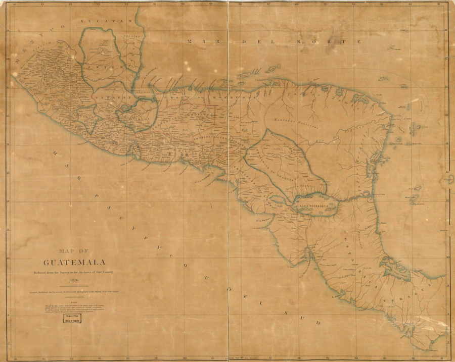
Peoples
- YNDYOS ZAMBOS
- YNDYOS MOSQUITOS
Citation
Arrowsmith;Aaron. Map of Guatemala: reduced from the survey in the archives of that country. [London: Published by A. Arrowsmith;to His Majesty;1826] Map. https://www.loc.gov/item/2004629011/.
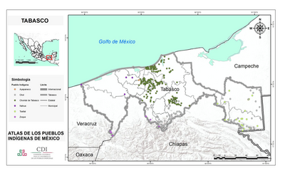
TABASCO
Map 2015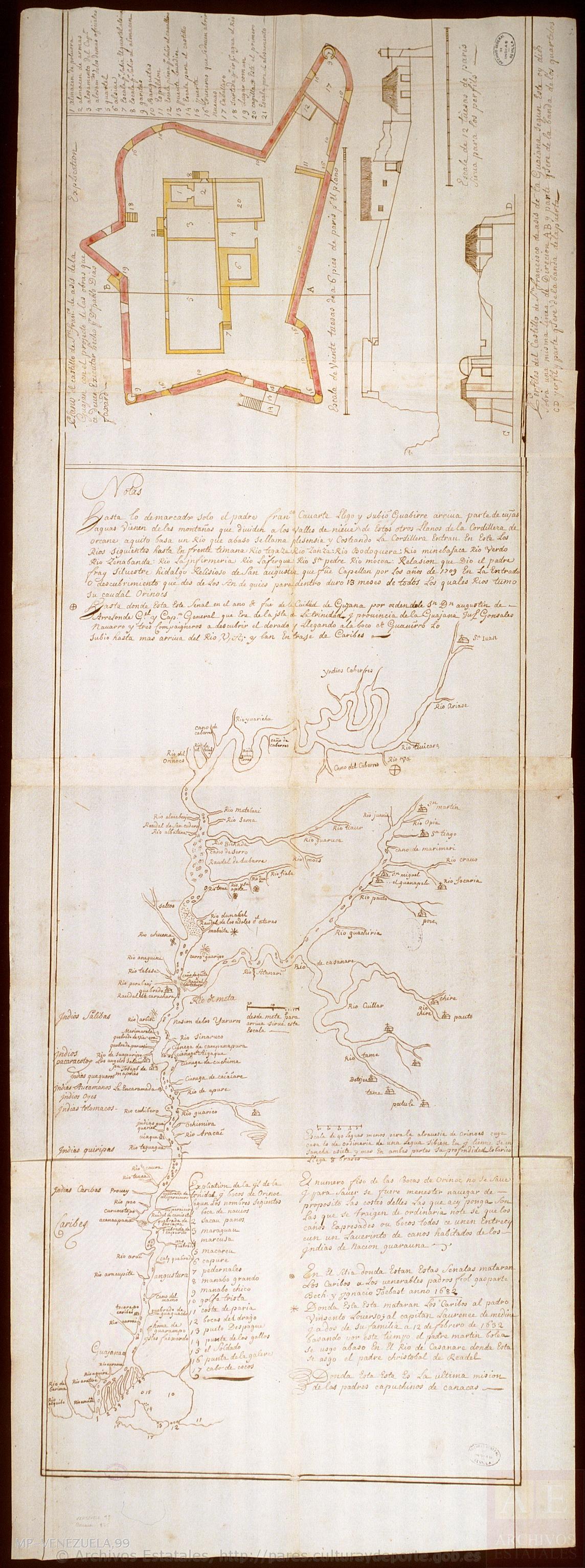
Mapa del Orinoco con planta y dos perfiles del castillo de San Francisco de Asís, en la Guayana.
Map 1736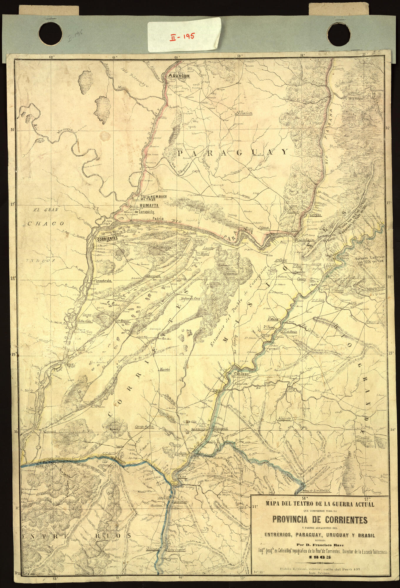
Mapa del teatro de la guerra actual que comprende toda la provincia de Corrientes y partes adyacentes del Entre Ríos, Paraguay, Uruguay y Brasil revisada por Don Francisco Rave Ingeniero Geógrafo ex Jefe del Departamento Topográfico de la Provincia de Corrientes, Director de la Escuela Politécnica. Impreso
Map 1860 - 1870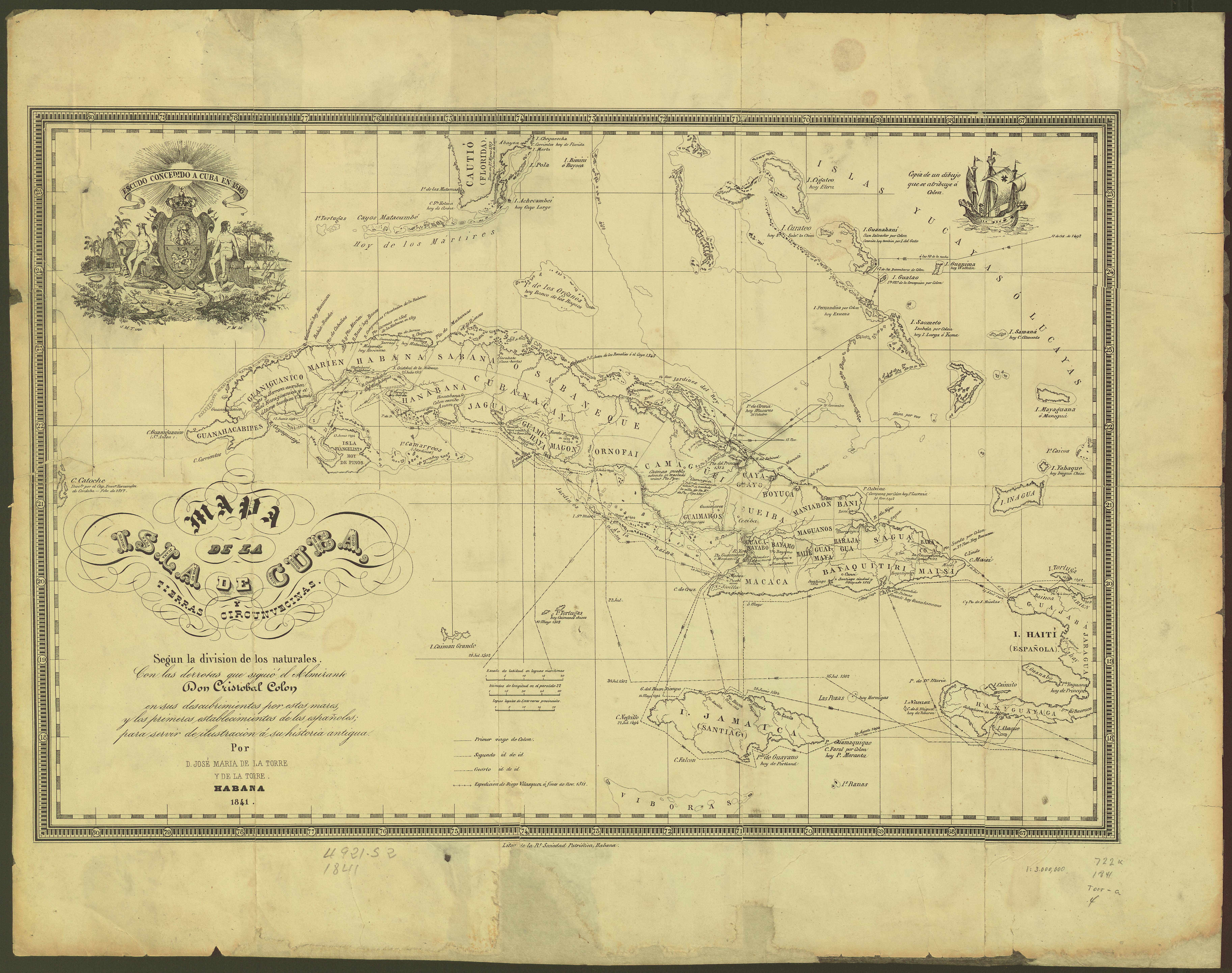
Mapa de la Isla de Cuba y tierras circunvecinas según la división de los naturales con las derrotas que siguió el Almirante Cristóbal Colón para servir de ilustración a su historia antigua
Map 1500 - 1599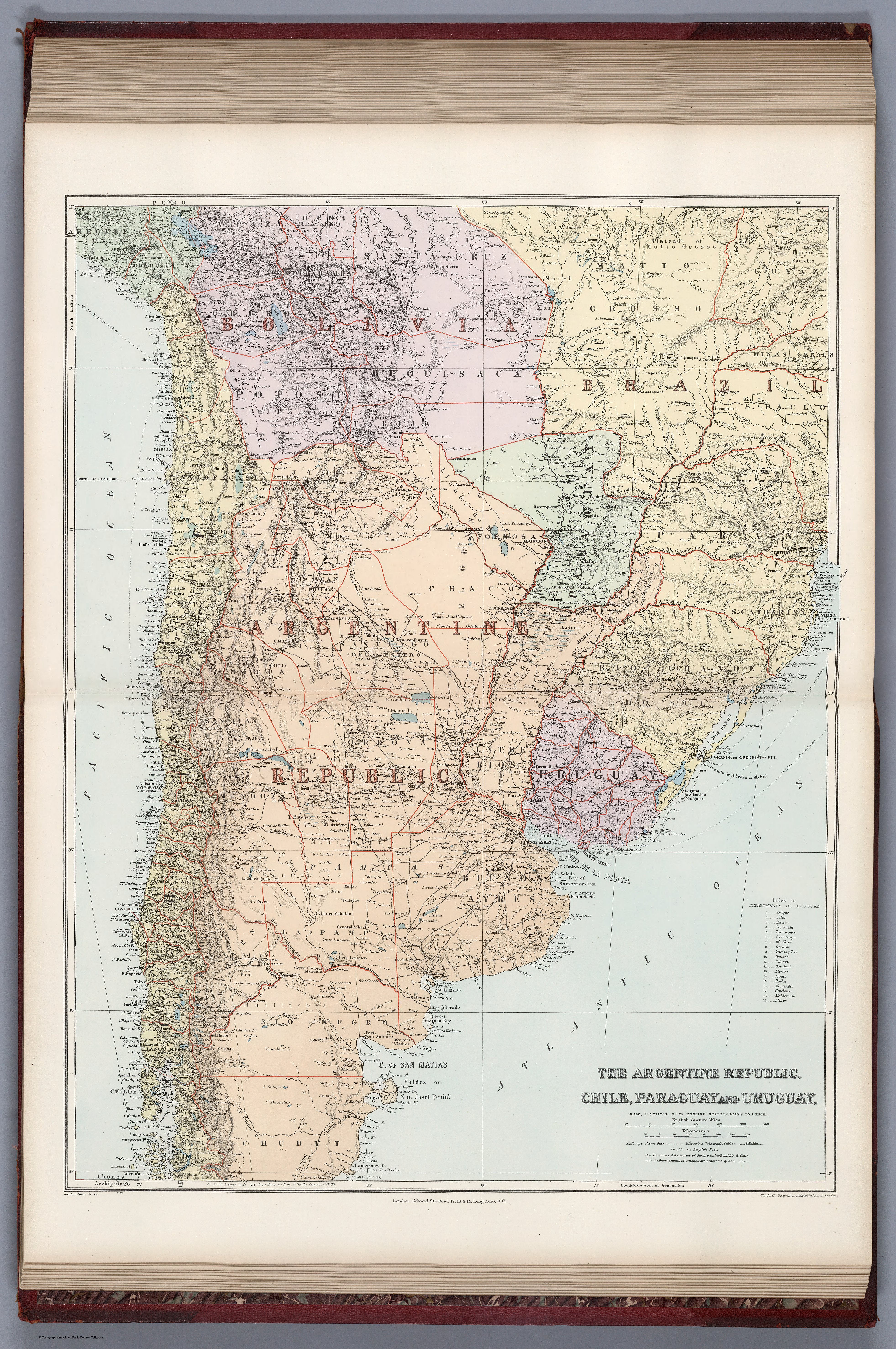
THE ARGENTINE REPUBLIC;CHILE;PARAGUAY AND URUGUAY
Map 1887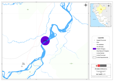
PUEBLO OMAGUA
Map 2021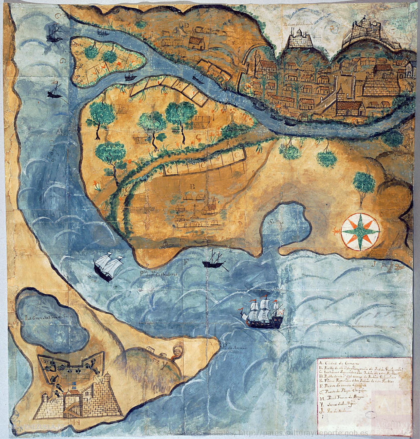
Plano del pueblo de Nuestra Señora de Altagracia y del reparto de tierras a los indios, con vista de Cumaná y de la fortaleza de Araya.
Map 1704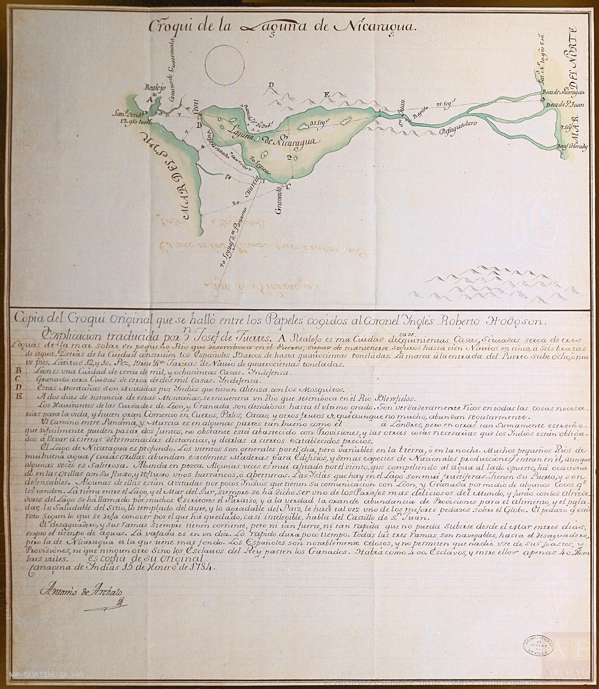
Croquis de la Laguna de Nicaragua
Map 1784