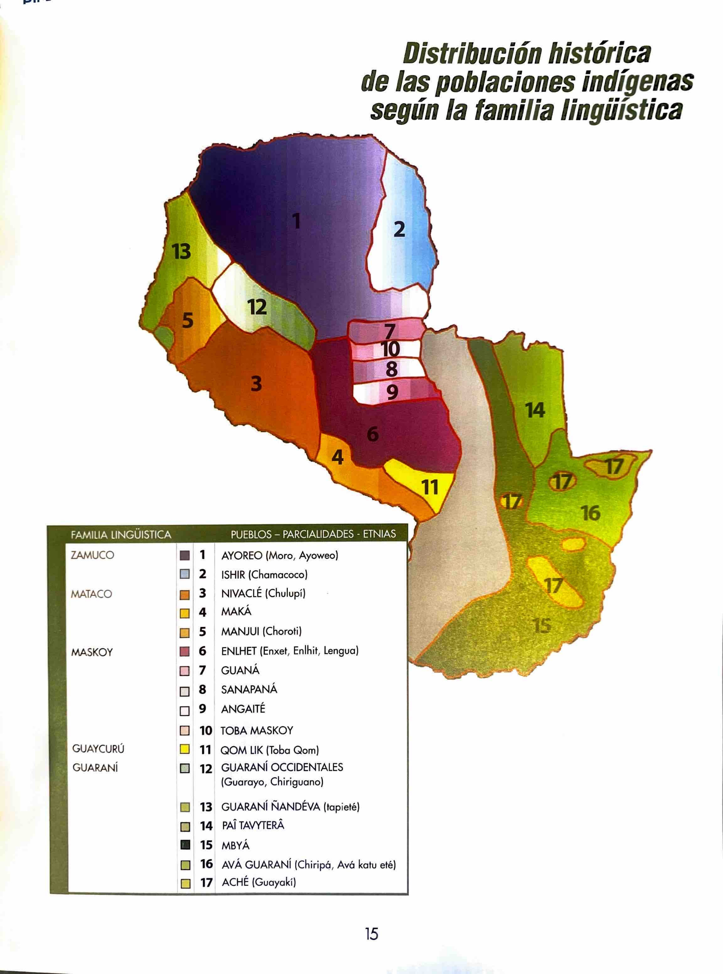
Peoples
- MESTIZOS
- MOSQUITOS
- YNDIOS MOSQUITOS
Citation
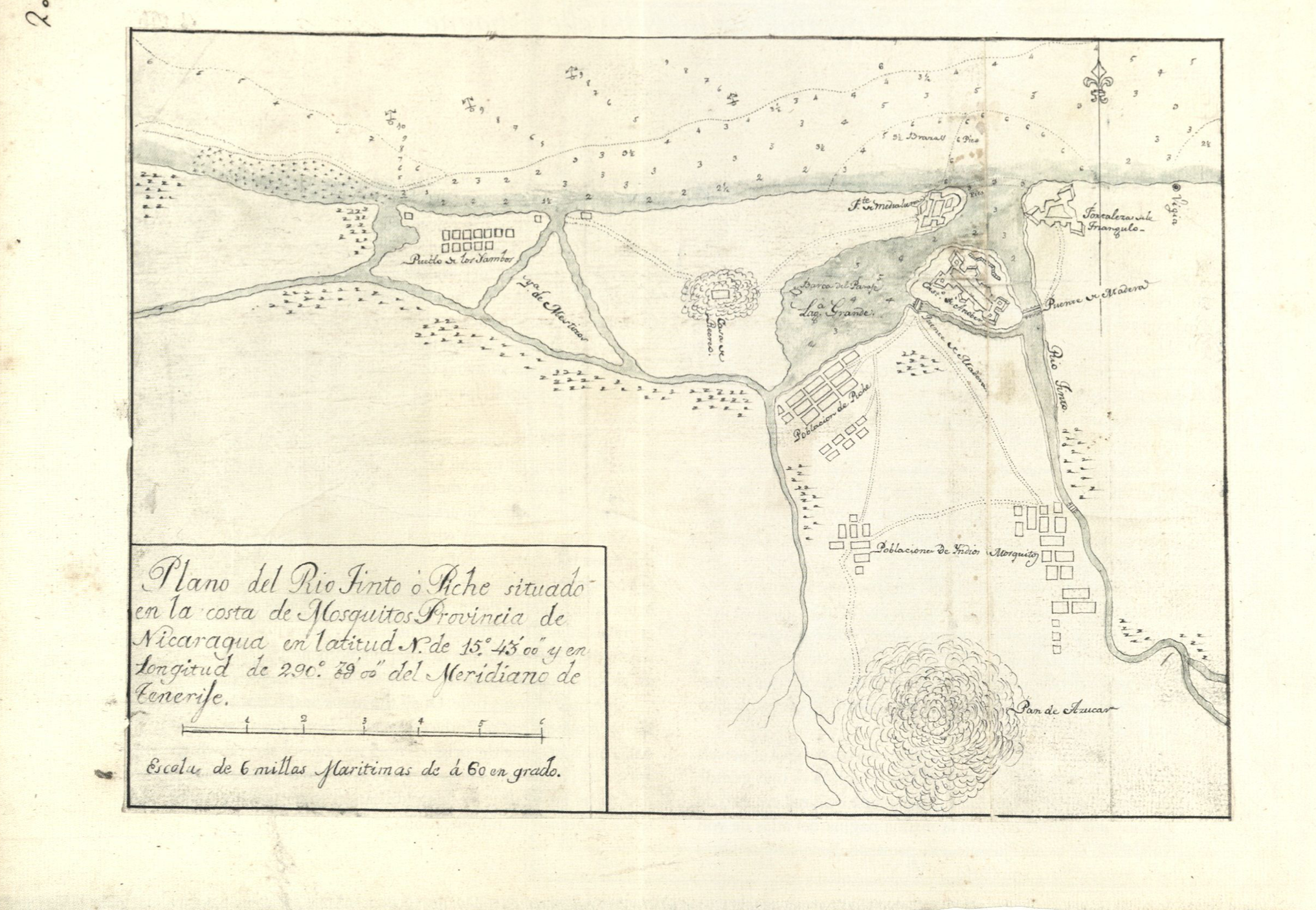
Plano del Rio Tinto ó Piche. Pg 22 Un Altas Histórico de Nicaragua. Aguierre Sacasa;Francisco Xavier. Managua: Fundación Vida;2002. Colección Cultural de Centro América. Serie Histórica;No. 15. https://biblioteca.ufm.edu/opac/record/136232