Dispossesions in the Americas

Dispossesions in the Americas

  • Home
  • Explore
  • About
  • Authors
  • Art
  • Bodies
  • Curricula
  • Cultural Heritage
  • Maps
  • Territories
Back to Explore
Map 1800 - 1856

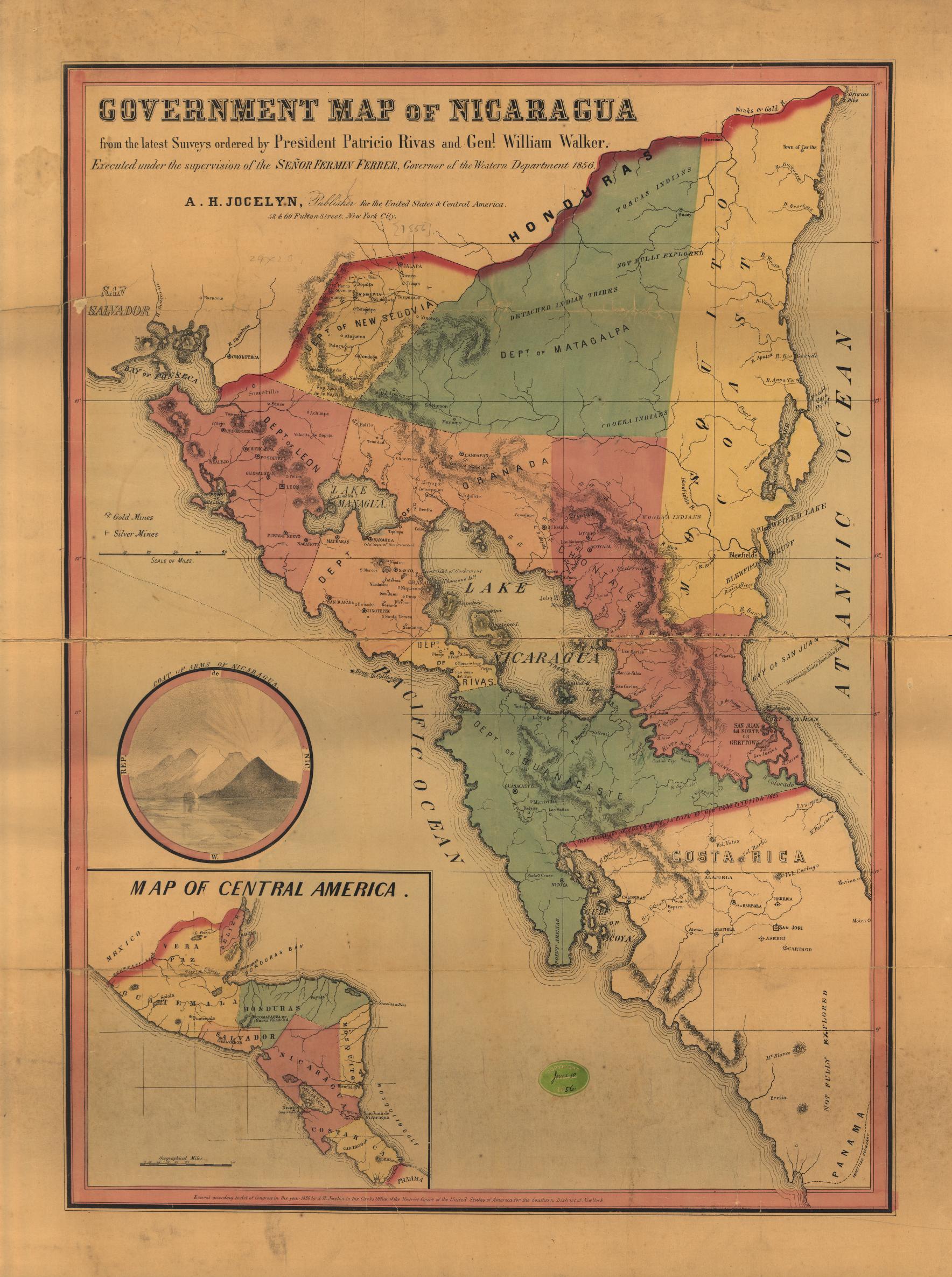
Government map of Nicaragua : from the latest surveys ordered by President Patricio Rivas and Genl. William Walker ;executed under the supervision of the Señor Fermín Ferrer;Governor of the Western Department;1856

  • JOCELYN;ALBERT

Published: 1856

  • Download Image

Peoples

  • TOACAS
  • WOOLWA
  • COOKRA
  • CARIBS

Citation

Government map of Nicaragua : from the latest surveys ordered by President Patricio Rivas and Genl. William Walker ;executed under the supervision of the Señor Fermín Ferrer;Governor of the Western Department;1856. Jocelyn;Albert H. New York. Library of Congress Geography and Map Division. G4850 1856 .G6. http://hdl.loc.gov/loc.gmd/g4850.ma001010AccessedJuly252023.
  • Download Image

Reading in Spanish

Map 1800 - 1856

Government map of Nicaragua : from the latest surveys ordered by President Patricio Rivas and Genl. William Walker ;executed under the supervision of the Señor Fermín Ferrer;Governor of the Western Department;1856

  • JOCELYN;ALBERT

Published: 1856

  • Download Image
  • Download Image

Related Content

MAYA CITIES

MAYA CITIES

Map
Terra Indígena Atikum

Terra Indígena Atikum

Map 1996 - 2021
MAPA de las PROVINCIAS DE VENEZUELA Y DEL REINO DE SANTA FE

MAPA de las PROVINCIAS DE VENEZUELA Y DEL REINO DE SANTA FE

Map 1831
Carte de la cote du Bresil

Carte de la cote du Bresil

Map 1579
Mapa de la República de Guatemala

Mapa de la República de Guatemala

Map 1800 - 1900
CAMINOS DE MIGRACIÓN EN EL MONTE

CAMINOS DE MIGRACIÓN EN EL MONTE

Map 2003
Territorios Indigenas en Guatemala 2,001

Territorios Indigenas en Guatemala 2,001

Map 2001
Map of Nicaragua showing Ulwa settlements in Eastern Nicaragua and field study sites (in rectangle)

Map of Nicaragua showing Ulwa settlements in Eastern Nicaragua and field study sites (in rectangle)

Map 1990

Dispossessions in the Americas

A project by

University of Pennsylvania

Copyright 2024

With support from

Mellon Foundation

Site design & development

Element 84

Art Credits

Government map of Nicaragua : from the latest surveys ordered by President Patricio Rivas and Genl. William Walker ;executed under the supervision of the Señor Fermín Ferrer;Governor of the Western Department;1856. Jocelyn;Albert H. New York. Library of Congress Geography and Map Division. G4850 1856 .G6. http://hdl.loc.gov/loc.gmd/g4850.ma001010AccessedJuly252023.
Site Pages

  • Home
  • Explore
  • About
  • Authors
  • Art
  • Bodies
  • Curricula
  • Cultural Heritage
  • Maps
  • Territories