Peoples
- MOSQUITOS
Citation
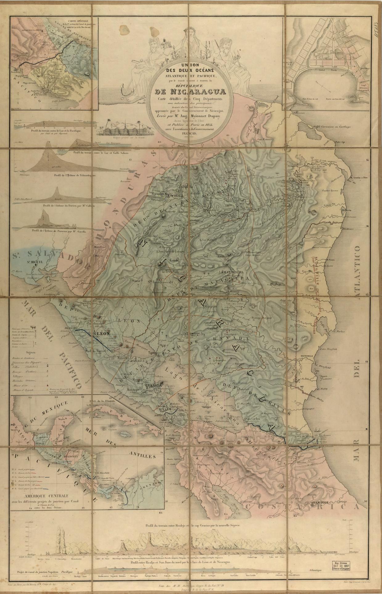
Union des deux ocʹeans Atlantique et Pacifique;par le transit ouvert à travers la rʹepublique De Nicaragua : carte dʹetaillʹee des cinq dʹepartements avec indication des principaux tracʹes du Canal Interocʹeanique ... Dupuy;Aug. Myionnet (Auguste Myionnet) Paris: vente chez M.M. Andriveau-Goujon;1855. Library of Congress Geography and Map Division. G4852.N55 1855 .D8. http://hdl.loc.gov/loc.gmd/g4852n.ma001019AccessedJuly252023.