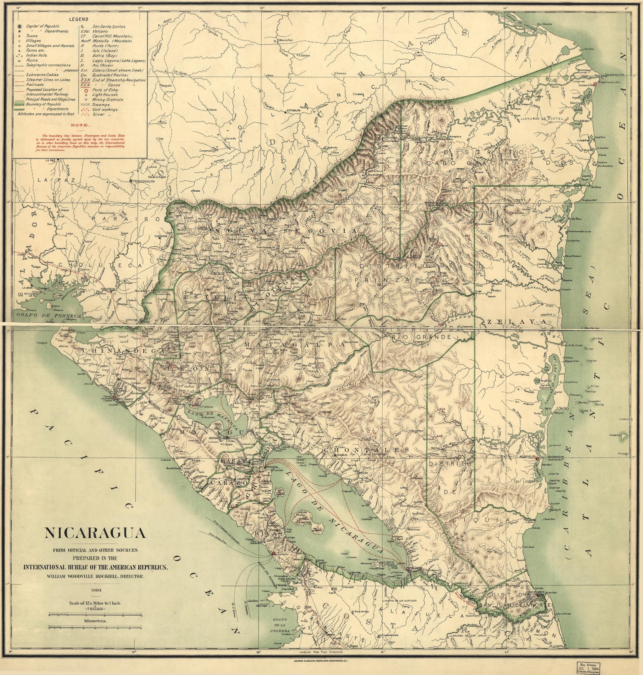
Dispossesions in the Americas

Dispossesions in the Americas

  • Home
  • Explore
  • About
  • Authors
  • Art
  • Bodies
  • Curricula
  • Cultural Heritage
  • Maps
  • Territories
Back to Explore
Map 1900 - 1903

Nicaragua

  • ROCKHILL;WILLIAM WOODVILLE

Published: 1903

  • Download Image

Peoples

  • RAMA
  • INDIANS

Citation

Nicaragua. International Bureau of the American Republics. Rockhill;William Woodville. International Bureau of the American Republics;1903. Library of Congress Geography and Map Division. G4850 1903 .I5. http://hdl.loc.gov/loc.gmd/g4850.ct000868.AccessedJuly242023.

  • Download Image

Reading in Spanish

Map 1900 - 1903

Nicaragua

  • ROCKHILL;WILLIAM WOODVILLE

Published: 1903

  • Download Image
  • Download Image

Related Content

PLAN DE L'ENTREE DE LA RIVIERE DE CONNANI dans la coste des maÿée province de guiàne

PLAN DE L'ENTREE DE LA RIVIERE DE CONNANI dans la coste des maÿée province de guiàne

Map 1755
Cróquis del Rio Paraguay y alta Paraná desde el Ivoy hasta un poco más al N. del Rio Jaurú donde se puso el Marco de los límites entre España y Portugal el 14 de Enero de 1753.

Cróquis del Rio Paraguay y alta Paraná desde el Ivoy hasta un poco más al N. del Rio Jaurú donde se puso el Marco de los límites entre España y Portugal el 14 de Enero de 1753.

Map 1750 - 1850
LOCALIZACIÓN ACTUAL DE LAS PRINCIPALES FAMILIAS LINGÜÍSTICAS EN SURAMÉRICA

LOCALIZACIÓN ACTUAL DE LAS PRINCIPALES FAMILIAS LINGÜÍSTICAS EN SURAMÉRICA

Map 2000
The Marañon or Amazon River with the Mission of the Society of Jesus

The Marañon or Amazon River with the Mission of the Society of Jesus

Map 1686 - 1707
PUEBLO ACHUAR

PUEBLO ACHUAR

Map 2021
Carte du gouvernement de Cayenne avec le Nombre des habitations, le lieu ou elles sont situées et le nom de ceux a qui elles appartiennent

Carte du gouvernement de Cayenne avec le Nombre des habitations, le lieu ou elles sont situées et le nom de ceux a qui elles appartiennent

Map 1600 - 1699
XIX. Cours du Rio Meta et d'une partie de la chaine de montagnes de la Nouvelle-Granade.

XIX. Cours du Rio Meta et d'une partie de la chaine de montagnes de la Nouvelle-Granade.

Map 1799 - 1804
PINTURA DE IZTAPALAPA

PINTURA DE IZTAPALAPA

Map 1500 - 1599

Dispossessions in the Americas

A project by

University of Pennsylvania

Copyright 2024

With support from

Mellon Foundation

Site design & development

Element 84

Art Credits

Nicaragua. International Bureau of the American Republics. Rockhill;William Woodville. International Bureau of the American Republics;1903. Library of Congress Geography and Map Division. G4850 1903 .I5. http://hdl.loc.gov/loc.gmd/g4850.ct000868.AccessedJuly242023.

Site Pages

  • Home
  • Explore
  • About
  • Authors
  • Art
  • Bodies
  • Curricula
  • Cultural Heritage
  • Maps
  • Territories