Peoples
- MANGUES
- CHONTALES
- MOSKITOS
Citation
Croquis de carte du Nicaragua aux XVe et XVIe siécles/ par Désiré Pector. Paris 1888. Gallica. https://gallica.bnf.fr/ark:/12148/btv1b84435581/f1.item.zoom#.AccessedJuly212023.
AMERICA KARATE VON LAUFE DES ORENOCO DES ATABAPO DES CASIQUIARE UND DES RIO NEGRO
Map 1850
OTROS MUNICIPIOS INDÍGENAS O CON PRESENCIA DE POBLACIÓN INDÍGENA
Map 2000
Carte de la Moskitie oú se fonde la Neustrie
Map 1830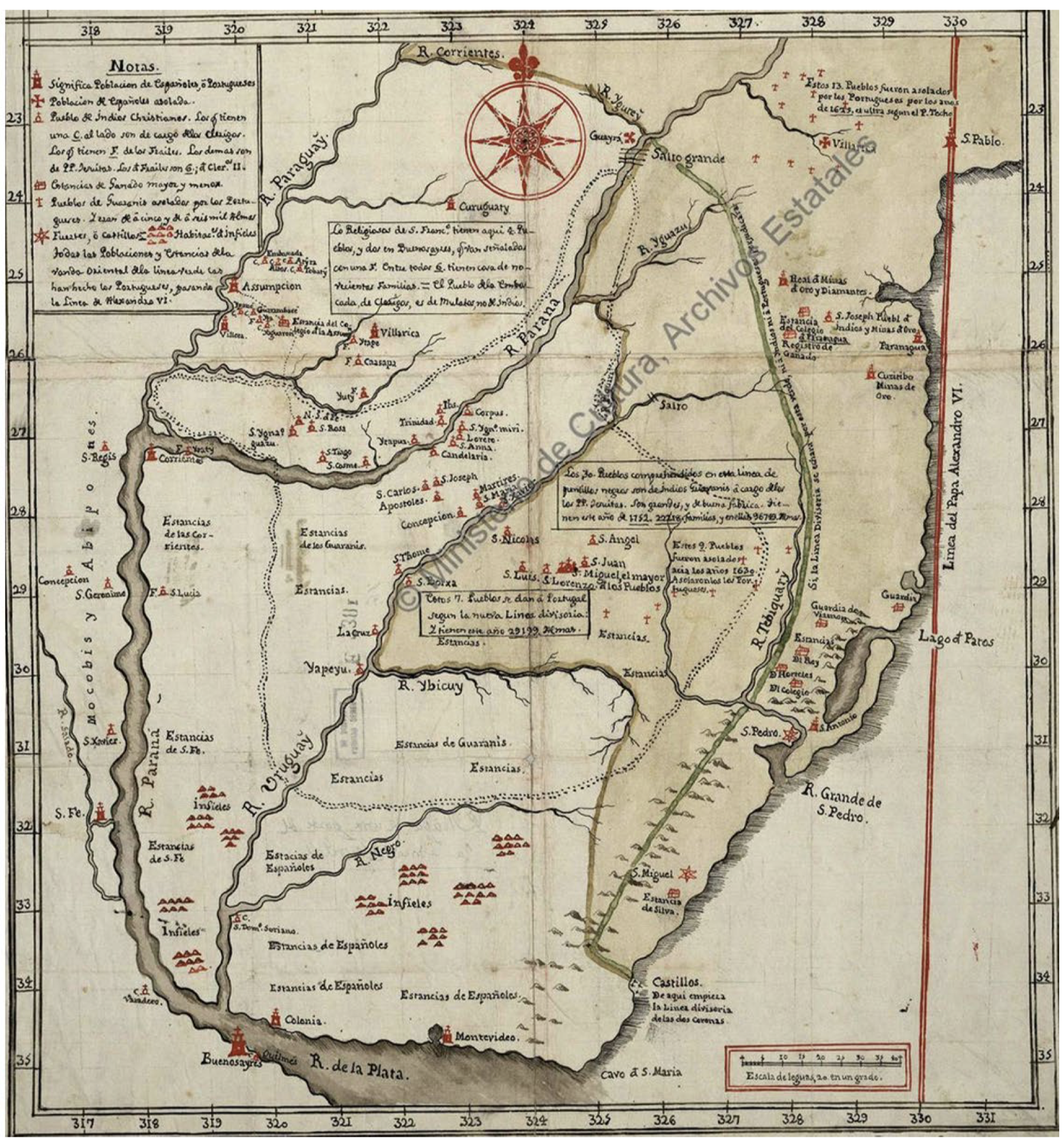
Mapa De La Gobernación Del Paraguay Y Buenos Aires, Con La Línea Divisoria De Las Tierras De España Y Portugal_1752.
Map 1752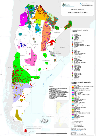
PUEBLOS INDIGENAS
Map 2021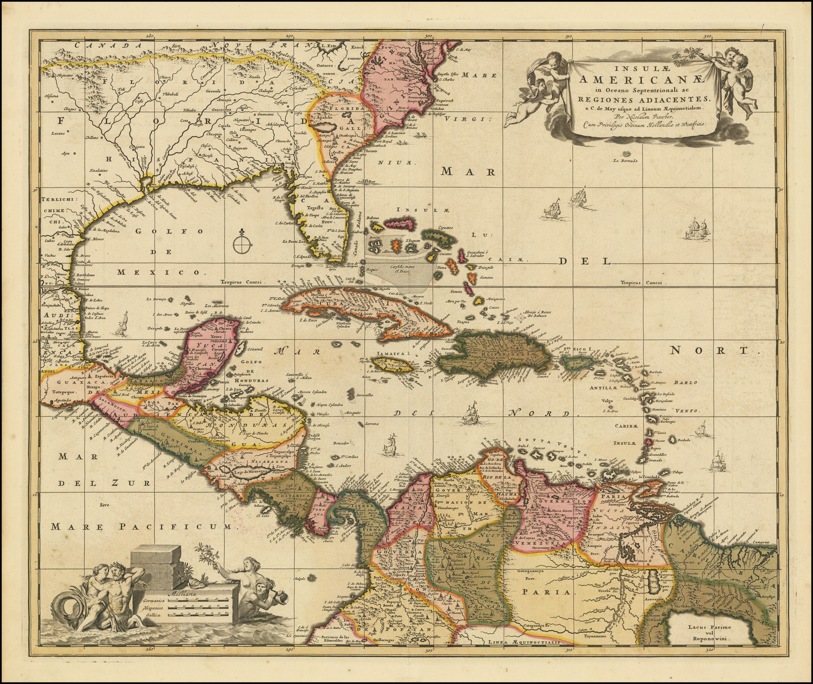
Insulae Americanae in Oceano Septentrionali ac Regiones Adiacentes, a C. de May usque ad Lineam Aequinoctialem.
Map 1700 - 1799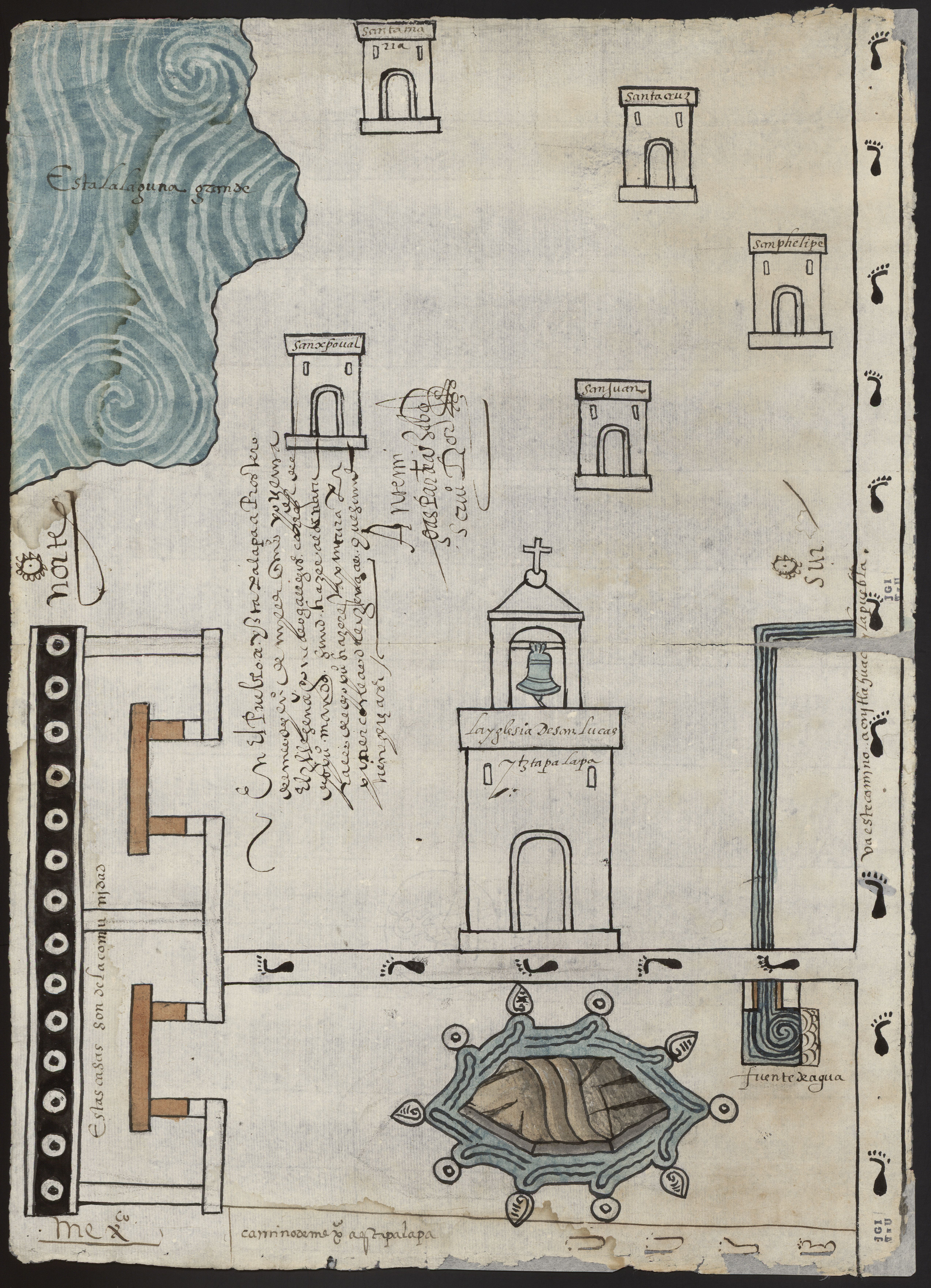
PINTURA DE IZTAPALAPA
Map 1500 - 1599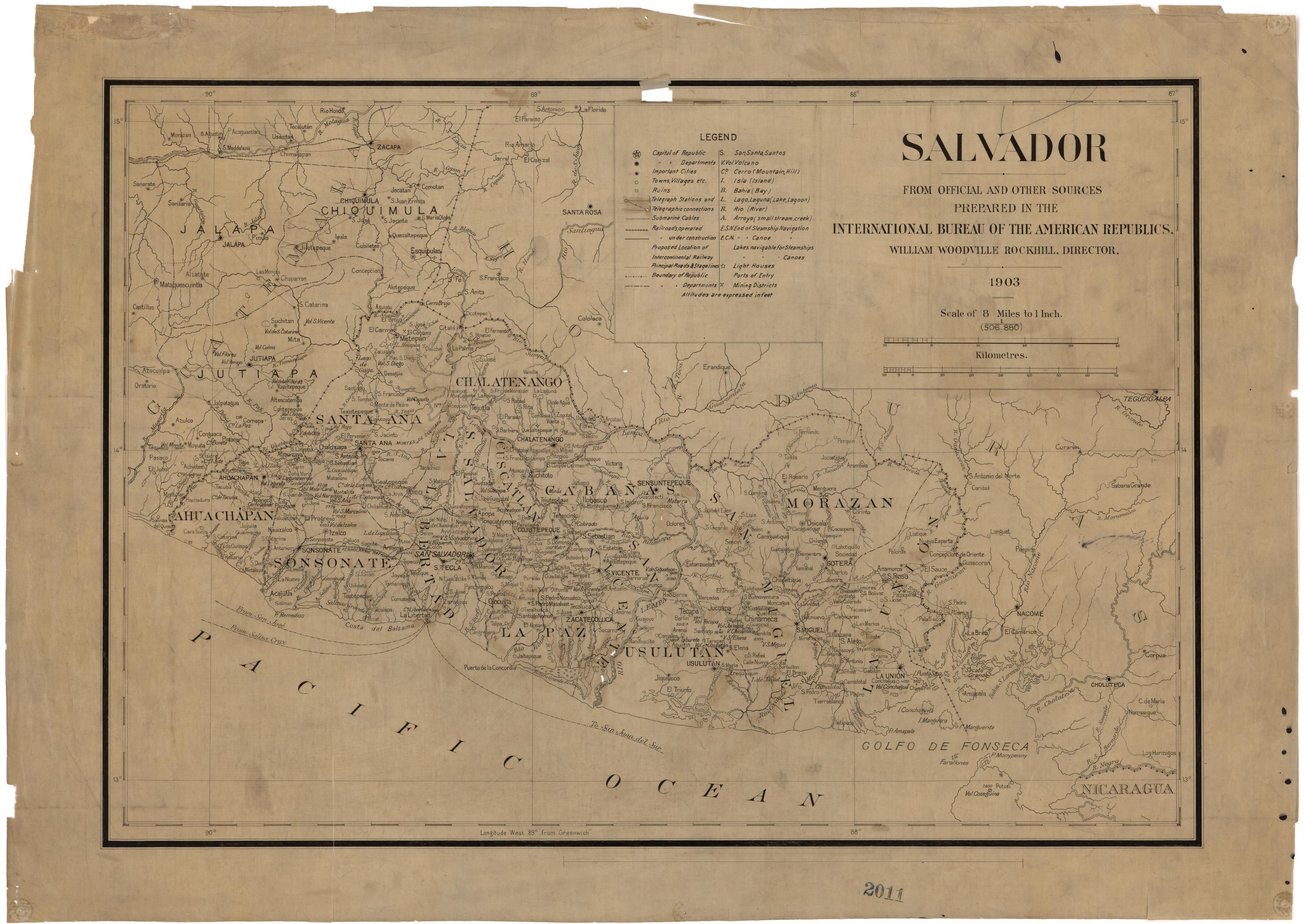
El Salvador: from Official and Other Sources.
Map 1903