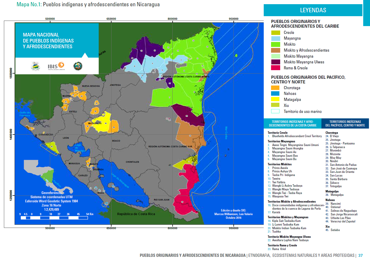
Peoples
- CREOLE
- MAYANGNA
- MISKITO
- MISKITO Y AFRODESCENDIENTES
- MISKITO MAYANGNA
- MISKITO MAYANGNA ULWAS
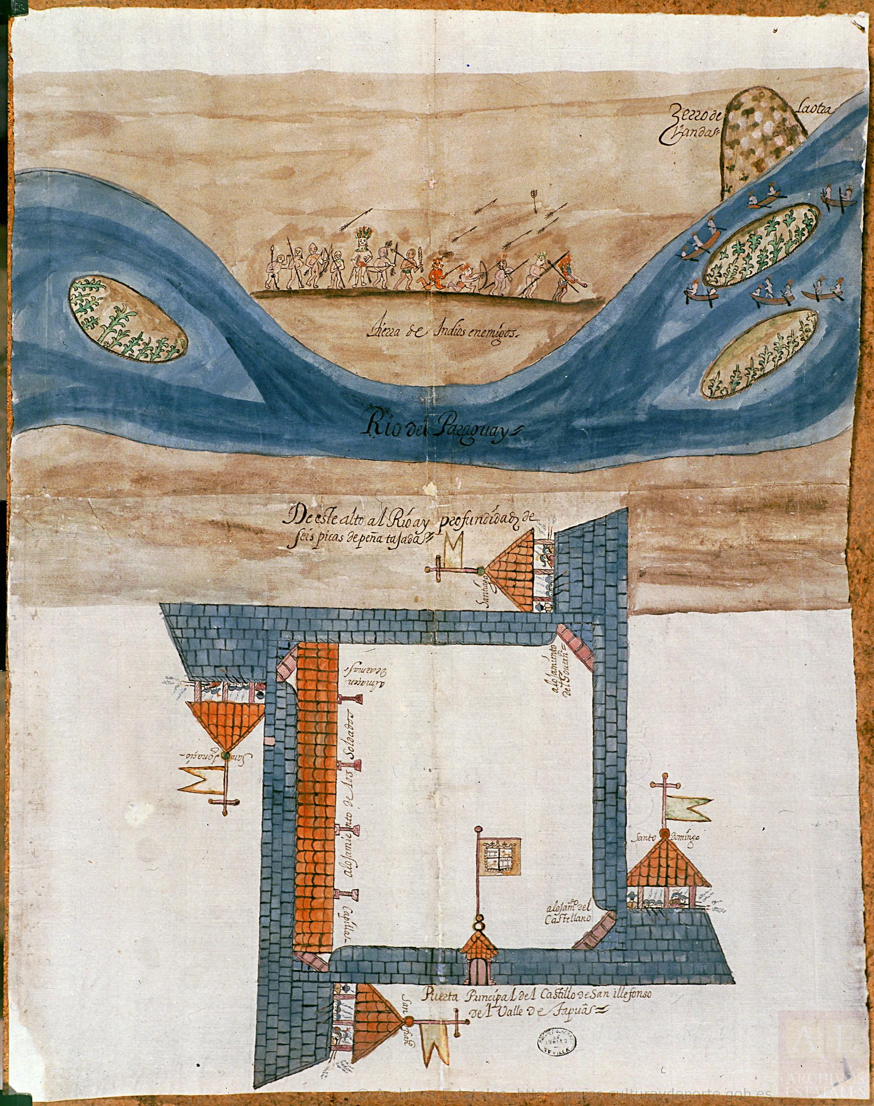
- RAMA & CREOLE
- CHOROTEGA
- NAHOAS
- MATAGALPA
- XIU
Citation
MARCOS WILLIAMS;LUIS VALERIO. Mapa Nacional de Pueblos Indígenas y Afrodescendientes. Edición y diseño SIG. Octubre 2016. In; Ethnografia;Ecosistemas Naturales y Areas Protegidas. Nativeland.ca. Territories: Rama. Accessed July 11 2023 https://native-land.ca/maps/territories/rama/
!["Senza titolo" ["Untitled"]](https://dnet8ble6lm7w.cloudfront.net/art_sm/ABRA015.png)
![[Embouchure de l'Oyapock].](https://dnet8ble6lm7w.cloudfront.net/maps/FGU/FGU0062.jpeg)