Peoples
- MOSQUITOS
- INDIANS
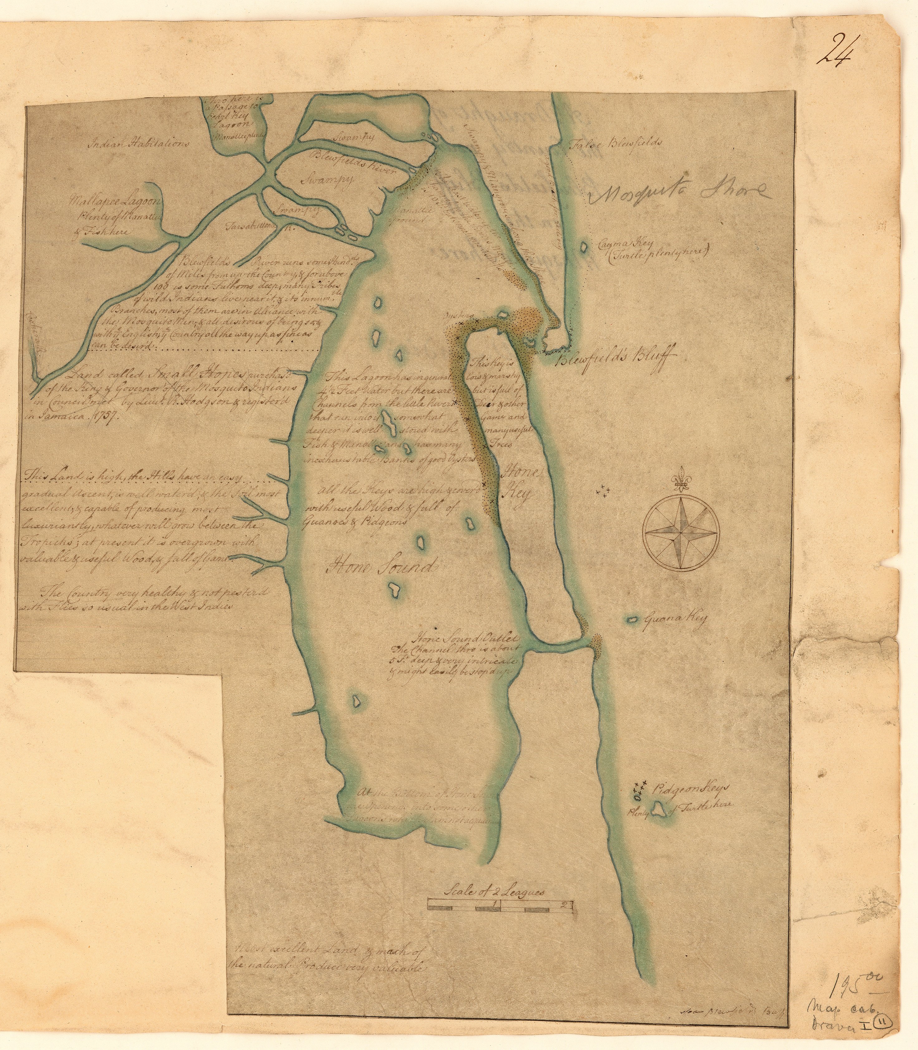
Citation
A draught of the country near Blewfields Bluff on the Mosquito Shore. 1757. John Carter Brown Map Collection. C-6713. File Name: C-6713-000. https://jcb.lunaimaging.com/luna/servlet/detail/JCBMAPS~1~1~6420~115902733:A-draught-of-the-country-near-Blewf?qvq=q:Nicaragua;lc:JCBMAPS~2~2;JCBMAPS~3~3;JCB~1~1;JCB~3~3;JCBBOOKS~1~1;JCBMAPS~1~1&mi=11&trs=66#
![Gente del Occidente de México II [People of Western Mexico II]](https://dnet8ble6lm7w.cloudfront.net/art_sm/AECU021.png)