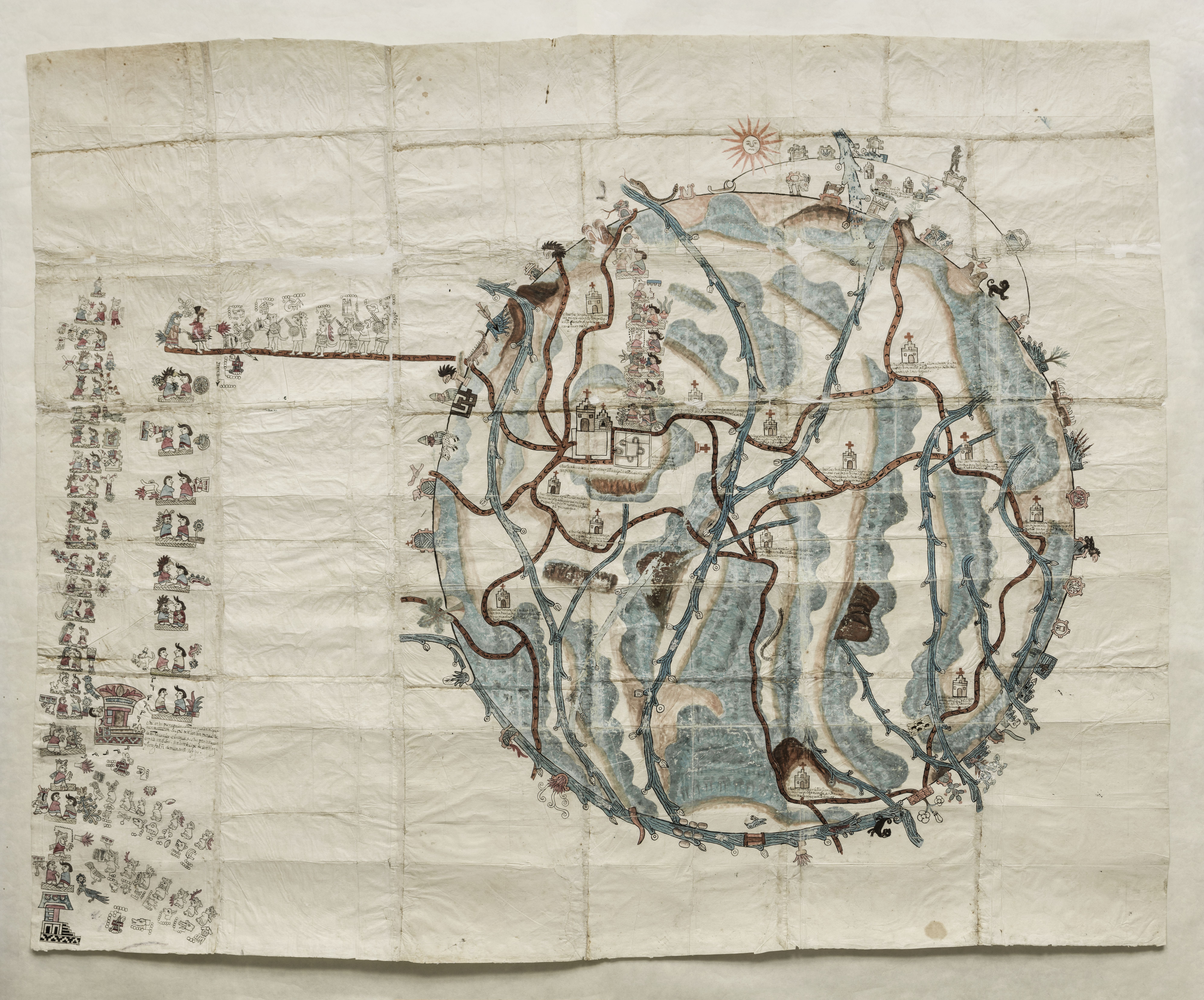
Citation
Unkown. "Pintura de Teozacoalco." Map. 1580. https://collections.lib.utexas.edu/catalog/utblac:059d9312-d77c-41d9-81ed-da65bda50a15.BensonLatinAmericanCollection,LLILASBensonLatinAmericanStudiesandCollections,TheUniversityofTexasatAustin
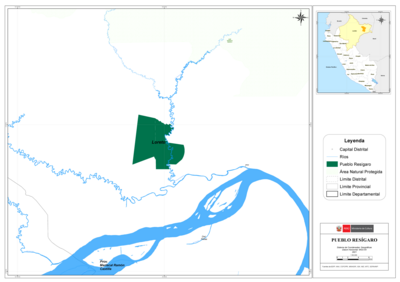
PUEBLO RESÍGARO
Map 2021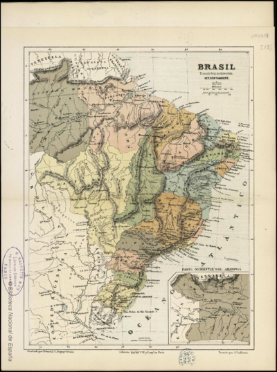
BRASIL
Map 1800 - 1899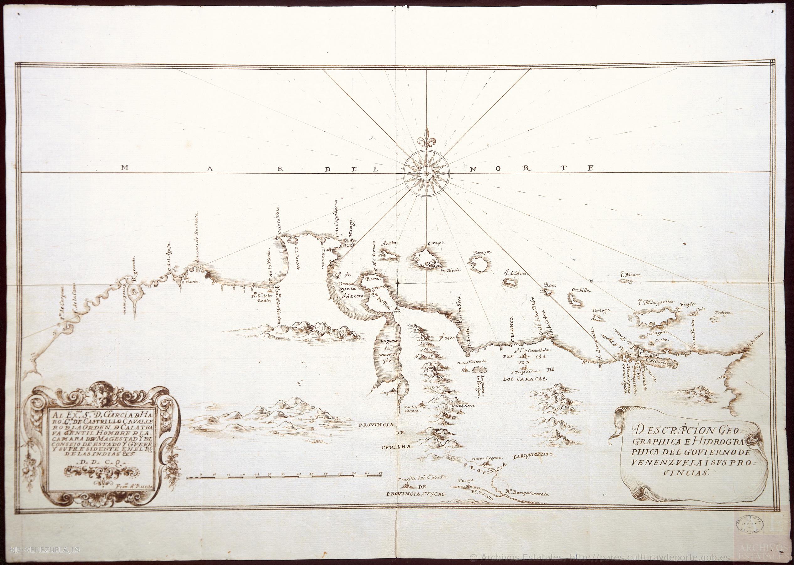
DESCRIPCIÓN GEOGRAPHICA E HIDORGRÁPHICA DEL GOVIERNO DE VENEZUELA I SUS PROVINCIAS
Map 1634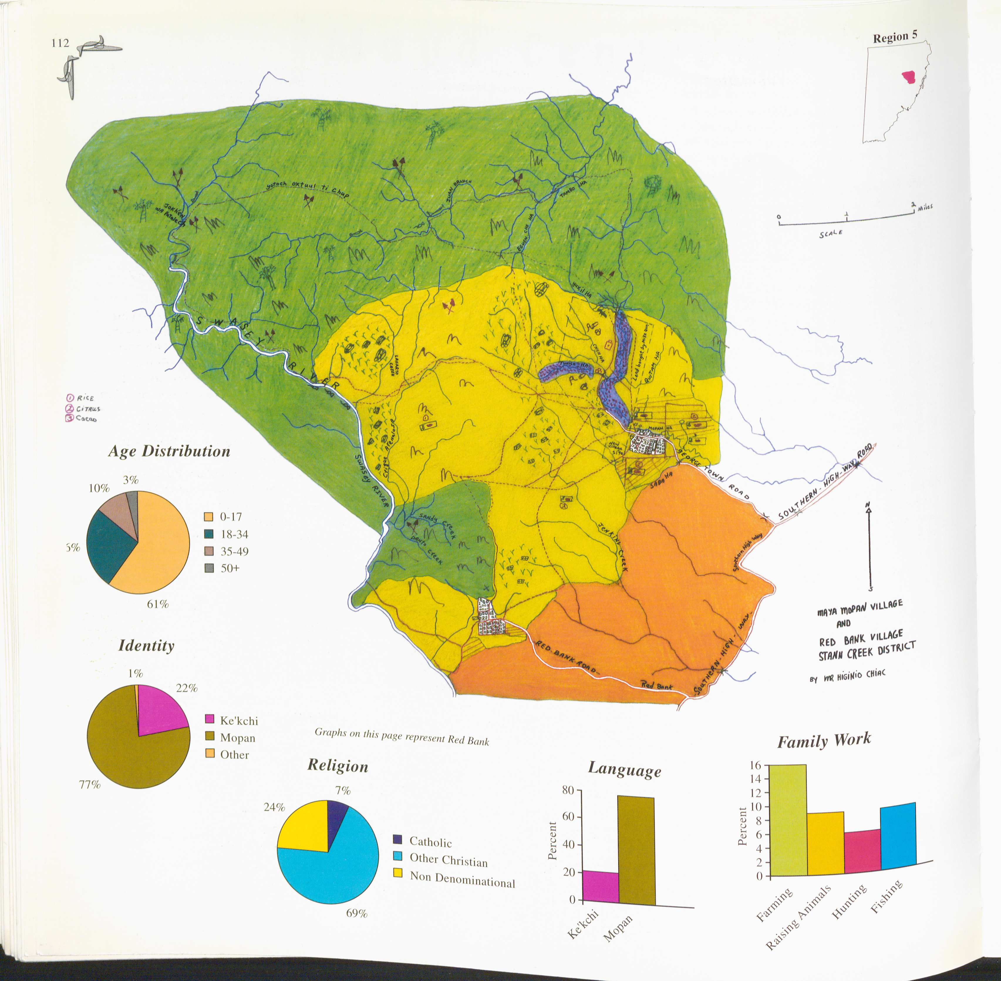
Red Bank and Maya Mopan
Map 1997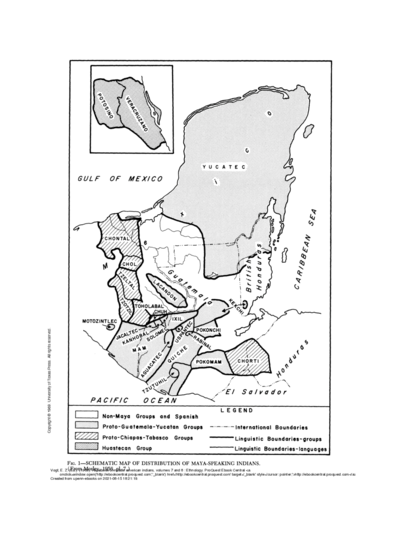
SCHEMATIC MAP OF DISTRIBUTION OF MAYA-SPEAKING INDIANS (From Morley, 1956, pl.7)
Map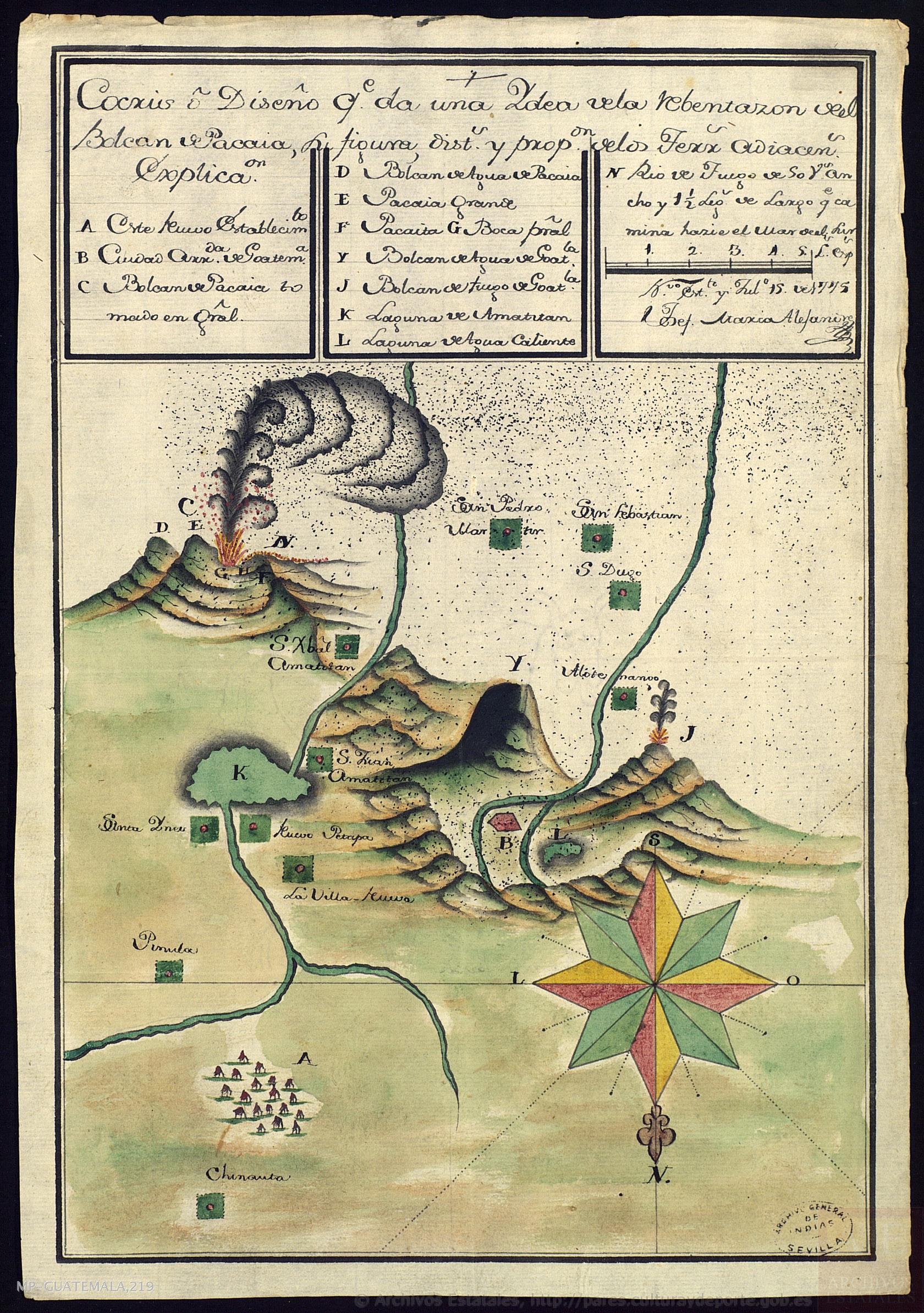
Cocris o Diseño que da una Ydea de la Rebentazón deel Bolcán de Pacaia, su figura, distancias y proporción de los terrenos adiacentes
Map 1700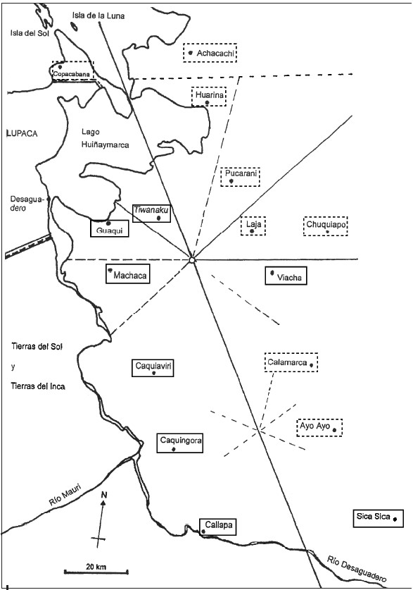
INDIGENOUS DRAFT LABOR (MITA) FOR MINES OF POTOSI UNDER SPANISH COLONIAL RULE – THE CASE OF THE PAKAXA AYMARA POLITY IN THE LATE 16TH CENTURY
Map 1570 - 1650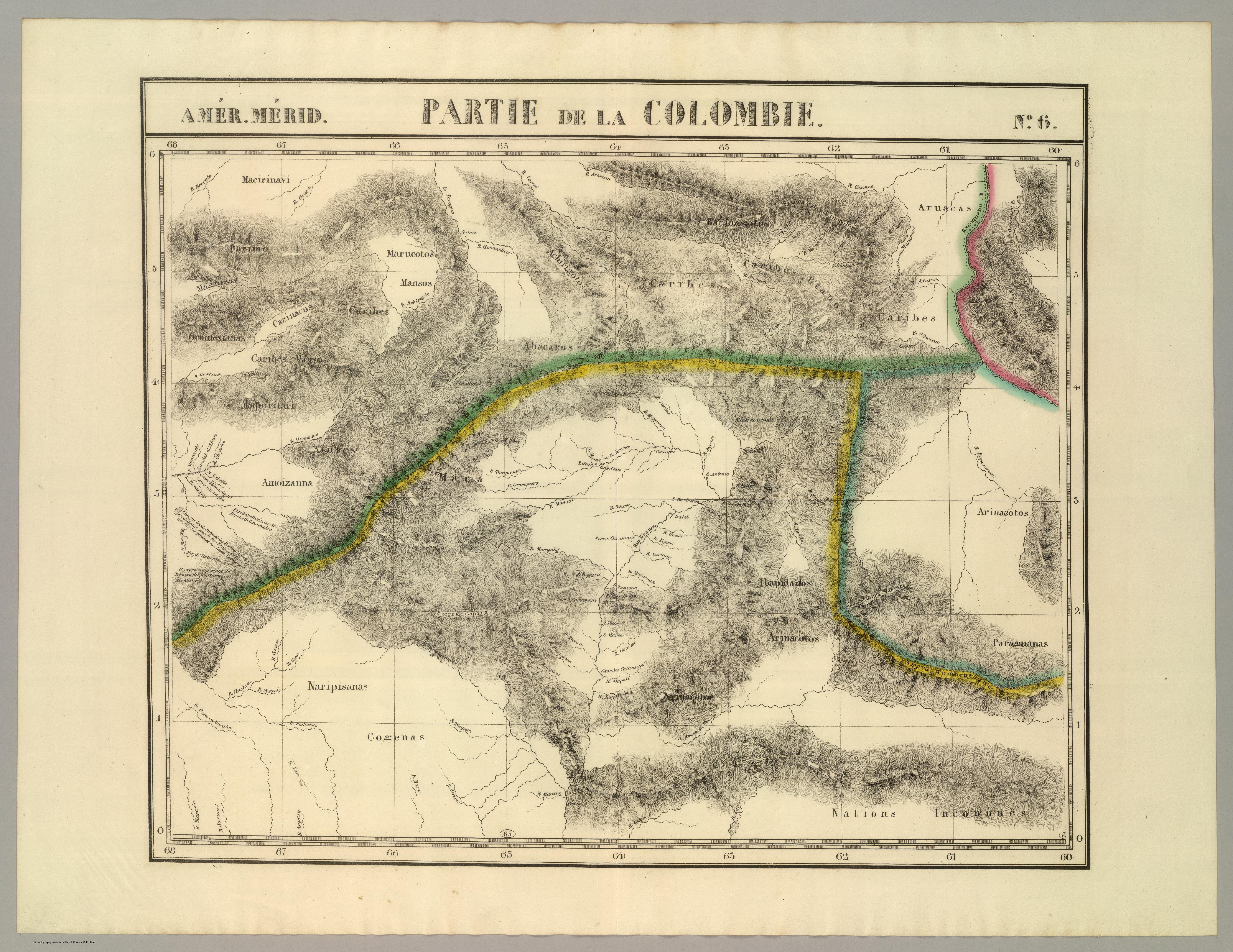
PARTIE DE LA COLOMBIE
Map 1827