Citation
"Mapa de Siguenza." Map. Siglo XVI. https://www.jstor.org/stable/community.15678379.
BRAZIL
Map 1895
A Sequel of the Seat of War in the West Indies containing… Sub-map title: A large & accurate MAP of part of the Isthmus of Panama, taken from a Spanish drought exhibiting the Country adjacent to that City and Puerto Bello, with the Roads and Course of the River CHAGRE, by which the Treasure of the South Sea is conveyed a cross the Isthmus
Map 1740
Guiana, comprehending British, Dutch & French
Map 1800 - 1899
FAMILIAS LINGUÍSTICAS Y LENGUAS INDÍGENAS. SEPTIMA REGION: SIERRA NEVADA DE SANTA MARTA
Map 1989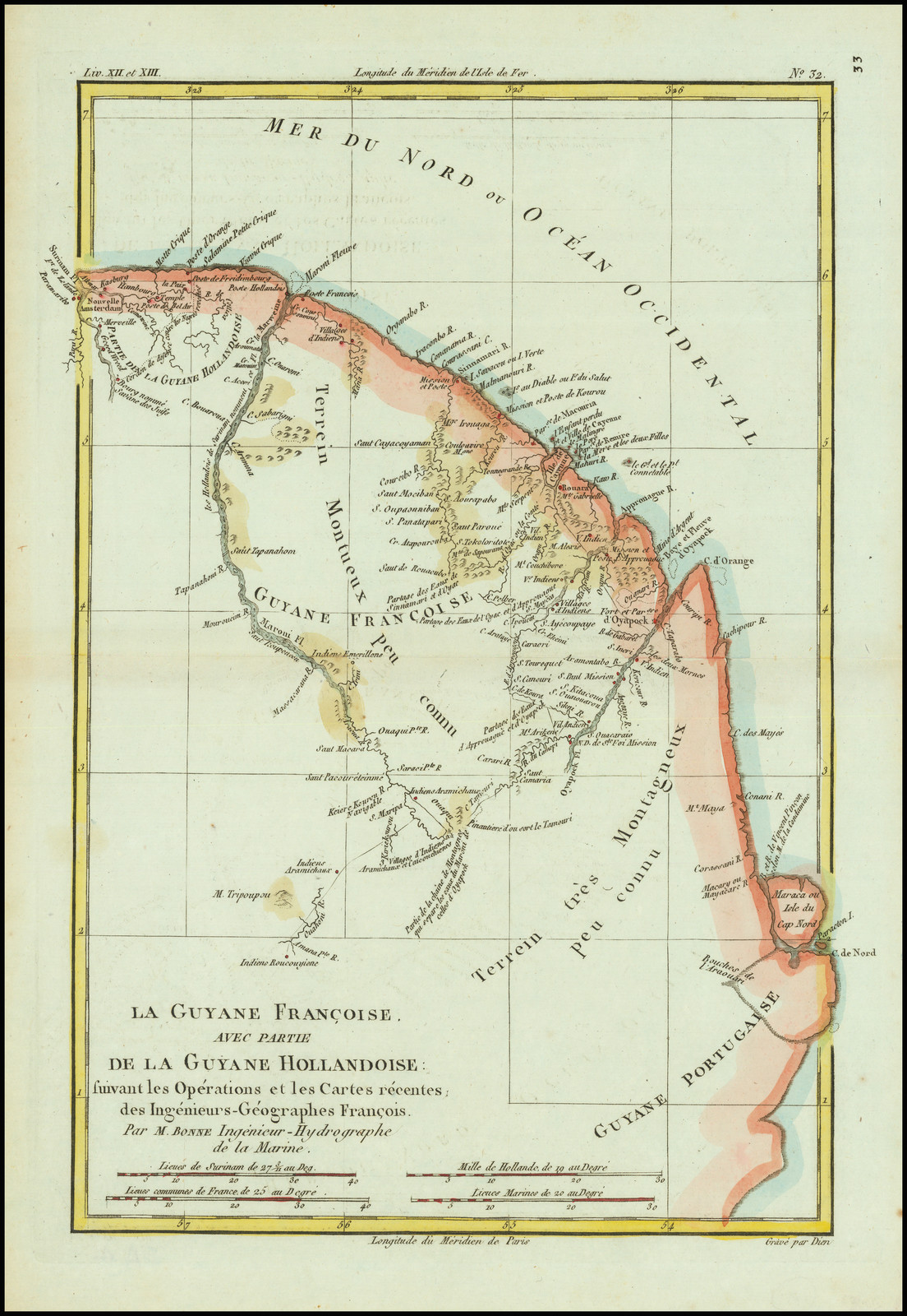
La Guyane Francoise, avec partie de la Guyane Hollandoise: suivant les Opérations et les Cartes récentes;des Ingênieurs-Géographes François.
Map 1787![Ordalía: el fin del cuerpo [Ordeal: The End of the Body]](https://dnet8ble6lm7w.cloudfront.net/art_sm/ACOL015.png)
Ordalía: el fin del cuerpo [Ordeal: The End of the Body]
Artwork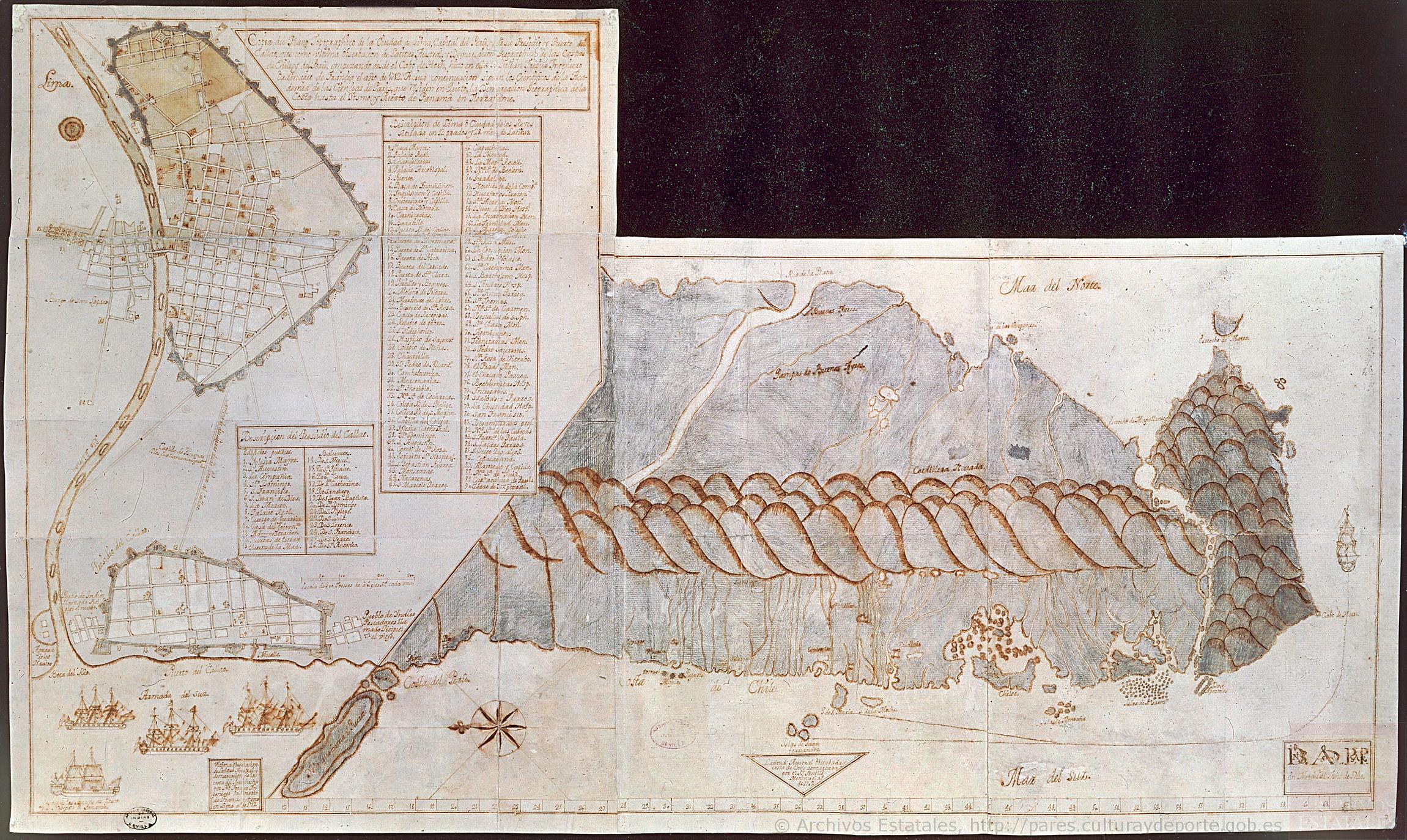
Copia del Plano Topográfico de la Ciudad de Lima, capital del Perú, y de su presidio y puerto del Callao, que como última observación de Latitud Austral, y demarcación geográfica de las costas de Chile y del Perú
Map 1712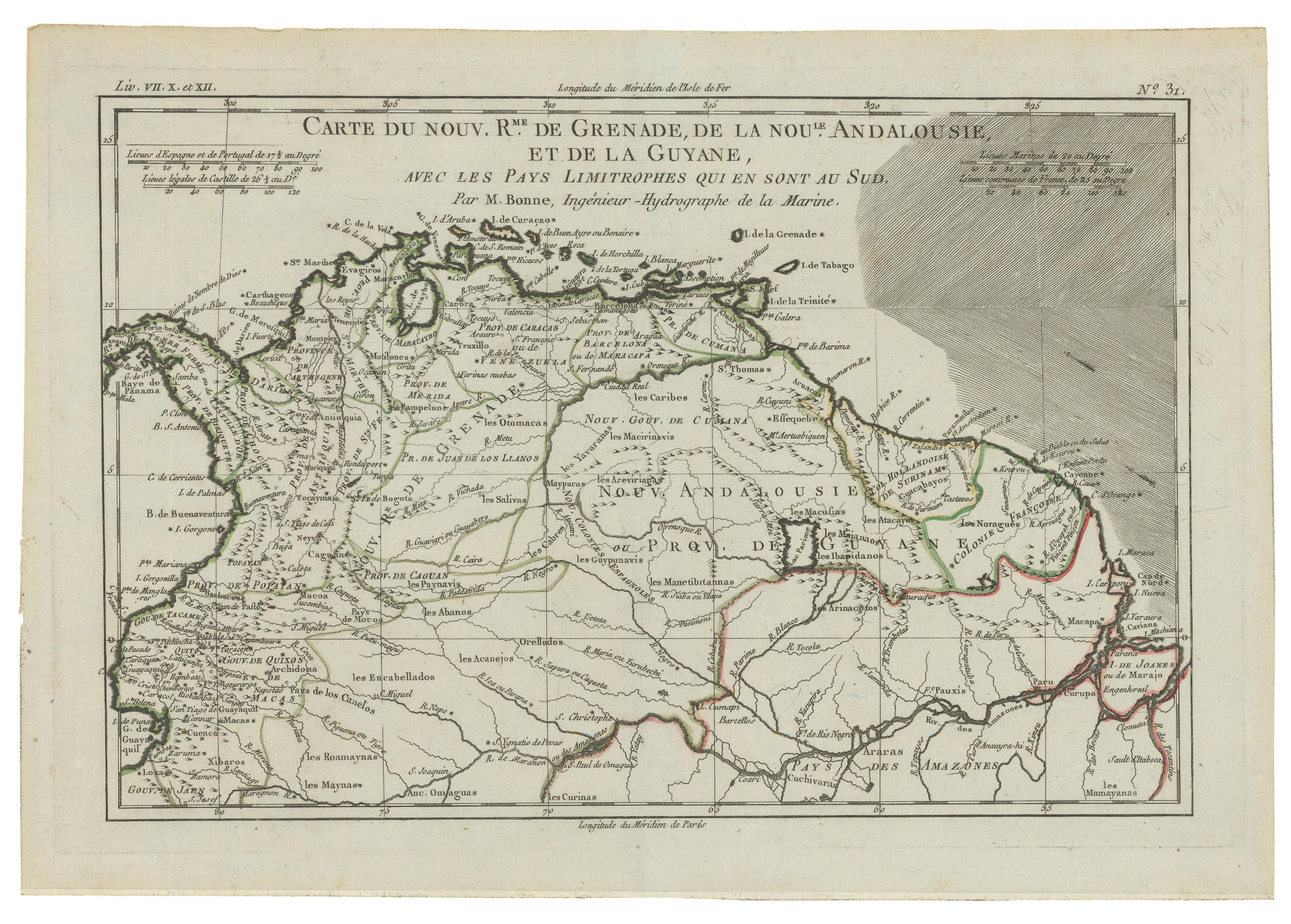
Carte du Nouveau Royaume de Grenade;de la Nouvelle Andalousie;et de la Guyane;avec les Pays limitrophes qui en sont au Sud
Map 1770