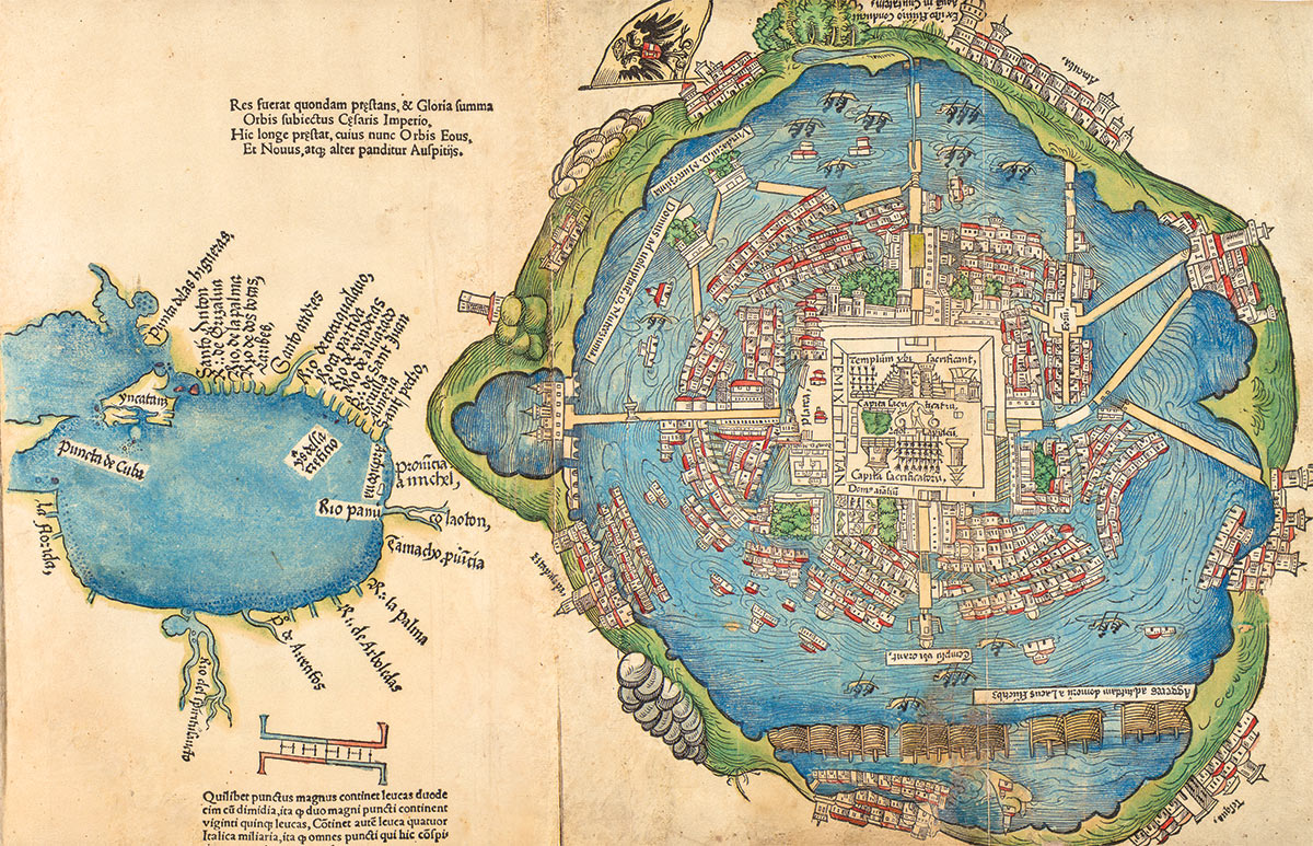
Citation
Mundy, Barbara E. "Mapping the Aztec Capital: The 1524 Nuremberg Map of Tenochtitlan, Its Sources and Meanings." Imago Mundi 50 1998: 11-33. PDF. https://www.latinamericanstudies.org/aztecs/aztec-capital.pdf

The Spanish and Musketor shore and the bay of Honduras and the islands adjacent
Map 1735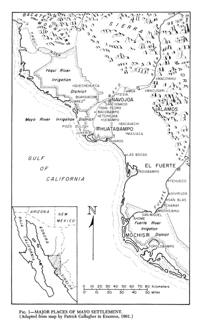
Major Places of Mayo Settlement
Map 1969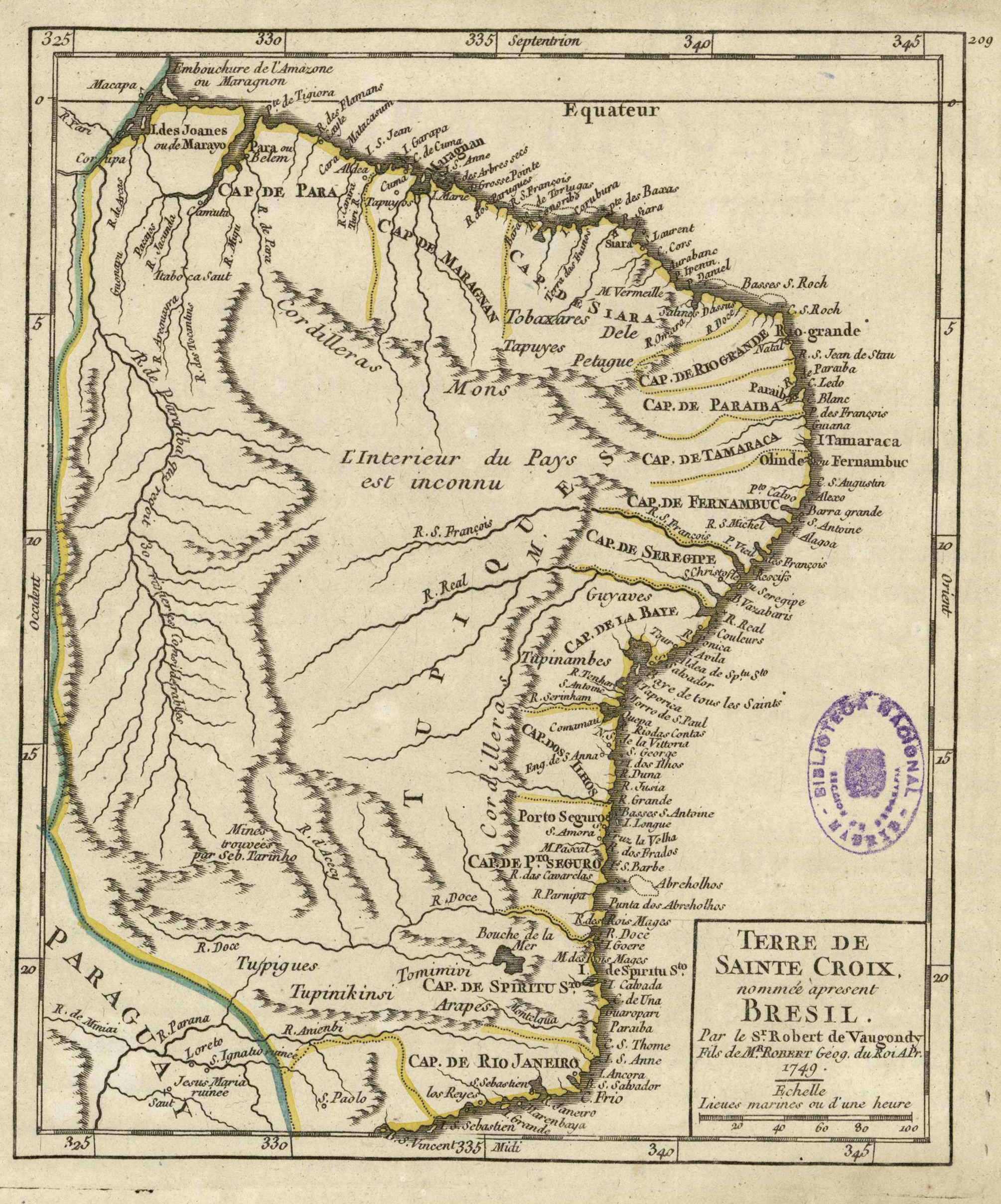
Terre de Sainte Croix, nommée apresent Bresil
Map 1749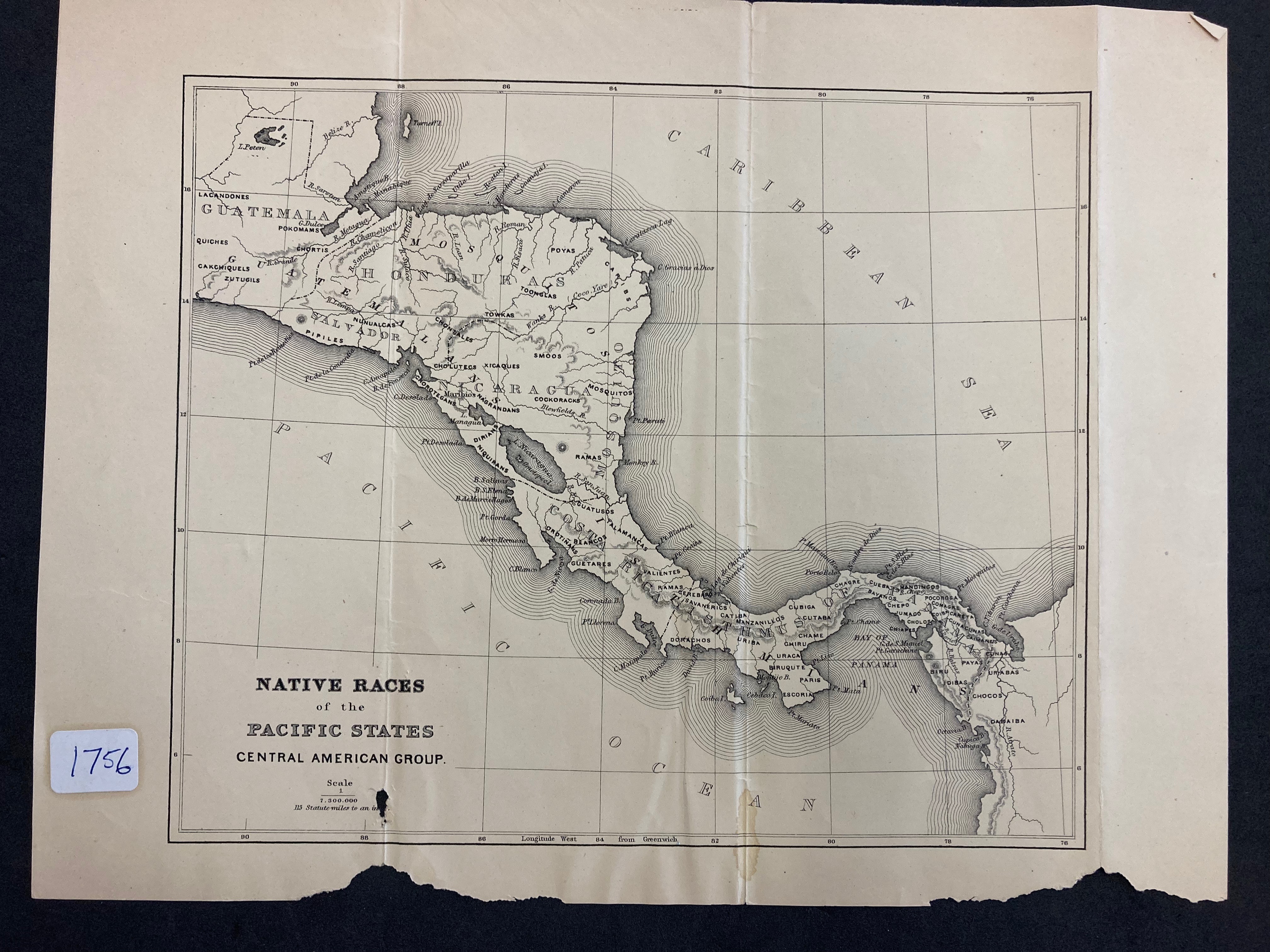
NATIVE RACES of the PACIFIC STATES
Map 1800
DIE REPUBLIK URUGUAY
Map 1857
Railroad Map of British Honduras Transportation Department of the United States Department of Commerce. Library of Congress Geography and Map Division. https://hdl.loc.gov/loc.wdl/wdl.11329
Map 1900
Principales Conventos en el Siglo XVI
Map 1500 - 1599
Coste de Guiane depuis le cap de nord jusqu'à Cayenne, par François Duvillard, sergent, traiteur, voyageur, en la susdite cote de Guiane.
Map 1727