
Citation
Xuchimilco. Distrito Federal, 1585. AGN, Tierras, vol. 279, exp. 1, f. 116 http://bdmx.mx/documento/galeria/mapas-indigenas-novohispanos-agn/co_imagen32/fo_05
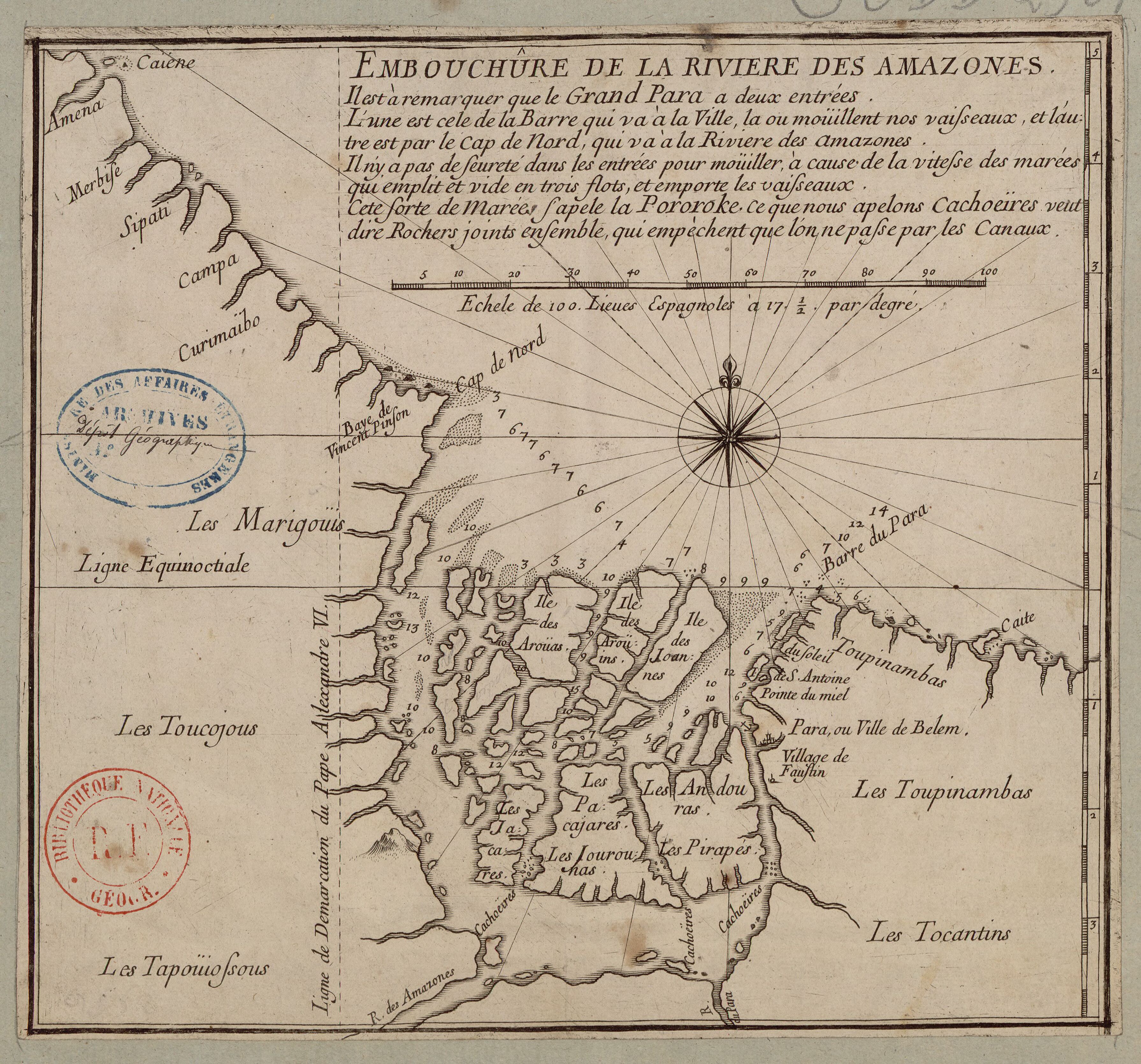
EMBOUCHÛRE DE LA RIVIERE DES AMAZONES
Map 1700 - 1799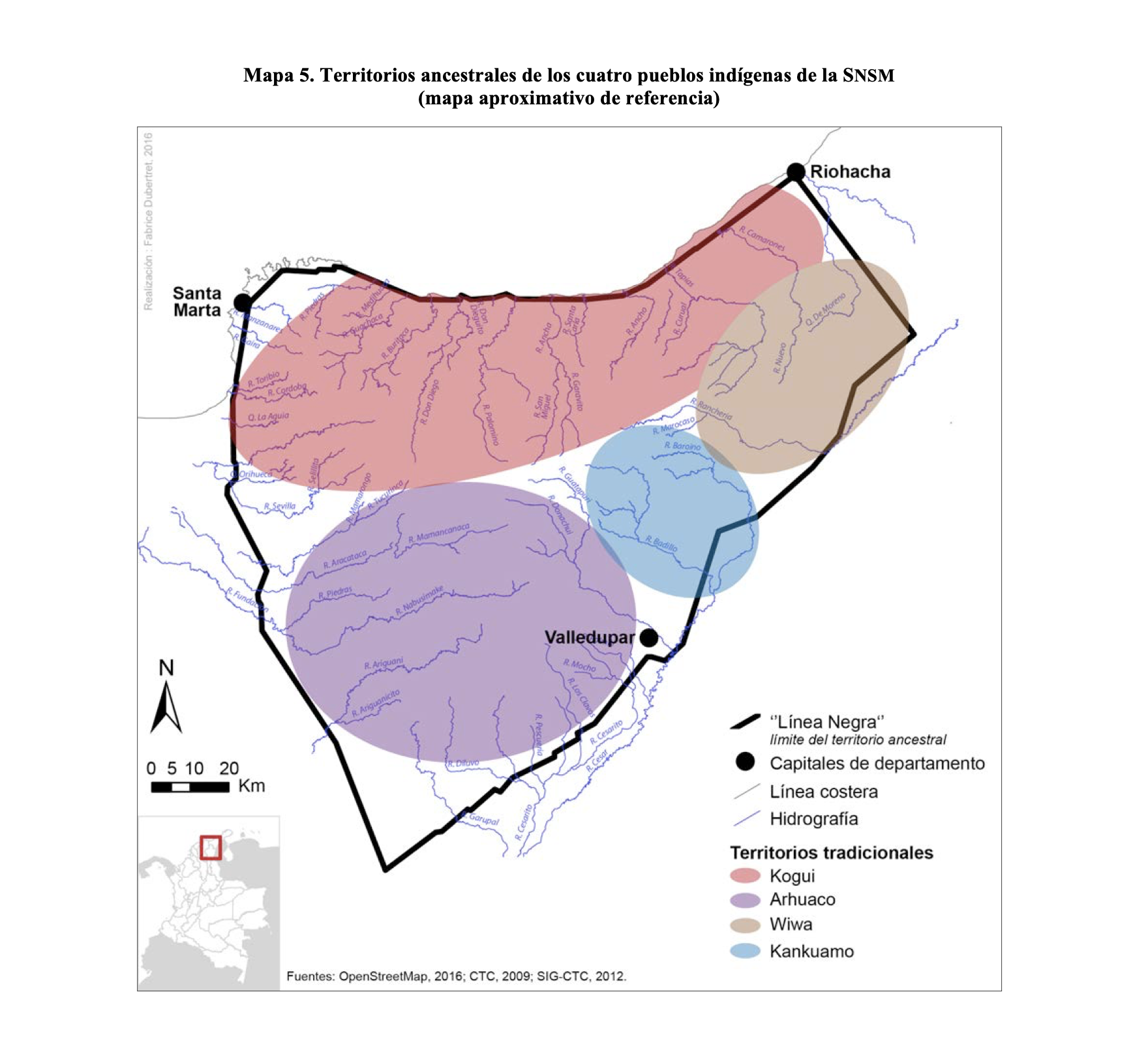
TERRITORIOS ANCESTRALES DE LOS CUATRO PUEBLOS INDIGENAS DE LA SSNM (MAPA APROXIMATIVO DE REFERENCIA)
Map 2009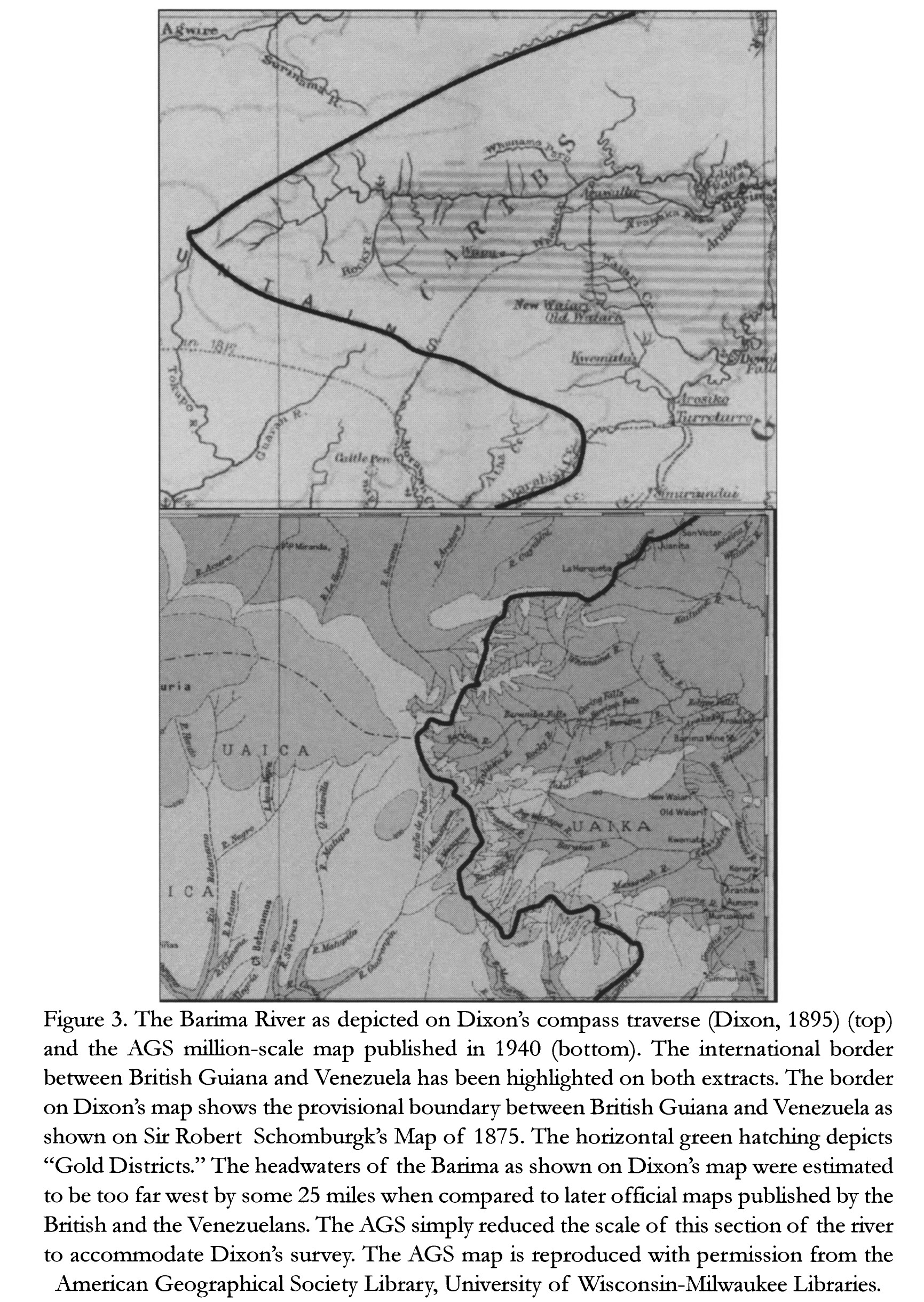
The Barima River as depicted on Dixon's compass traverse and the AGS million-scale map published in 1940 (bottom)
Map 1895
Mapa Nova Cartografia Social dos Babaçuais: Mapeamento Social da Região Ecológica do Babaçu
Map 2014 - 2017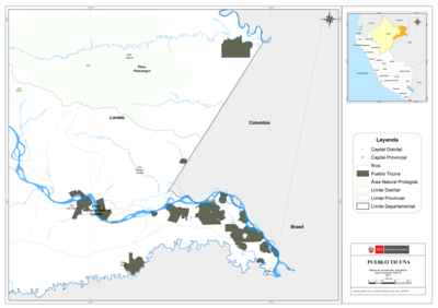
PUEBLO TICUNA
Map 2021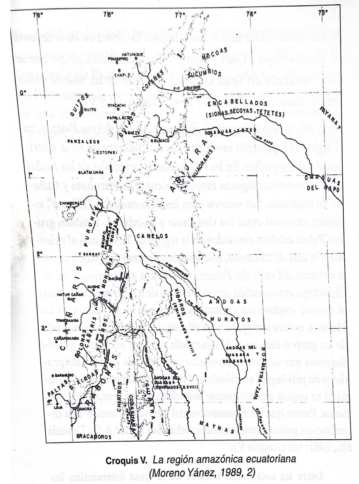
Croquis V. La región amazónica ecuatoriana (Moreno Yanez;1989;2)
Map -500 - 1530
AYMARA POLITIES of THE QULLASUYU in the 16th CENTURY
Map 1585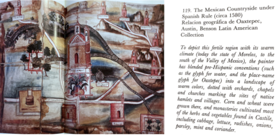
The Mexican Countryside under Spanish Rule (Circa 1580), Relacion Geográfica de Oaxtepec
Map 1580