Citation
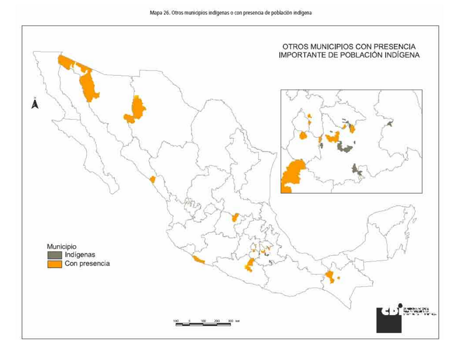
Comisión Nacional para el Desarrollo de los Pueblos Indígenas. Regiones indígenas de México. Publication no. 330.972. 2006. https://www.gob.mx/cms/uploads/attachment/file/35735/cdi-regiones-indigenas-mexico.pdf.
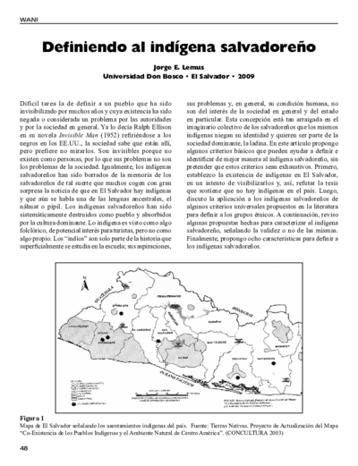
Mapa de El Salvador señalando los asentamientos indígenas del país. Fuente: Tierras Nativas. Proyecto de Actualización del Mapa “Co-Existencia de los Pueblos Indígenas y el Ambiente Natural de Centro América”. (CONCULTURA 2003)
Map 2003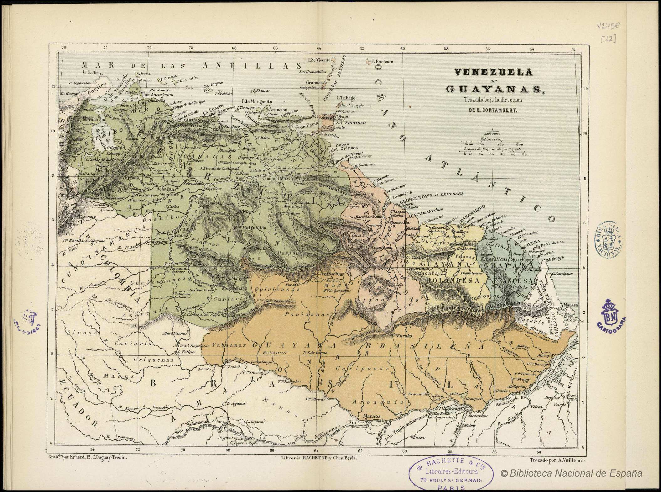
VENEZUELA Y GUAYANAS
Map 1800 - 1899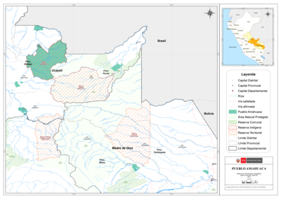
PUEBLO AMAHUACA
Map 2021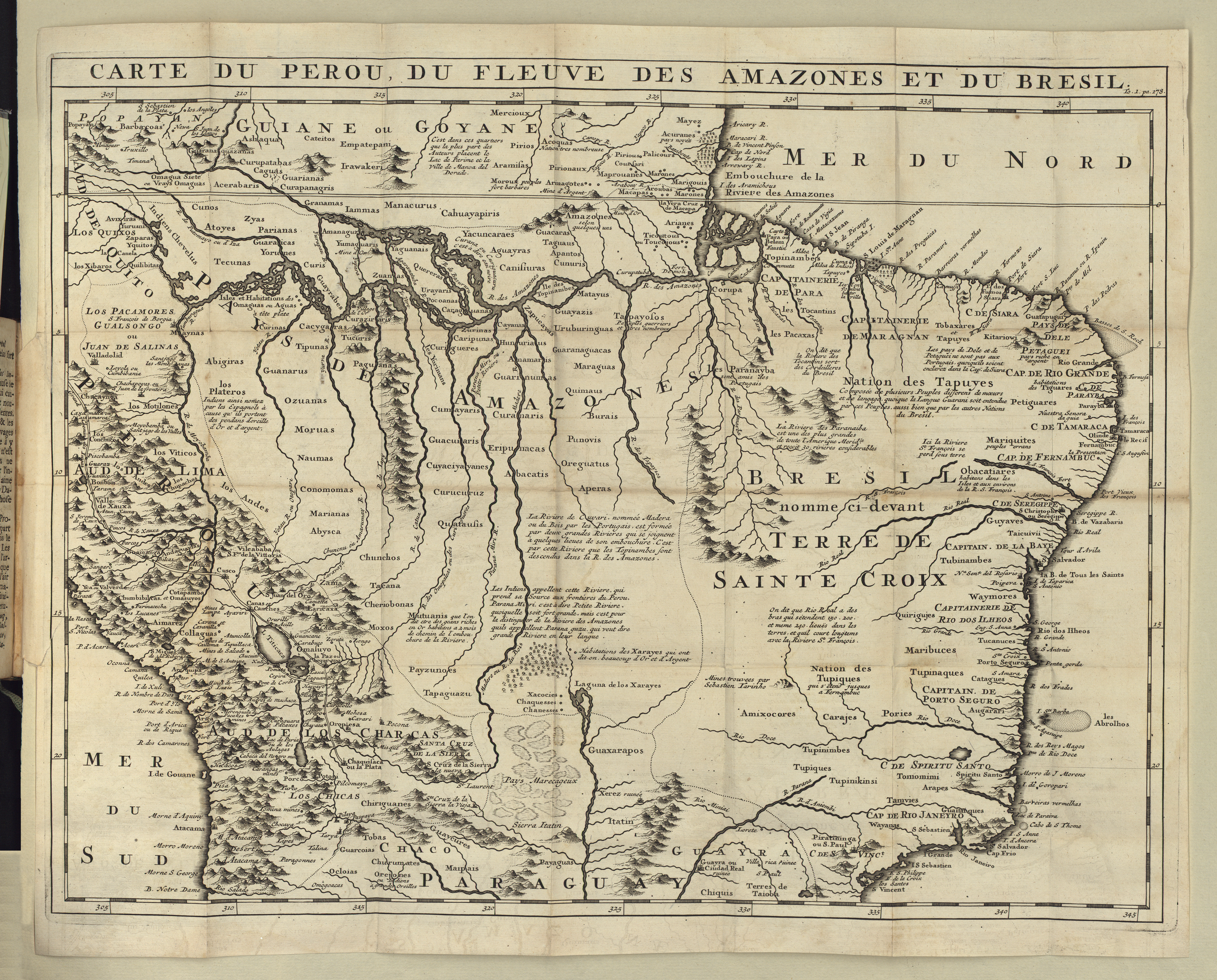
CARTE DU PEROU DU FLEUVE DES AMAZONES ET DU BRESIL
Map 1700 - 1799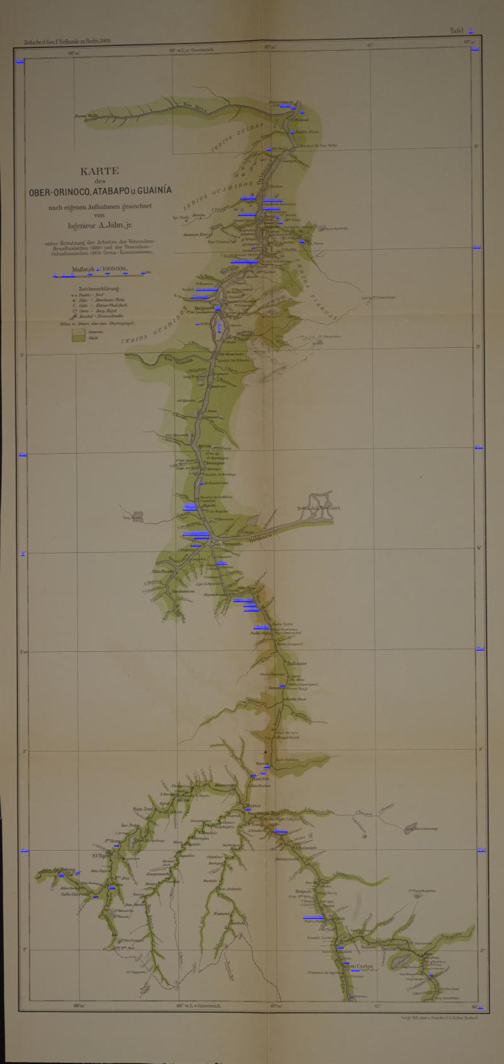
KARTE des OBER-ORINOCO;ATABAPO U GUAINÍA
Map 1909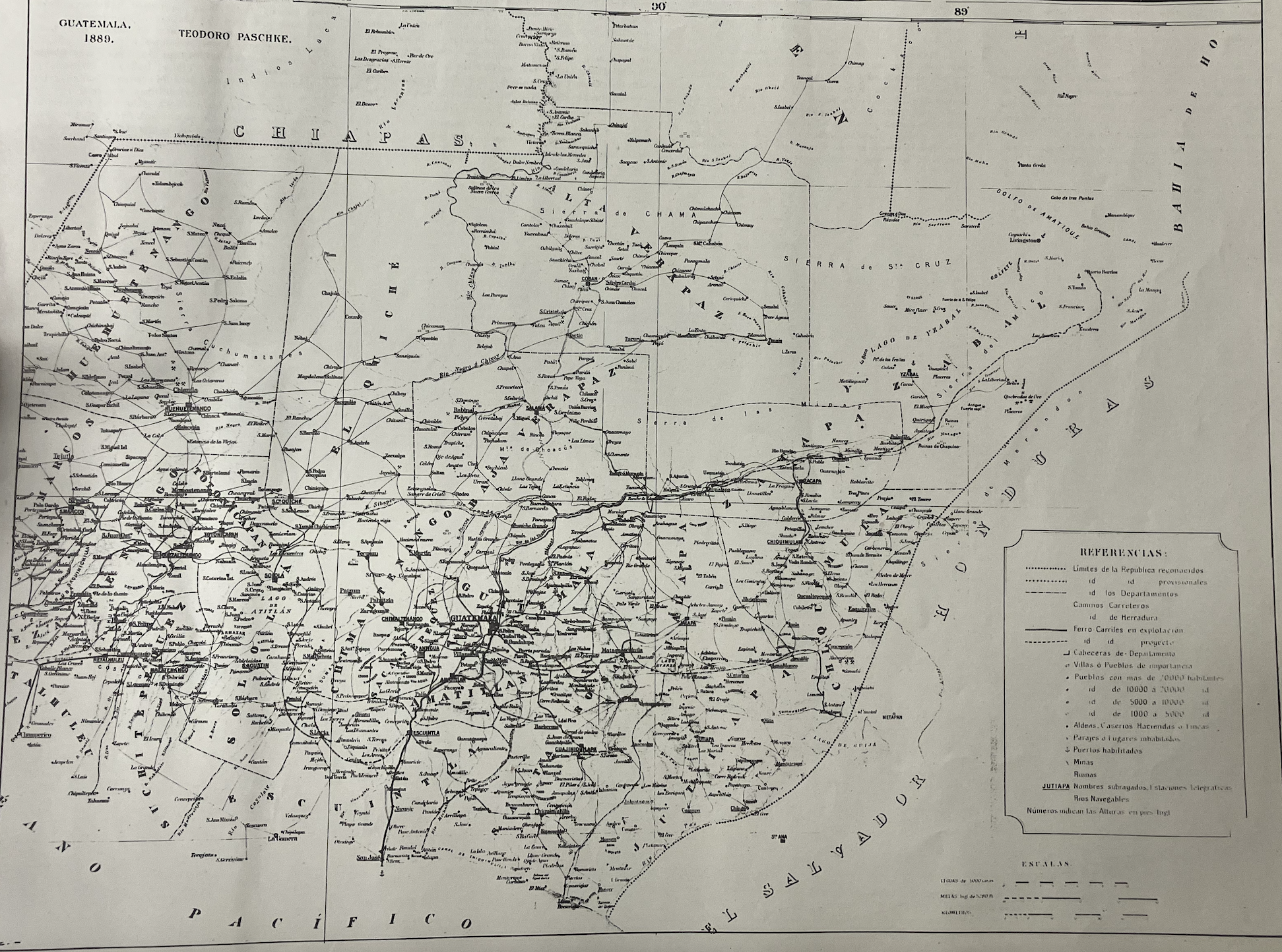
Mapa de la Republica de Guatemala, America Central
Map 1880 - 1900
Detail from the 1770 copy of Francisco Álvarez Barreiro’s 1728 map of northern New Spain illustrating Spanish mapping of Indian domains in southern Texas and along the Gulf Coast, especially through the repetition of labels: “tierra de los Pampopas,” “tierra de los Carrizos,” “tierra de los Cujanes,” etc.
Map 1728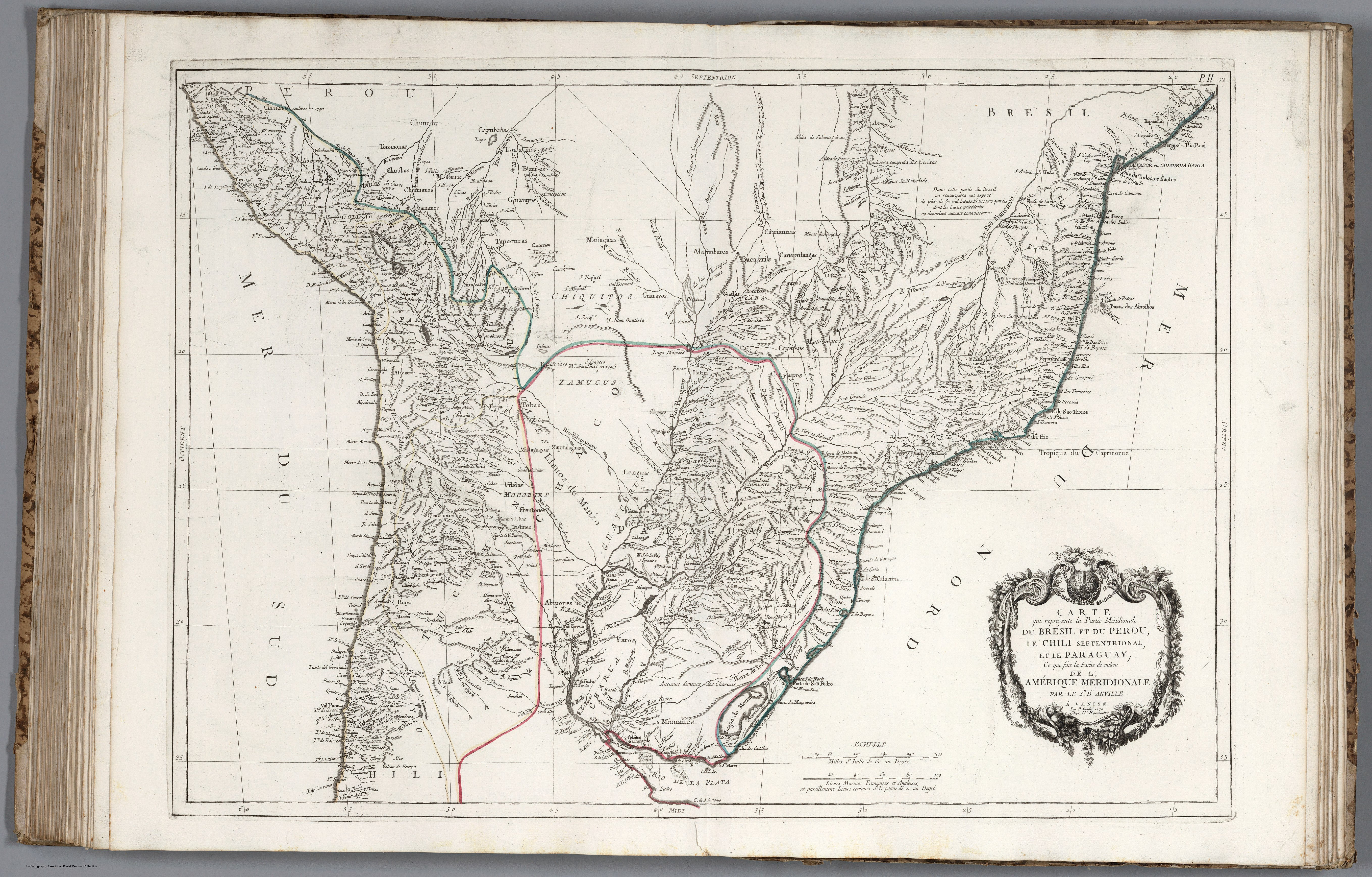
CARTE que représente la Partie Méridionale DU BRÉSIL ET DU PEROU;LE CHILI SEPTENTRIONAL;EL LE PARAGUAY;Ce qui fait la Pártie de milieu DE L’AMÉRIQUE MERIDIONALE PAR LE SR. D’ANVILLE À VENISE Par P. Santini 1779. Chez M’.Remondiri.
Map 1779