
Citation
Comisión Nacional para el Desarrollo de los Pueblos Indígenas. Regiones indígenas de México. Publication no. 330.972. 2006. https://www.gob.mx/cms/uploads/attachment/file/35735/cdi-regiones-indigenas-mexico.pdf.
![Pescaria [Fishing]](https://dnet8ble6lm7w.cloudfront.net/art/ABRA017.jpeg)
Pescaria [Fishing]
Artwork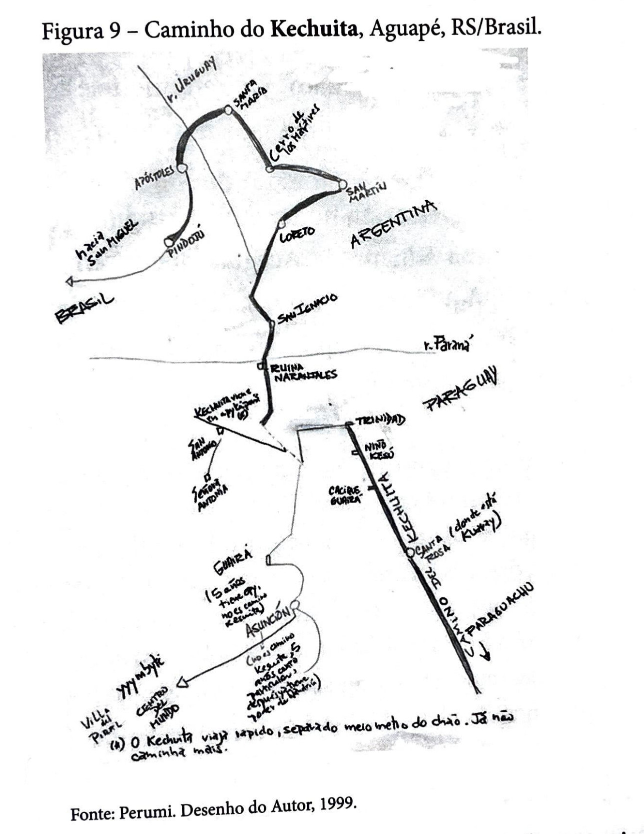
Caminho do Kechuita, Aguapé, RS/Brasil
Map 1999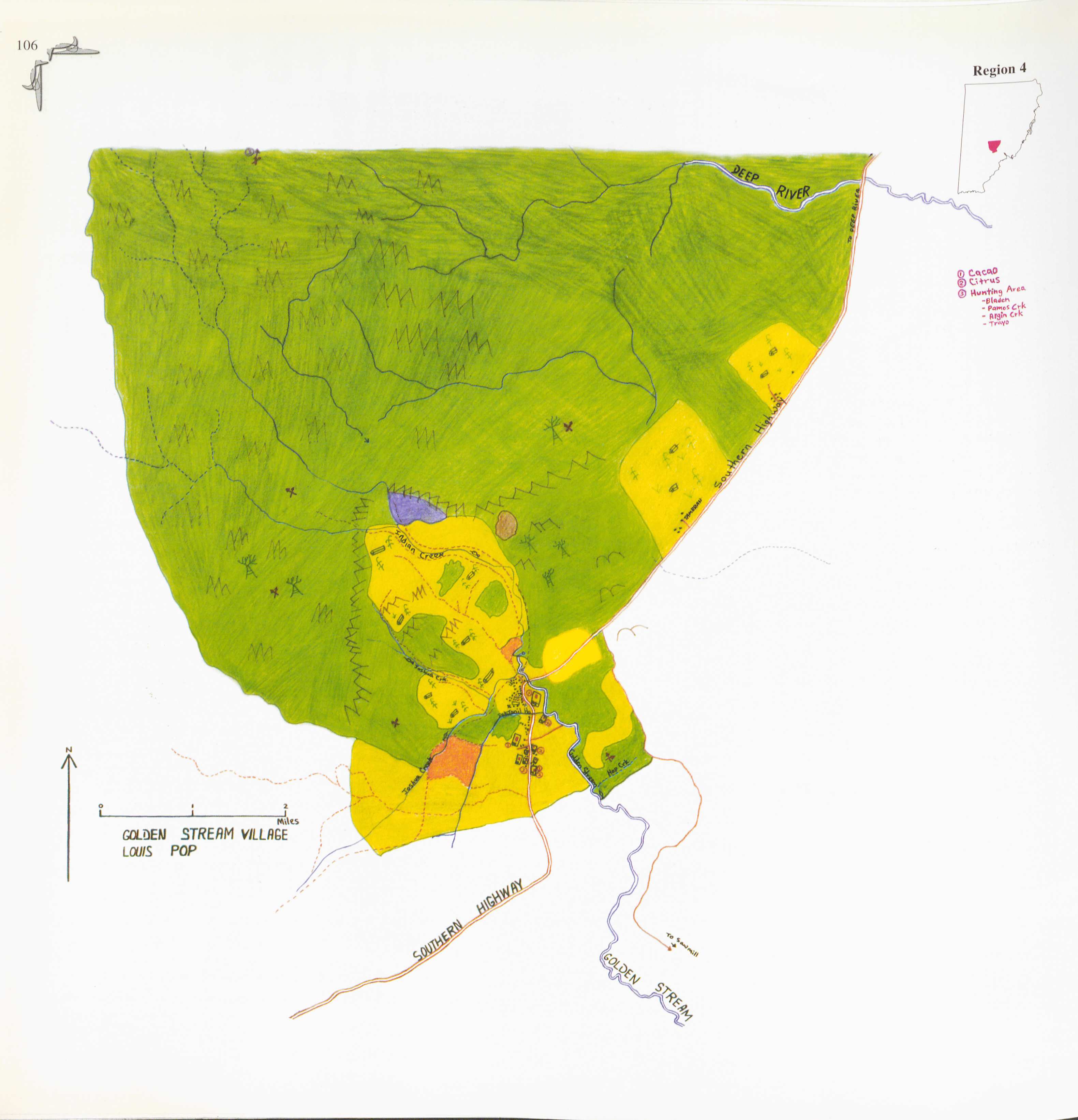
Golden Stream
Map 1997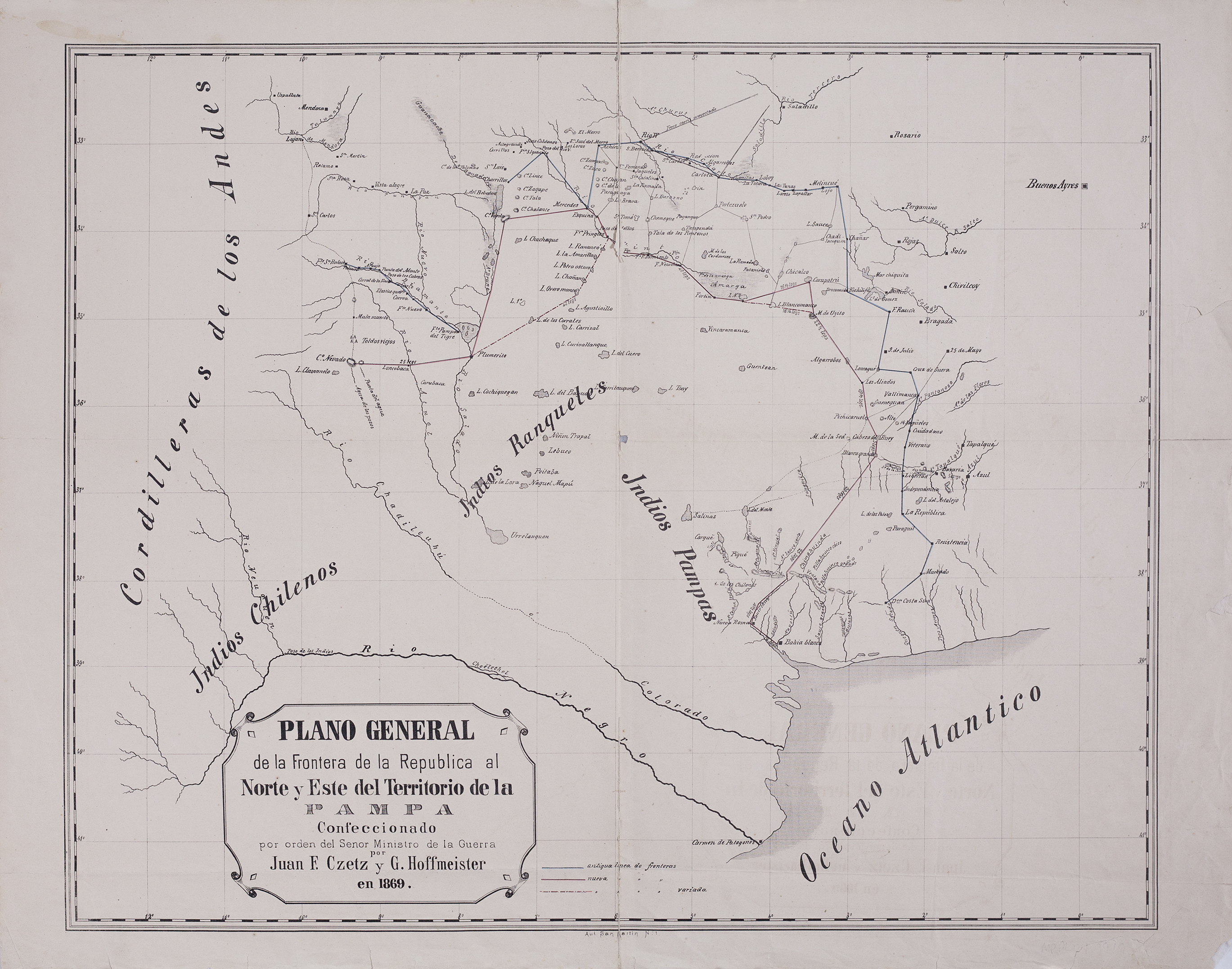
Plano general de la frontera de la República al norte y este del territorio de la Pampa.
Map 1869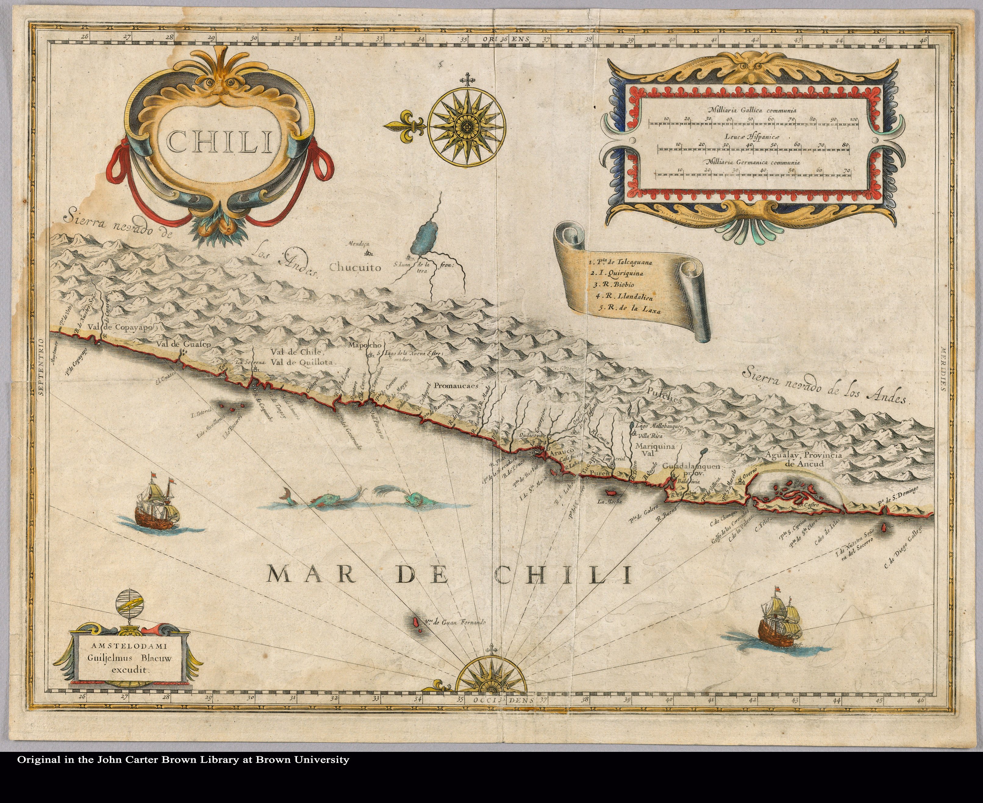
Chili
Map 1663
Outlines of the physical and political division of South America: Delineated by A. Arrowsmith partly from scarce and original documents, published before the year 1806 but principally from manuscript maps & surveys made between the years 1771 and 1806, corrected from accurate astronomical observations to 1810.
Map 1800 - 1899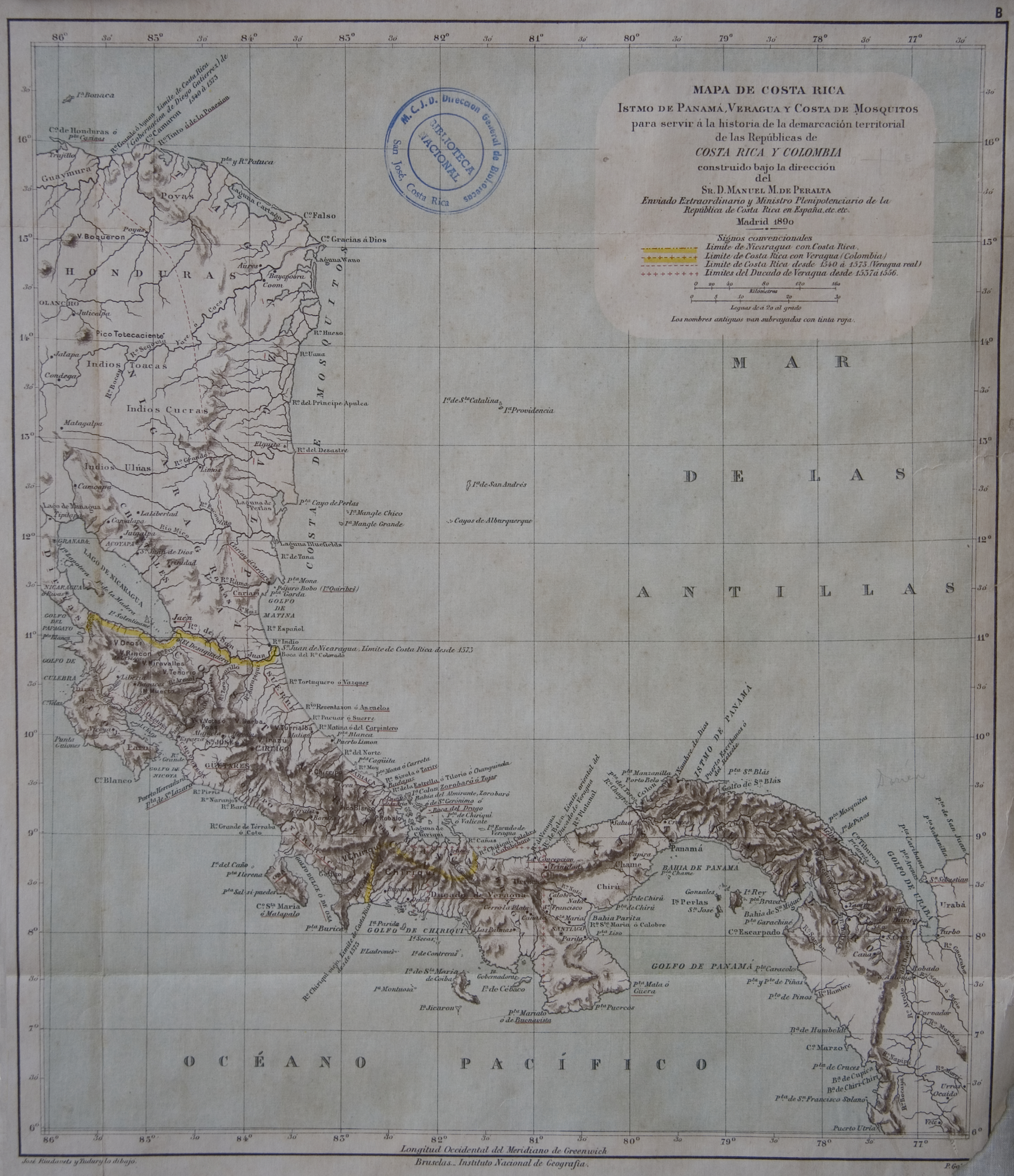
Mapa de Costa Rica, Veragua. Istmo de Panamá. y Costa de Mosquitos, para servir a la historia de la demarcacion territorial de las Republicas de Costa Rica y Colombia
Map 1800 - 1899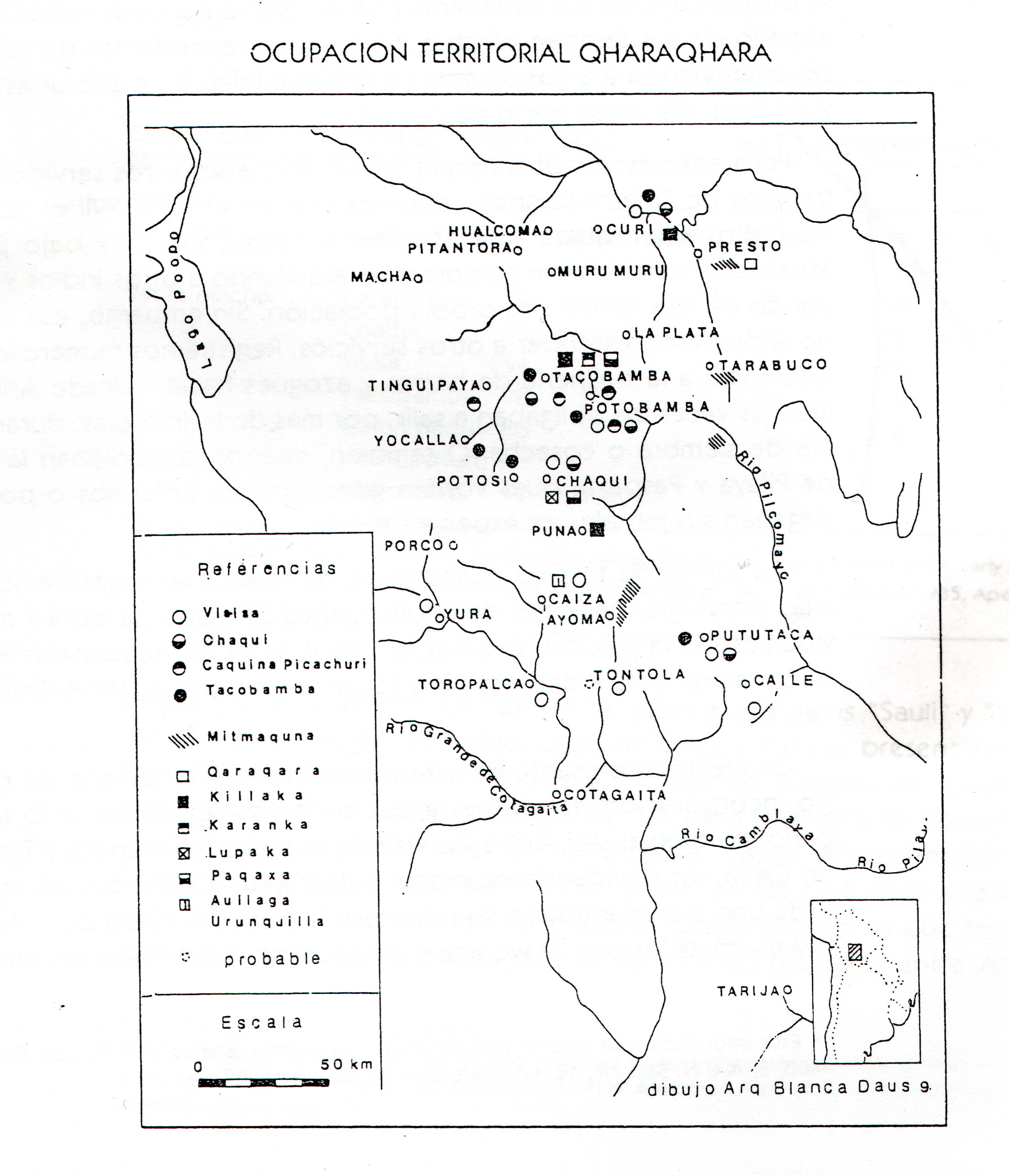
TERRITORIO DEL SEÑORÍO AYMARA DE LOS QARAQARA EN EL SIGLO XVI
Map 1530