Peoples
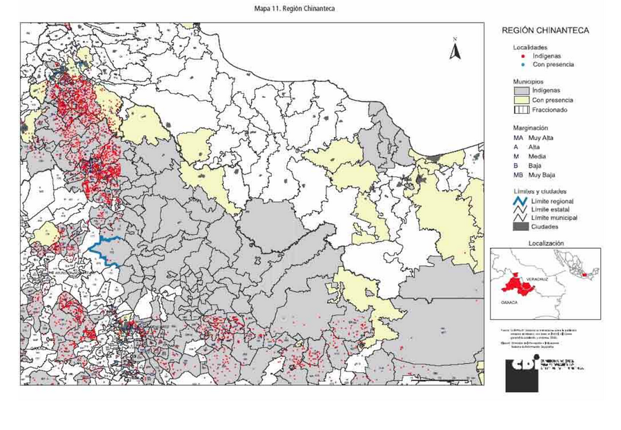
- CHINANTEC
Citation
Comisión Nacional para el Desarrollo de los Pueblos Indígenas. Regiones indígenas de México. Publication no. 330.972. 2006. https://www.gob.mx/cms/uploads/attachment/file/35735/cdi-regiones-indigenas-mexico.pdf.
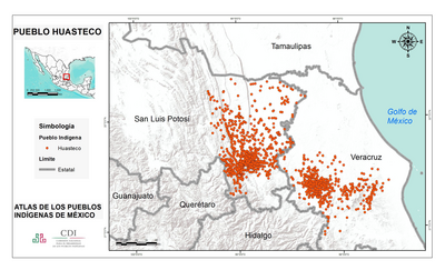
PUEBLO HUASTECO
Map 2020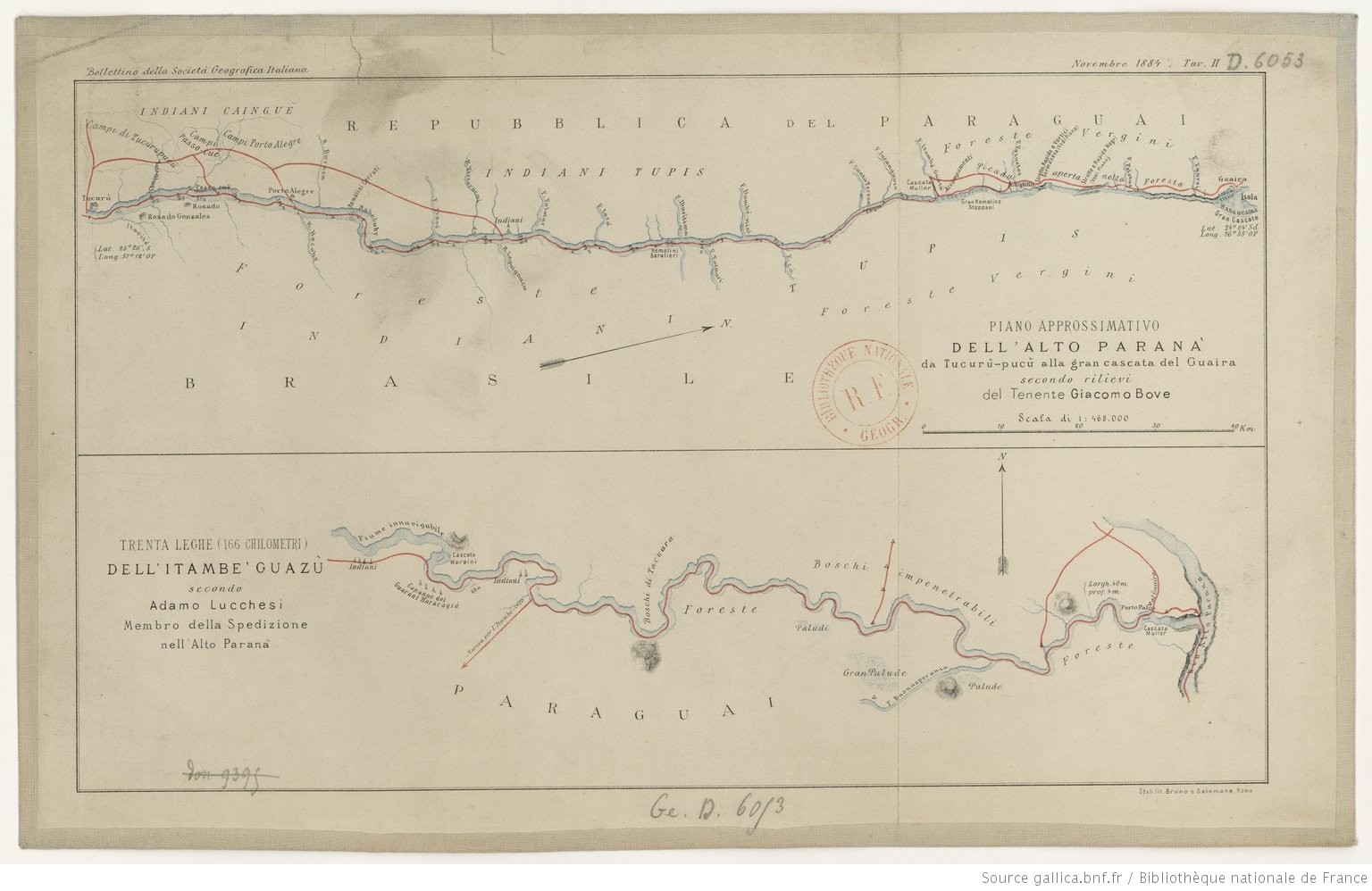
PIANO APPROSSIMATIVO DELL’ ALTO PARANA` da Tucurù-pucù alla gran cascata del Guaira
Map 1884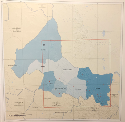
INTENDENCIA DE SAN LUIS POTOSÍ
Map 1800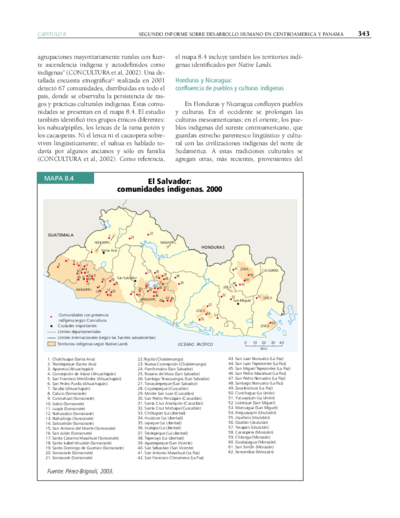
El Salvador: comunidades indígenas. 2000
Map 2000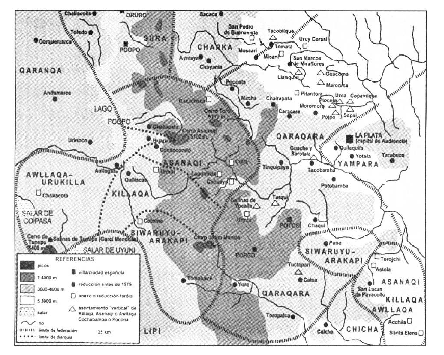
TERRITORIO DEL SEÑORÍO AYMARA DE LOS KILLAKAS A PRINCIPIOS DEL SIGLO XVI
Map 1500 - 1530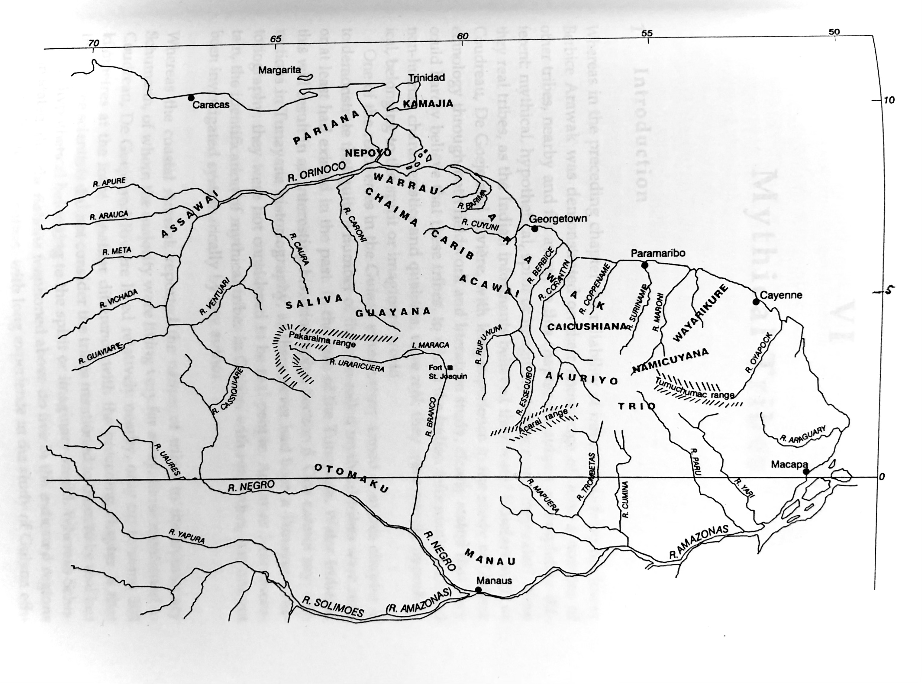
Plate 8. The 18 tribes reported by the Berbice Arawak
Map 1700 - 1799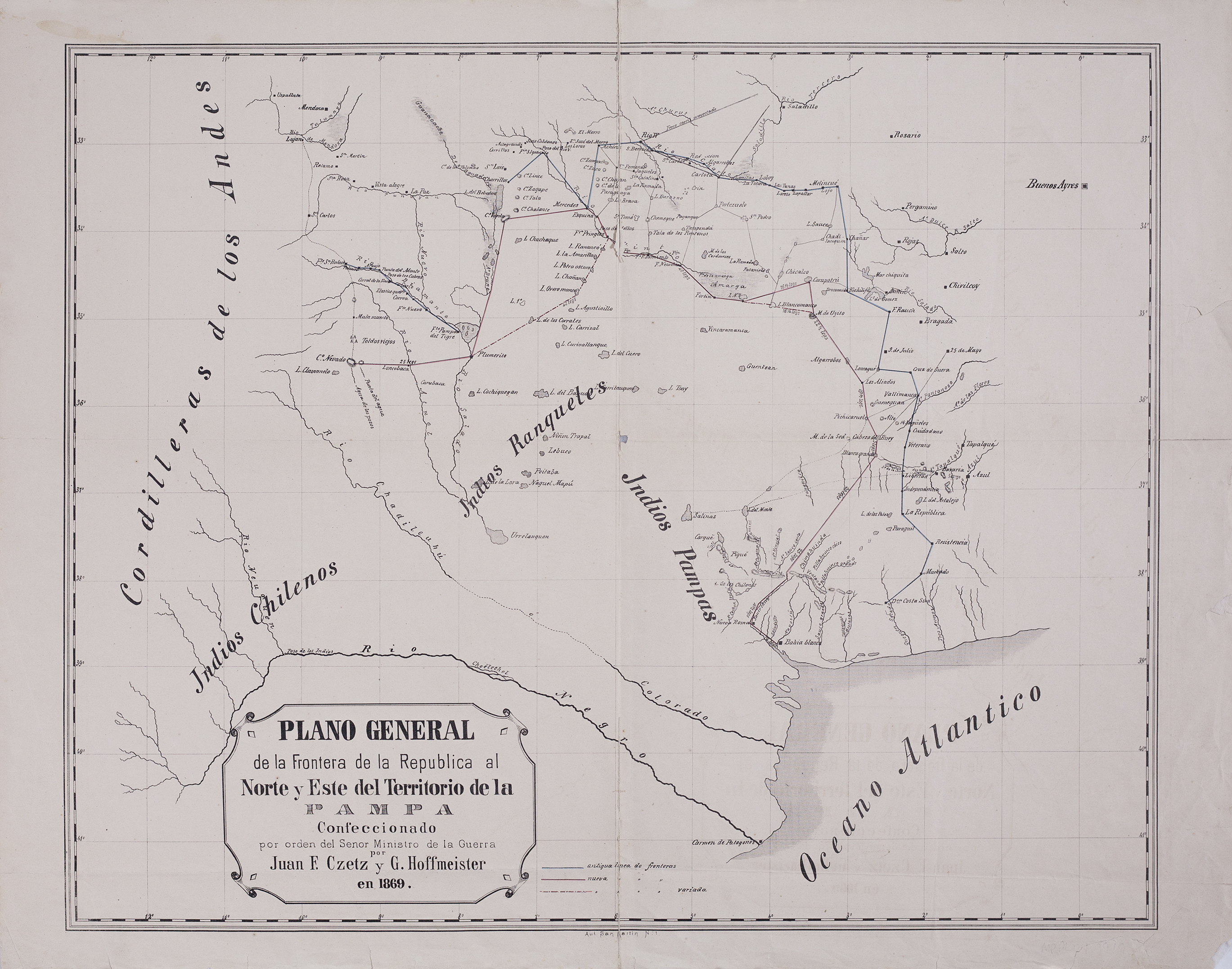
Plano general de la frontera de la República al norte y este del territorio de la Pampa.
Map 1869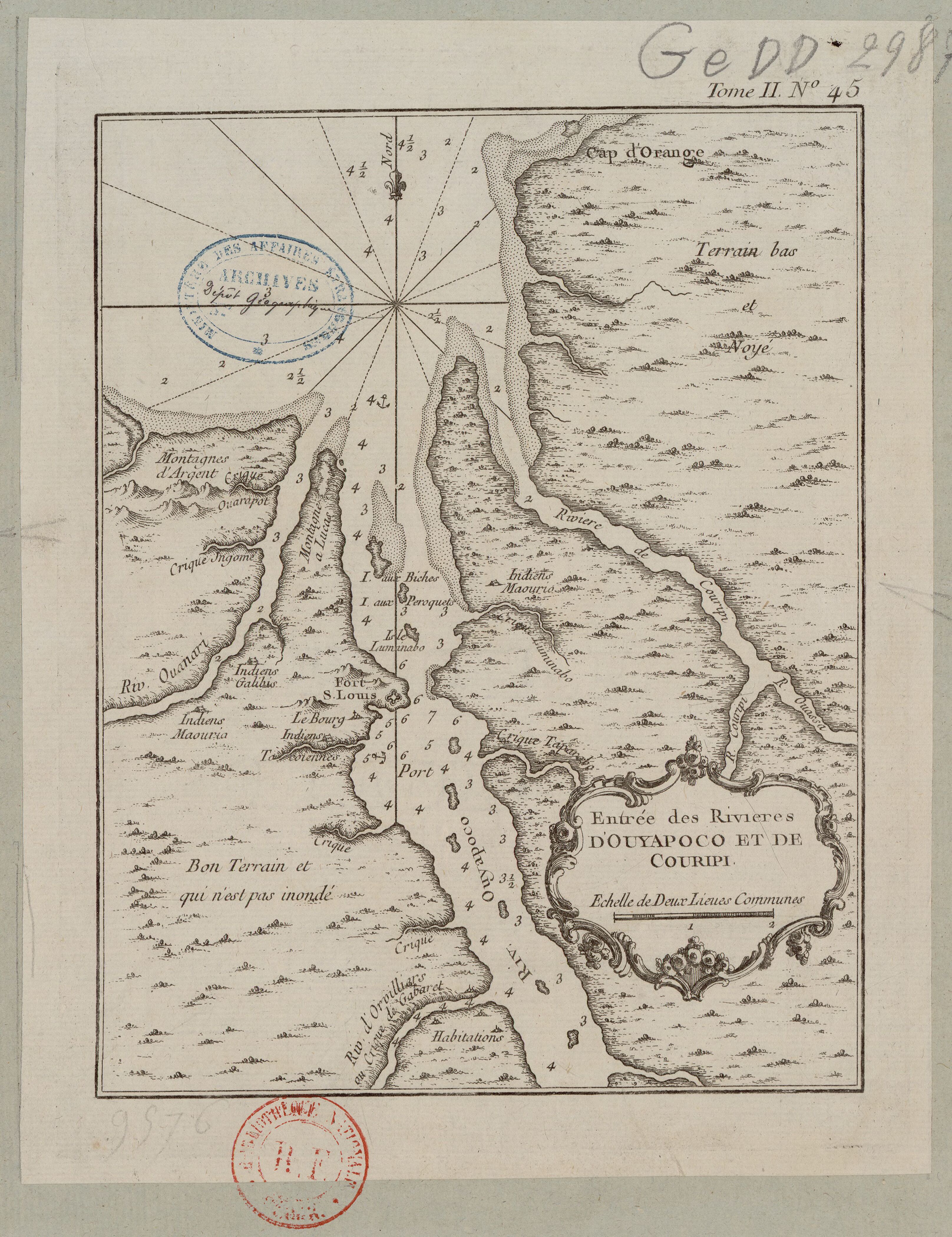
Entrée des rivières d'Ouyapoco et de Couripi.
Map 1764