Citation
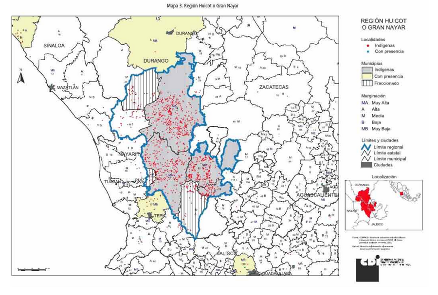
Comisión Nacional para el Desarrollo de los Pueblos Indígenas. Regiones indígenas de México. Publication no. 330.972. 2006. https://www.gob.mx/cms/uploads/attachment/file/35735/cdi-regiones-indigenas-mexico.pdf.
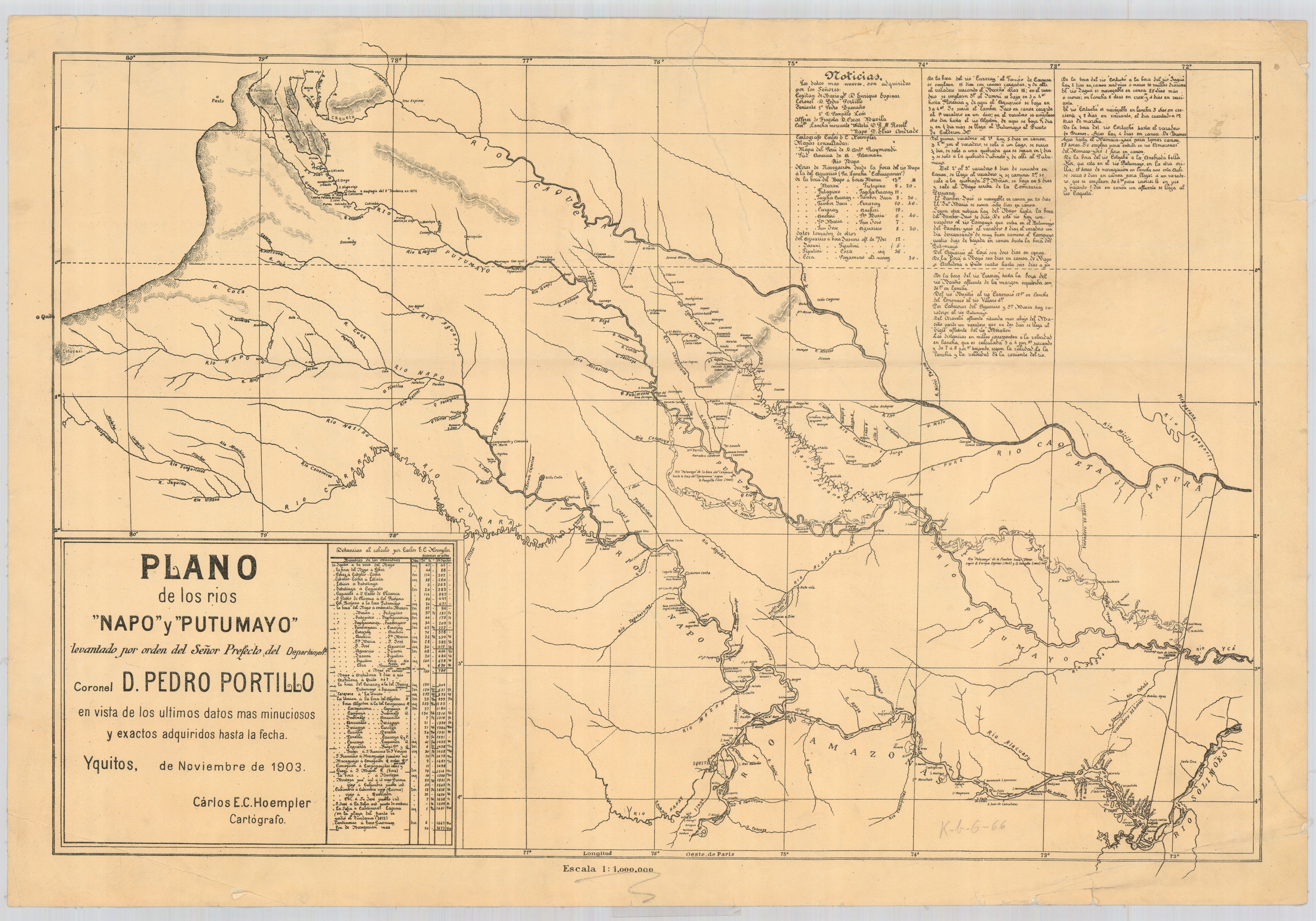
Plano de los rios Napo y Putumayo / levantado por orden del señor prefecto del departemento coronel d. Pedro Portillo en vista de los últimos datos mas minuciosos y exactos adquiridos hasta la fecha
Map 1903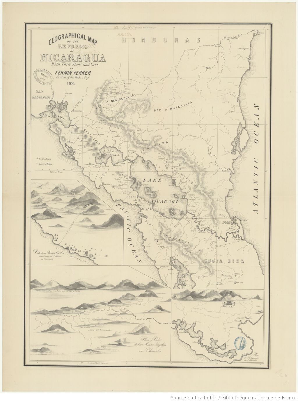
Geographic Map of the Nicaragua with three plans and views.
Map 1855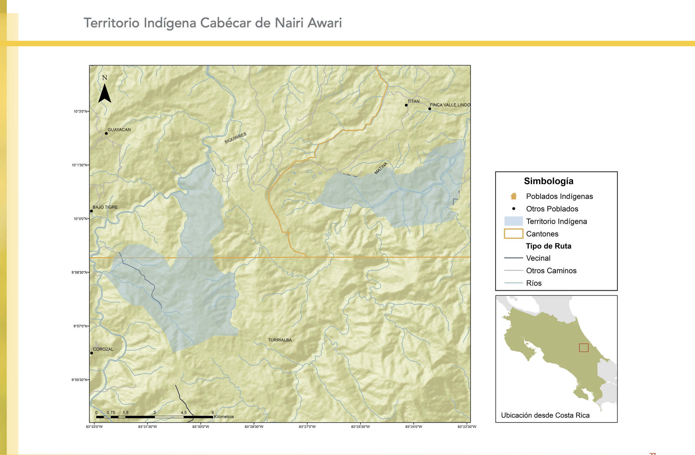
"Territorio Indígena Cabécar de Nairi Awari"
Map 2010
MAPA ÉTNICO DEL RÍO DE LA PLATA
Map 1500 - 1900
A NEW MAP OF BRAZIL, COMPILED FROM THE LATEST Government & other Authentic Surveys.
Map 1866
O. DIE REP: ARGENTINA. P. DAS DICTATORAT PARAGUAY.
Map 1830![El diablo del dengue [The Dengue Devil]](https://dnet8ble6lm7w.cloudfront.net/art/APER057.jpg)
El diablo del dengue [The Dengue Devil]
Artwork
Terra Indígena Rio Branco (do Itanhaém)
Map 2012