
Peoples
- TARAHUMARA
Citation
Comisión Nacional para el Desarrollo de los Pueblos Indígenas. Regiones indígenas de México. Publication no. 330.972. 2006. https://www.gob.mx/cms/uploads/attachment/file/35735/cdi-regiones-indigenas-mexico.pdf.
Figure 10.1. Map of Ecuador showing the Western Pichincha research region and the site of Palmitopamba.
Map -700 - 1534
PLATA AMERICAE PROVINCIA
Map 1500 - 1599
Accuratissima Brasiliae Tabula
Map 1600 - 1699![Sementerio [Semen-tary]](https://dnet8ble6lm7w.cloudfront.net/art_sm/ACOL018.png)
Sementerio [Semen-tary]
Artwork
Plano del pueblo de Nuestra Señora de Altagracia y del reparto de tierras a los indios, con vista de Cumaná y de la fortaleza de Araya.
Map 1704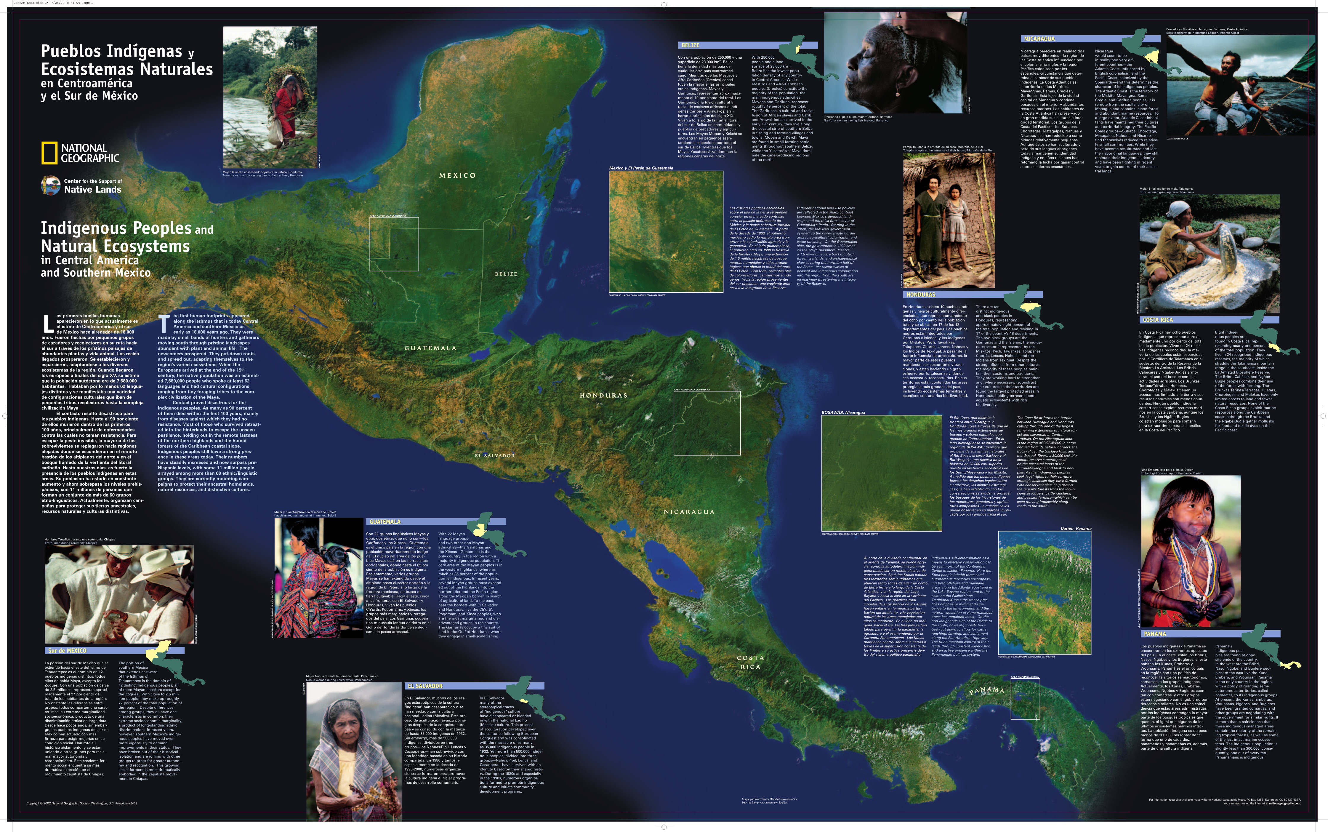
Pueblos Indígenas y Ecosistemas Naturales en Centroamérica y el Sur de México
Map 2000 - 2024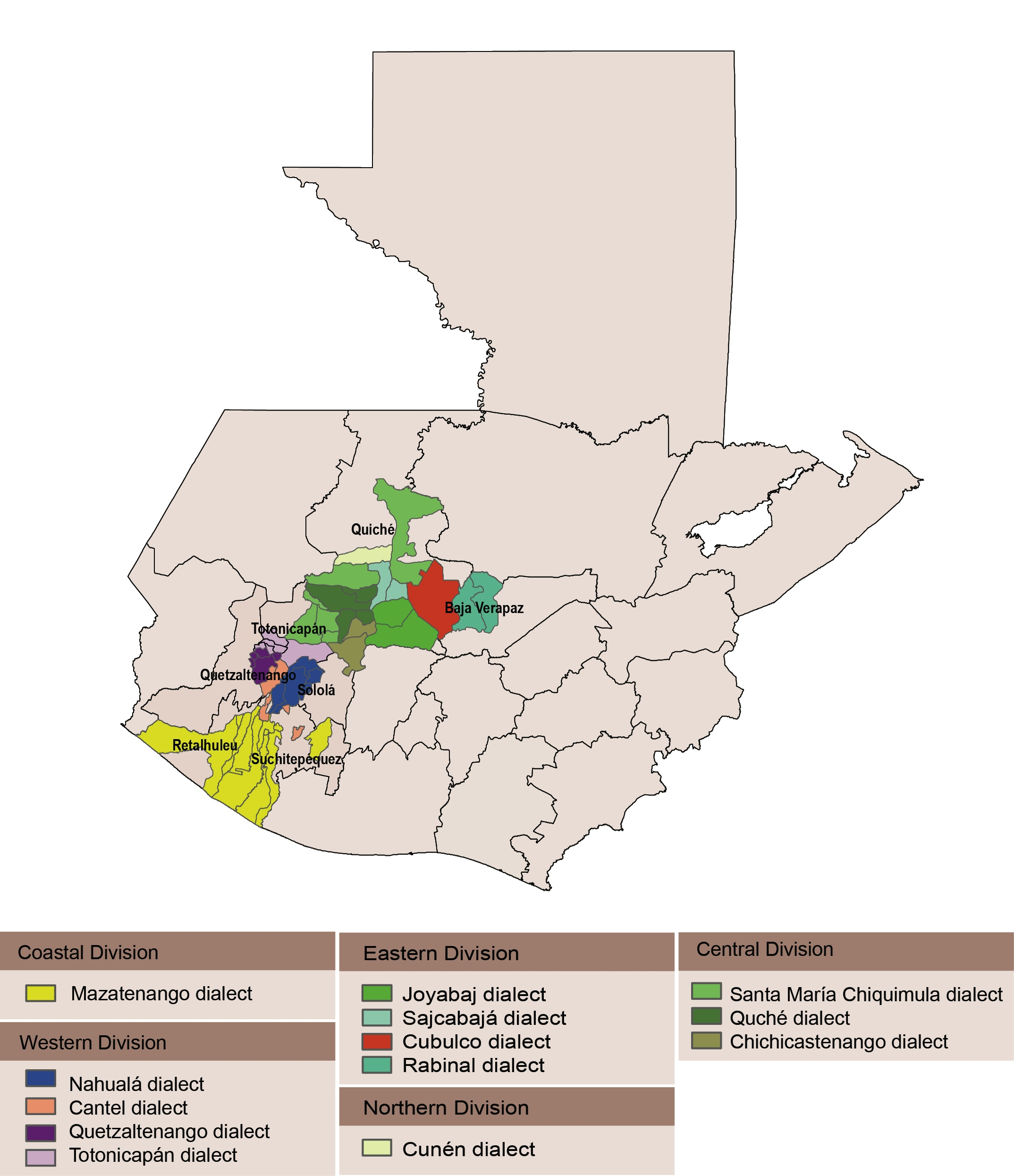
Dialect geography of K'ichee'
Map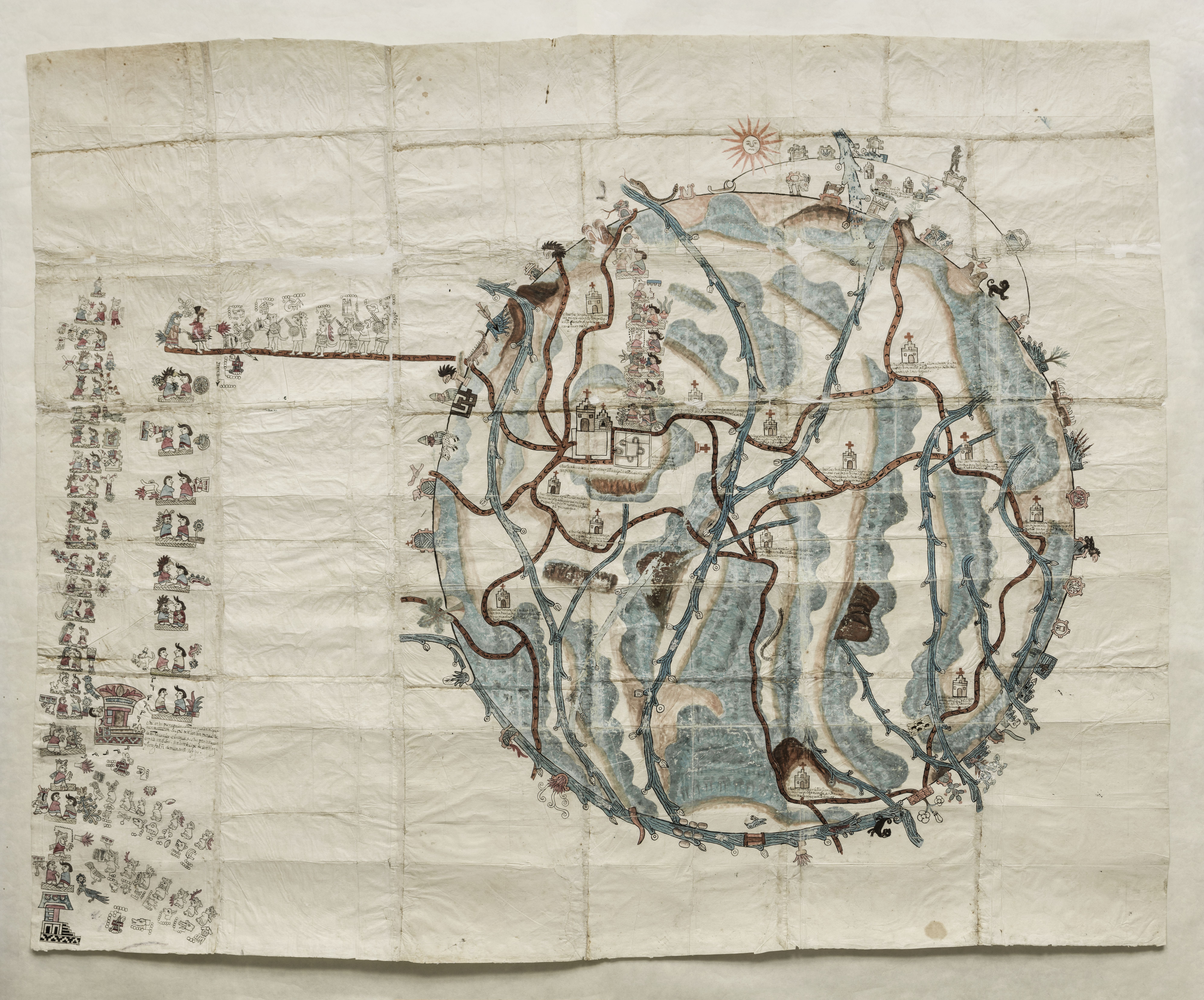
PINTURA DE TEOZACOALCO
Map 1500 - 1599